Ticker for January 25, 2024
MESONET TICKER ... MESONET TICKER ... MESONET TICKER ... MESONET TICKER ...
January 25, 2024 January 25, 2024 January 25, 2024 January 25, 2024
Foggy Top
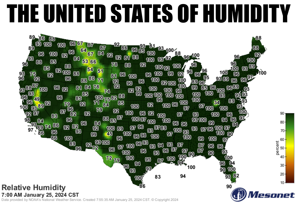
The air is often saturated in the morning thanks to a lack of mixing, and that's
a problem. The same could be said of hillbillies, but we won't go there. It's kind
of a cool process (get it?), and takes place in several parts. The cooling of
the ground at night near the boundary layer can lead to an increase in relative
humidity and the formation of fog in the mornings due to several factors:
Radiational Cooling: During the night, the Earth's surface loses heat through
radiation. This causes the ground and the air in contact with it to cool down.
Temperature Inversion: As the ground cools, it can create a temperature
inversion where the air near the surface becomes cooler than the air above it.
This can trap moisture close to the ground.
Condensation: When the air near the surface cools sufficiently, it may reach
its dew point temperature, at which point it becomes saturated with moisture.
This leads to condensation of water vapor in the air, forming tiny water
droplets or fog.
Boundary Layer: The boundary layer is the lowest part of the atmosphere where
the effects of friction with the Earth's surface are significant. As the ground
cools, the boundary layer becomes shallower, which can trap moisture near the
surface, contributing to fog formation.
So overall, the cooling of the ground at night near the boundary layer sets the
stage for the increase in relative humidity and the formation of fog in the
mornings through a combination of radiational cooling, temperature inversion,
condensation, and changes in the boundary layer dynamics.
Then you get this.
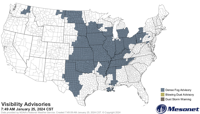
Because of this.
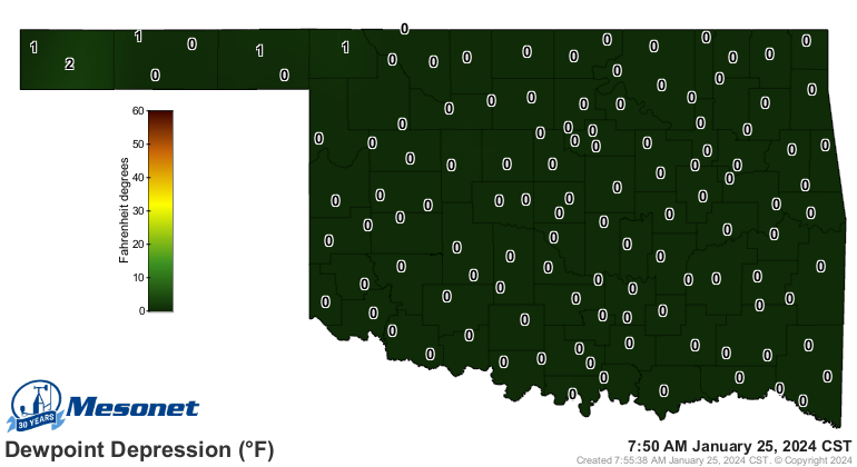
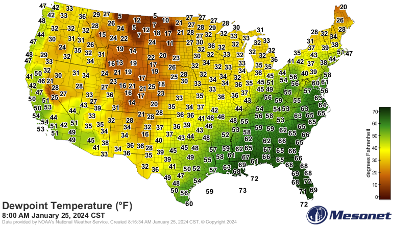
Right? When the actual air temperature and the dewpoint temperature are equal,
water vapor starts condensing and you get fog.
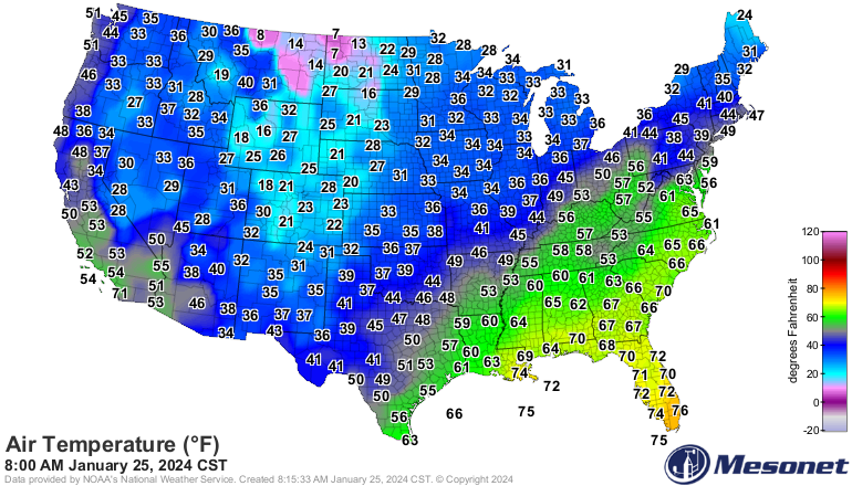
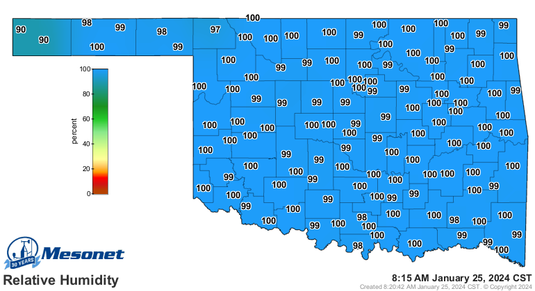
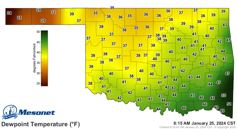
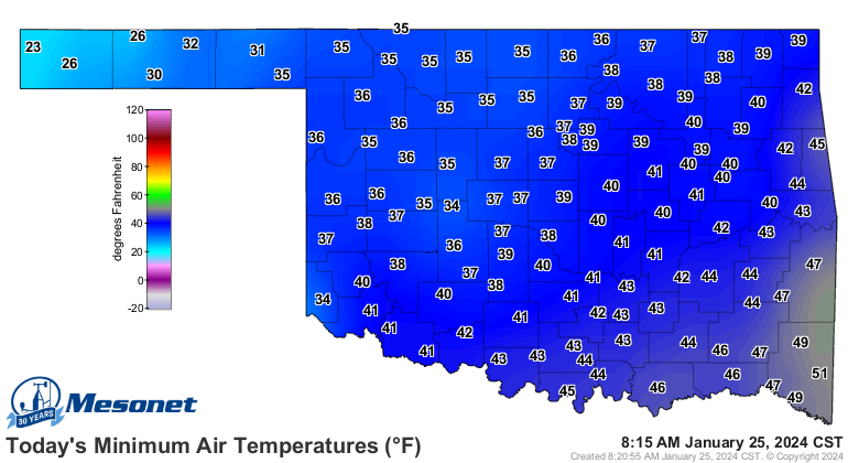
And that dewpoint temperature can act as a "bottom" for our temperatures. If
the air temperature drops below the dew point, condensation will happen,
releasing latent heat into the air. This latent heat release can prevent the
air temperature from falling below the dew point temperature, acting as a
stabilizing factor. So for most of the state, at least where the RH has been
100% (hence, water vapor condensing, releasing heat into the air), today's lows
will be somewhat close to the dewpoint temperature. Not exactly because we have
had some heating with the sun up and thus some mixing of the boundary layer.
What's this all mean? Well, not much, other than much of the middle of the
country is in fog, thanks to the processes listed above. I do think a lot of
this might be advection fog to our east. Heck, maybe ours as well. Advection
fog is where relatively warm, moist air moves over cooler ground, causing
condensation and therefore, fog. I see we have a lot of flow coming up from the
Gulf of Mexico, flooding the Eastern U.S. with low-level moisture.
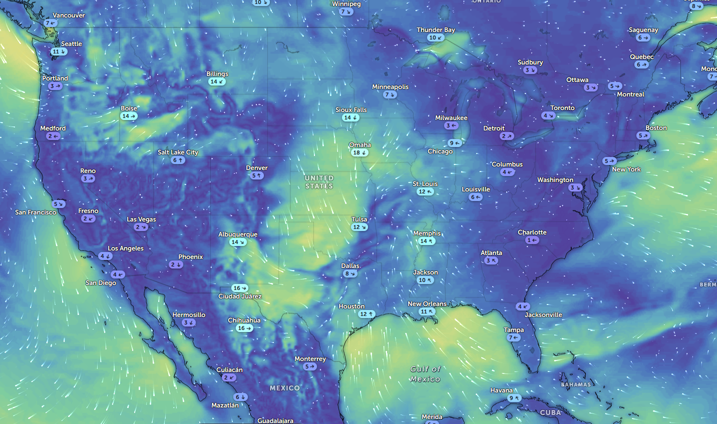
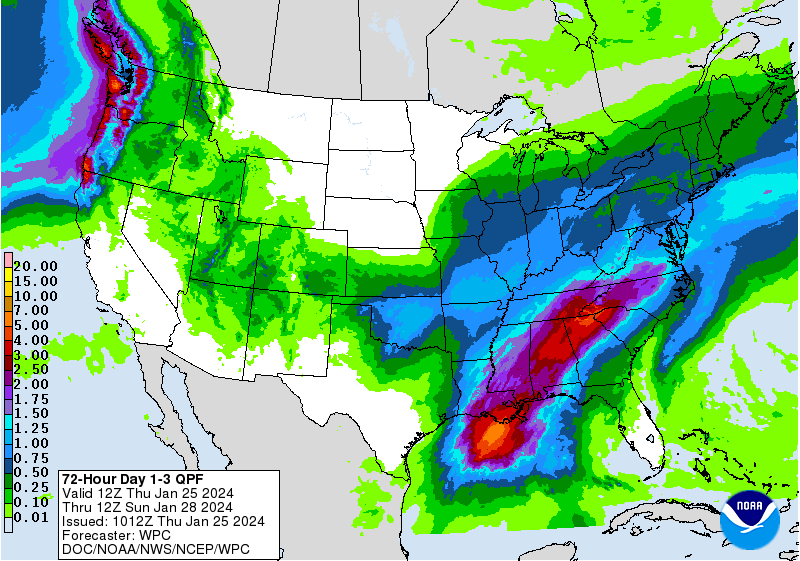
That is a lot of moisture in place, just waiting for a reason to precipitate
out. We'll see that later tomorrow into Saturday with another storm system
from the west, giving us more rain (and maybe some snow up in NW OK).
After that, lots of sunshine. We deserve that for sure, what with it being a
mostly dreary January thus far. Check out this graph of statewide averaged
percent of normal sunshine (departure from average). You can see in the sunshine
dept., we've definitely been below average (and believe me, I know below
average!).

BRING BACK THE SUN!
Gary McManus
State Climatologist
Oklahoma Mesonet
Oklahoma Climatological Survey
gmcmanus@mesonet.org
January 25 in Mesonet History
| Record | Value | Station | Year |
|---|---|---|---|
| Maximum Temperature | 77°F | MADI | 2005 |
| Minimum Temperature | 7°F | VINI | 2019 |
| Maximum Rainfall | 3.32 inches | MTHE | 2012 |
Mesonet records begin in 1994.
Search by Date
If you're a bit off, don't worry, because just like horseshoes, “almost” counts on the Ticker website!