Ticker for January 24, 2024
MESONET TICKER ... MESONET TICKER ... MESONET TICKER ... MESONET TICKER ...
January 24, 2024 January 24, 2024 January 24, 2024 January 24, 2024
Janu-Spring
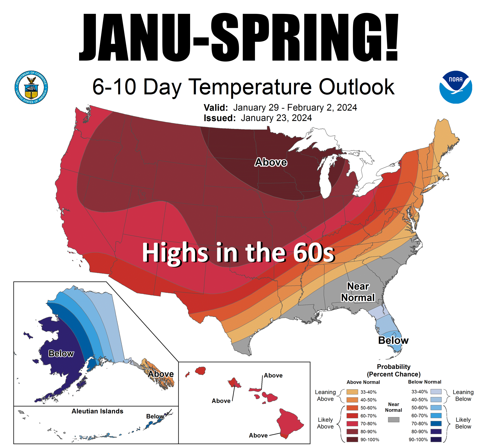
Now don't we deserve some warm weather? I know December ended up as the 4th
warmest on record (dating back to 1895), but we had like 4 days of frigid weather
two weeks ago and quite Frankly (which is obviously better than Gary-ly) that was
enough to last me for awhile. You can see the big dip (WATCH IT!!) on this graph
of statewide average highs (green) vs. the long-term avg statewide avg highs
(black). There's also our ice-tinged dip from earlier this week.
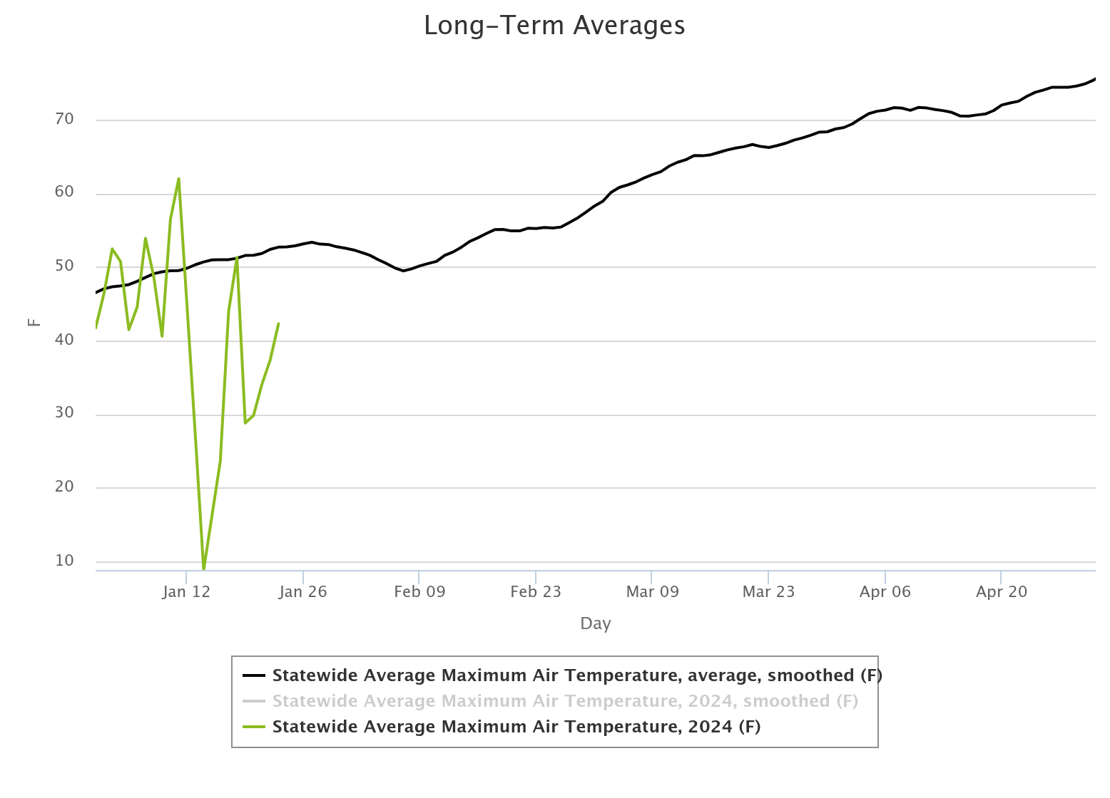
Also notice on that black curve how we steadily march upwards from highs in the
low 50s into the mid-70s by May 1. Will that happen? Well, one curve doesn't
necessarily beget the other, right? In other words, weather trumps climate to a
large degree in the short-term, but climate wins out in the long-term. For
example, we might end up with much of April being below normal in temperature due
to weather. Let's hope not, but if we see lots of clouds and some cold air from
up North, we would likely see colder than normal weather. But the fact the sun
is getting higher in the sky, daylight is increasing, drives the climate to
warmer weather regardless of any short-term wobbles. So we might see highs in
the mid-60s during much of April, which is below normal, but not mid-30s, which
would be catastrophically below normal. In other words, climate wins out over
weather. The ups and downs oscillate from a moving base, and that directions
for temperature is upwards.
In the case for next week, the trends in weather will greatly overcome climate
and give us highs 10+ degrees above normal.
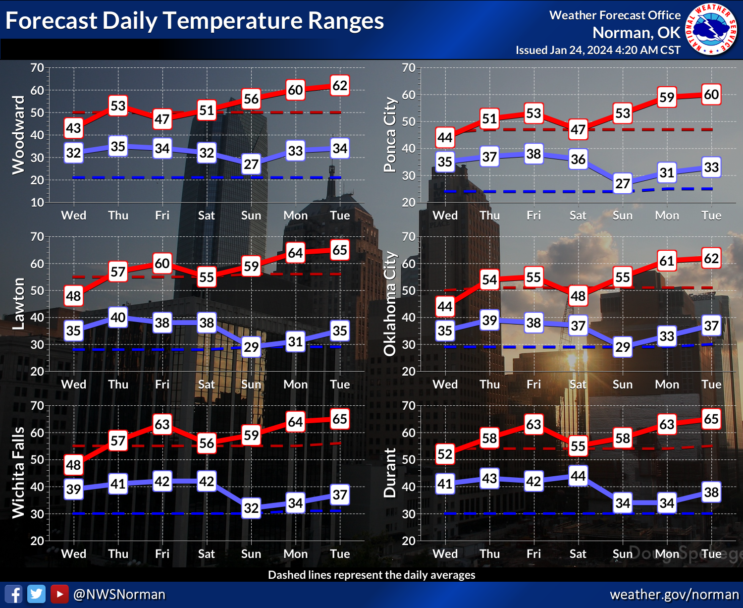
Before we get there next week, however, we have to get by all this cloudiness
and rain through the next 3 days.
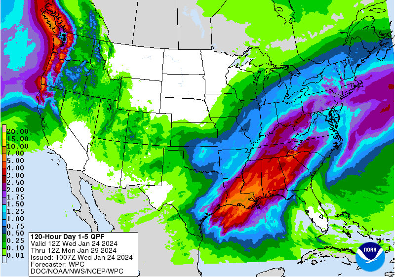
Heck, it's raining right now for crying out loud!
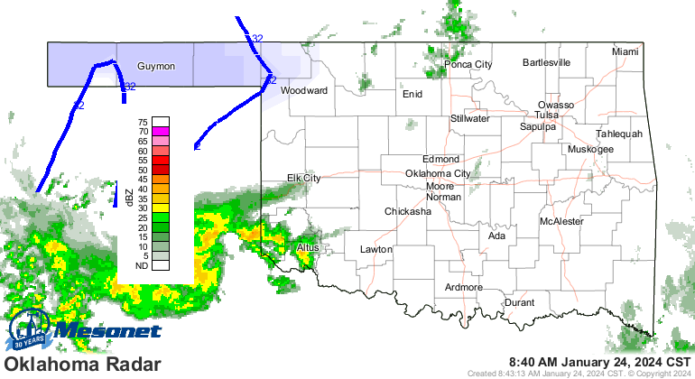
But it'll be worth it.
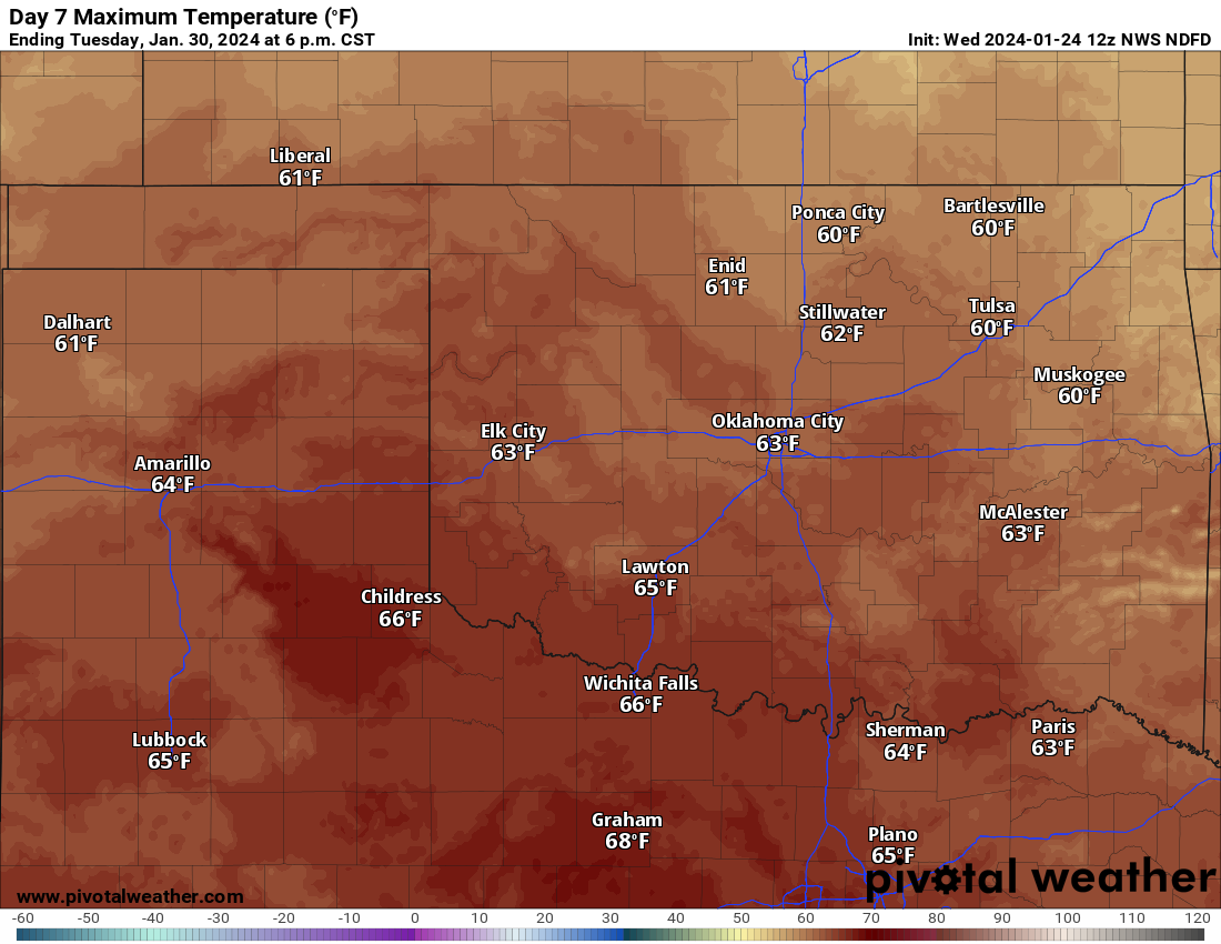
Now doesn't that look glorious?
Gary McManus
State Climatologist
Oklahoma Mesonet
Oklahoma Climatological Survey
gmcmanus@mesonet.org
January 24 in Mesonet History
| Record | Value | Station | Year |
|---|---|---|---|
| Maximum Temperature | 80°F | WAL2 | 2017 |
| Minimum Temperature | -3°F | BRIS | 2014 |
| Maximum Rainfall | 1.81″ | DURA | 2012 |
Mesonet records begin in 1994.
Search by Date
If you're a bit off, don't worry, because just like horseshoes, “almost” counts on the Ticker website!