Ticker for December 7, 2023
MESONET TICKER ... MESONET TICKER ... MESONET TICKER ... MESONET TICKER ...
December 7, 2023 December 7, 2023 December 7, 2023 December 7, 2023
Frostycide
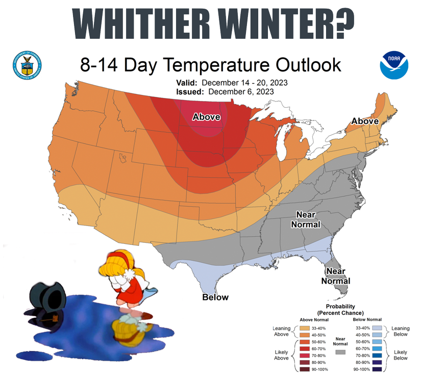
I always thought Frosty the Snowman was pretty creepy myself.
Corncob pipe? Hey, let's teach kids to smoke!
Button nose? Cool, here's where you can use a needle to sew it on??
Two eyes made of coal? HOW ABOUT THE DEAD LIFELESS EYES OF A KILLER?
Okay, maybe I'm reading too much into it (or reading too much Stephen King), but
it's not like much of the country needs to be worrying about building snowmen
lately. Check out this map of current snow depth.

And while Oklahoma's gotten into the snow act already, it's been slim pickins for
much of the U.S. thus far this season, AND this season thus far.

That first map there with the snow depth has some pretty important implications
for Oklahoma, considering our lack of Arctic air down this way. Not only is
it indicative of the lack of cold air available for WINTER to erupt this far
south, but it's also a major player in any cold air that is able to move down
this way. A big snowpack to our north and west would allow cold air moving
south to remain that way, sort of like putting something in the refrigerator.
But leave that ground bare for the sun to heat up, any cold air that moves down
over it will modify fairly quickly due to the warmer ground, robbing it of its
frigidity (hey, that was one of my band's hit songs when I was in medical
school..."Robbing My Frigidity").
Right now we're dealing with WARM air, however, with near record high
temperatures forecast for western OK, and just plain old warm elsewhere.
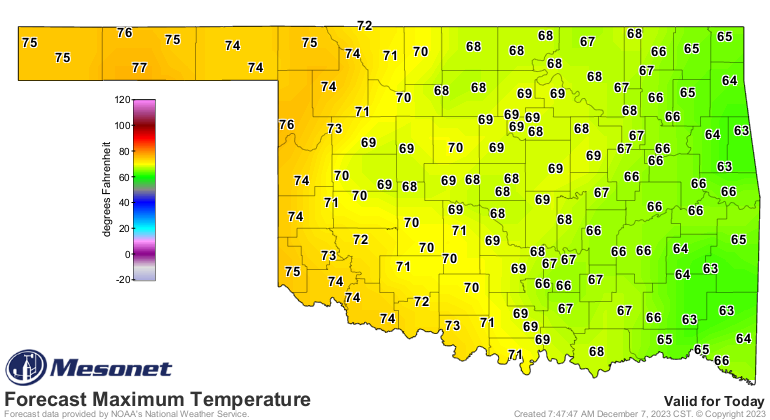
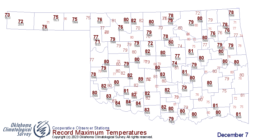
Not as high as on this day back in 1966, however.

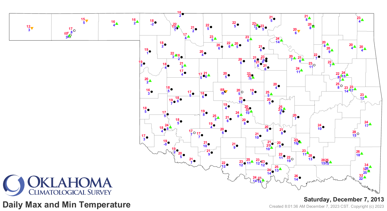
Nor as cold as this day back in 2013.
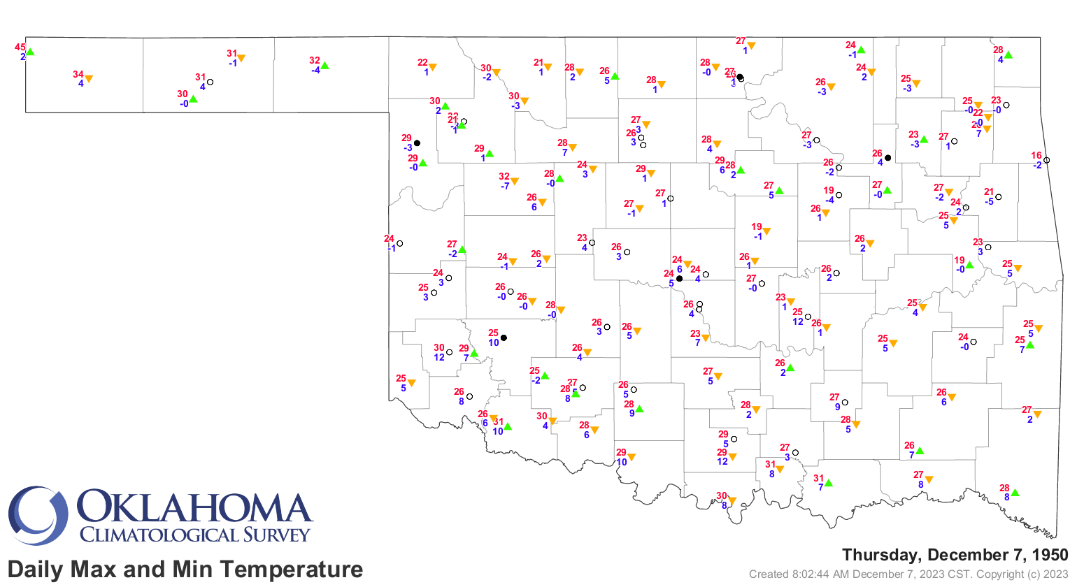
Or Dec. 7's coldest morning, in 1950.
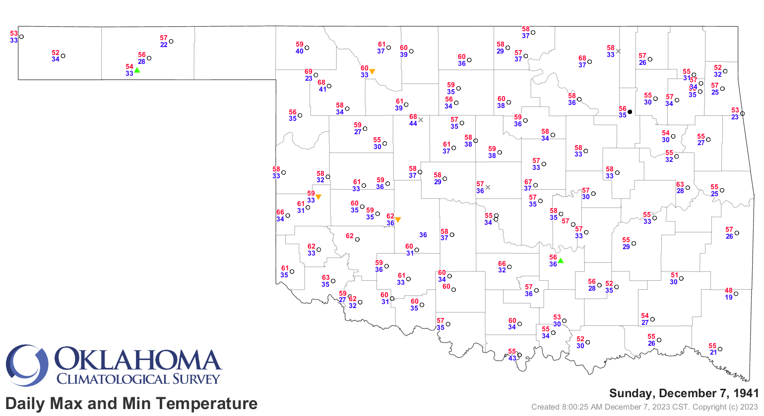
How about a date which lives in infamy?
How about 135 years ago?
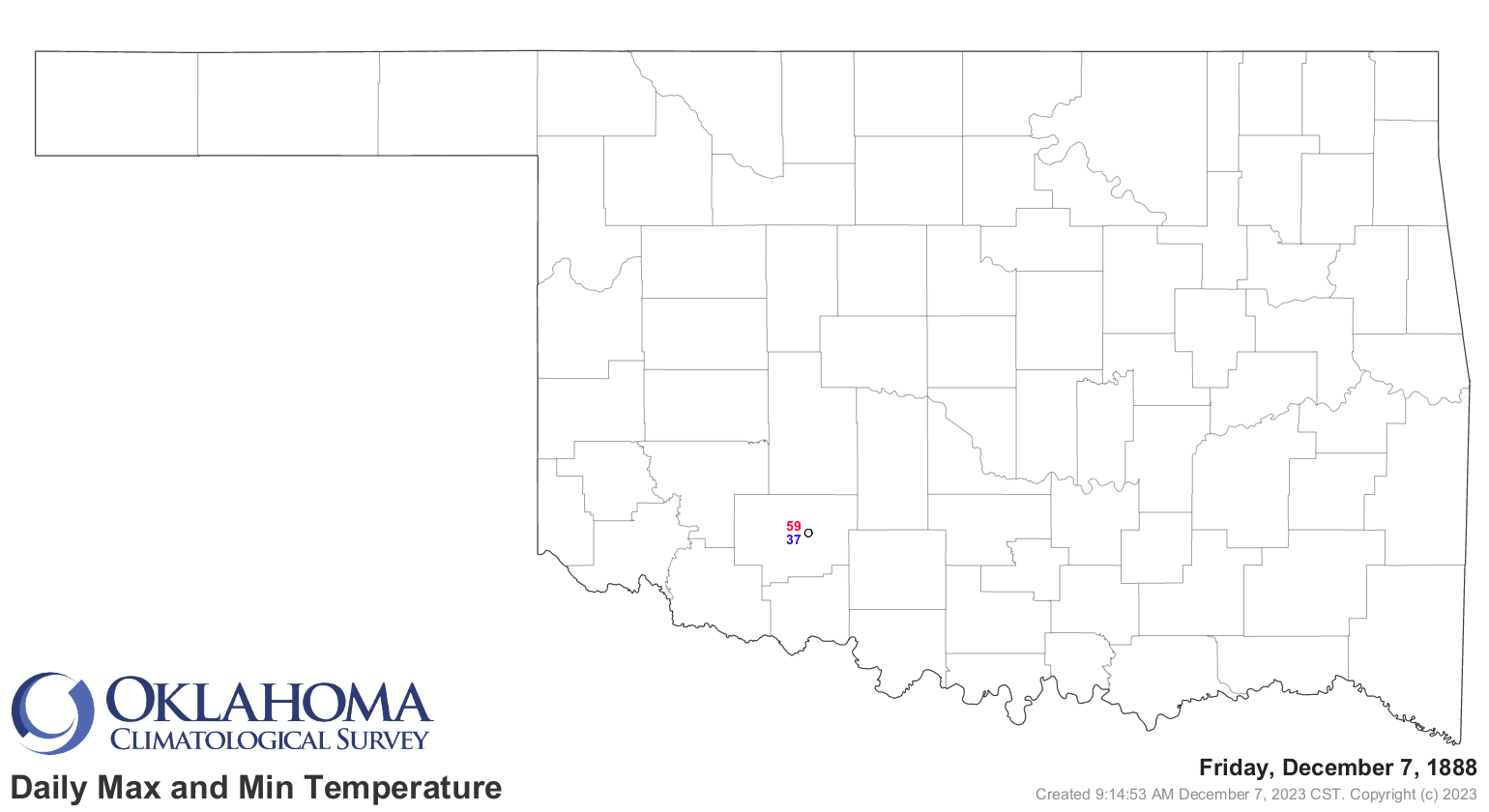
How about we stop? Well fine, but it was a lovely day in Ft. Sill back then.
What's not so lovely? How about the growing dry spell across the state, now up
to more than 60 days in the Panhandle, and past 2 weeks in other areas.
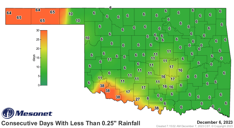
Starting to look pretty orangish-red on the 60-day deficit maps.
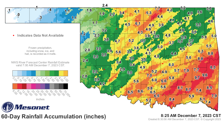
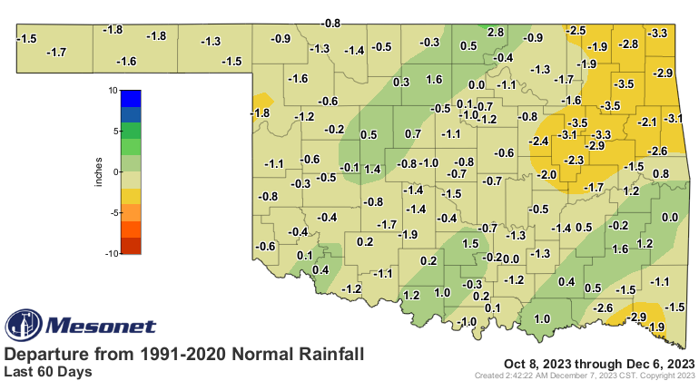
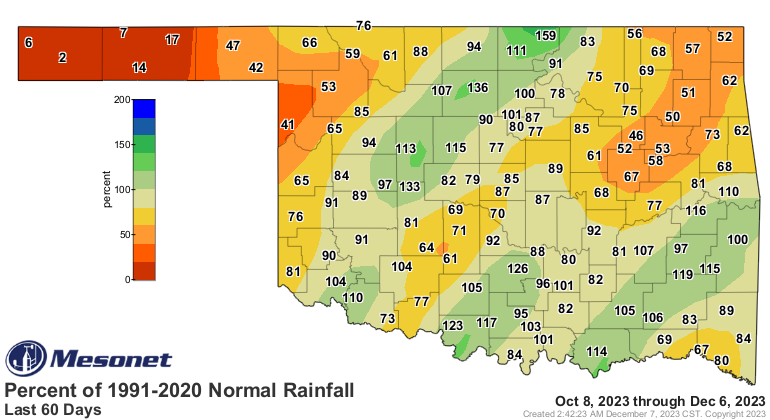
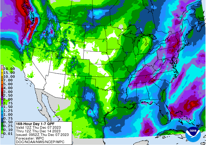
And there is very little help coming, at least in the next week or so.
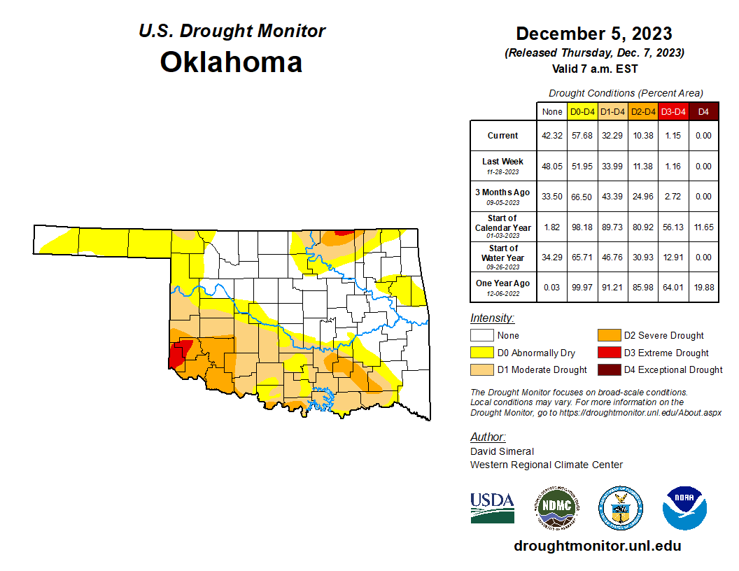
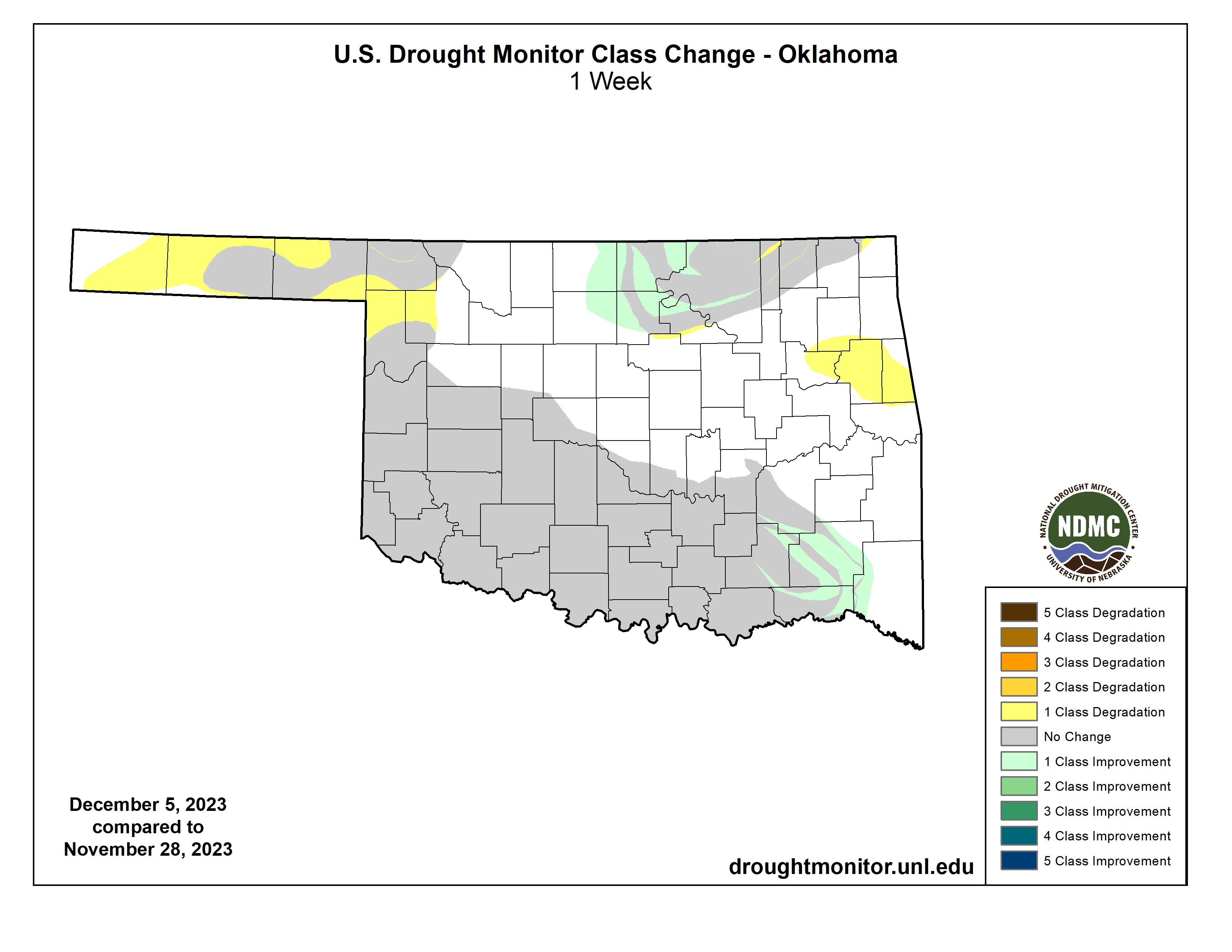
And we have dry areas starting to spread on the Drought Monitor map.
Frosty the Snowman, was as evil as he could be,
He'd sneak up behind you, and laugh maliciously
As he slid an icicle across your throat.
Thumpity thump thump, thumpity thump thump,
Look at Frosty go!
Yeah, who's crying now, huh??
Gary McManus
State Climatologist
Oklahoma Mesonet
Oklahoma Climatological Survey
gmcmanus@mesonet.org
December 7 in Mesonet History
| Record | Value | Station | Year |
|---|---|---|---|
| Maximum Temperature | 80°F | BURN | 2007 |
| Minimum Temperature | -9°F | BOIS | 2005 |
| Maximum Rainfall | 1.27″ | BBOW | 1997 |
Mesonet records begin in 1994.
Search by Date
If you're a bit off, don't worry, because just like horseshoes, “almost” counts on the Ticker website!