Ticker for November 16, 2023
MESONET TICKER ... MESONET TICKER ... MESONET TICKER ... MESONET TICKER ...
November 16, 2023 November 16, 2023 November 16, 2023 November 16, 2023
WOOP WOOP!
First off, let me just say I'm very pleased to be accepting this award for...oh
shoot, WRONG WINDOW! Yes, if you must know I have been chosen as the #1 Recording
Artist in the world, specializing in small bowel sounds.
Jealous??
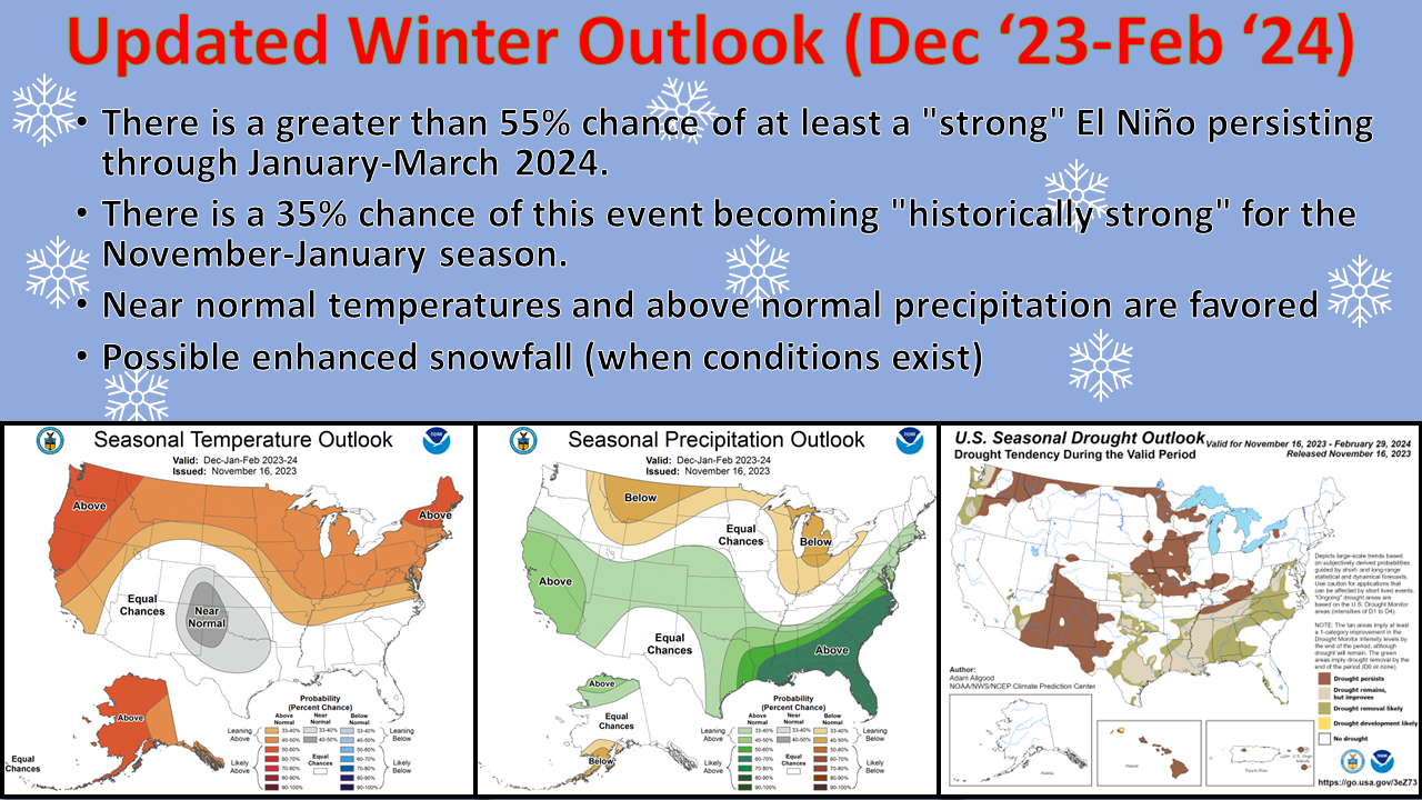
I thought so. Anyway, we do have an updated set of outlooks from CPC, and we
continue with the pattern as laid out by El Nino, coupled with decadal trends (and
we all know just how painful that can be!) and modeled output. So we're left with
a somewhat rare "near normal" designation for temperatures over the state, which
is something of a compromise of how warm the Southwest and South Central U.S. has
gotten, vs. a usual impact of "cooler than normal" due to El Nino. But it's a far
cry from what we've seen the last 3 years with most above normal cool season
months expected due to La Nina. You can also see the tilted odds towards wetter
than normal conditions. As for our drought outlook through February, we do see
relief on the map with improvements expected in our long-term drought areas across
SW and NC OK, but still expected to remain.
I still believe these factors point towards some enhanced wintry weather as
we get into the depths of the cool season, especially towards January into
March. Now of course you have to have (as opposed to halve to halve) those
proper conditions with each storm system that comes through, meaning that
the WEATHER outweighs the CLIMATE at those points.
Okay, enough about hopefully fantasy-casts (more on that later, and don't call
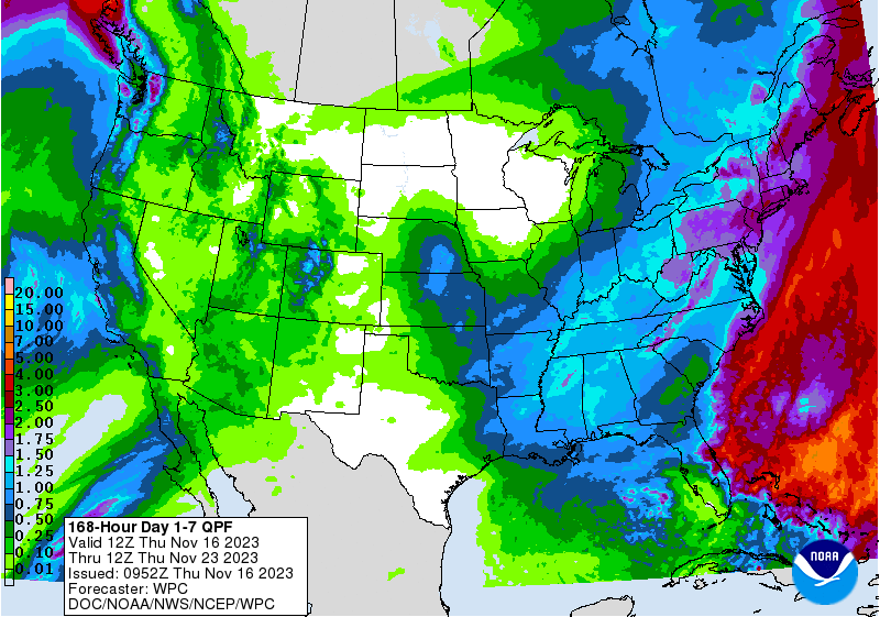
me "more-on"), how about the next few days? Well, we'll see chances of rain
return this weekend and into early next week with two separate storm systems.
The most hopeful is Saturday-Sunday, and we'll see a second early next week
with a bit lower hopes for good moisture.
It all adds up to this, which ain't much but better than none much.
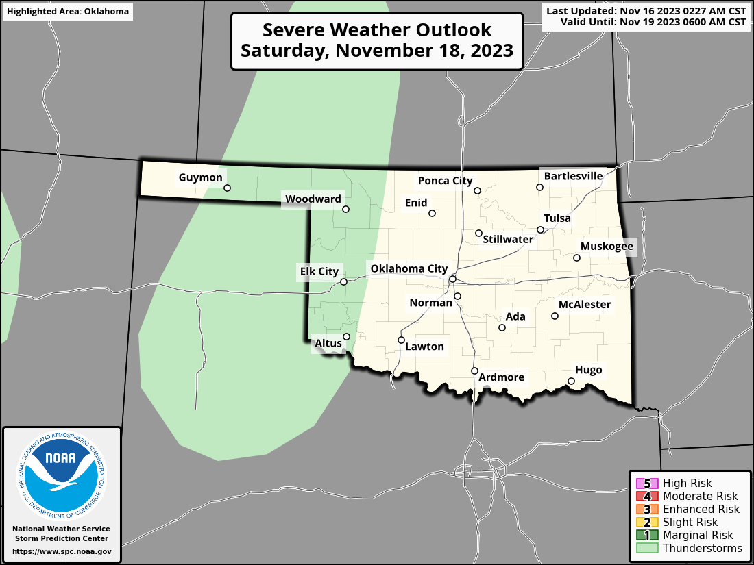
We might even see a bit of convection this weekend, especially if you have
that feature on your oven...weather too. A chance of storms on Saturday out
west, but we see a chance of severe weather on Sunday, so that will need to
keep your attention across central and eastern OK.
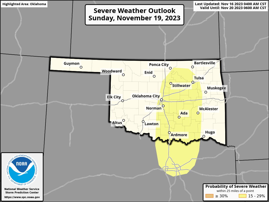
Most likely threats will be some large hail and severe winds, but on the lower
end of the severe scale. No softballs and no tornadoes. Certainly not like
we saw at times last November when we had some bigtime tornadoes rumbling across
the state (and then set records for the highest tornado counts for December,
January, and February with 8, 5, and 13, respectively). We're sitting at 73
official twisters for 2023 thus far...we don't want to add to that total!
We do need the rain, however. We saw drought AND abnormally dry conditions
expand just a tiny bit this week up in northern OK, so we need to head that
off at the pass as quickly as possible.
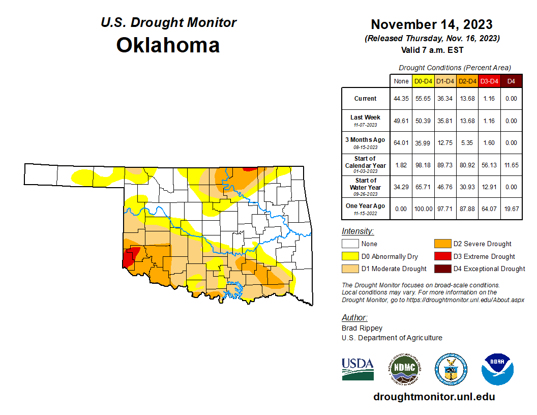
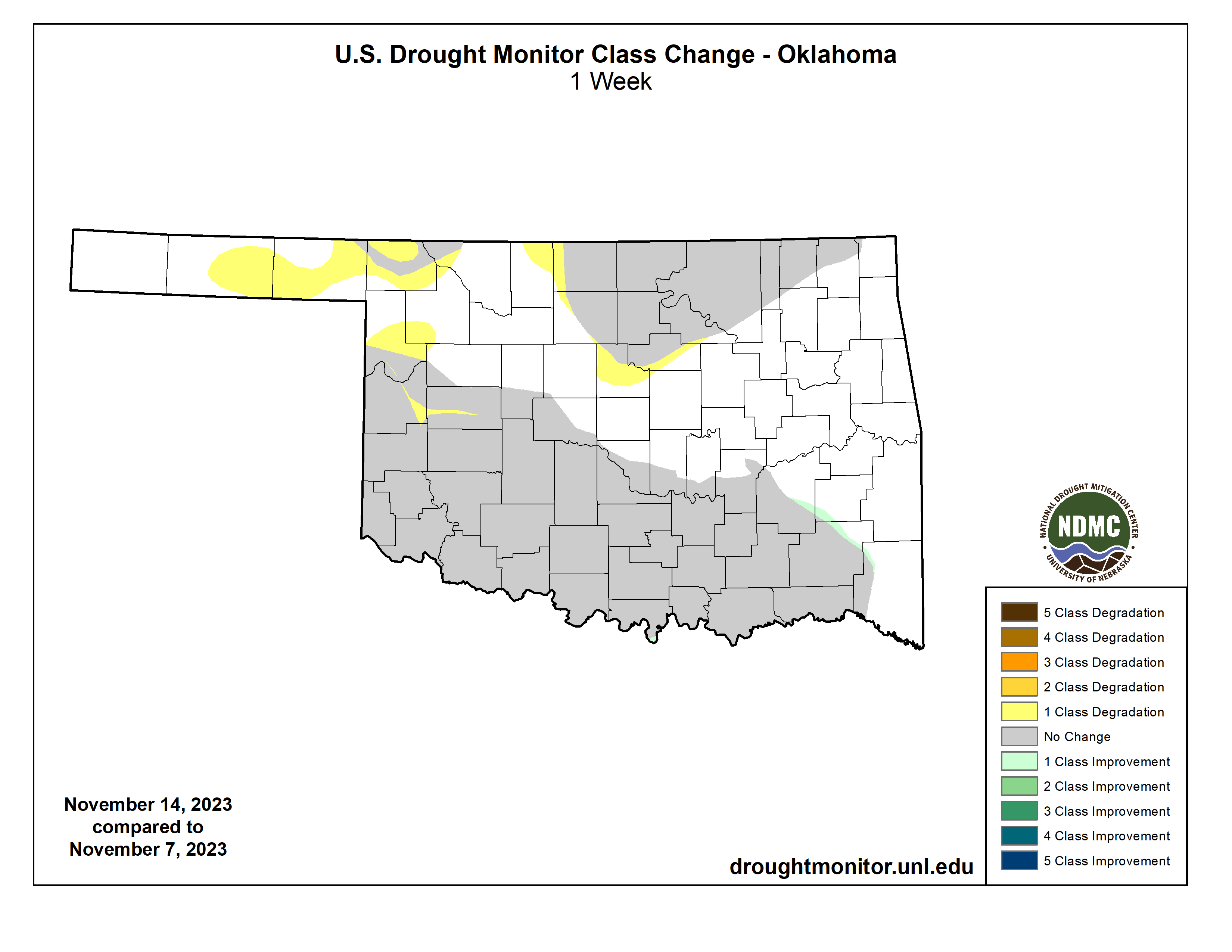
Yeah, "ruh roh" indeed!
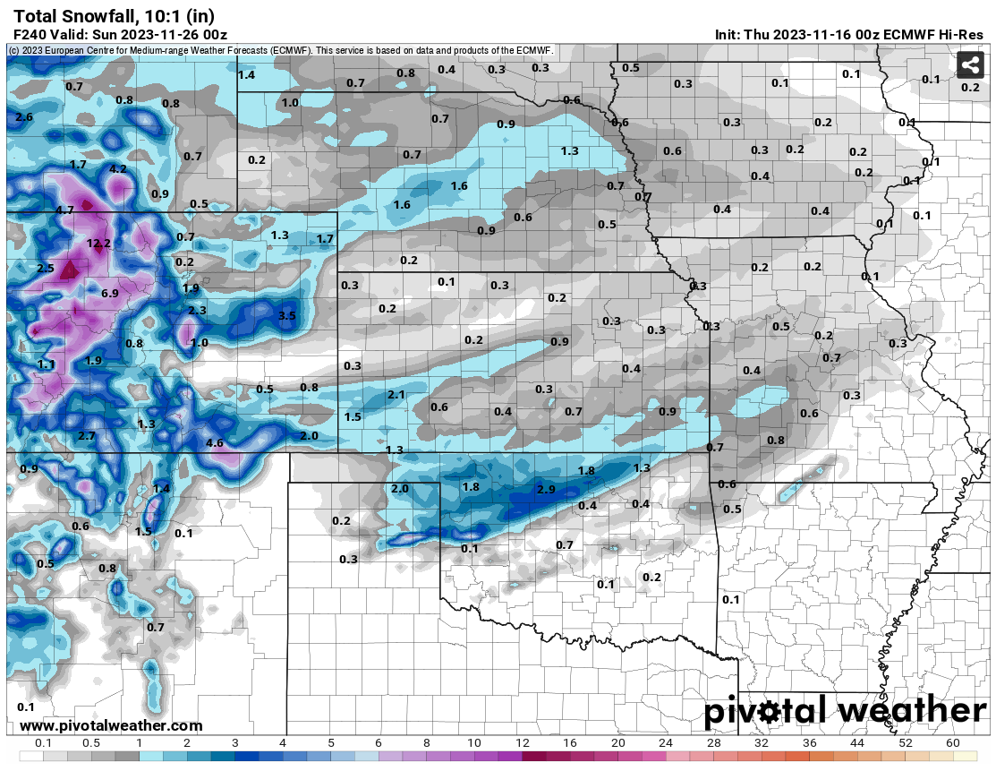
Finally, I'll leave you with growing fantasy...errrr, confidence of some
possible wintry weather as we get into Thanksgiving weekend. The European forecast
model has been consistent with a few inches of snow across the NW third of the
state, with SOME snow (i.e., less than an inch) down farther south as we get
into next Saturday.
And of course the American model has to go act the fool and start putting
huge amounts down just to our north, as it is wont to do (English to Okie
translation: it regularly does it).
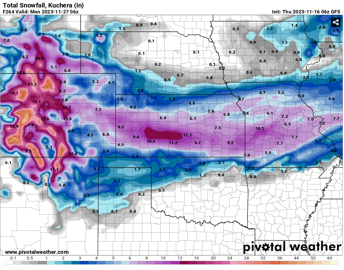
Now that's extended out a bit longer than the ECMWF, so maybe in future runs
of that model we can see if:
1) the snow continues to show up at all, consistent from run to run,
and
B) if it keeps the snow falling longer like the GFS does.
Hey, it's ALL fantasy at this point...now listen to this gurgling sound.
Gary McManus
State Climatologist
Oklahoma Mesonet
Oklahoma Climatological Survey
gmcmanus@mesonet.org
November 16 in Mesonet History
| Record | Value | Station | Year |
|---|---|---|---|
| Maximum Temperature | 90°F | BUFF | 2016 |
| Minimum Temperature | 7°F | KENT | 1997 |
| Maximum Rainfall | 3.72″ | PAWN | 1996 |
Mesonet records begin in 1994.
Search by Date
If you're a bit off, don't worry, because just like horseshoes, “almost” counts on the Ticker website!