Ticker for November 14, 2023
MESONET TICKER ... MESONET TICKER ... MESONET TICKER ... MESONET TICKER ...
November 14, 2023 November 14, 2023 November 14, 2023 November 14, 2023
Dry leaves
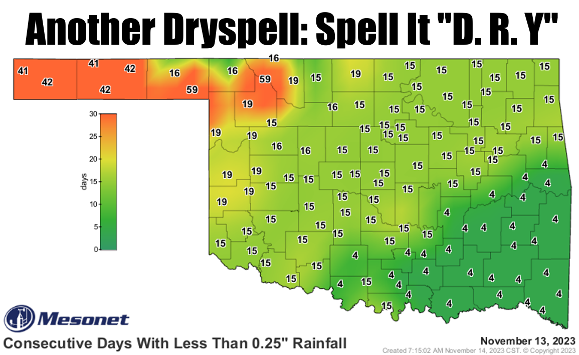
Fifty-nine days ago (let's just call it an even 60), things were different then.
Bread was a quarter, you could get into the movies for a nickel, and cars were
made of steel.
Wait, I'm being told that was 59 YEARS ago.
Fifty-nine days ago, things were different then. Bread was $3, you could get into
the movies for $13, and cars were made of aluminum and plastic.
Yes, that's just how long ago it has been since Freedom and Slapout have seen
a quarter-inch of rain in a single day (and if you've ever had the Freedom
Slappedout of ya, you know just how painful that can be!). For others farther out
in the Panhandle, it's been over 40 days. For much of the NW half of the state,
we're now up no just over 2 weeks. For those lucky few across the SE third, less
than a week. It's like Mother Nature just doesn't want ME to catch a break on
monitoring drought!
And the Oscar for "MAKING IT ABOUT HIMSELF" goes too...
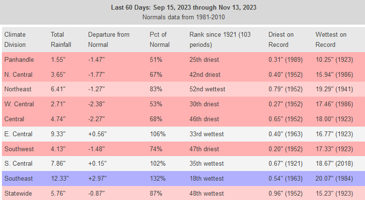
But that elongated period of dry weather is how droughts get started. Just
looking at the 60-day rain maps shows the danger areas, at least areas where
drought is not already in place.
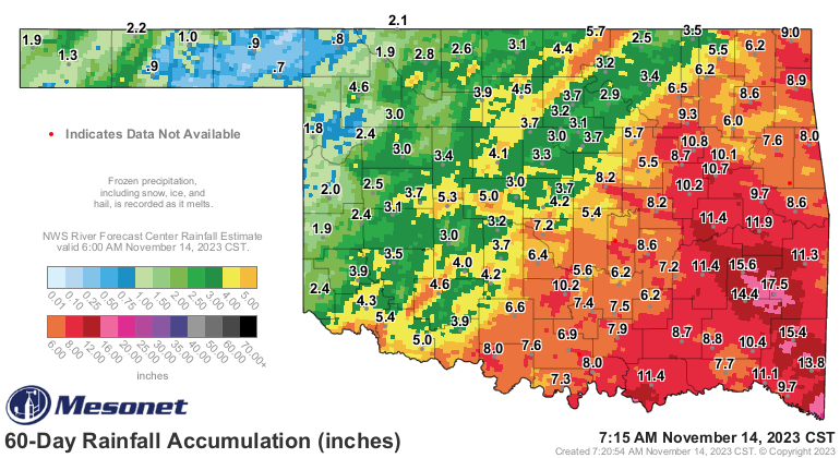
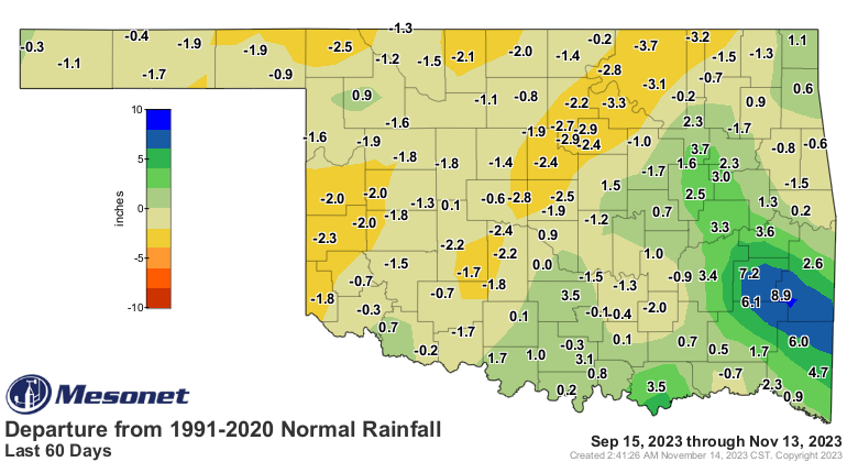
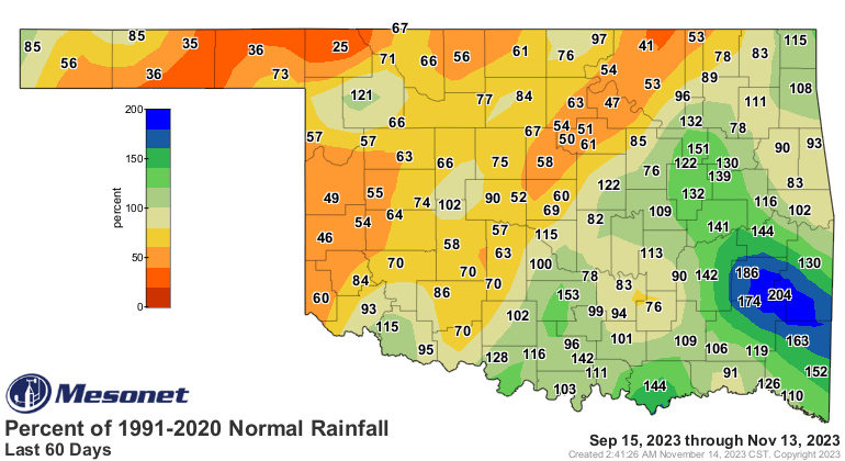
And you might be saying to yourself "But Harriet, this time of year is dry
anyway, and so losing this moisture isn't so bad."
Well, Harriet...if that is your real name, you go back 60 days and you're smack
dab in the middle of September during the secondary rainy season. So if you
see these kinds of stats for that period, you have missed out on vital
precipitation.
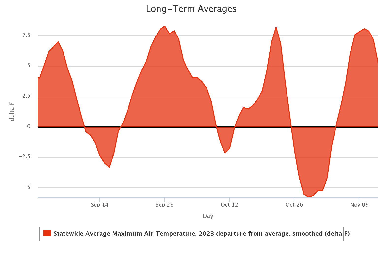
And let's not forget that most of that period has seen temperatures well above
normal, which puts more pressure on that soil moisture.
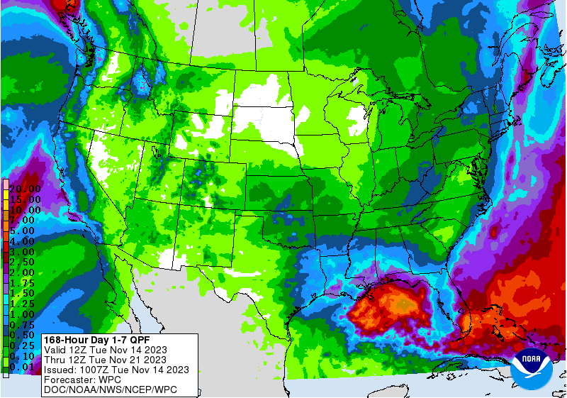
We do have some possible moisture coming up this weekend, as we discussed
yesterday. Don't pin your hopes on WHERE, just yet, but maybe a half-inch to an
inch across much of the state?
And pinning your hopes is dangerous indeed for a storm system that's still well
off the West Coast of the U.S., having yet to be sampled by out more-dense (I
hear your jokes, and I'm hurt) land-based observation platforms.
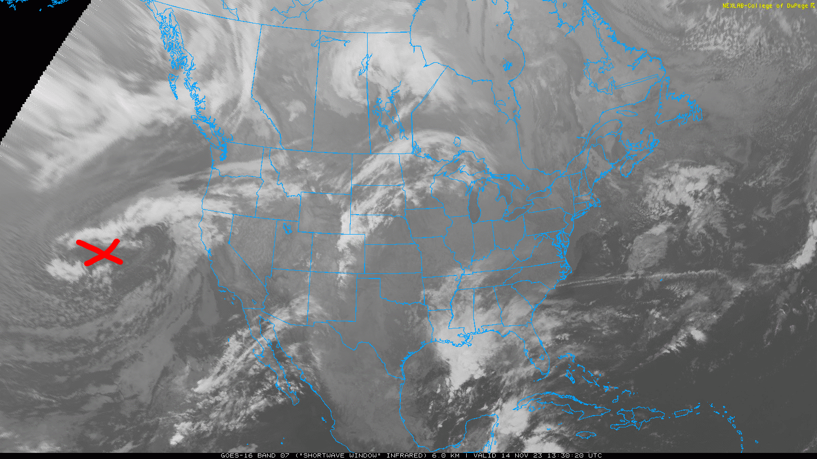
We won't be able to pin possible amounts or locations down for another couple
of days, thanks to the uncertainties in the forecast models thanks to our old
friend Chaos.

Maybe more luck down the road?
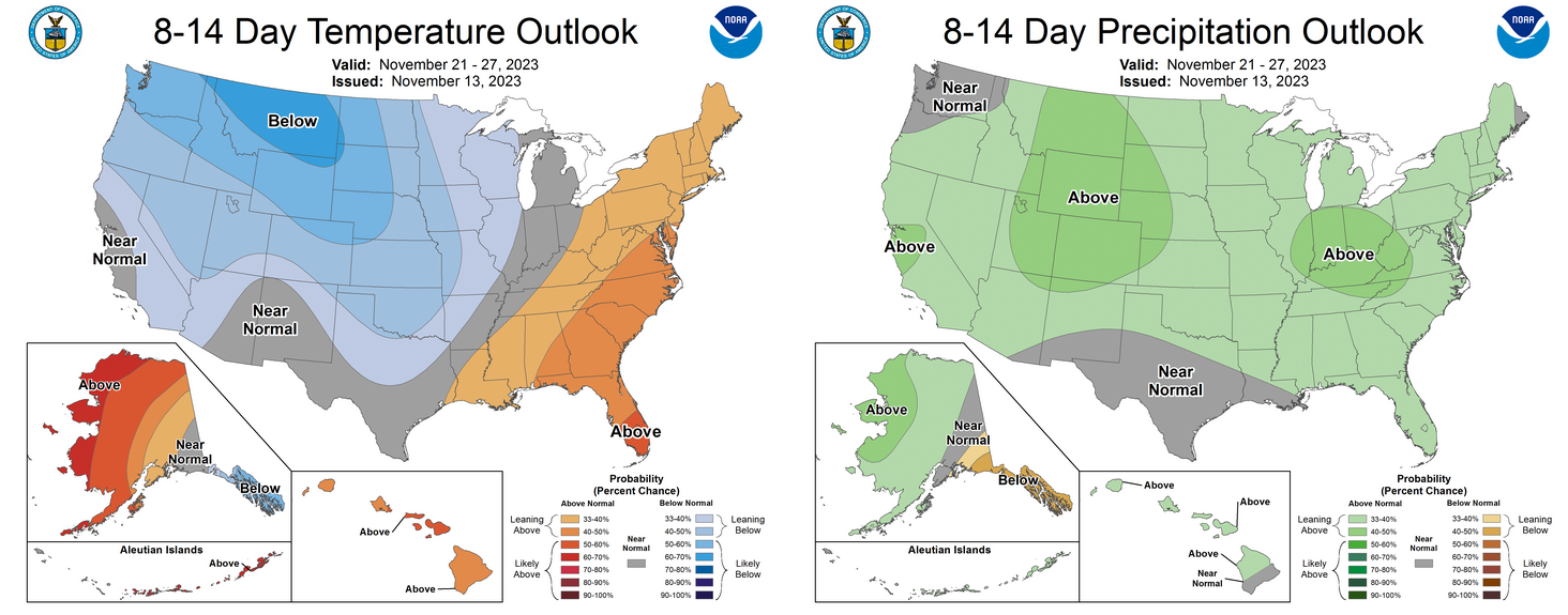
I'm hoping we get the dry Slappedout of us.
Gary McManus
State Climatologist
Oklahoma Mesonet
Oklahoma Climatological Survey
gmcmanus@mesonet.org
November 14 in Mesonet History
| Record | Value | Station | Year |
|---|---|---|---|
| Maximum Temperature | 89°F | GRA2 | 2025 |
| Minimum Temperature | 11°F | OILT | 2018 |
| Maximum Rainfall | 4.93 inches | CLAY | 1994 |
Mesonet records begin in 1994.
Search by Date
If you're a bit off, don't worry, because just like horseshoes, “almost” counts on the Ticker website!