Ticker for August 7, 2023
MESONET TICKER ... MESONET TICKER ... MESONET TICKER ... MESONET TICKER ...
August 7, 2023 August 7, 2023 August 7, 2023 August 7, 2023
A Summer Story
Only this time, I DID say fudge, because fudge is delicious. But anyways...
Don't look now (you can do it...I say the same thing every morning when I'm
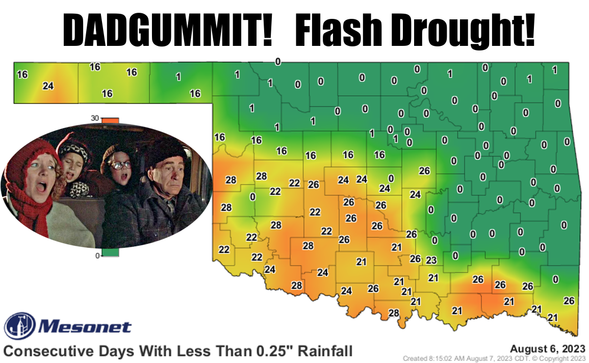
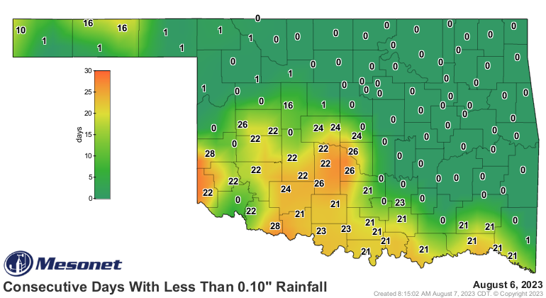
approaching the mirror), but are we going into flash drought? Sure looks like it,
right? Especially when we look at the days without a tenth of an inch...like my
scalp.
And remember, some parts of the state are in drought already and getting worser,
which is worser than worse despite it not being a word.

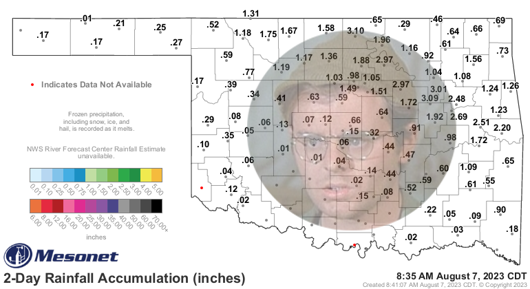
Now it has rained a bit over the last couple of days, but the pattern emerging is
that it sticks to the northeastern half of the state or so, while the SW half or
so misses out. Our radar overlays aren't on the map right now due to technical
issues, so I added my own.
Ahhhhh, Bach.
Heck, it's raining right now for crying out loud!
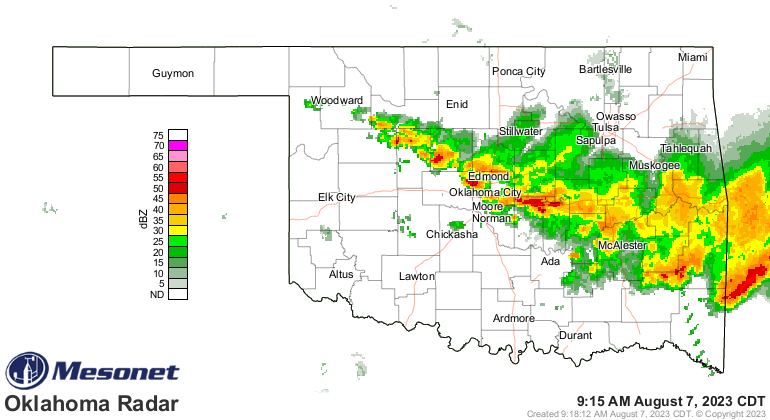
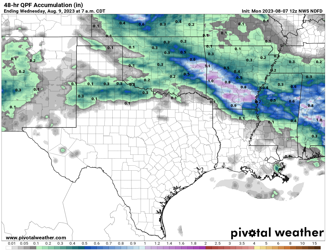
The trouble is that rain, like recent events, is skedaddling (Okie to English
translation: moving) off to the southeast, bypassing SW OK. And the 48-hour
rainfall forecast reflects that as well.
Now we do have some rain chances through the week, but mostly in that same
pattern mentioned above as we remain in NW flow, at least the NE half of the
state or so. Unfortunately for the SW sections of the state, they'll continue
mostly in full summer mode since they are still under the influence of that
upper-level high to our west. However, that NW flow will allow various fronts
and clouds and rain chances to continue throughout the week.


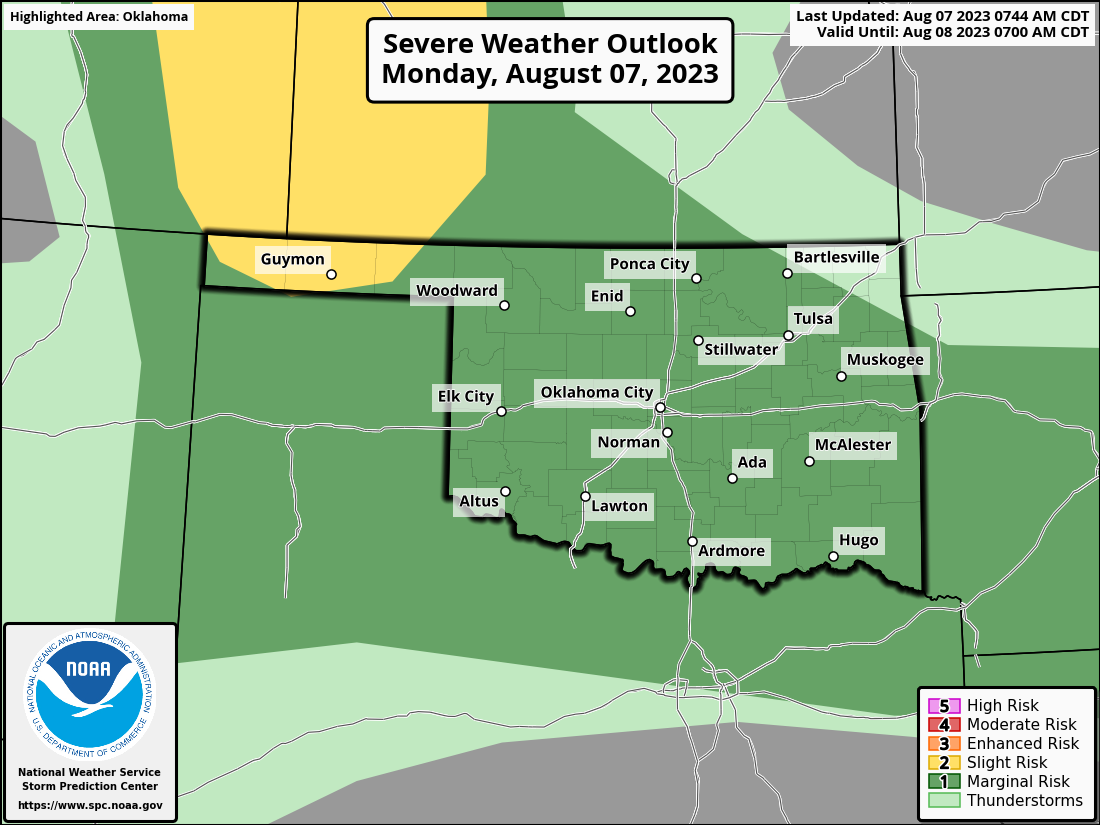
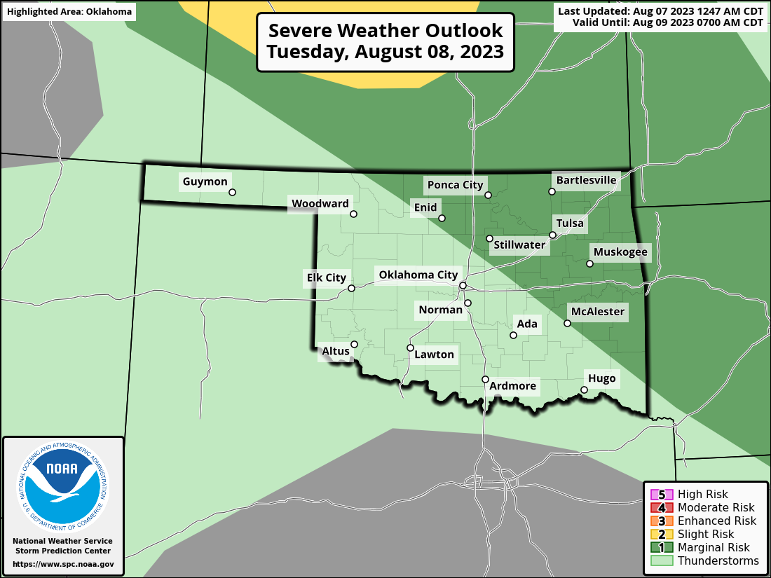
And as we've seen in the past, some of those rounds of storms will be of the
*build in the High Plains and move to the SE, hopefully over Oklahoma, but
probably in the overnight hours* variety. And there will be a chance of severe
weather.

Annnnnnndddddd...we might see that moisture chance continue as we go into next
week.
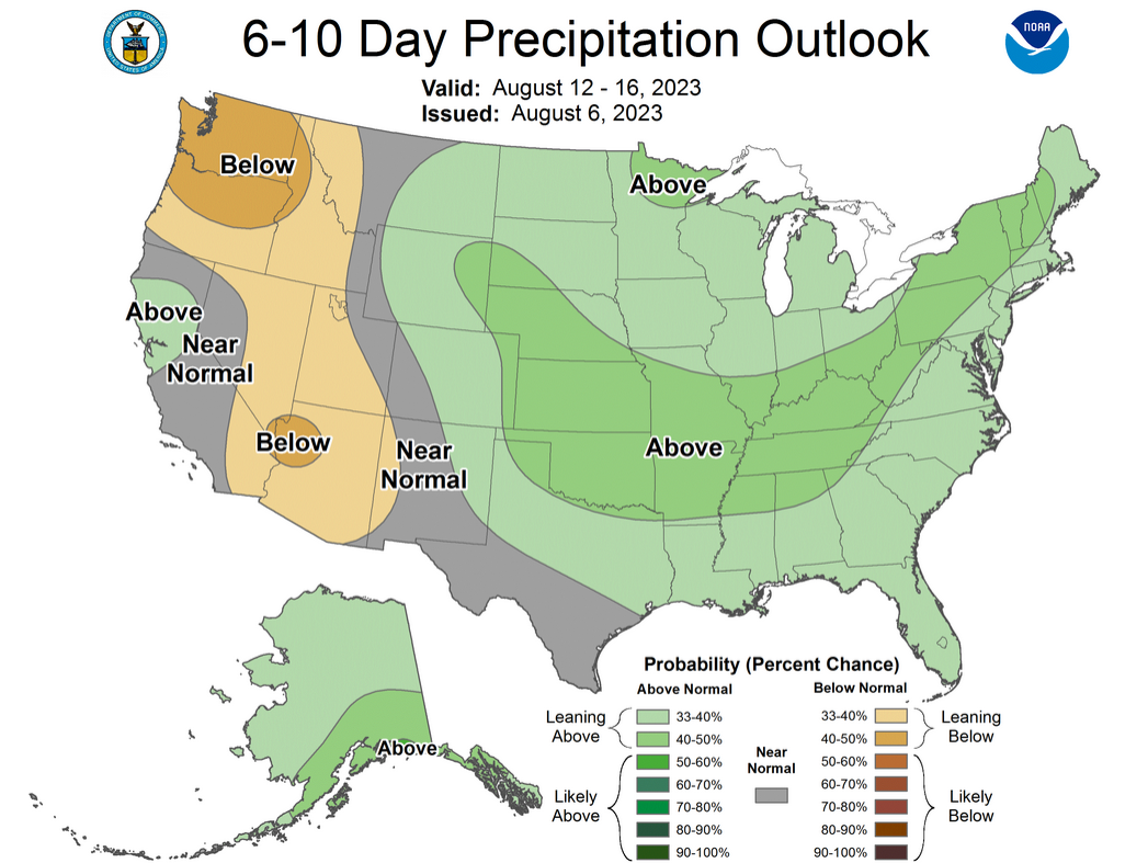
That's fantasy-cast territory, and those CPC 6-10 and 8-14 day outlook maps
aren't looked at and adjusted by humans over the weekend...they're strictly
computer generated, so grain of salt time.
So until we meet again...enjoy or hate Oklahoma weather, depending on where
you are.
Gary McManus
State Climatologist
Oklahoma Mesonet
Oklahoma Climatological Survey
gmcmanus@mesonet.org
August 7 in Mesonet History
| Record | Value | Station | Year |
|---|---|---|---|
| Maximum Temperature | 111°F | MANG | 2003 |
| Minimum Temperature | 52°F | KENT | 1997 |
| Maximum Rainfall | 4.28 inches | WEBR | 2020 |
Mesonet records begin in 1994.
Search by Date
If you're a bit off, don't worry, because just like horseshoes, “almost” counts on the Ticker website!