Ticker for August 3, 2023
MESONET TICKER ... MESONET TICKER ... MESONET TICKER ... MESONET TICKER ...
August 3, 2023 August 3, 2023 August 3, 2023 August 3, 2023
The Ballad of Drought Buster
Somebody sent in a request for this graphic and meme. I get a lot of those types
of requests, and I just want to say "HOW DARE YOU!"
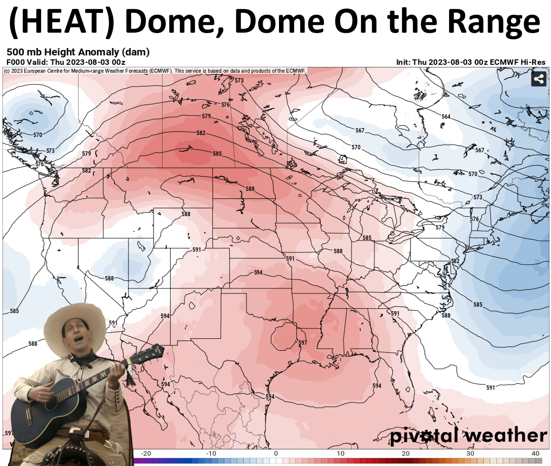
Yes, how dare you come up with something better than I could have. But that
graphic of 500 millibar height anomalies gives us a great snapshot of the upper-
level heat dome that has plagued us for almost two weeks now. That closed
area of anti-cyclonic (clockwise) circulation keeps that air sinking and
compressing, suppressing clouds AND rain chances, and pumps those temperatures
up into the dangerous category that we've seen over that 11-12 day period.
And today again.

And it's gonna stay that way into the weekend before we see relief.
Our relief-maker actually shows up on that top map there. See that area of blue,
indicating cooler temps, and the kink in the height anomaly contours hanging
out over Nevada and Utah? Well look again, it's there!
It's okay, I'll wait until you're done to start typing again.
Yes, that small storm system will eventually turn into a weather-changer for us
as that heat dome slinks off to the SE and weakens and that storm system rotates
over the top of it, until we get this picture of that height anomaly field
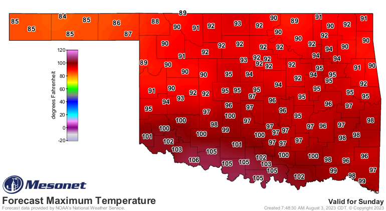
Sunday at 1pm (this is a forecast...but looks pretty solid).
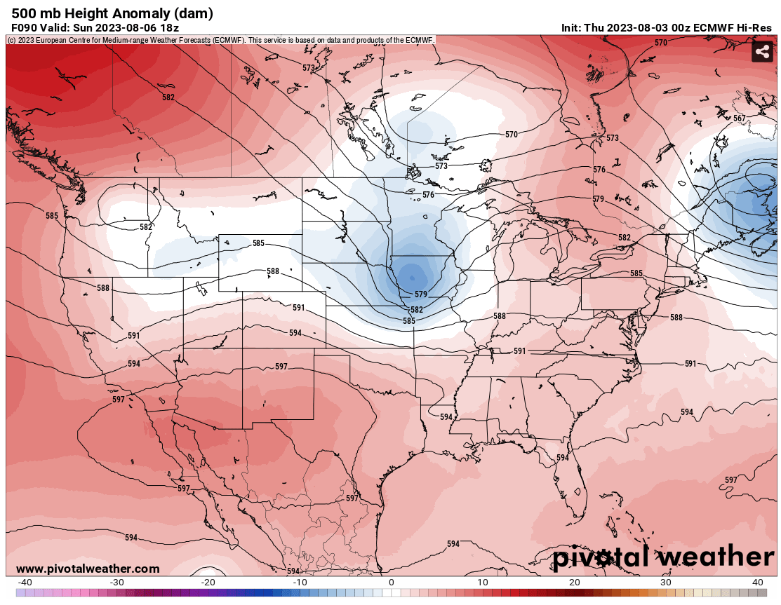
Notice how that trough has strengthened up over Iowa, and Oklahoma is now on
the pereph...perif...edge of that clockwise rotation, putting us back in
northwesterly flow, like we saw for much of June and the first 3 weeks of July?
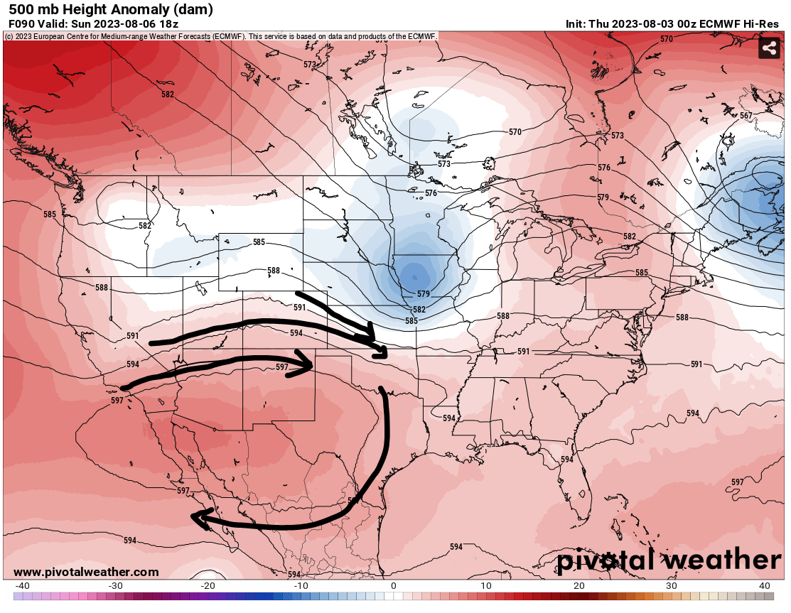
Well, without trying to teach you a whole course in synoptic meteorology (because
then we'd both fail), that feature is going to allow a fairly substantial cold
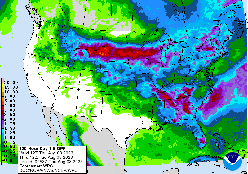
front through the state Sunday into Monday. AND it should allow for some rain
chances. Storms should fire up in the High Plains and move to the southeast,
hopefully into Oklahoma. It doesn't look like we will see the types of toad-
stranglers we saw early last month, but it's moisture and better than our
attempts at a mini-flash drought we're seeing currently.
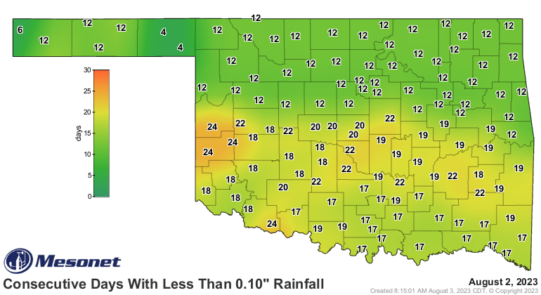
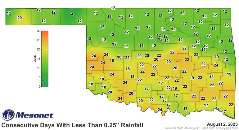
With those lengths without significant precip...uhhhhh, lengthening, and the
terrible heat we've had recently, it doesn't take long for flash drought to
erupt and we start heading backwards from all the progress against that 2-year
drought we were mired in (and we all know just how painful a good miring can
be!). And the cooler weather should help.

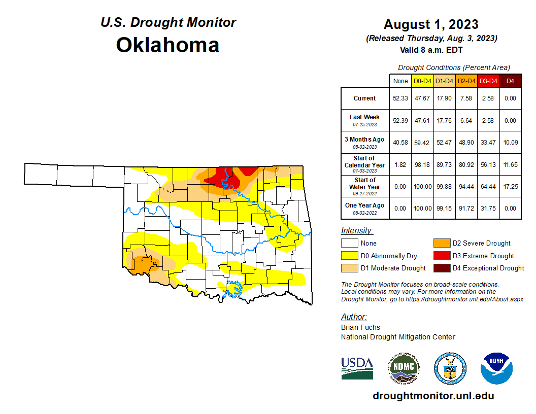
Drought in the state actually went up for the first time since early June as
conditions continue to deteriorate in the far SW. Pictures from Jackson County
show horrible conditions continue with dry ponds and dead grass.
Going forward, it appears we're gonna be on the edge of that heat dome that
intensifies over the Desert Southwest (just once, I'd like to go see the Dessert
Southwest, where cakes abound along with the cacti), and just how far north
and east it tries to shift. Hopefully it stays to our SW and we can continue in
that NW flow with occasional cold fronts and storm chances.
Gary McManus
State Climatologist
Oklahoma Mesonet
Oklahoma Climatological Survey
gmcmanus@mesonet.org
August 3 in Mesonet History
| Record | Value | Station | Year |
|---|---|---|---|
| Maximum Temperature | 115°F | WILB | 2011 |
| Minimum Temperature | 53°F | CAMA | 2021 |
| Maximum Rainfall | 5.73 inches | CHER | 1995 |
Mesonet records begin in 1994.
Search by Date
If you're a bit off, don't worry, because just like horseshoes, “almost” counts on the Ticker website!