Ticker for May 18, 2023
MESONET TICKER ... MESONET TICKER ... MESONET TICKER ... MESONET TICKER ...
May 18, 2023 May 18, 2023 May 18, 2023 May 18, 2023
WHOO-HOO!!
WHOO-HOO INDEED! Before I get started, or start before I getted, let me just say
it HAS rained out west, and heck, it's raining right now for crying out loud!

And furthermore, or more further, our "have-nots" over our current rainy period
are starting to shrink. I know the folks in Roger Mills, Dewey and Custer counties
felt left out, so that should ease the deficits out there for a bit, but we still
have some of those light-to-dark green holes to fill as we gaze out through the
30-day period.
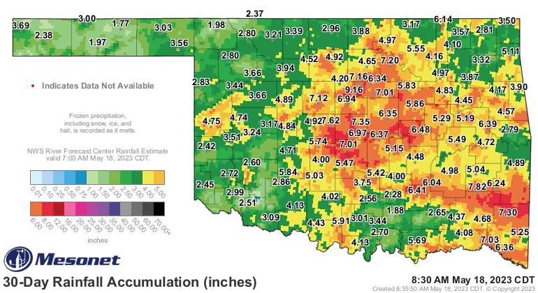
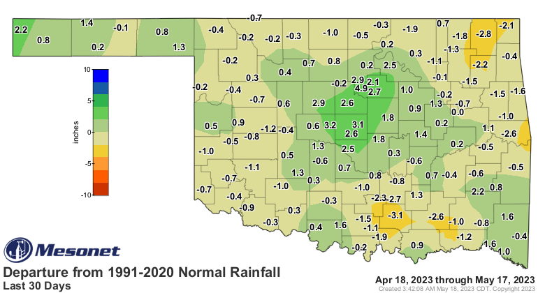
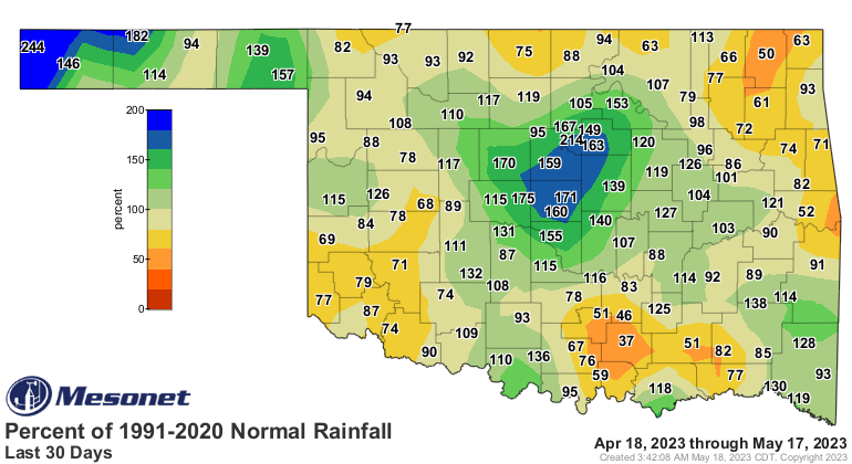
Those departure and percent of normal maps don't take into account today's
rainfall, so we're missing some of those totals out west. But again, things
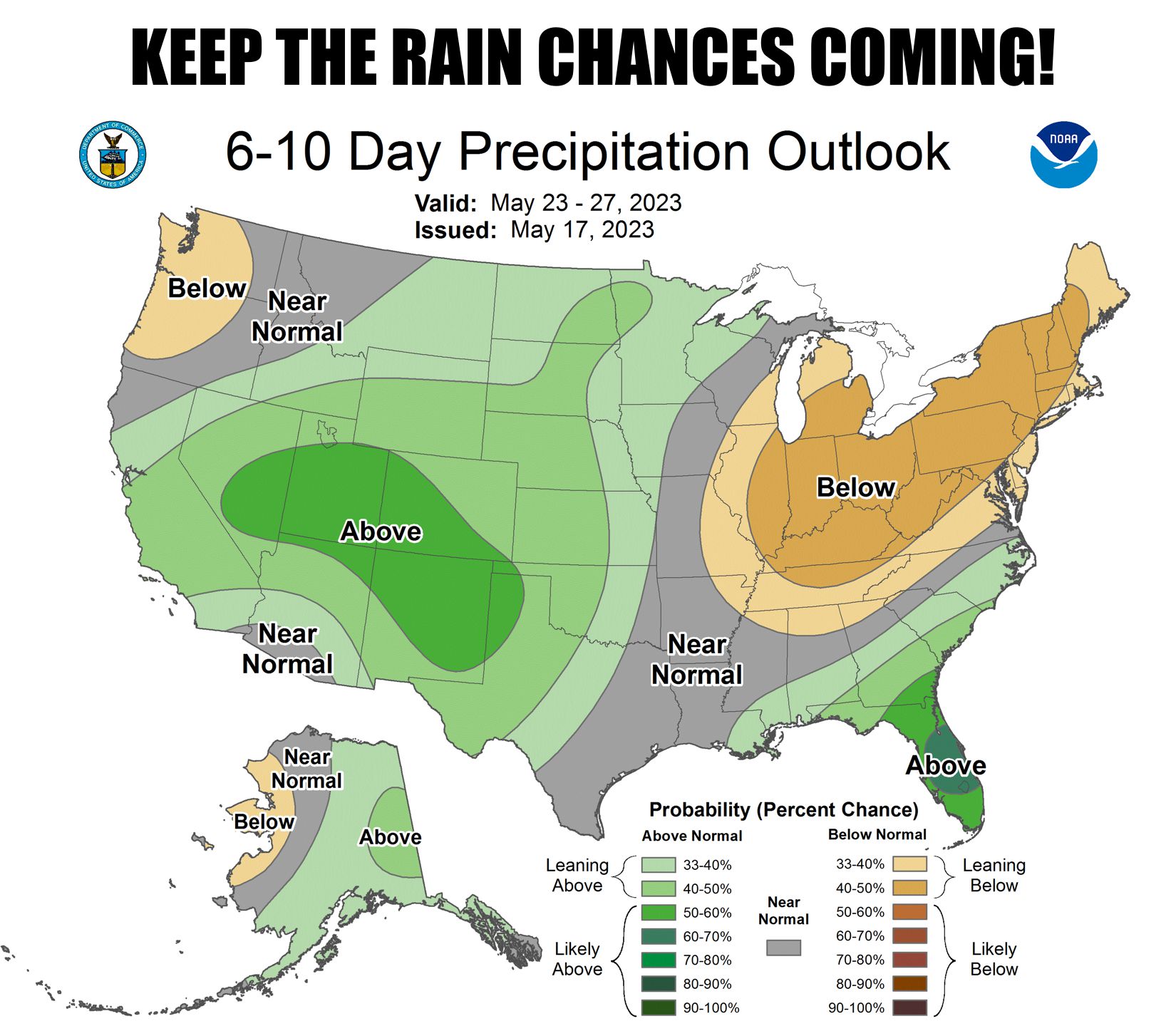
are looking up, especially for western Oklahoma. All the signs point towards
a wetter next couple of weeks across all of Oklahoma, but especially the western
half.
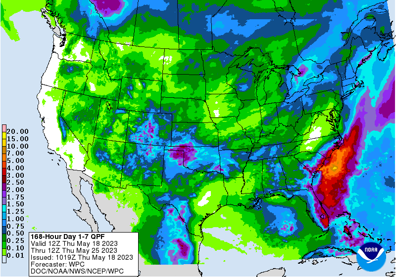
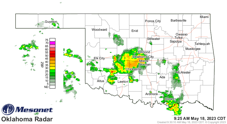
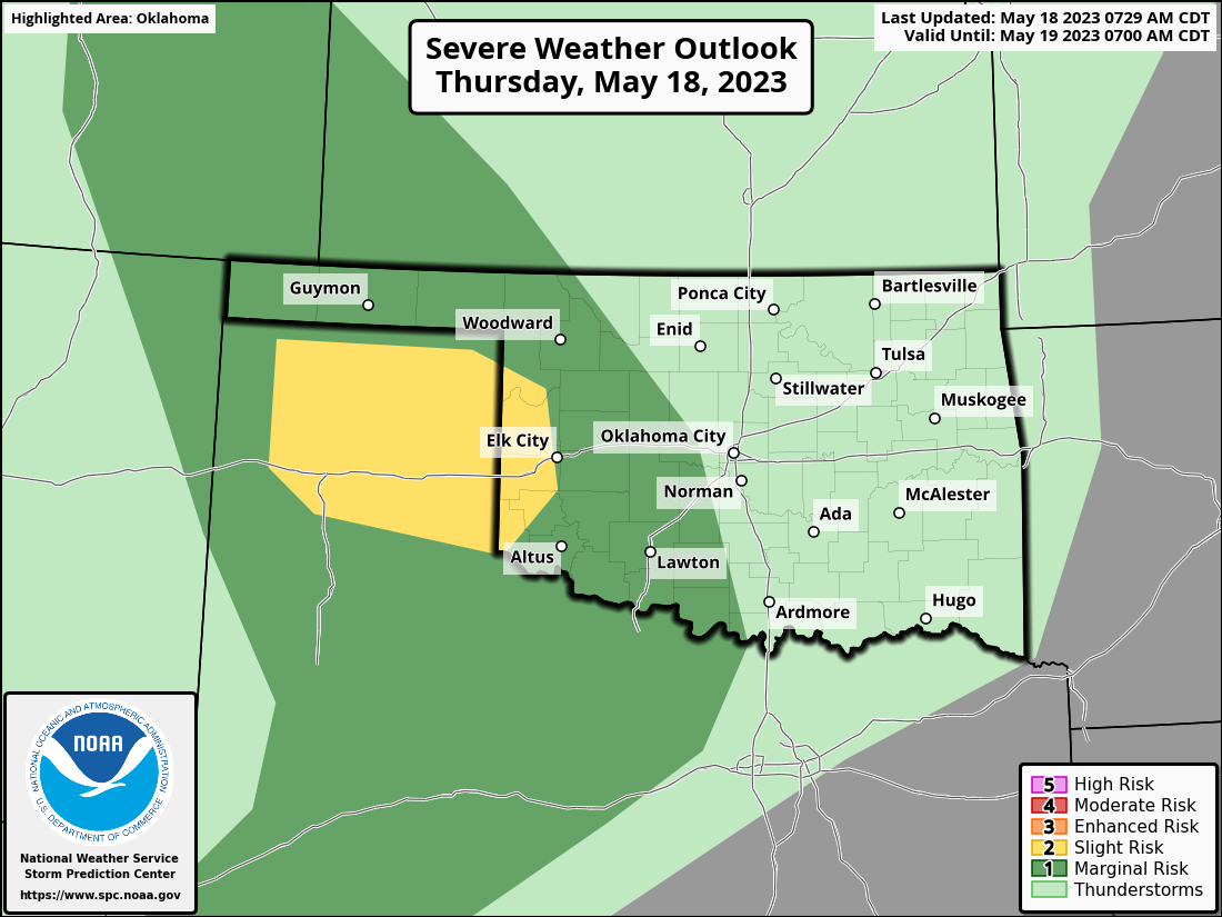
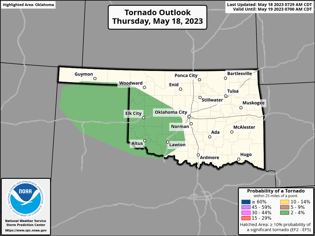
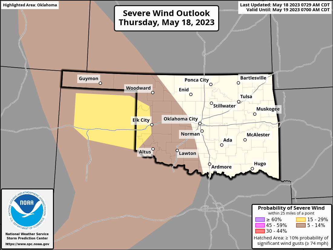
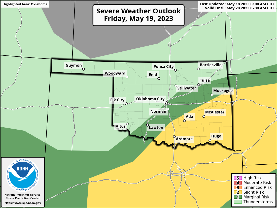
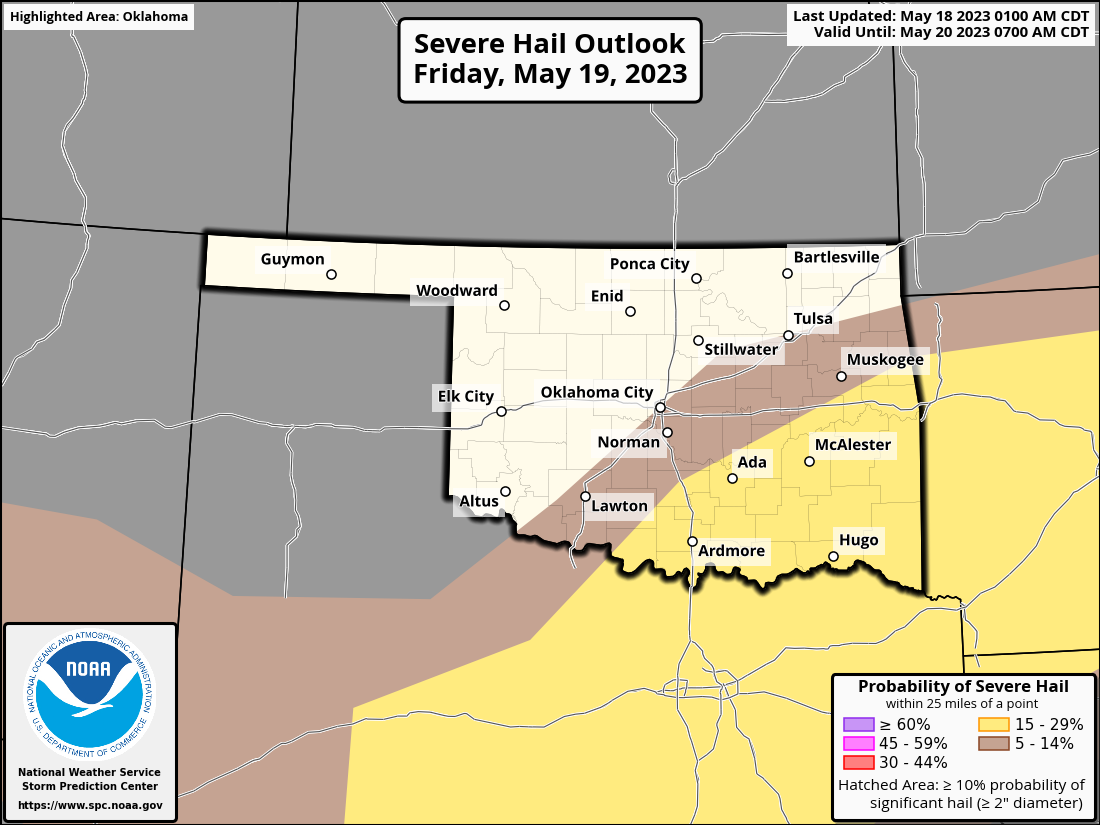
A cold front should slide in the state overnight, kicking up another round
of showers and storms, in addition to the possible trigger provided by the
current convection kicking out an outflow boundary here and there. Areas of
training thunderstorms set up a possible flash flood hazard, as well as the
chance for some severe weather. Nothing high end, but enough to stay weather
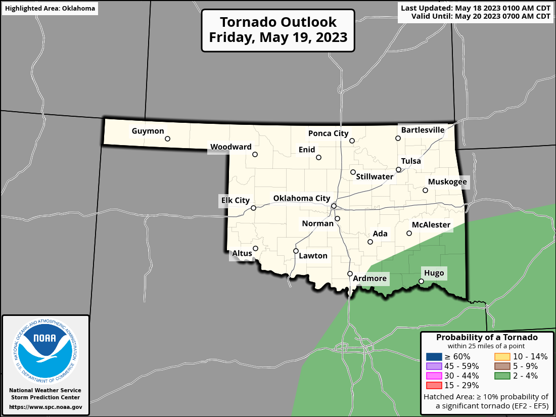
aware. And then again tomorrow as the front slides farther southeast. As per
usual, the tornado threat both days is low, but not zero.


Back to the rain, what we've seen from last Tuesday 7am to this Tuesday 7am
was used to ease the drought depiction on the Drought Monitor just a bit, so
any rain that has fallen since that cutoff period will be used on next week's
map. But the map is improving nonetheless.
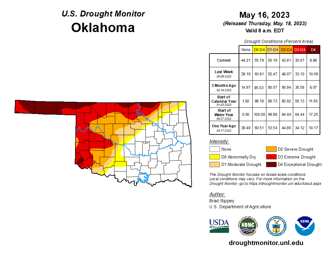
The 30.7% of the state in D3-D4 drought is the lowest total we've seen since
July 19, 2022, and after it peaked at 86% of the state on Oct. 11, 2022. But
that's also a reminder that summer is coming, whether we like it or not, and
we need to build up a reserve of surface and soil moisture to withstand the
hot weather. In that regard, CPC's summer outlooks call for increased odds of
above normal temperatures (SHOCKER!) and above normal precip, but confined to
the far eastern edge of Oklahoma.
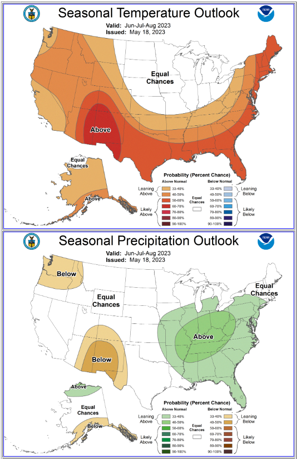
The presence of above normal summer temperatures alone is enough to further
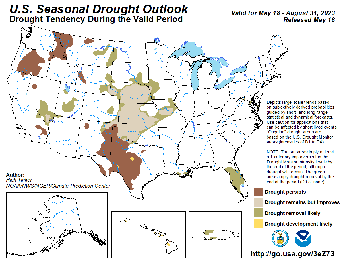
drought concerns, even in the event of "normal" rainfall amounts. However, CPC's
drought outlook does call for improved drought conditions by the end of August, if
not downright removal.
So we have favorable forecasts, both short- and long-term, for drought prospects
across Oklahoma. And then, Mother Nature is gonna take those into advisement and
do what she wants to do anyway, so the best thing to do is stay hopeful and
stay tuned.
Gary McManus
State Climatologist
Oklahoma Mesonet
Oklahoma Climatological Survey
gmcmanus@mesonet.org
May 18 in Mesonet History
| Record | Value | Station | Year |
|---|---|---|---|
| Maximum Temperature | 104°F | BEAV | 2013 |
| Minimum Temperature | 37°F | JAYX | 2002 |
| Maximum Rainfall | 5.06 inches | REDR | 2001 |
Mesonet records begin in 1994.
Search by Date
If you're a bit off, don't worry, because just like horseshoes, “almost” counts on the Ticker website!