Ticker for May 17, 2023
MESONET TICKER ... MESONET TICKER ... MESONET TICKER ... MESONET TICKER ...
May 17, 2023 May 17, 2023 May 17, 2023 May 17, 2023
Hey to Kermit
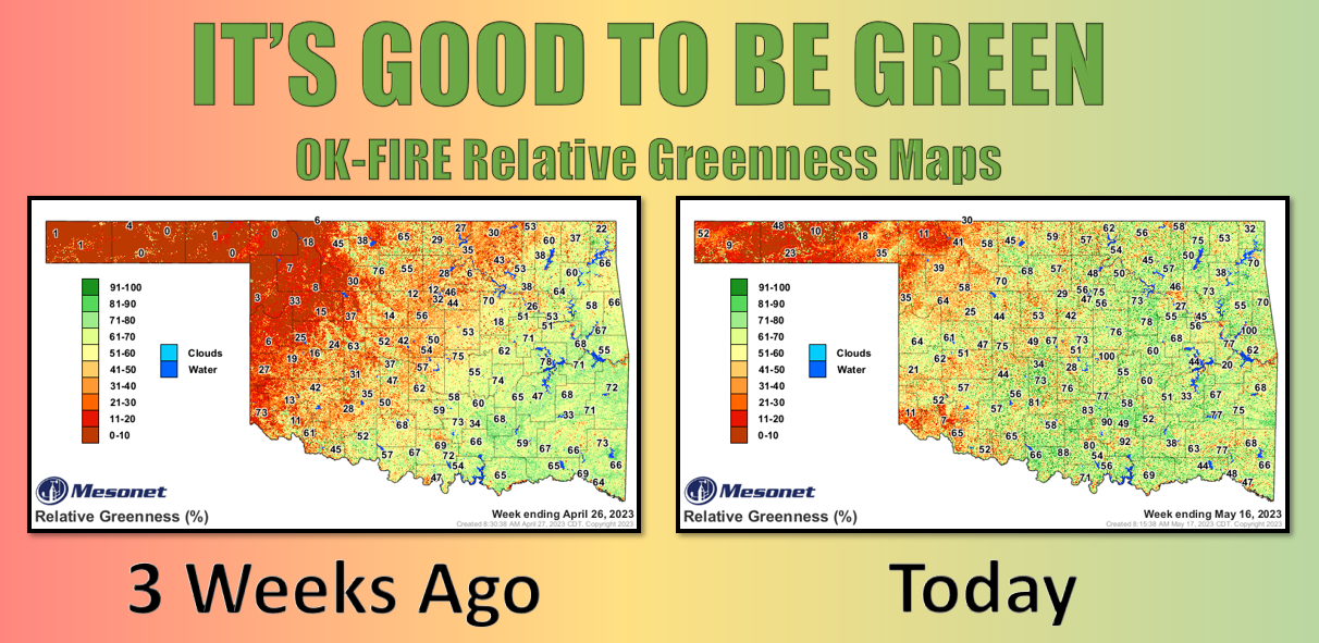
What a difference just a few weeks can make, right? I mean, look at how *I'VE*
changed in the last 3 weeks! From this:

Ugh, hideous, amirite?
To this:

What's with the laughing?? How DARE you! Okay, that first pic isn't really me. I'll
fess up. But back on April 26, Oklahoma's weather fortunes-for most at least-were
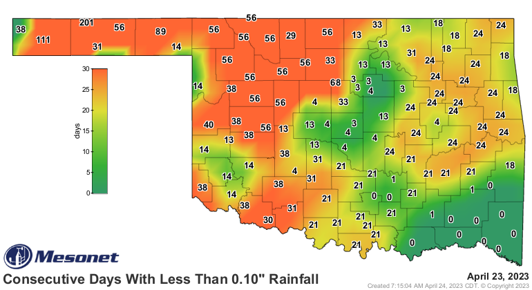
much different. We were just coming out of the throes of these maps (and I've been
in throes...it's not pleasant!)

to these maps:
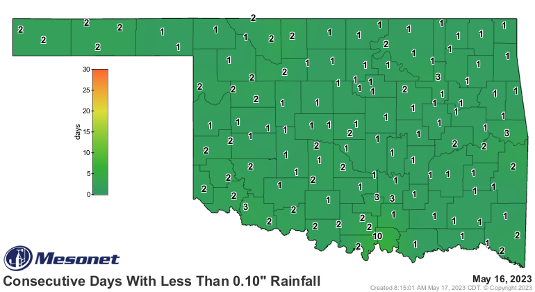
And this map shows what rain has fallen over that period that has (or hasn't,
in some cases) transformed our barren landscape across the NW half of the state
into something more springlike.
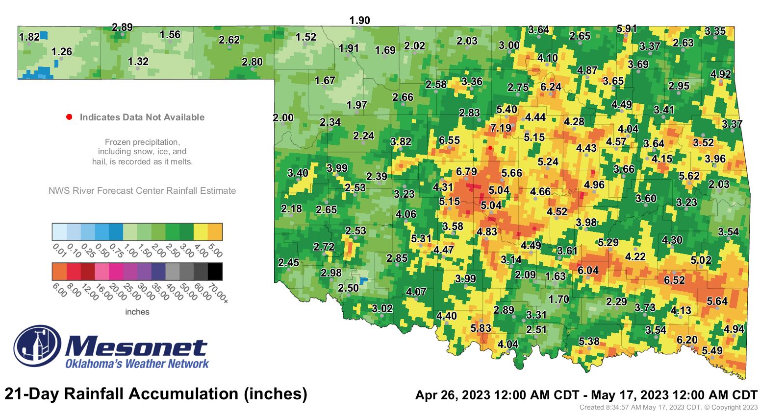
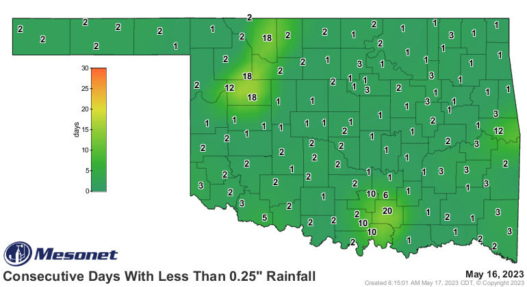
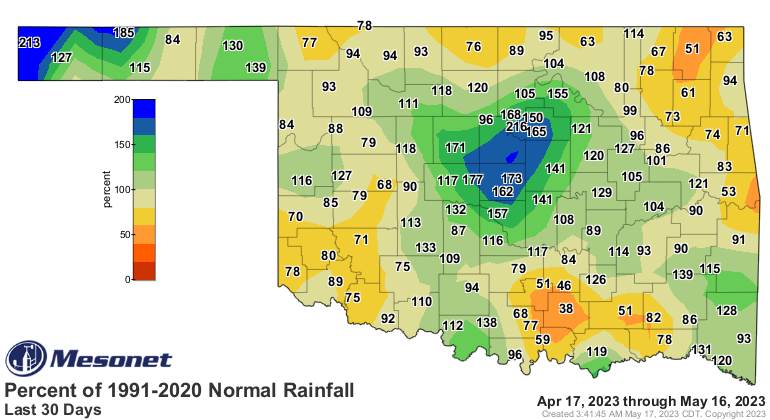
The problem areas show up on these maps in the lighter greens, and even a few
blues in the SW, as well as the western Panhandle. But we can also see those
troubles on the 30-day pct of normal map.
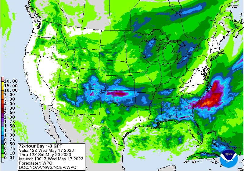
In the case of NW OK, help is possibly on the way. We're still seeing a big
rain event for that area over the next 3 days, or at least a chance of
reinforcing moisture.
Where have we heard that one before? But change can happen quickly...just look
at how I've changed since I've been writing this Ticker.

I know. Amirite?
Gary McManus
State Climatologist
Oklahoma Mesonet
Oklahoma Climatological Survey
gmcmanus@mesonet.org
May 17 in Mesonet History
| Record | Value | Station | Year |
|---|---|---|---|
| Maximum Temperature | 101°F | HOLL | 2022 |
| Minimum Temperature | 37°F | CAMA | 2009 |
| Maximum Rainfall | 3.66 inches | PORT | 2002 |
Mesonet records begin in 1994.
Search by Date
If you're a bit off, don't worry, because just like horseshoes, “almost” counts on the Ticker website!