Ticker for May 3, 2023
MESONET TICKER ... MESONET TICKER ... MESONET TICKER ... MESONET TICKER ...
May 3, 2023 May 3, 2023 May 3, 2023 May 3, 2023
More!
Yeah, I know SOME of you don't want rain, but this isn't a democracy.
It's a climatocracy.
Yes, I've watched the movie, many times, and I'm not ashamed!
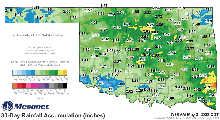
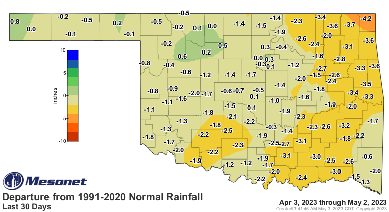
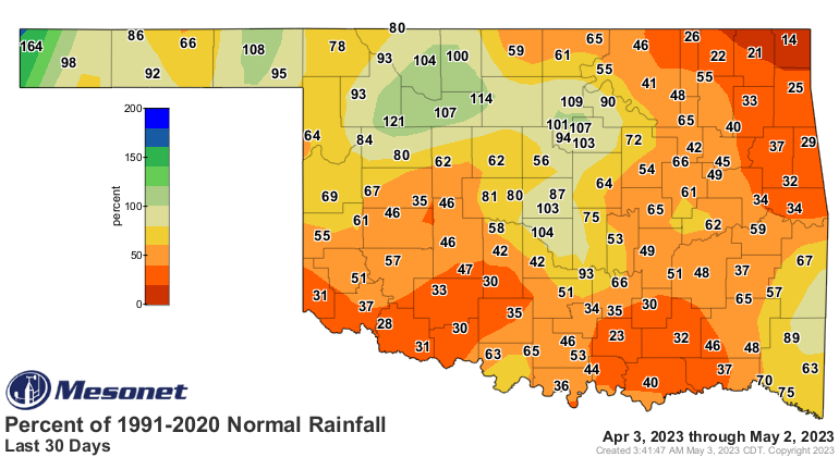
Here's the deal, though. Half or more of the state has had one good rain in the
last several months, but drought is still here, of course. Even down to the 30-day
rain maps, it's pretty plain to see.
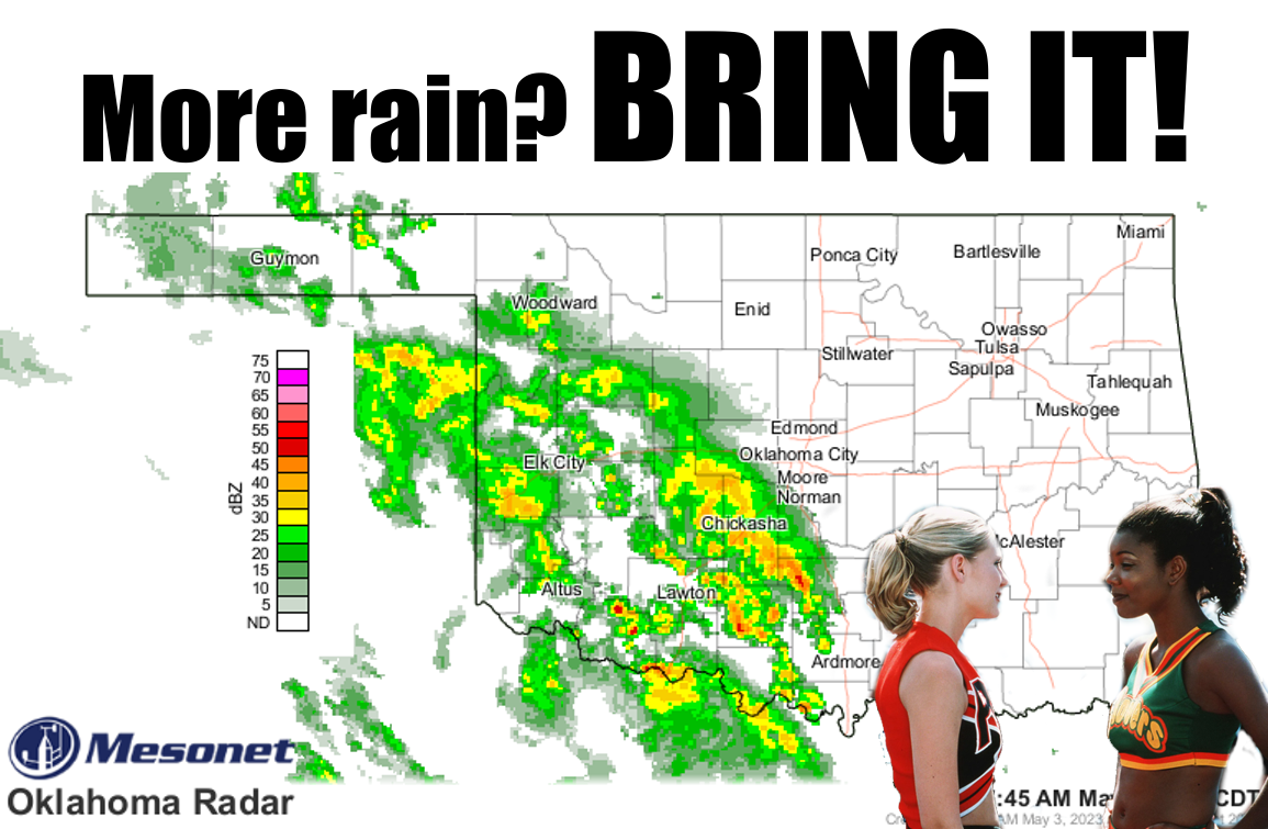
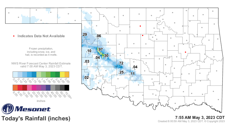
So the rain falling this morning is still much needed, and we've had an inch
or more in some select locales. Spirit fingers to Butler and Fort Cobb!
More rain chances are coming, not only today, but with some severe weather
concerns tomorrow and into the weekend. The rainfall forecast map is starting
to look like a typical 7 days in May.

We are NOT saying "bring it" to the severe weather, but it's May. In Oklahoma.
While tomorrow's severe threat is starting to sharpen, the tornado threat is
still low. Remember, it was pretty low on April 19, too, and we ended up with
at least 18 tornadoes.
It's May.
In Oklahoma.
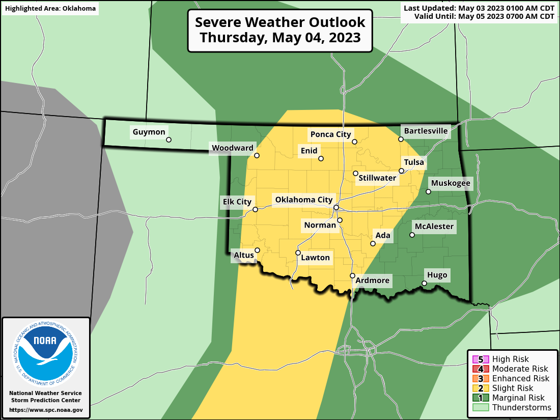

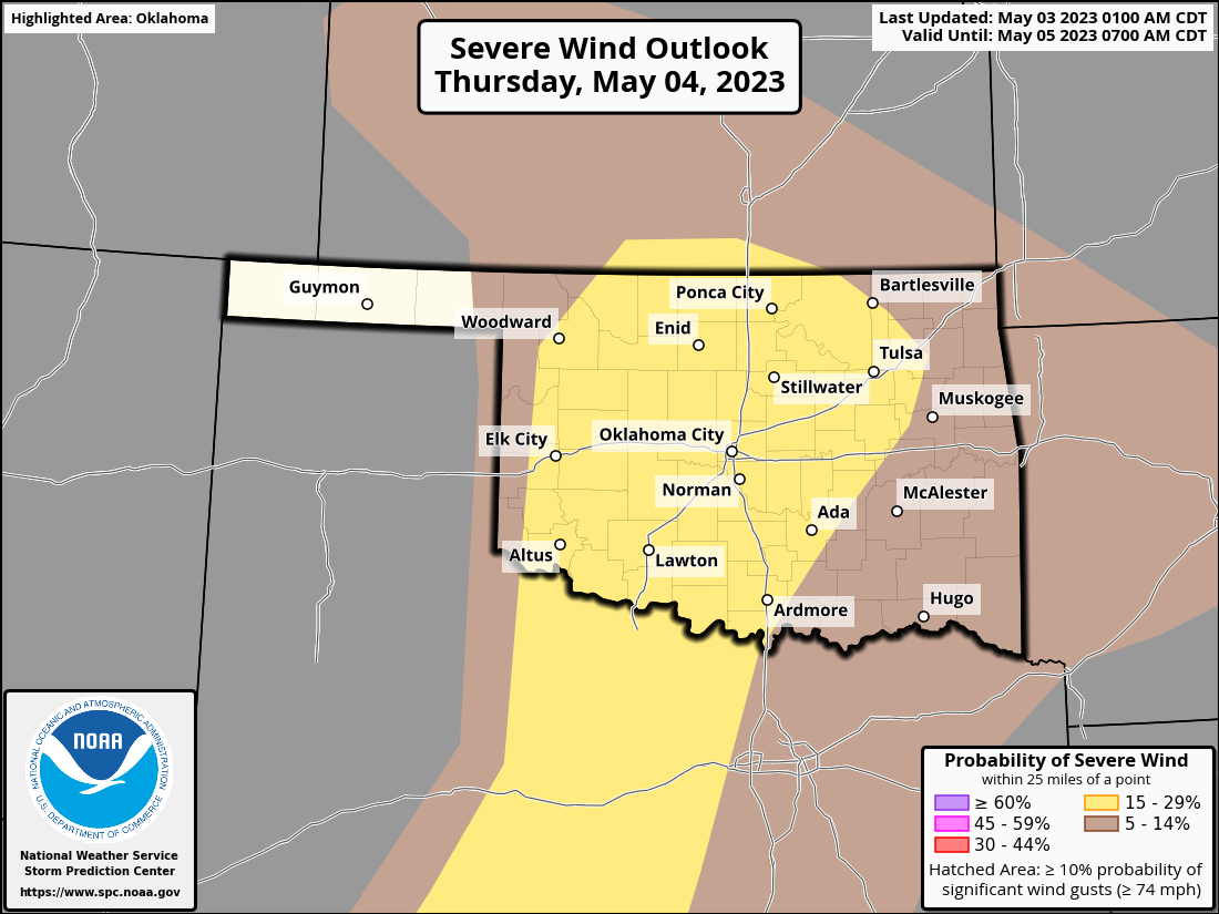
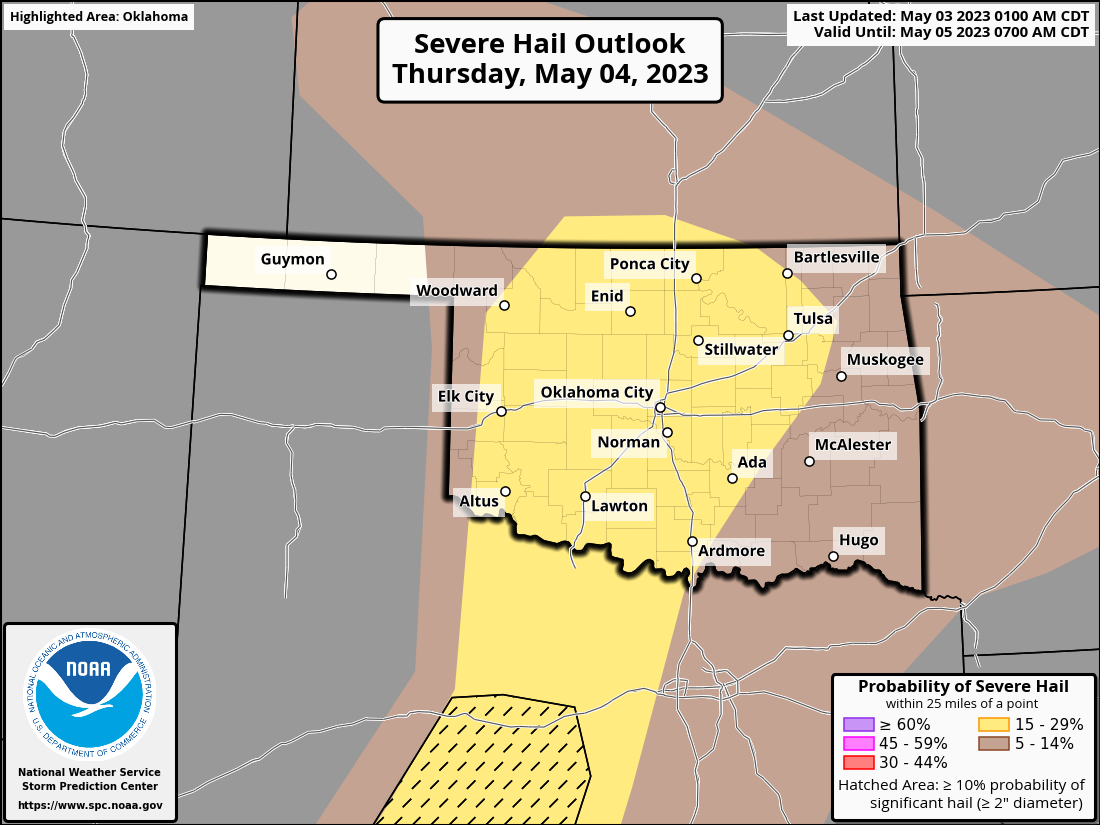
So it looks like mainly a wind and hail threat, but...
It's M...oh you get the point!
For some of you young folk, this is the 24th anniversary of the May 3, 1999,
tornado outbreak across Oklahoma that killed 40 and caused over a billion
dollars of damage in the state. Here's a detailed summary of the event from
our friends at the Norman NWS office.
https://www.weather.gov/oun/events-19990503
May in Oklahoma. SHEESH!
Gary McManus
State Climatologist
Oklahoma Mesonet
Oklahoma Climatological Survey
gmcmanus@mesonet.org
May 3 in Mesonet History
| Record | Value | Station | Year |
|---|---|---|---|
| Maximum Temperature | 101°F | ALTU | 2012 |
| Minimum Temperature | 22°F | BOIS | 2013 |
| Maximum Rainfall | 3.14 inches | MCAL | 2021 |
Mesonet records begin in 1994.
Search by Date
If you're a bit off, don't worry, because just like horseshoes, “almost” counts on the Ticker website!