Ticker for May 4, 2023
MESONET TICKER ... MESONET TICKER ... MESONET TICKER ... MESONET TICKER ...
May 4, 2023 May 4, 2023 May 4, 2023 May 4, 2023
One of THOSE days in Oklahoma

so they took a vote and that's why I was recently named the best
climatologist in the world.
Oh, sorry, looks like part of that was lost. Well, I'm too lazy to type it all
again, you'll just have to trust me. Speaking of trust, do you trust the weather
today? Because it's one of THOSE days in Oklahoma. No, not one of those days, or
even one of these days, but one of THOSE days where you have to stay weather
aware and keep your wits about you should the sky turn dark and 60,000-degree bolts
of molten death start striking from the sky, pelting you with frozen projectiles
followed by fingers of swirling fury (and we all know how painful that can be)
scouring the ground with winds of 100+ mph.
Wow, didn't know Mother Nature was so sinister, did ya?
Okay, probably not a high end severe weather event, with many conditional things
to consider before we start to get worked up, but all modes of severe weather will
be possible later this afternoon if thing line up in that direction. This
morning's convection might have foiled severe weather's plans, so that would be
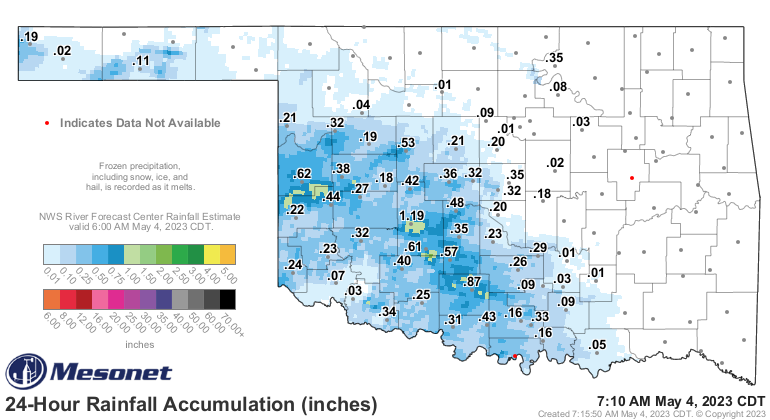
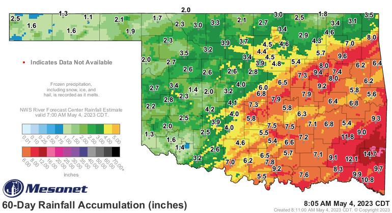
a good thing, AND it came with some rainfall. Check out the totals added in
with yesterday's haul.
Heck, it's raining right now for crying out loud!
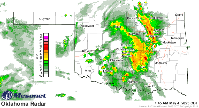
So that convection with all its rain-cooled air could help stabilize the
atmosphere enough to prevent further convection later today. Or at least lessen
the severity. But that doesn't mean you can let your guard down. Or your gourd.
But at least your gourds can grow now that it has rained and we've lessened
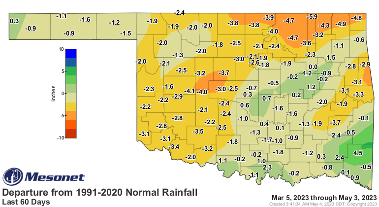
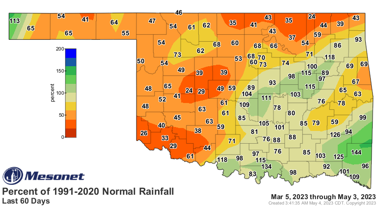
our drought intensity across northwestern Oklahoma. Now remember these maps
don't take into account any rainfall after 7 a.m. Tuesday, which is how it works
every week, not just this one.
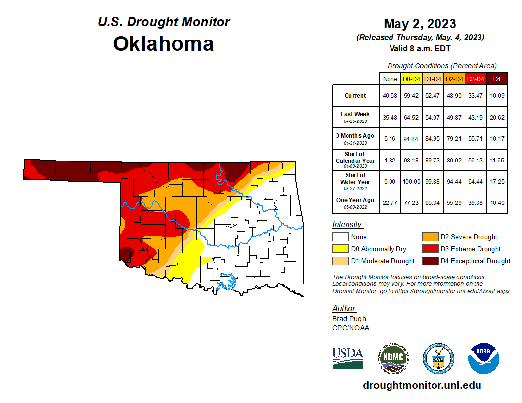
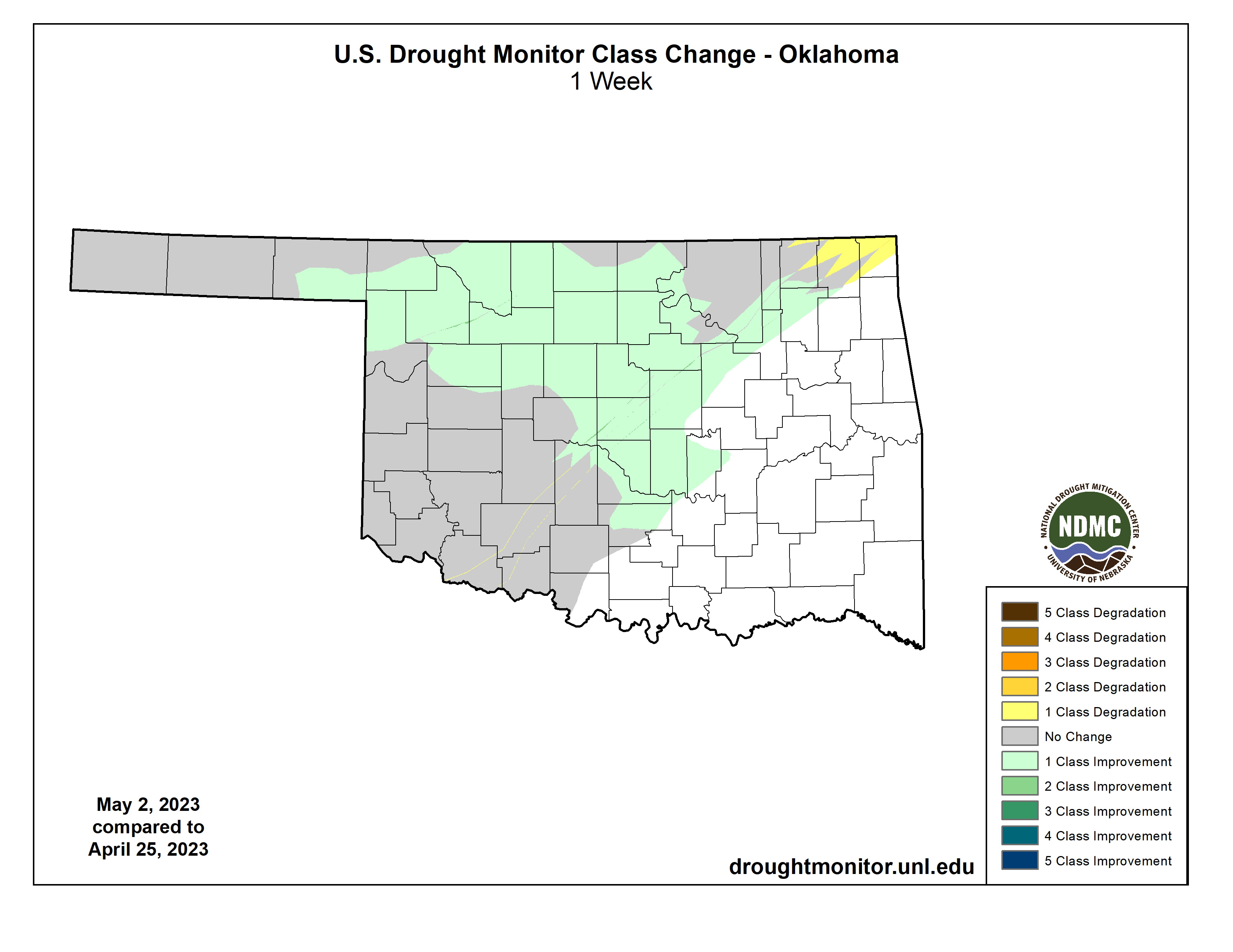
So you can see from the light green area there that we improved our drought
intensities by one category over a lot of areas to the north and west of I-44,
but added a bit of abnormally dry conditions up in the far northeast where the
best rains were missed. We lost about 10% of our D4 (Exceptional Drought) area,
but those areas are left in D3 (Extreme Drought), so don't celebrate too much
just yet. Deficits have lessened in the short term, but longer-term deficits
still abound.
We're still expecting several bouts of showers and storms, severe or not, over
the next week or so, which should give us some reinforcing moisture like we saw
over the previous 24 hours. Some will get a decent amount, some will get an
indecent amount.

So stay weather aware today, just in case. Our weather pattern has turned towards
non-droughty and more springy.
Gary McManus
State Climatologist
Oklahoma Mesonet
Oklahoma Climatological Survey
gmcmanus@mesonet.org
May 4 in Mesonet History
| Record | Value | Station | Year |
|---|---|---|---|
| Maximum Temperature | 106°F | ALTU | 2020 |
| Minimum Temperature | 26°F | KENT | 2013 |
| Maximum Rainfall | 5.55 inches | VINI | 1999 |
Mesonet records begin in 1994.
Search by Date
If you're a bit off, don't worry, because just like horseshoes, “almost” counts on the Ticker website!