Ticker for April 24, 2023
MESONET TICKER ... MESONET TICKER ... MESONET TICKER ... MESONET TICKER ...
April 24, 2023 April 24, 2023 April 24, 2023 April 24, 2023
Bring it home!
Aha, I hear you Negative Nancys out there:
"Whatever Gary, you've predicted this before and we barely got anything!" and
"Whatever Gary, I'm not falling for these hopeful rain forecasts again!" and even
"Whatever Gary, you said shaving my head would make me look cool, like you!"
But hey, this time...I mean it. I mean it looks likely. The forecast models have
been consistently consistent since last week in dumping copious amounts of
rainfall across drought-plagued north and western Oklahoma, so we're going to
go with the hopeful flow and lean into it. We're talking the first significant
statewide rainfall in well over 6 months, going back to late last summer. I
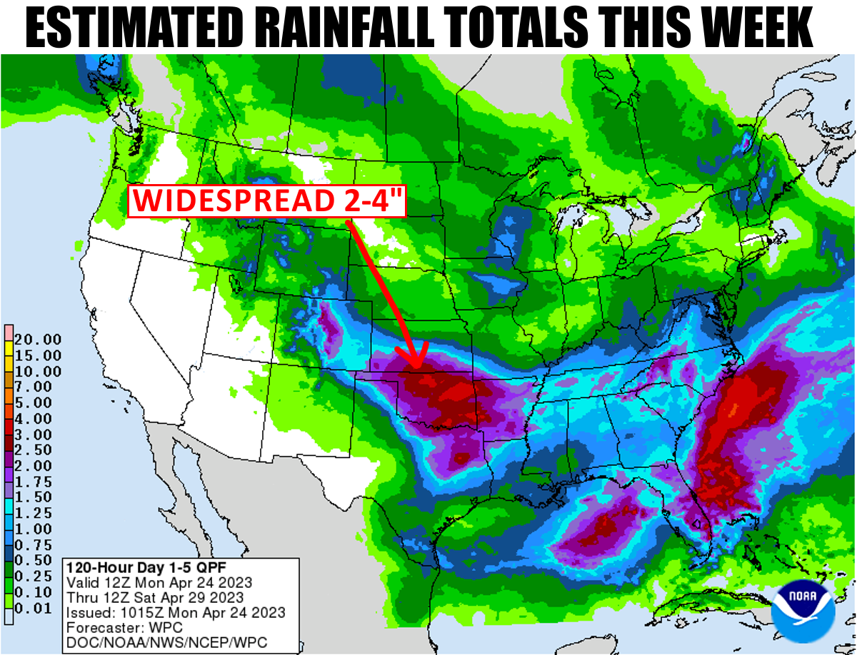
managed to patch together the totals predicted this week from our friends at the
Tulsa and Norman NWS offices and came up with this (sorry to Tulsa for obliterating
your logo and whatnot), confirming the widespread 2-4 inches being predicted
by the national folks in the top graphic above:
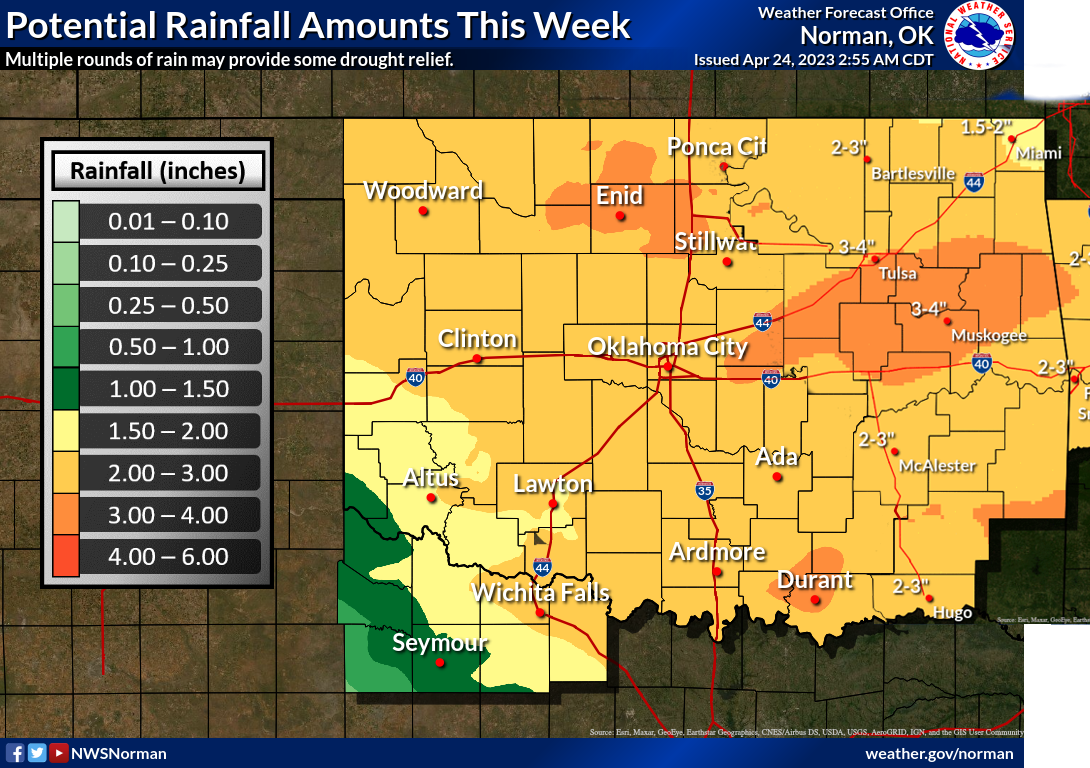
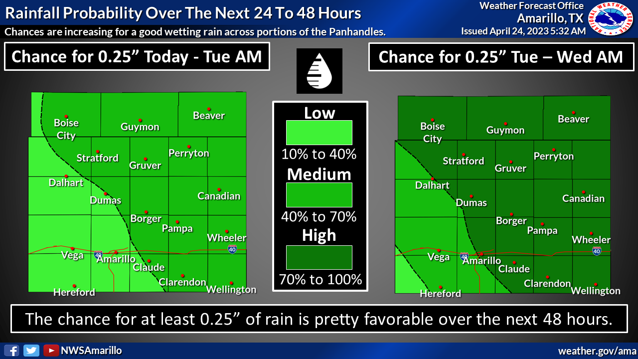
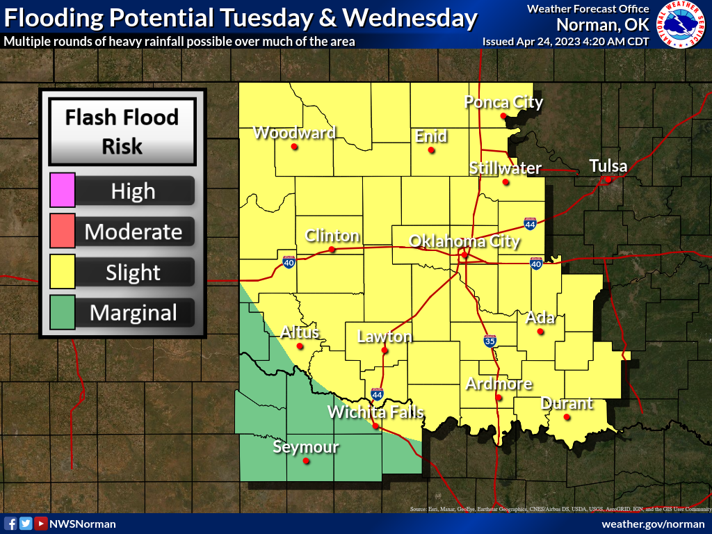
And additional thoughts from the Norman and Amarillo NWS offices.
So it is shaping up to be a drought-quencher, if not a drought-ender, for some
parts of the state. And let's remember where we're at before the expected
reset of a lot of these maps.
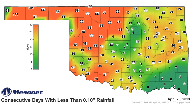
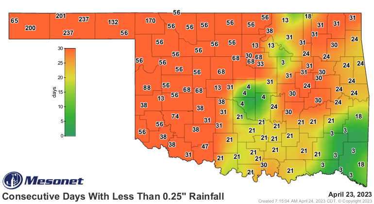

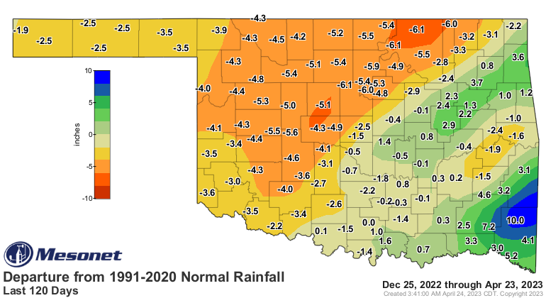
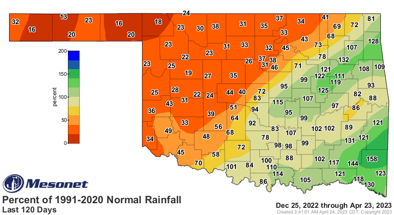
Yeah, we're REALLY needing a reset there. So as we see several waves of storms
over the next few days, keep in mind that flooding will be a concern due to the
hard ground, baked into an impenetrable plate by the sun and lack of rainfall
over the last 6+ months, which makes it tough for the moisture to soak in. But
soak in it will, eventually, since we're talking multiple rounds and not bigtime
storms dumping 3 inches in 2 hours type of stuff. There will be hints of
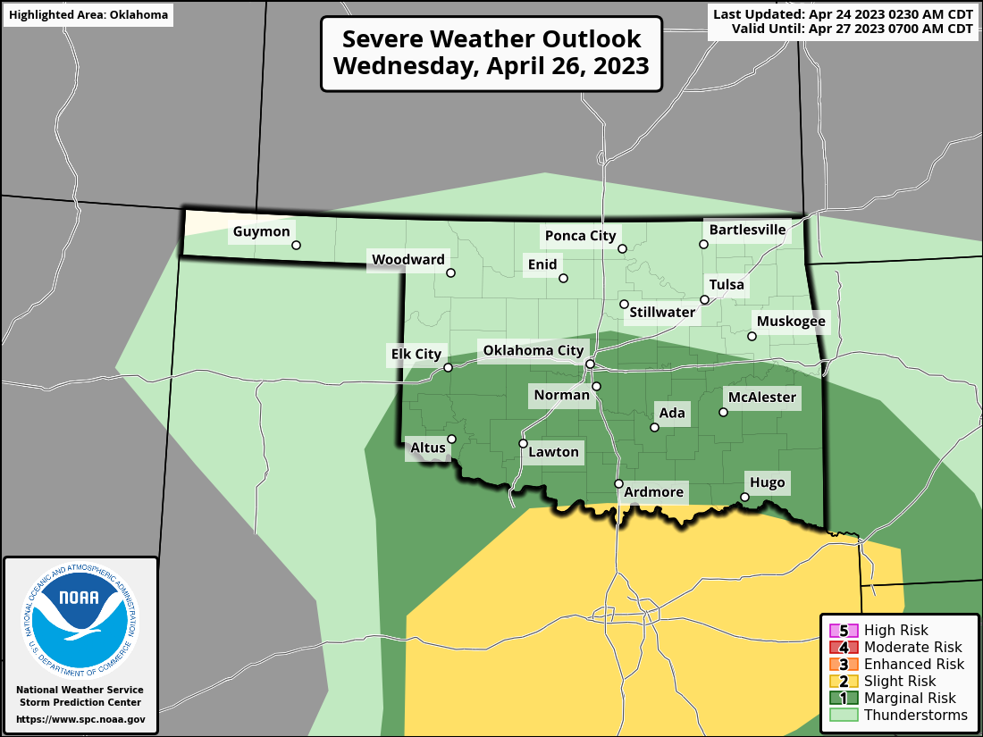
severe weather around, but more typical severe threats in such a cold
environment like some hail and wind. Wednesday might be a day to watch for in
far southern Oklahoma with a bit more "oomph."
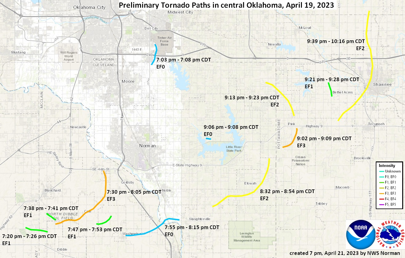
Speaking of severe weather, NWS Norman has singled out 13 tornadoes so far from
last Wednesday's outbreak, so everything on this map in addition to an EF0
twister near Little Axe.
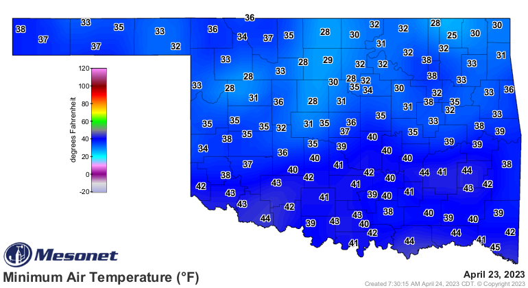
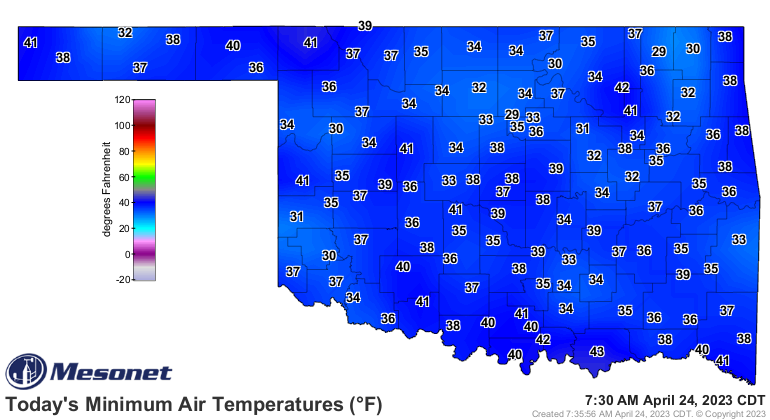
So nothing like that coming this way this week, but still pays to be weather
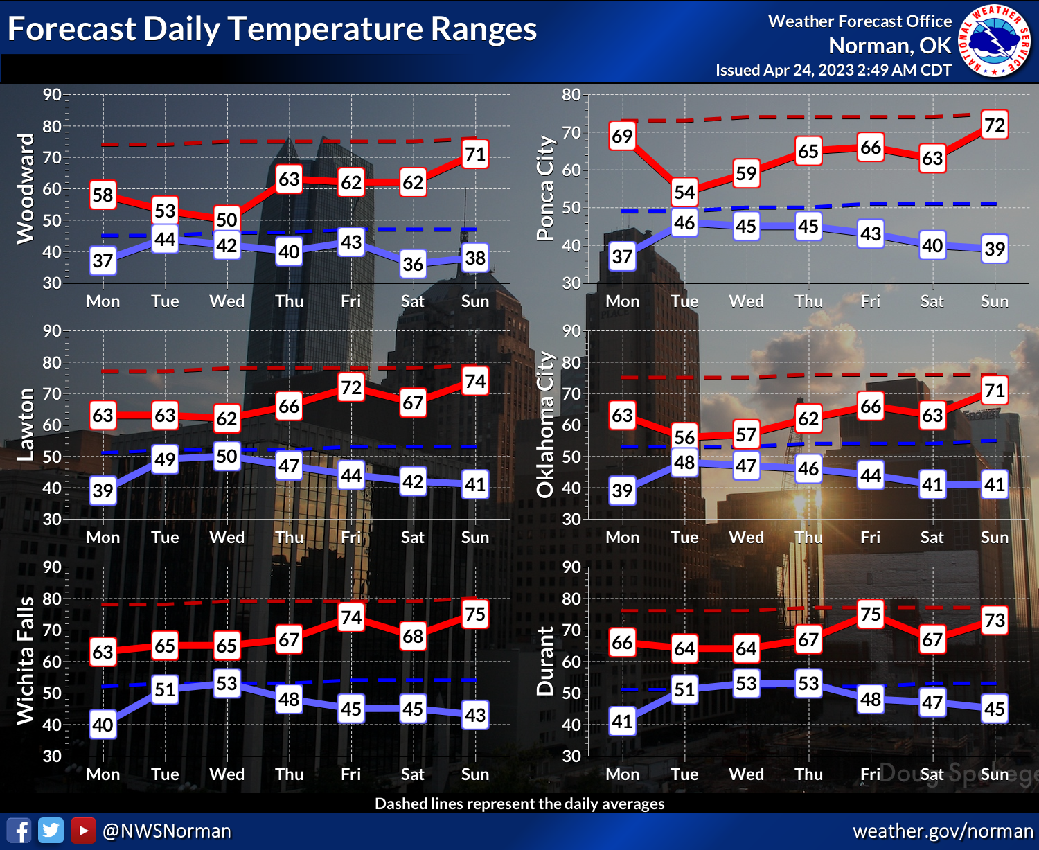
aware. Speaking of crappy weather (wasn't I), I can't get onboard with these
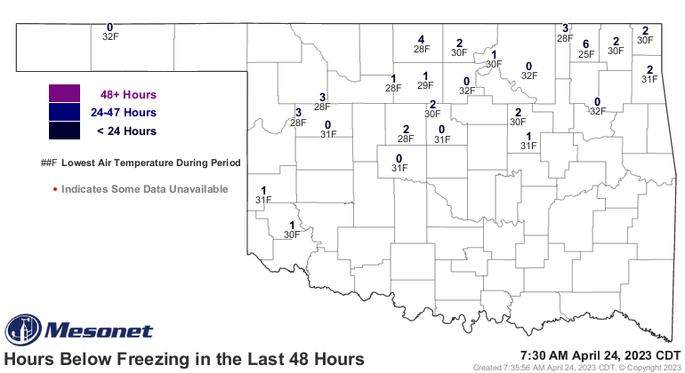
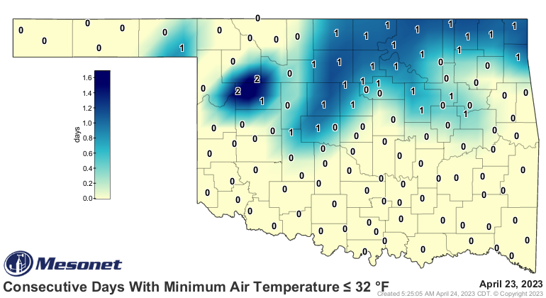
temperatures. We had another spotty freeze last night, just like the last 3
nights, as we continue in a late-winter/early-spring pattern with our
temperatures, which will continue this week thanks to all the clouds and
precip.
Oh by the way, did you see the Northern Lights last night? For me, that would
mean the Aurora Oklahoma Cityus, but for those across northern Oklahoma with
less light pollution, you might have seen the actual Aurora Borealis. Check out
this pic from our Mesonet Technician Steve Thompson from the Medford Mesonet
site. Warning, it's a bit large, but click for embiggenation.
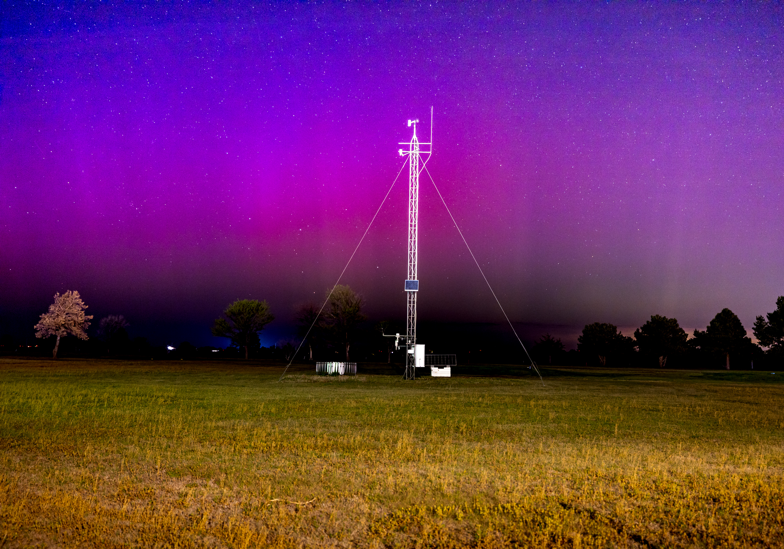
Take a good look at that night sky...probably the last viewing for awhile.
Gary McManus
State Climatologist
Oklahoma Mesonet
Oklahoma Climatological Survey
gmcmanus@mesonet.org
April 24 in Mesonet History
| Record | Value | Station | Year |
|---|---|---|---|
| Maximum Temperature | 97°F | BEAV | 2012 |
| Minimum Temperature | 15°F | BOIS | 2013 |
| Maximum Rainfall | 6.77 inches | HASK | 2011 |
Mesonet records begin in 1994.
Search by Date
If you're a bit off, don't worry, because just like horseshoes, “almost” counts on the Ticker website!