Ticker for April 20, 2023
MESONET TICKER ... MESONET TICKER ... MESONET TICKER ... MESONET TICKER ...
April 20, 2023 April 20, 2023 April 20, 2023 April 20, 2023
Happier days ahead
Well we didn't really know yesterday was going to be one of THOSE days in Oklahoma,
did we? And I may be something of an idiot (savant) when I said I thought we'd get
storms in yesterday's Ticker, but really underestimated just how well the severe
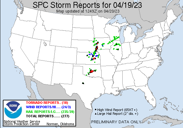
parameters stacked up as far as a severe weather outbreak goes. At least a dozen
tornadoes later, we are reminded that that's how quickly things can change
around here.
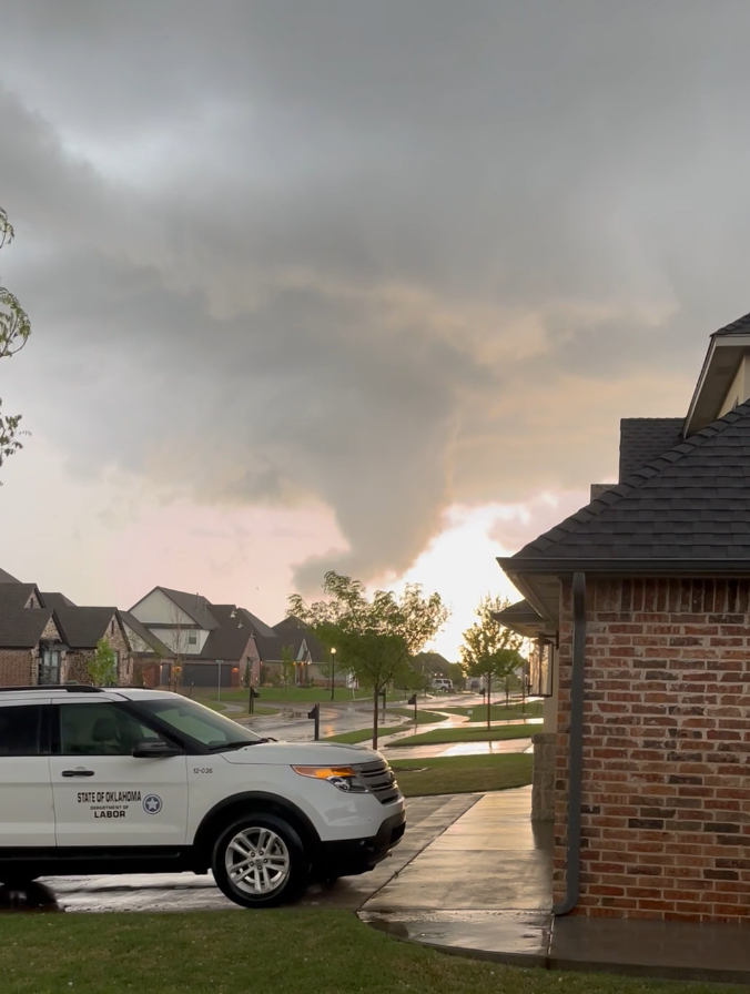
This was the view directly west from my neighborhood as one of the first big
supercells went directly over our house with a funnel. No thank you very much!
I've had my share of tornadoes moving through my neighborhood thanks to the
March 20, 2013, Moore EF5.
Definitely not a fan!
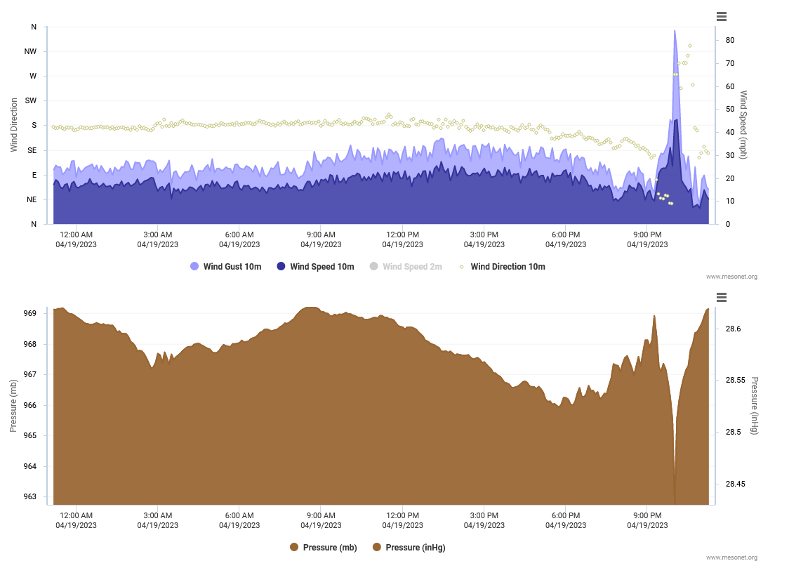
And our Shawnee Mesonet site might have caught a bit of tornado as well at its
site just to the west of OBU and the Shawnee Airport.
That brings our 2023 tornado total up to at least 30, almost double the average
Jan-April total of 16.5 (if anybody would ever get hit by half a tornado, it'd be
me!). Heck, the hail alone would probably have made yesterday a multi-million
dollar disaster. The NOT disastrous part is the rainfall that, uhhhh, fell,
yesterday in these storms. We didn't need the ice cubes added by Mother Nature,
but it's part of the territory.
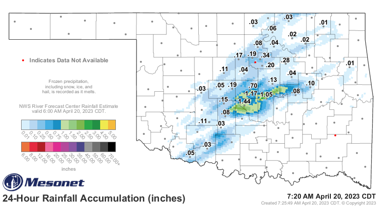
Still doing that weird I-44 thingy, but at least some fell north and west of
there. Heck, it's raining right now for crying out loud! These storms have
been kicked up by the cold front moving through.
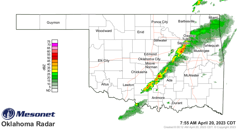
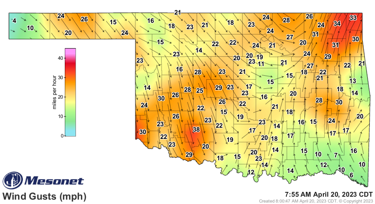
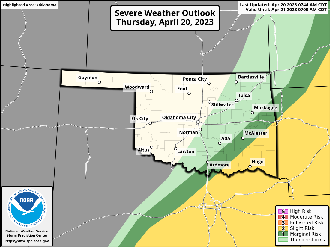
And lest we let our guard down, remember there is still a severe threat later
today as that front progresses and stalls somewhere south and east. Doesn't
look like much of a tornado threat but hey, did yesterday? Well yes, it did, at
least as the day unfolded. So let's stay weather aware.
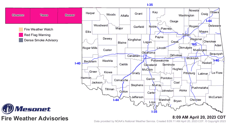
Lost in all the storm mania yesterday was the big fire danger that occurred to
the west of the dryline. Those storms really stole the fire's thunder, if you'll
pardon the really bad pun, but again, that fire danger continues today.
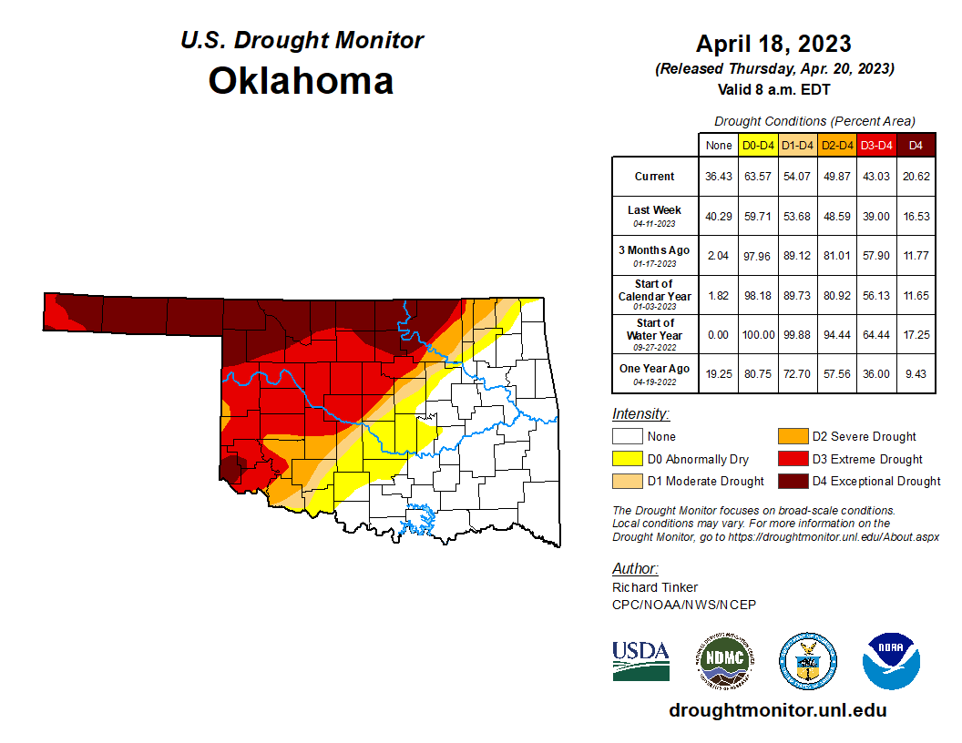
Lest we take our eyes on what's occurring to the north and west, let's remember
that drought still rages on, with the most intense drought categories of
extreme (D3) and exceptional (D4) continuing to increase.
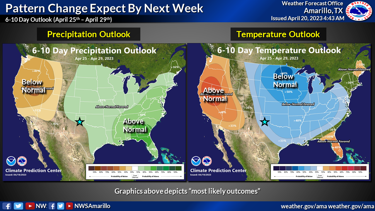
Let's look ahead, shall we (you don't want to look abehind...that's just asking
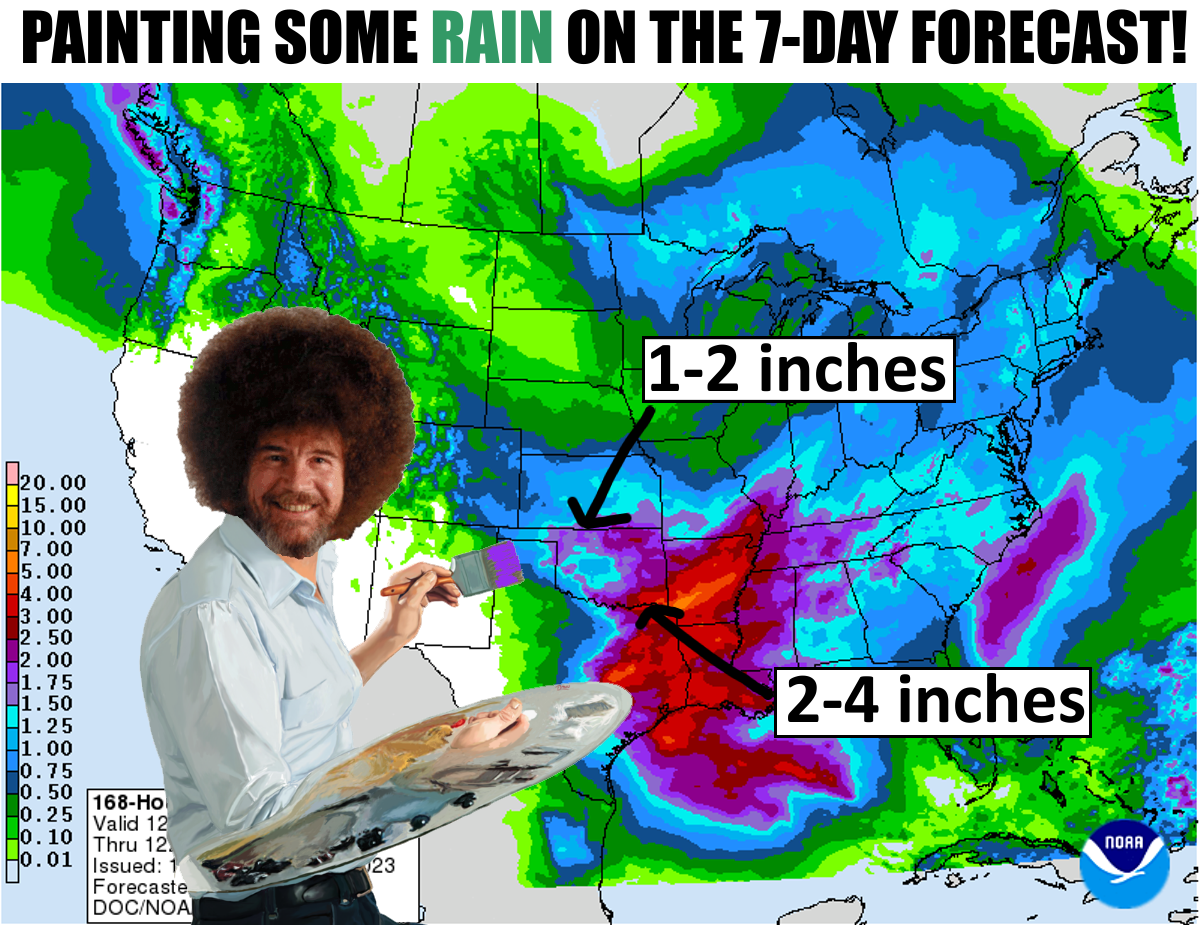
for trouble)? Now we enter into a truly "April showers" pattern that will
hopefully make "May flowers" possible. I see rain falling (I used to see dead
people until a ghost helped me over that...somebody should make a movie about
that!) everyday from Sunday through Thursday, and maybe beyond. And this will
possibly be our first 77-county rain in quite awhile. Our pattern change started
last night with the cold front, and that should continue through next week.
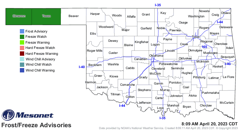
The rain will be a Godsend, so I'm not even going to complain about the
prolonged bout with the crappy stupid cold weather. Nope, not going to complain
at all. We could see a freeze in the Panhandle the next few mornings.
50s and 60s will dominate over the next few days, so that better come with lots
of rain!

I really think it will. So better days ahead for Oklahoma, at least until our
next bad day.
Gary McManus
State Climatologist
Oklahoma Mesonet
Oklahoma Climatological Survey
gmcmanus@mesonet.org
April 20 in Mesonet History
| Record | Value | Station | Year |
|---|---|---|---|
| Maximum Temperature | 98°F | GRA2 | 2022 |
| Minimum Temperature | 24°F | BOIS | 2021 |
| Maximum Rainfall | 2.74″ | VINI | 2025 |
Mesonet records begin in 1994.
Search by Date
If you're a bit off, don't worry, because just like horseshoes, “almost” counts on the Ticker website!