Ticker for April 19, 2023
MESONET TICKER ... MESONET TICKER ... MESONET TICKER ... MESONET TICKER ...
April 19, 2023 April 19, 2023 April 19, 2023 April 19, 2023
Must go hotter
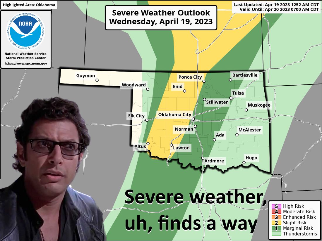
WIND is what I want to talk about! This ain't wind! For us folks that grew up in
the High Plains, the stuff we've seen lately is but a gentle breeze.
(Insert audible scoffing here).
Heck, remember LAST April when we had the windiest month in the 29-year history
of the Mesonet? I remember because it says so in a Ticker from May 2, 2022 (and
that Ticker guy isn't a liar, just wrong a lot):
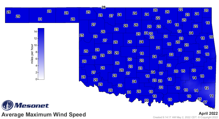
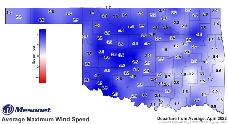
"Already Oklahoma’s windiest calendar month climatologically, the seemingly
unceasing gales howling day and night became a common point of exasperation.
Data from the Oklahoma Mesonet lends credence to that frustration. Both the
statewide average wind speed and maximum wind speed for this April were tops
since Mesonet data began in 1994 at 12.2 mph and 22.9 mph, respectively.
Previous top marks were held by 1996’s 12 mph and 2011’s 22.5 mph, again
respectively. Those and other metrics point towards the month as the windiest
April statewide in the Mesonet era. Fourteen of April’s 30 days saw
non-thunderstorm wind gusts of at least 50 mph somewhere in the state, and nine
days with at least 60 mph."
Here's a graph showing our statewide maximum winds speeds from last April (red),
this April thus far (blue), and the 2008-2022 average (black).
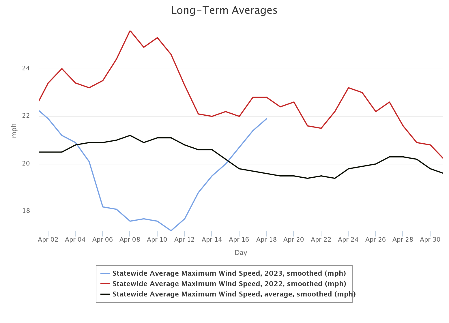
Heck, you look at that and you can see this April has been downright tame for
the most part. Today will be a different story, of course, and it's gonna kick
up the fire danger, without a doubt.
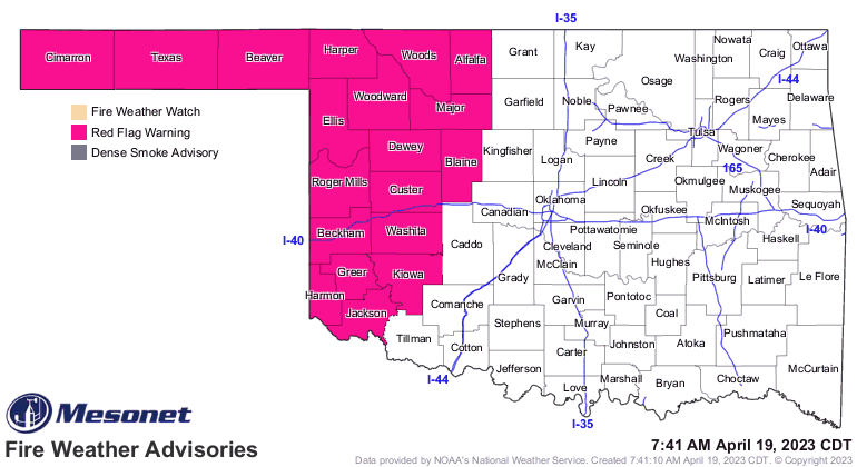

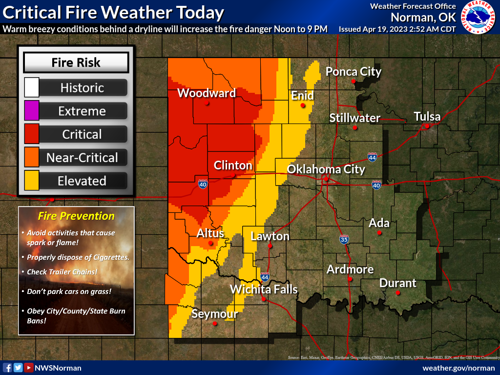
Another big fire day is possible, but we know the drill here. DON'T use a drill
outdoors, because it could cause a spark which could spawn a fire which could
get quickly out of control and could cause a wildfire that could cause a loss
of life and property.
Could I stop saying "could?" Certainly.
Now for the iffy part today: could we see storms? HA! I said I could stop saying
could, not that I would. Anyway, same old story with out storm chances that
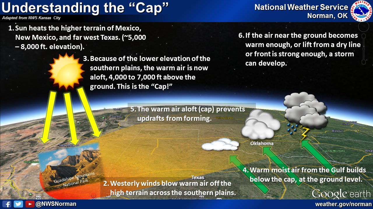
has seemingly limited us over the last month-and-a-half or so, with a strong
cap or lid present above us in the atmosphere that prevents those updrafts from
breaking free and forming thunderstorms. Remember this graphic from our friends
across the hall at the Norman NWS office:
Another old refrain...IF we can somehow get those updrafts strong enough, either
by heating up enough to get those updrafts more energetic, or through convergence
along the dryline and/or trailing cold front, we should see storms. Both of
those are iffy, but I'm gonna go out on a limb here and tumble to the ground
when it snaps, then recall what a horrible idea it was. But while out on that
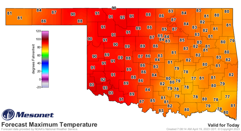
limb, I'm gonna say we manage to break the cap with a combination of bigtime heat
and convergence along the dryline. I think that's gonna take some clearing skies
across western Oklahoma, and if that occurs, I think we can see SW OK getting
close to the triple-digit mark, instead of low 90s.
You're now getting a clear indication of why my meteorology professors told me:
"Gary, have you thought about climatology?"
"No, why?"
"Well, you're probably better suited for telling people what happened with an
event AFTER it occurs rather than trying to forecast it."
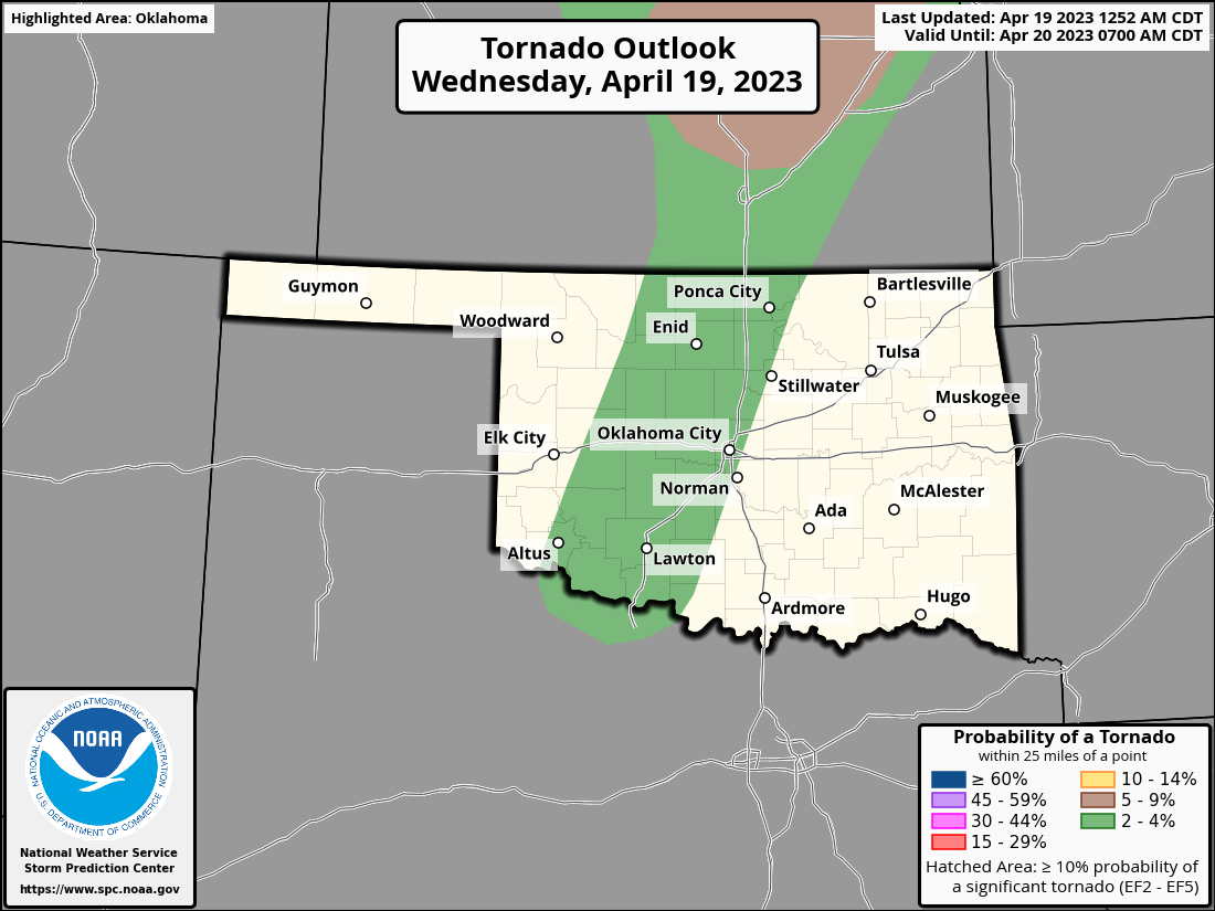
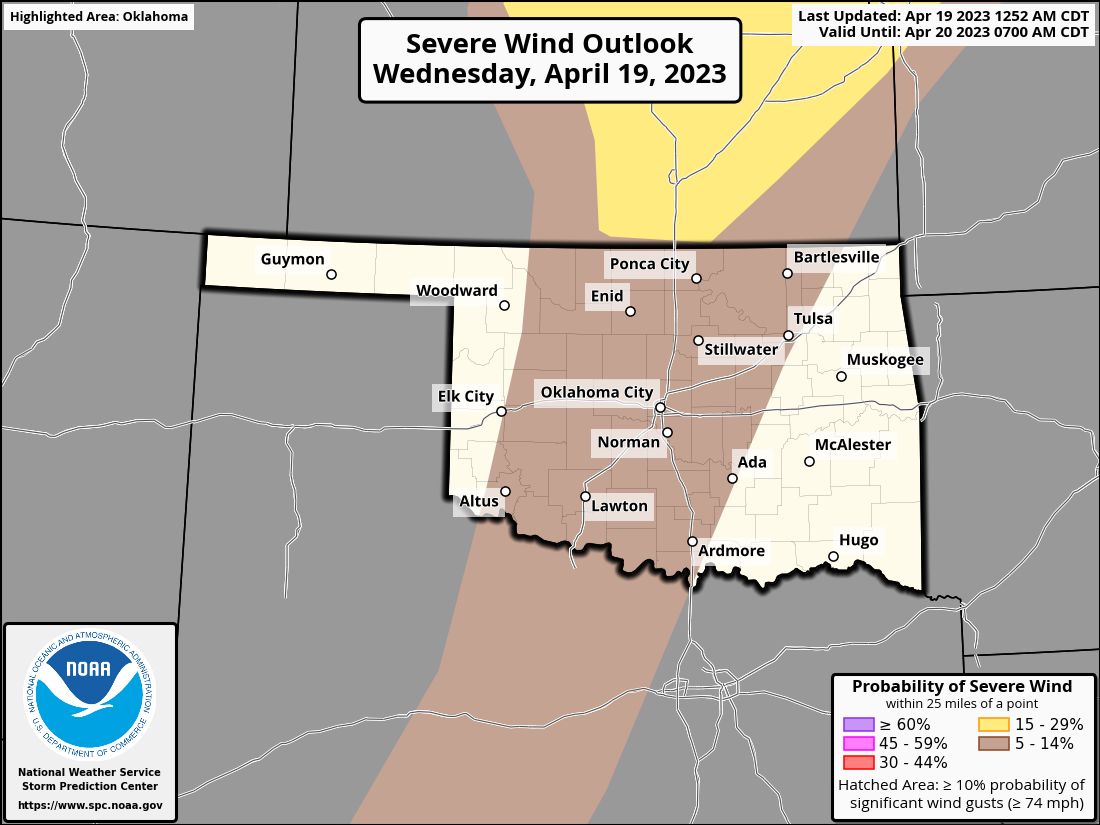
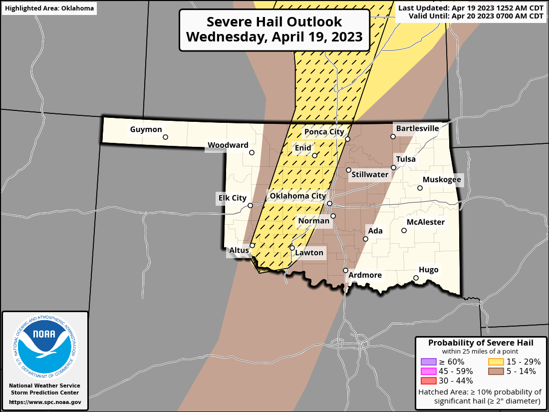
Well, we'll see. If storms do go up, there is a low chance of a tornado or two,
but high winds and big hail (especially) will be the main threats.
There's probably a better chance of storms as the cold front moves through
overnight, but those should (DIDN'T SAY COULD because I know that makes you
mad) be elevated and less potent...maybe some small hail and a few strong wind
gusts, and probably as they get farther to the south and east.
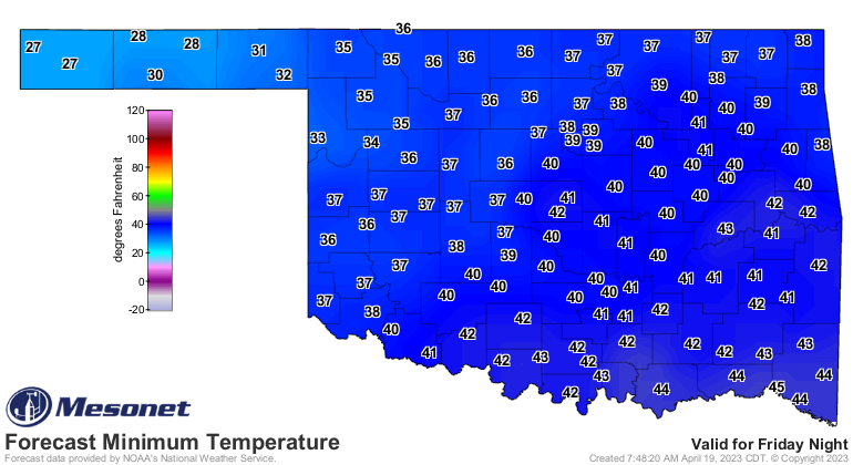
After that, we cool down back to March-like territory, and we continue to look
for a freeze in NW OK Saturday morning, with some frost possible to the south
and east of that area.
The better news is better rain chances pushing farther west as we get into early
next week. Showers and storms starting Sunday bring heavier forecast totals
into that non-magical area north and west of the I-44 corridor that have
repeatedly missed out on beneficial moisture. But as we showed the last couple
of days, even folks to the south and east need another dose of rain.
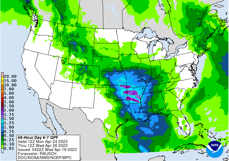
That's 5 days out, so it's a bit shaky, but keep hope alive! And for today, too.
We don't need the severe weather, but we definitely need the rain.
Gary McManus
State Climatologist
Oklahoma Mesonet
Oklahoma Climatological Survey
gmcmanus@mesonet.org
April 19 in Mesonet History
| Record | Value | Station | Year |
|---|---|---|---|
| Maximum Temperature | 95°F | HOLL | 2023 |
| Minimum Temperature | 21°F | BOIS | 2013 |
| Maximum Rainfall | 4.77″ | NEWP | 2025 |
Mesonet records begin in 1994.
Search by Date
If you're a bit off, don't worry, because just like horseshoes, “almost” counts on the Ticker website!