Ticker for April 18, 2023
MESONET TICKER ... MESONET TICKER ... MESONET TICKER ... MESONET TICKER ...
April 18, 2023 April 18, 2023 April 18, 2023 April 18, 2023
A freeze is a coming!
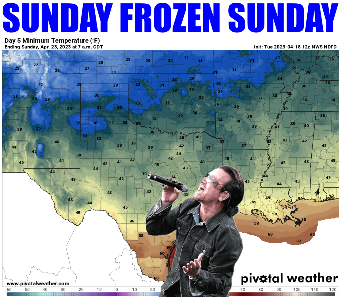
I went to see U2 on Owen Field at the University of Oklahoma a time or two ago.
My wife was there to see the Black Eyed Peas. I wore shorts, as any
self-respecting idiot...I mean climatologist would. After all, climatology said
it would be warm, but the weather turned out to say "cold." By the time the
concert was over, I was a pocsicle. A frozen pencil with an eraser on top
(obligatory bald joke completed). A chilled dolt.
SO IT'S ONLY FITTING WE GLORIFY THE COMING RETURN OF WINTER WITH A BONO PIC!
Yes, winter is returning. Oh, my climatology friends (worst Saturday morning
cartoon EVER!) would say winter is long gone, this is just part of spring. Really?
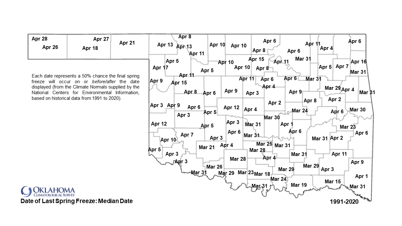
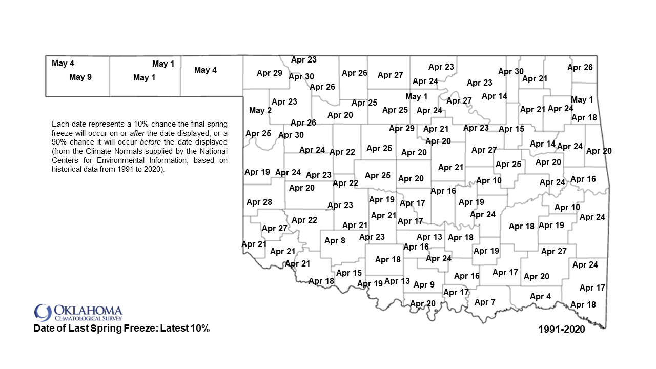
Freezing weather down into central Oklahoma the last week of April? PFFFTTTT!
That's going to push it well past the probable latest normal freeze date for crying
out loud! (No, it's not raining). And it's blowing past the average final freeze
date by nearly 3 weeks in some places.
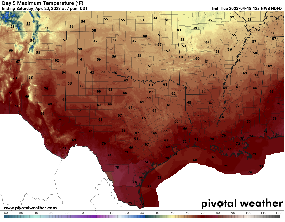
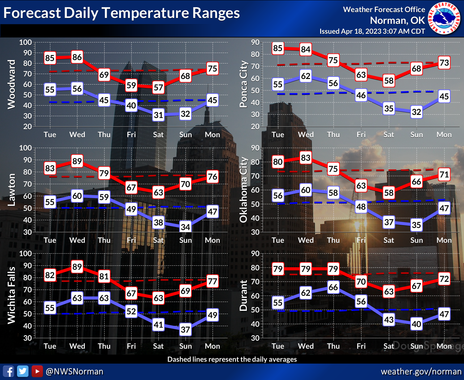
And check out those highs on Saturday, when I'm scheduled once again to attend
the spring football game on...yeah, you guessed it: Owen Field at the University
of Oklahoma! (As a fan, not a player...you guessed wrong).
Now you're probably saying to yourself: "But Gary, how can this be? It's nearly
May."
I've warned you multiple times to stop calling yourself Gary. That's an honor
reserved only for the greats! But anyway, yes, this is getting pretty ridiculous.
The first front comes through Wednesday night and cools us down, but the second
front on Friday is the one that freezes us.
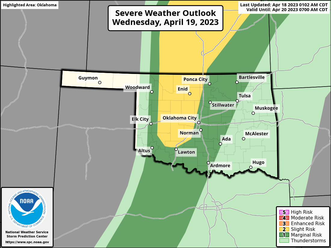
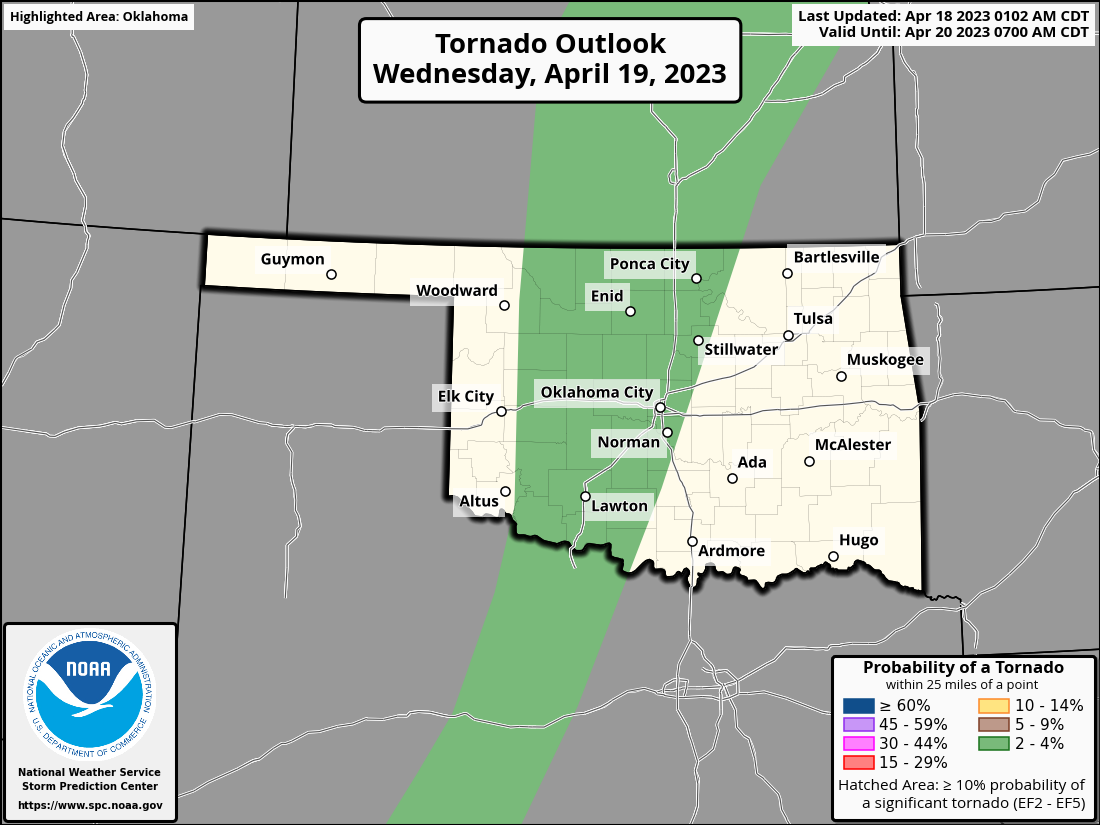
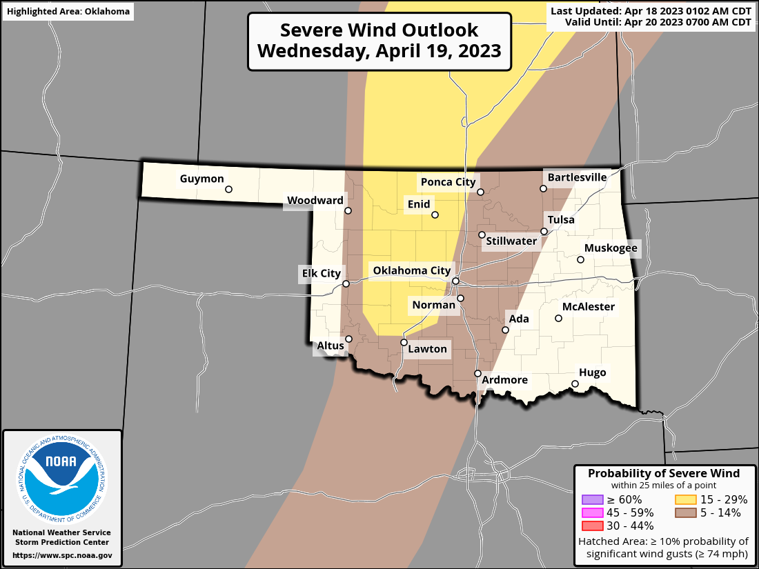
The rest of the weather story is the same as what I told you yesterday...chance
for storms the next three nights with a strong cap in place tonight and Wednesday
across western OK that will almost definitely limit the storms, severe weather,
and more importantly...rain. Nevertheless, if storms do go up, they could be
severe, especially tomorrow.

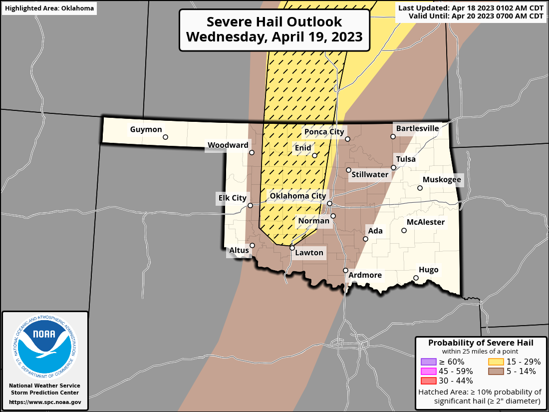
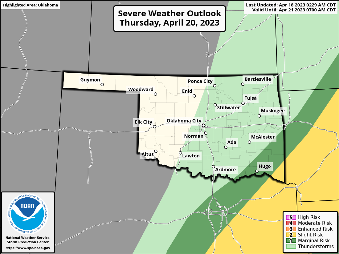
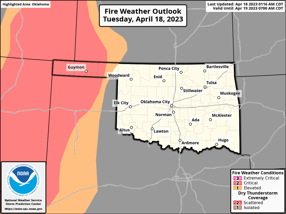
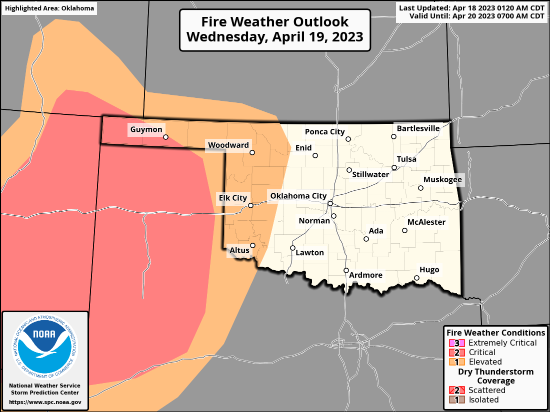
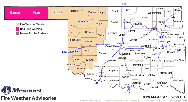
AND fire danger is a particular concern the next couple of days behind the
dryline.
I'm wondering whether we can maybe eke out a triple-digit tomorrow. I know it's
not close in the forecasts, but maybe if the clouds stay away (or clear out)
and we get more of a westerly component to the wind for some downslope
compressional heating (and we all know just how painful that can be), it could
happen!
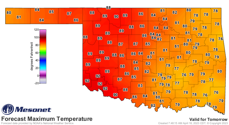
Altus...Mangum...this map is looking pretty bare.

You know it's coming. Might as well get it out of the way.
Gary McManus
State Climatologist
Oklahoma Mesonet
Oklahoma Climatological Survey
gmcmanus@mesonet.org
April 18 in Mesonet History
| Record | Value | Station | Year |
|---|---|---|---|
| Maximum Temperature | 101°F | ALTU | 2011 |
| Minimum Temperature | 22°F | BOIS | 2013 |
| Maximum Rainfall | 3.17″ | TAHL | 2009 |
Mesonet records begin in 1994.
Search by Date
If you're a bit off, don't worry, because just like horseshoes, “almost” counts on the Ticker website!