Ticker for April 17, 2023
MESONET TICKER ... MESONET TICKER ... MESONET TICKER ... MESONET TICKER ...
April 17, 2023 April 17, 2023 April 17, 2023 April 17, 2023
Not ape for April
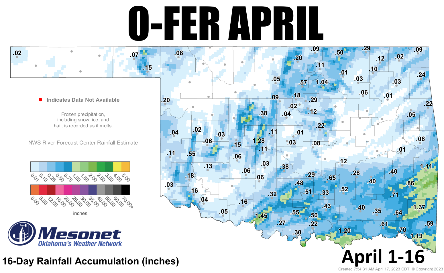
Well friends (the ones I pay to be my friends, at least), April is failing us. No,
this isn't a failed "The Office" plot-line, nor does it have anything to do with
my purchase of "Dr. Follicular's Magic Hair Growth" elixir. No, we're talking
rainfall, BUT FIRST...we had a pretty good example of inversion poking last night
(and we all know how painful that can be) at our usual suspects...Medicine Park
and Cheyenne. Take a look at our low temp map from this morning. First thing we
notice is yet another freeze for parts of the state, and no doubt widespread
frost in others.
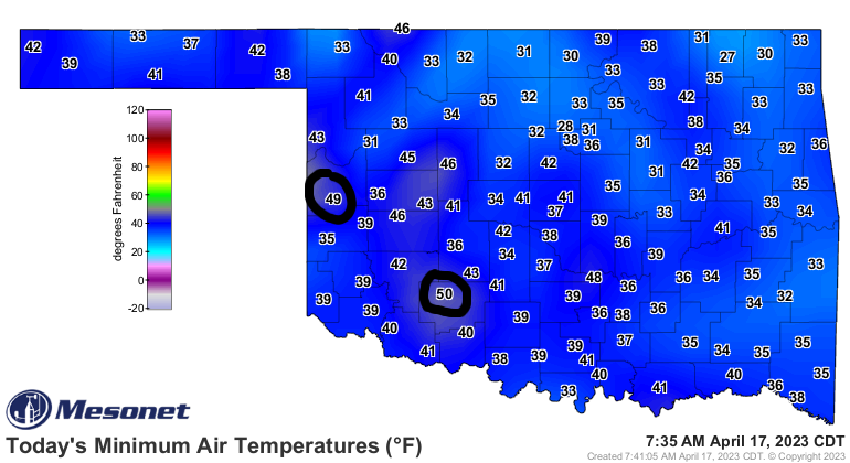
But if you were standing near the Cheyenne or Medicine Park Mesonet towers, at
those locations increased elevations--relatively speaking--you'd have been basking
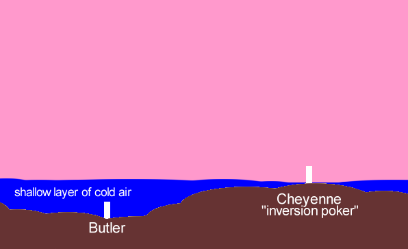
in temps around 50 degrees. Not too shabby, eh? Well, with this shallow layer of
cold air in place, these two stations "poked" through the cold air and stayed
above the inversion layer (temps increasing with height), as shown in this
illustration, using the Butler Mesonet site as our control case.
These stations often get to sample higher wind speeds and sometimes from a
different direction than their nearby counterparts, as well as that warmer air.
It's all connected, usually, and you can see that by looking at the meteogram
from Cheyenne and nearby Erick, which doesn't have the advantage of inversion
poking. It just gets inversioned, a word which I just made up but I'm doing the
writing so there you go.
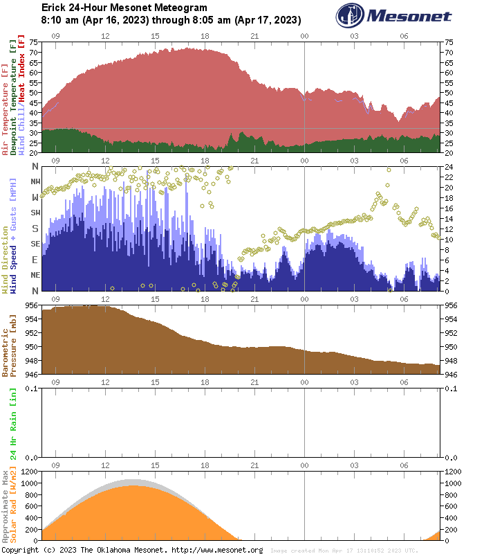
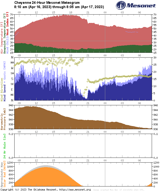
So Erick got to drop down 14 more degrees than Cheyenne, which depending on
your perspective, gives a vastly different perspective on this morning's chill.
Okay, back to your regularly scheduled Debbie Downer programming...ah yes, our
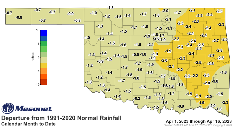
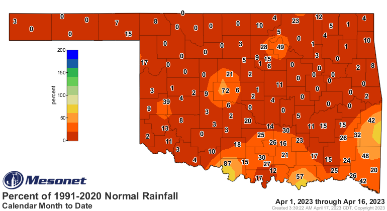
terrible April thus far. Well, here's the skinny...April is gonna turn out to
be one of our driest on record if we're not careful. And for all the bragging
we've done on our "southeast of Interstate 44" rainfall bounty, well, we have
another big dry spell brewing, and it looks to continue for another week or so
at least. Even now, April has been pitiful for rainfall for most of the state,
and we can see that dry spell is now getting close to 3 weeks for even
southeastern Oklahoma.
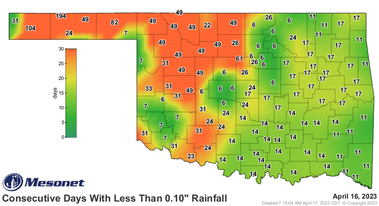
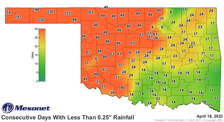
Now northern and western Oklahoma are laughing/crying/screaming at 3 weeks or
so worth of dryness, but they're gonna have company if we're not careful. Did
you know that east central Oklahoma's currently undergoing their driest April
in at least the last 100 years, currently, as we type?
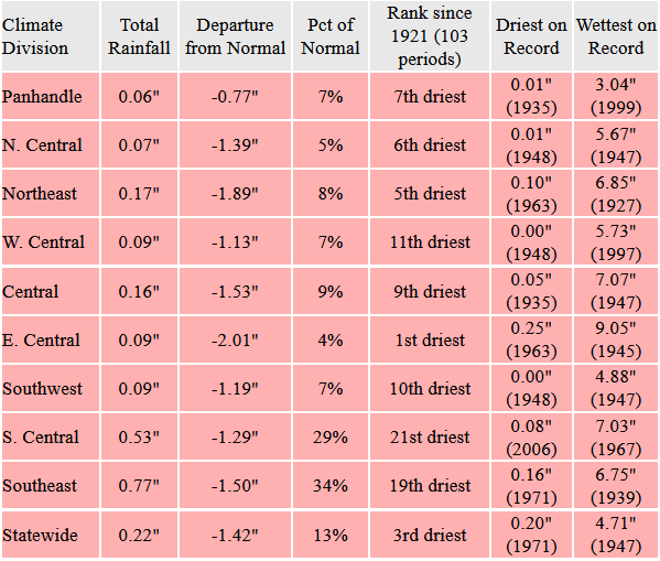
I mean, it's not pretty for anybody, really.
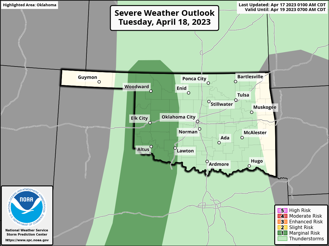
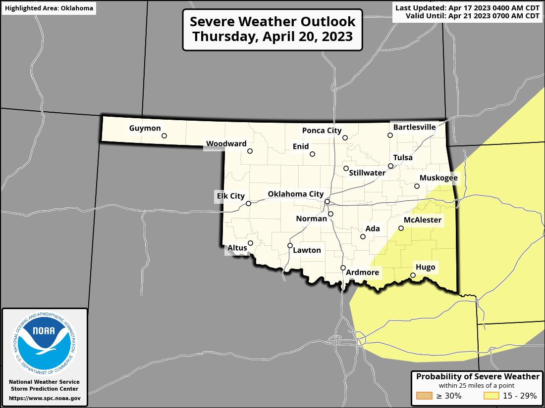
And like I said, prospects for rain ain't exactly booming for the rest of the
week. We'll have chances for storms Tuesday and again Thursday, but we're not
talking much about amounts, really, because there's not much to talk about.
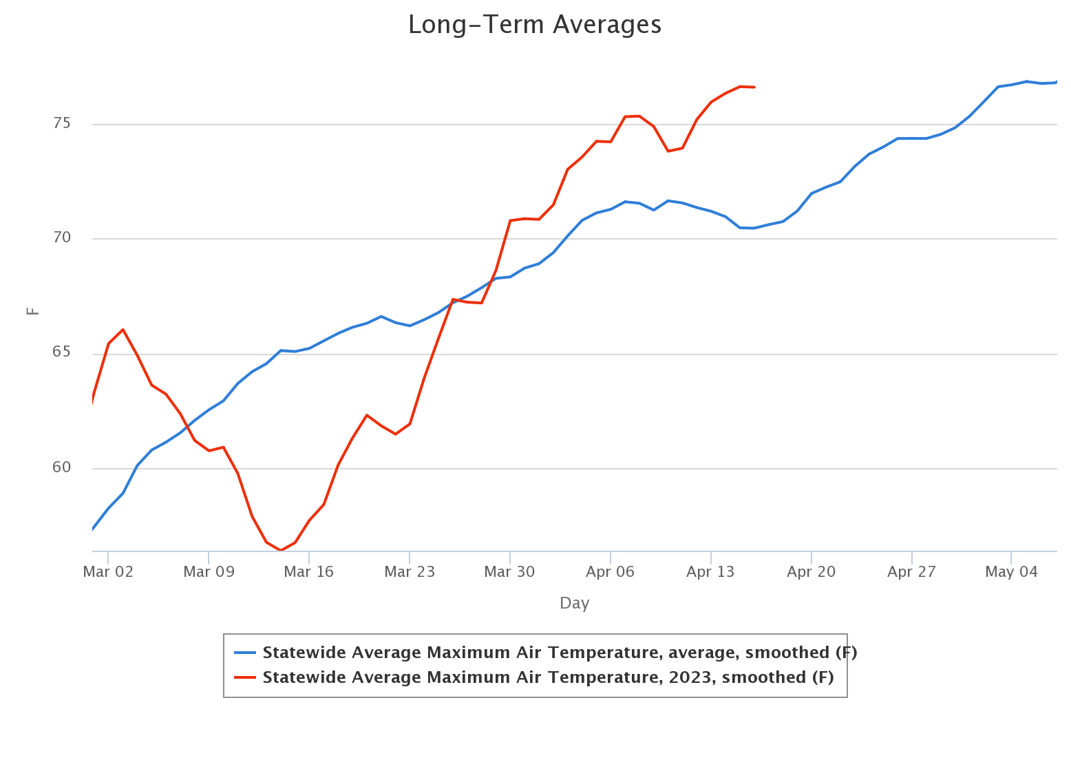
To top it off, temperatures have been mostly above normal during April, which
puts more pressure on our water cycle...even for those that received a ton of
rain in the last 3 months.
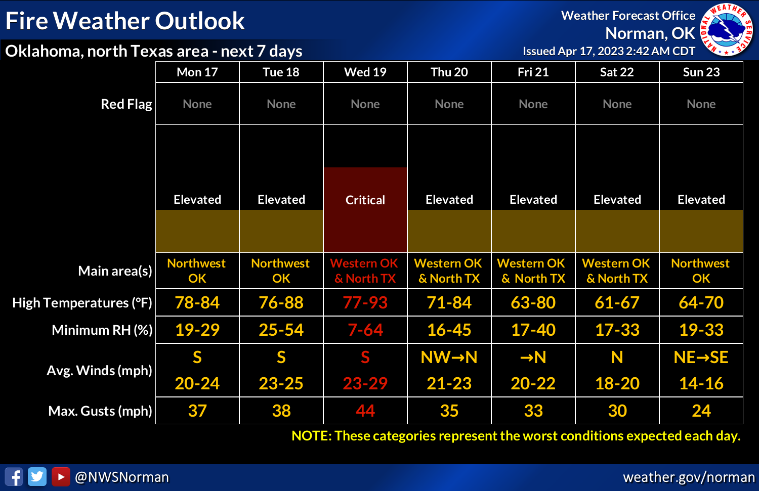
Wednesday will be a rotten summer day with temps in the 80s and 90s and strong
southerly winds gusting to 40-50 mph, which means fire danger will be through
the roof once again, which we don't like to see because fire departments might
be hearing calls saying...go ahead and groan while you wait for it..."THE ROOF,
THE ROOF, THE ROOF IS ON FIRE!"
Well you were asking for it!
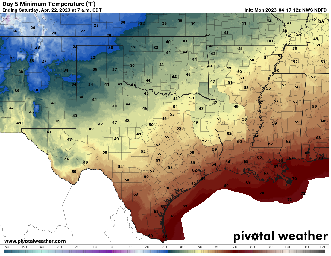
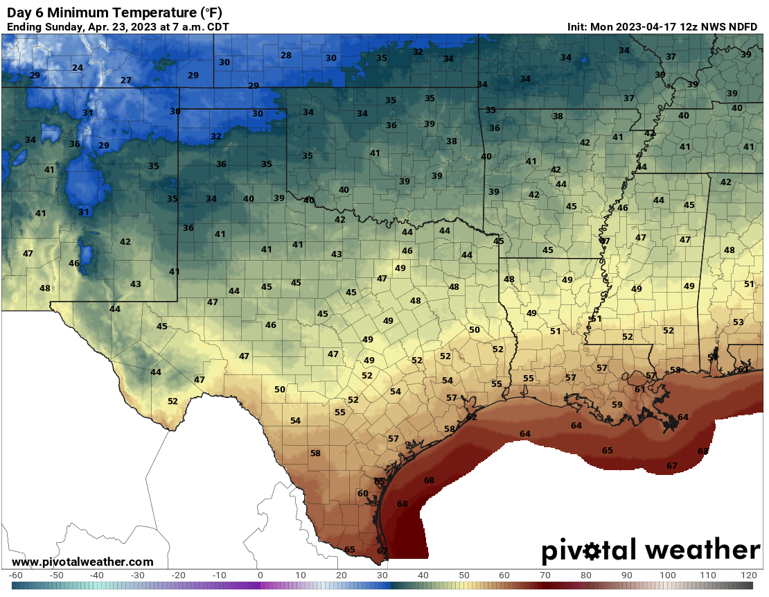
Even worse news...looking at another freeze next weekend in far NW OK and maybe
widespread frost following a big cold front on Thursday as cold air filters
south from, uhhhhhh, the north. Sadly, not much precip with it. What else is
new!
Okay, I feel my damage is done for today. Stay tuned for more damage tomorrow.
Gary McManus
State Climatologist
Oklahoma Mesonet
Oklahoma Climatological Survey
gmcmanus@mesonet.org
April 17 in Mesonet History
| Record | Value | Station | Year |
|---|---|---|---|
| Maximum Temperature | 102°F | GRA2 | 2006 |
| Minimum Temperature | 22°F | BOIS | 2020 |
| Maximum Rainfall | 6.57 inches | MEDI | 2013 |
Mesonet records begin in 1994.
Search by Date
If you're a bit off, don't worry, because just like horseshoes, “almost” counts on the Ticker website!