Ticker for April 14, 2023
MESONET TICKER ... MESONET TICKER ... MESONET TICKER ... MESONET TICKER ...
April 14, 2023 April 14, 2023 April 14, 2023 April 14, 2023
Fire time
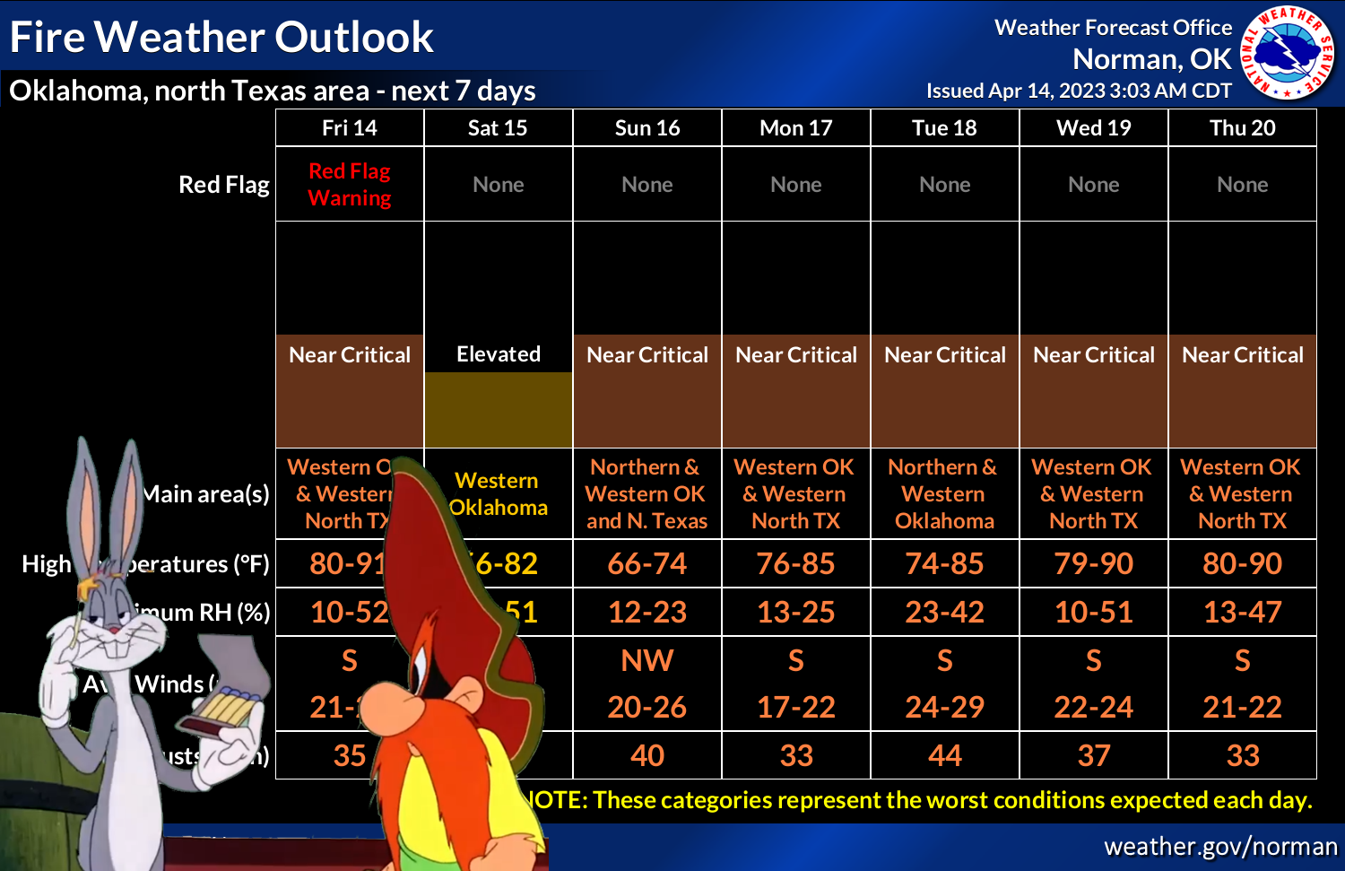
Now look at what the drought has wrought. Or even worse, look at what the wrought
has drought. The weird thing is I don't even know what "wrought" means! But when
has that stopped me? So this is April (SCIENCE!). We're supposed to be dealing
with showers and storms and rain and hail and lions and tigers and bears, oh my!
Instead, what we got? Fire danger, drought, blowing dust, impenetrable
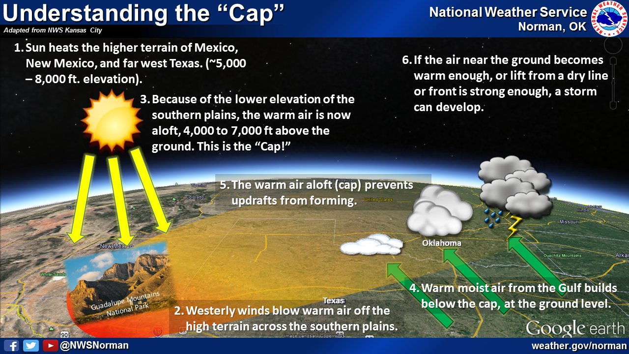
storm-denying lids on the atmosphere. As a reminder, a big reason we *probably*
won't see storms today.
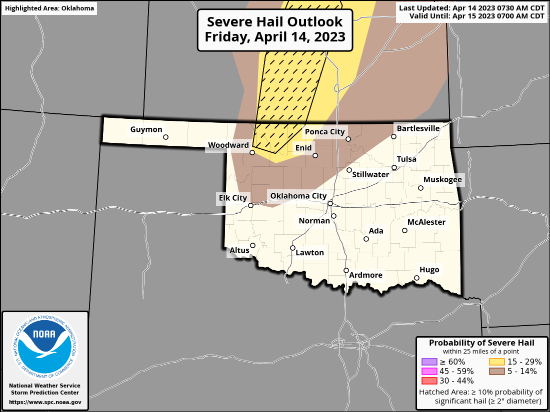
However, there's still a chance, mostly across far north central Oklahoma, and big
hail would be the largest threat. Largest as in most impactful, not that it's the
LARGEST. Well, I guess it would be the LARGEST because it's bigger than rain and
maybe wind. Wait, how do you measure the dimensions of wind? Anyway, here are the
SPC outlooks for today. No tornado threat, at least.
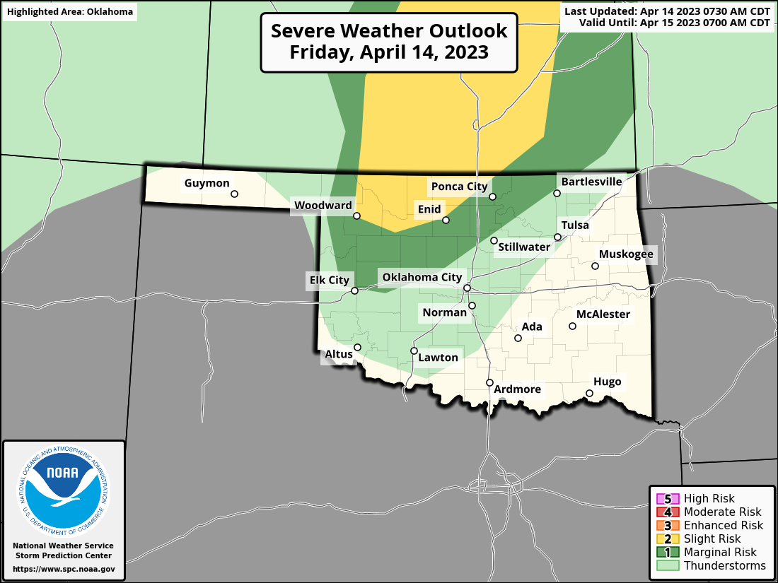
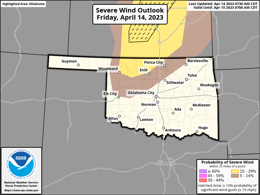
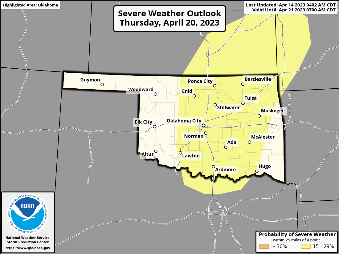
That's our biggest rain chance until next week, and our only chance for severe
weather until next Thursday when we might see the eastern half of the state
get hit. A LONG ways out, so take with a grain of salt (check with doctor
before taking grain of salt).
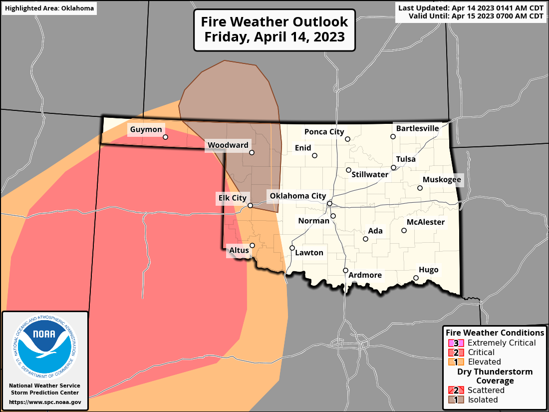
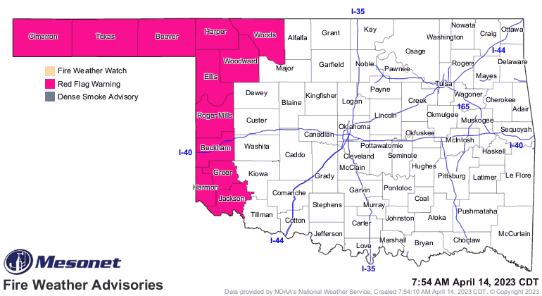
But today we're dealing with big fire danger out west, with a dryline and then
cold front moving through.
The front will take us back to early spring for the weekend, although any
freezing temperatures should be isolated mainly in the Panhandle. Patch frost
is also a possibility down-state (Panhandle talk for the main body of the state,
or as they know it: "Fake Oklahoma".
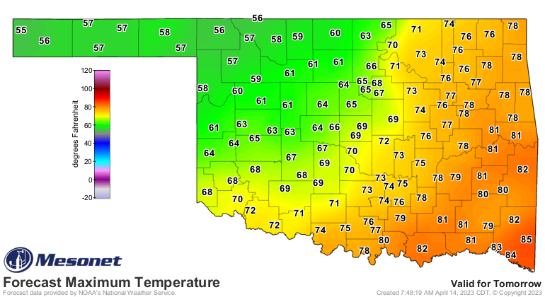
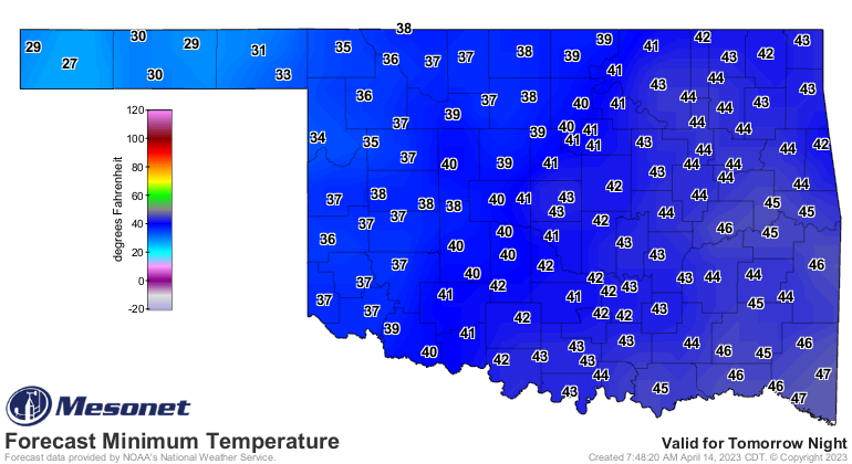
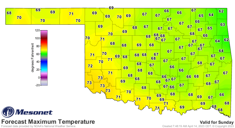
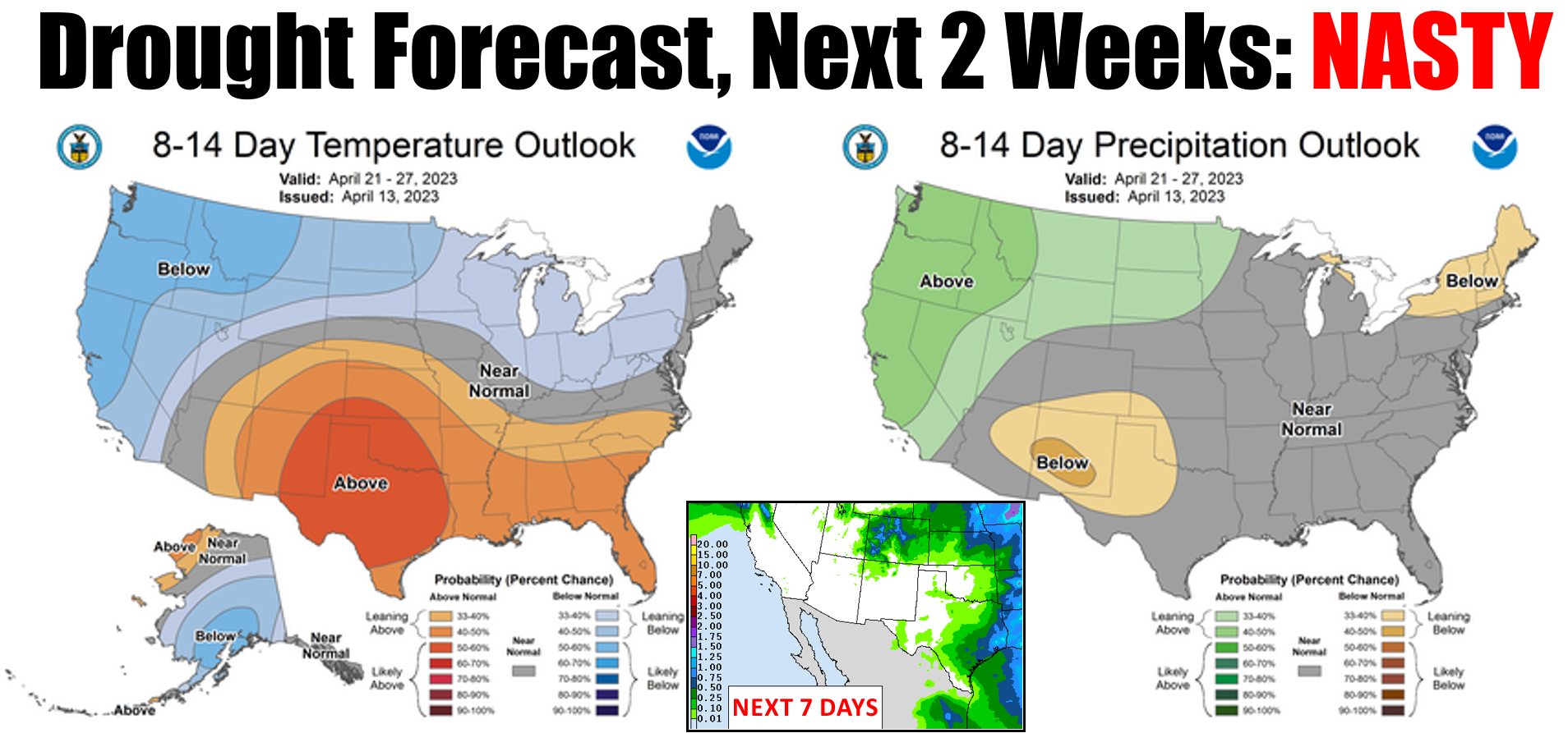
As for rain over the next week...well, as my mirror said: I hate to show you
this, but":
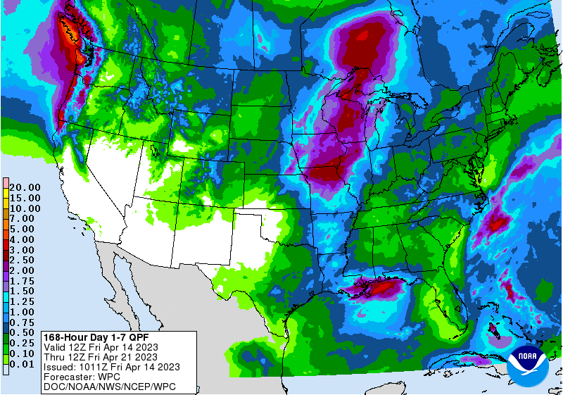
Farther out, again as my mirror said: "Nasty."
Hey, don't blame me! I don't make the weather, I just incorrectly forecast it.
Gary McManus
State Climatologist
Oklahoma Mesonet
Oklahoma Climatological Survey
gmcmanus@mesonet.org
April 14 in Mesonet History
| Record | Value | Station | Year |
|---|---|---|---|
| Maximum Temperature | 97°F | HOOK | 2003 |
| Minimum Temperature | 16°F | EVAX | 2022 |
| Maximum Rainfall | 3.12 inches | GUTH | 2012 |
Mesonet records begin in 1994.
Search by Date
If you're a bit off, don't worry, because just like horseshoes, “almost” counts on the Ticker website!