Ticker for April 13, 2023
MESONET TICKER ... MESONET TICKER ... MESONET TICKER ... MESONET TICKER ...
April 13, 2023 April 13, 2023 April 13, 2023 April 13, 2023
Hatfields and McRains

I've used this Monopoly theme before, and for awhile it looked like the areas
to the southeast of I-44 were playing with Monopoly rain, buying rain hotels and
putting them on Boardwalk and Park Place.
ARGH! Boardwalk and Park Place with hotels...how they've sent a Monopoly board
flying a time or two in my house growing up. And you just know the person
appointed as the banker was sliding some $500s into their pile on the sly.
Anyway, that's for my therapist to worry about. Well don't look now but even the
SE half of the state is starting to work on a dry spell of nearly 2 weeks.
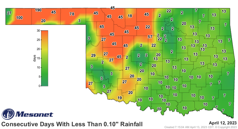
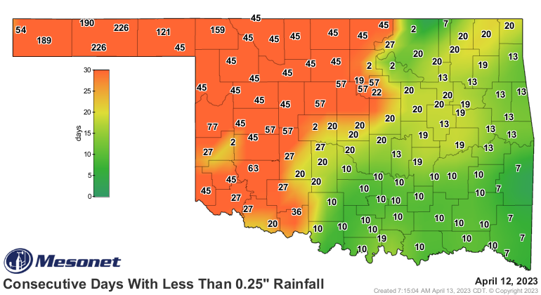
WELL I TOLD YA NOT TO LOOK! Here's the deal...I've heard quite a bit from that
area of wanting to "dry out," but as the NW half of the state can tell you...be
careful what you wish for, because there's always a chance that "drying out" can
become "dried up."
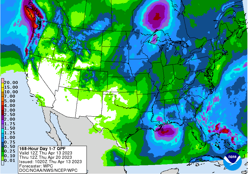
The last thing I'm gonna do is say "I told you I was sick!" But the next to the
last thing I'm gonna do is predict SE OK will go back into drought. The NW half
seems to have hotels built on that commodity. But it should serve as a cautionary
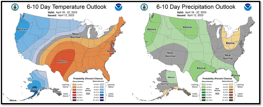
tale. And there does seem to be some chances for moisture coming up next week,
maybe? Very iffy, to be honest.
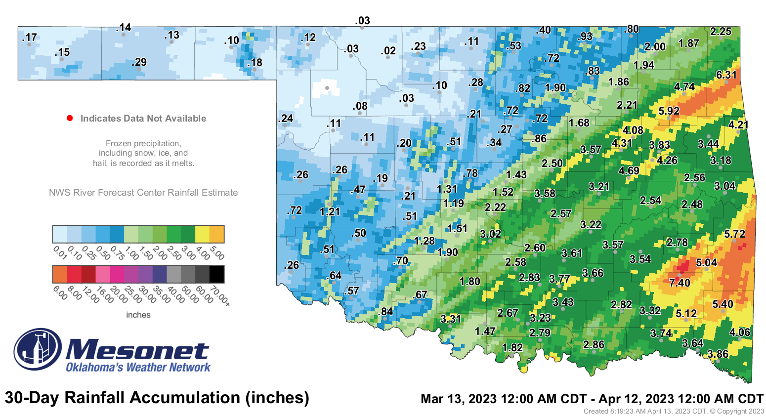
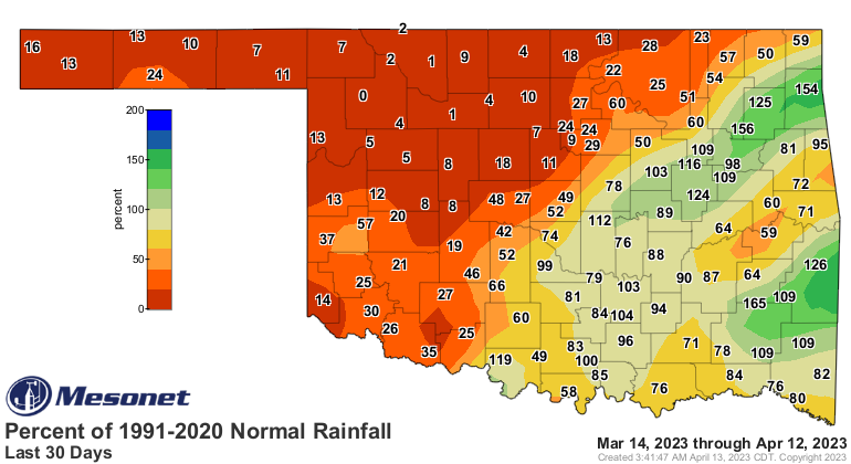
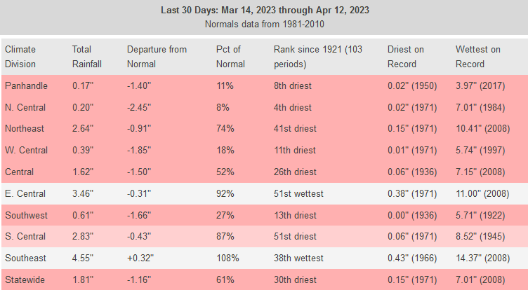
Regardless of any current dry spell, we are dealing with the dichotomy (English
to Okie dictionary: contrast of opposites) between the NW half of the state
vs. the SE half where we see top-10 driest vs. top-10 wettest year-to-date
periods since records began in 1895. And to be honest, the last 30 days are no
picnic either.
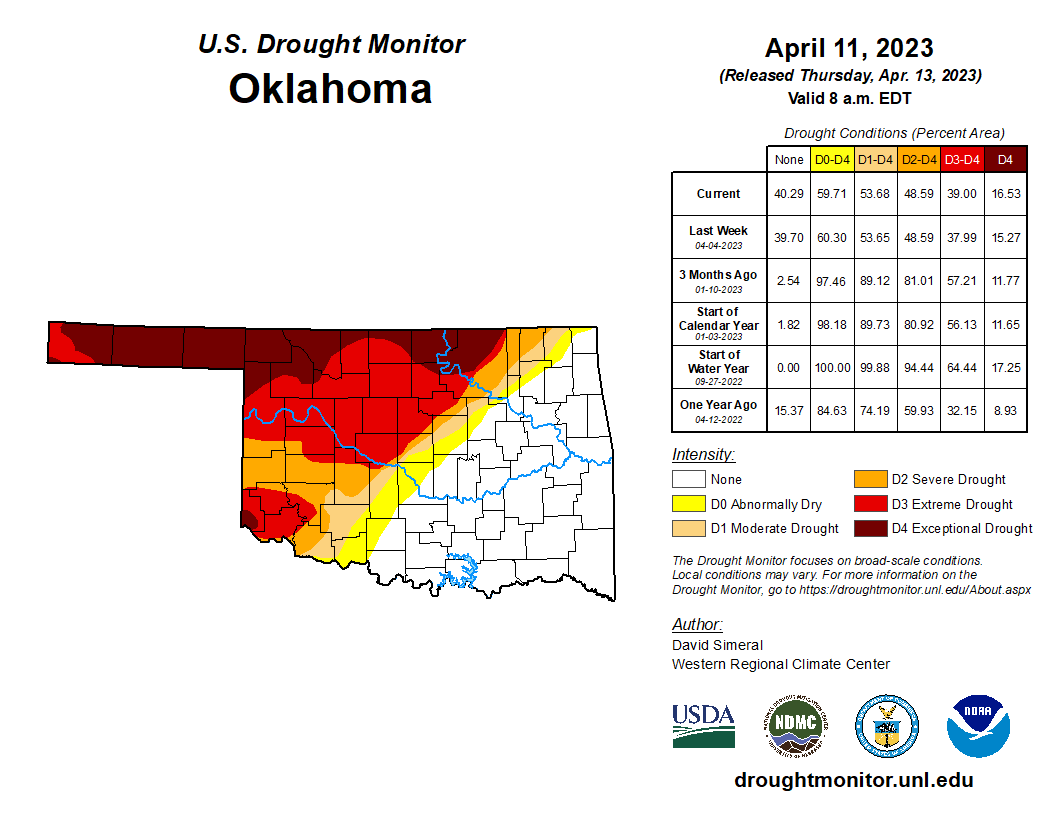
That leaves us with this current drought map, which once again saw a bit of
an increase in that D4 exceptional drought up in far NW OK.
The rain chances we see over the next couple of days hinge on the ability of
thunderstorms to form with that aforementioned cap in place in the atmosphere.
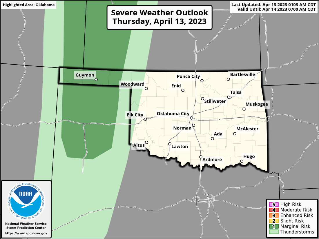
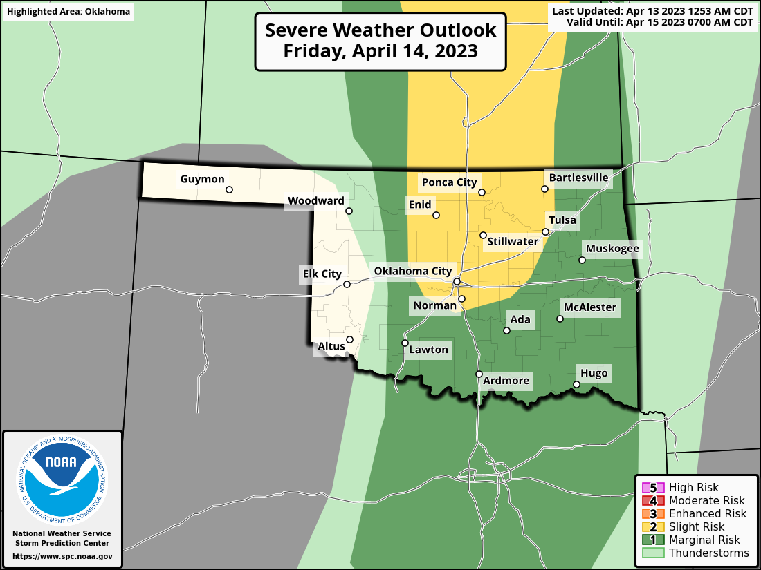
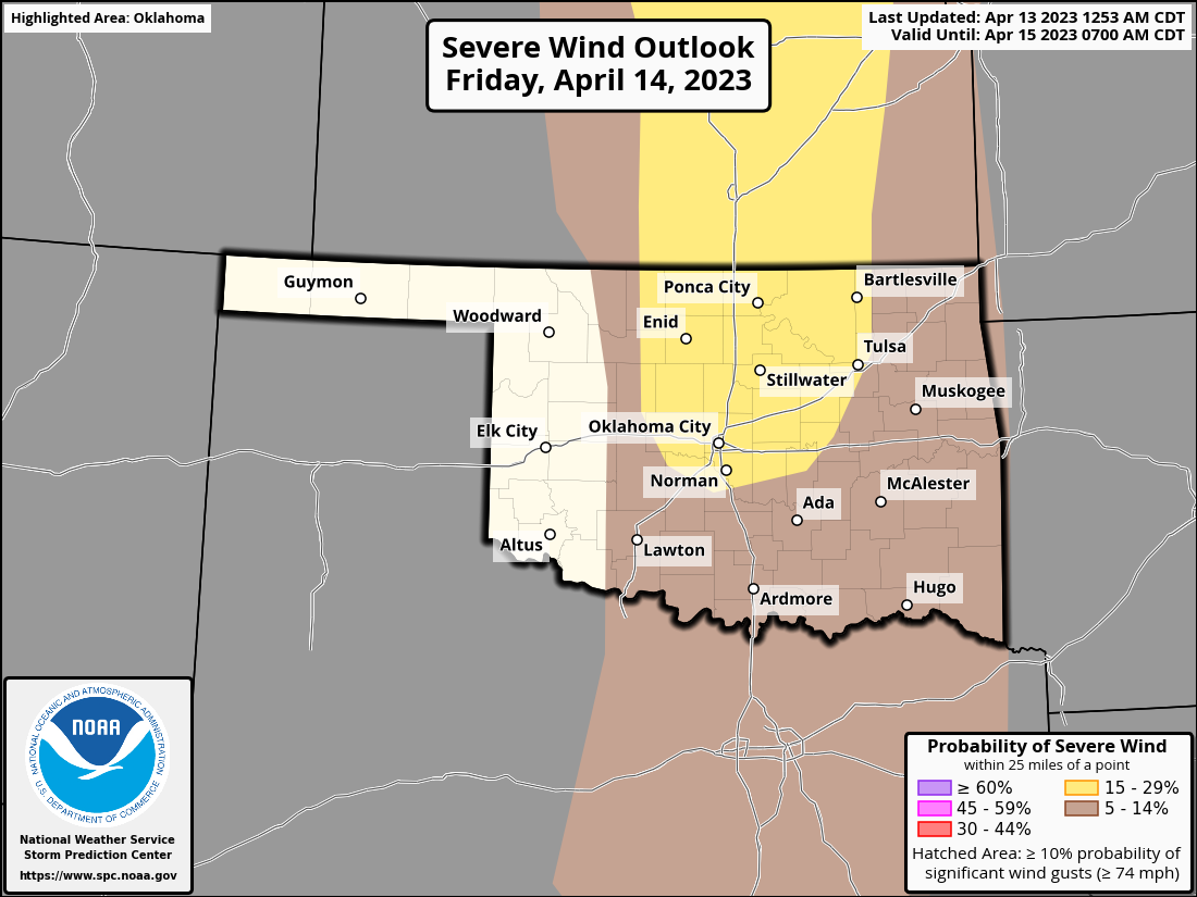
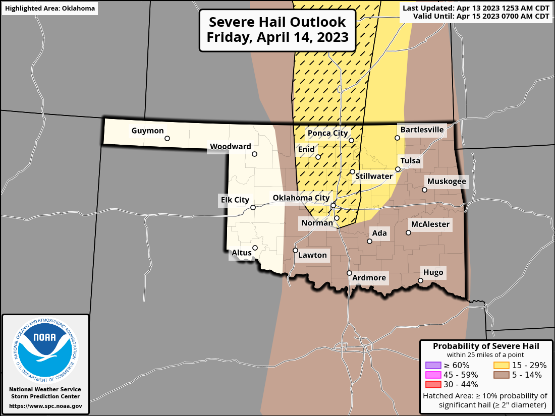
You've already seen from the forecast rain map that hopes aren't high, but here
are the risks for the next couple of days. Note that IF storms can form
tomorrow, large hail will be the biggest threat.

We've seen this act before. We can't stop these storm systems from coming
through with their drylines and hot SW winds behind those drylines, nor can we
force them to rain. So what we're left with is lots and lots of fire danger. And
blowing dust. And drought. And scorching sun. And a lip-cracking lack of
humidity.
All will be plentiful over the next week or so.
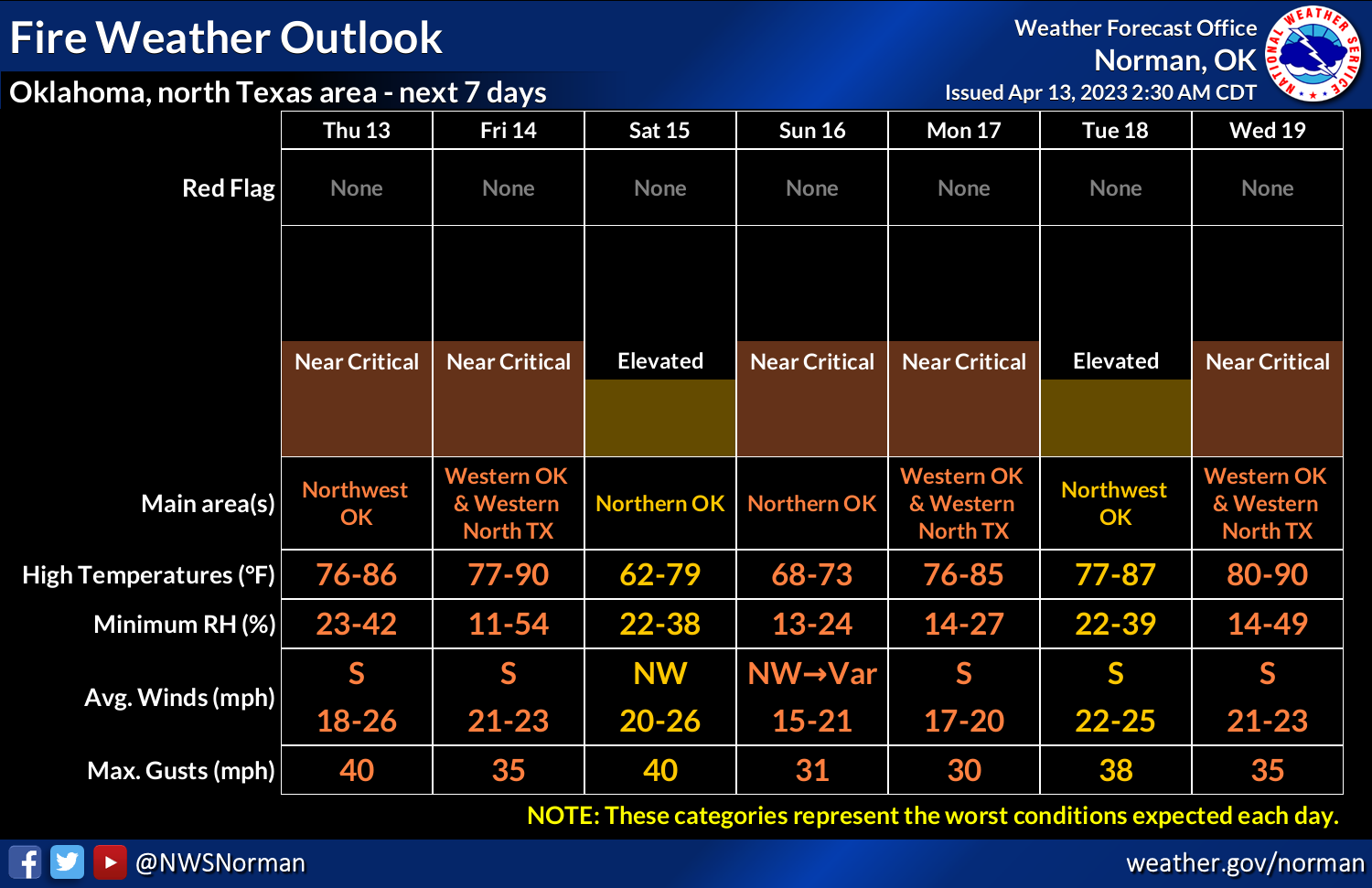
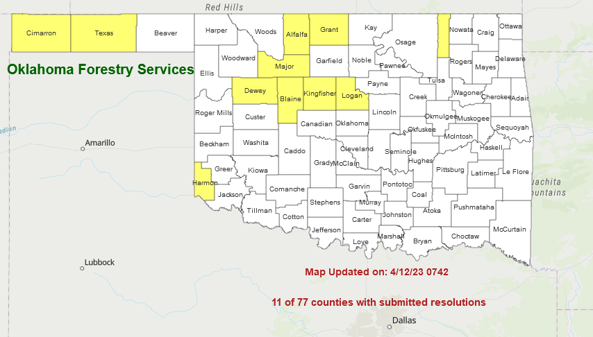
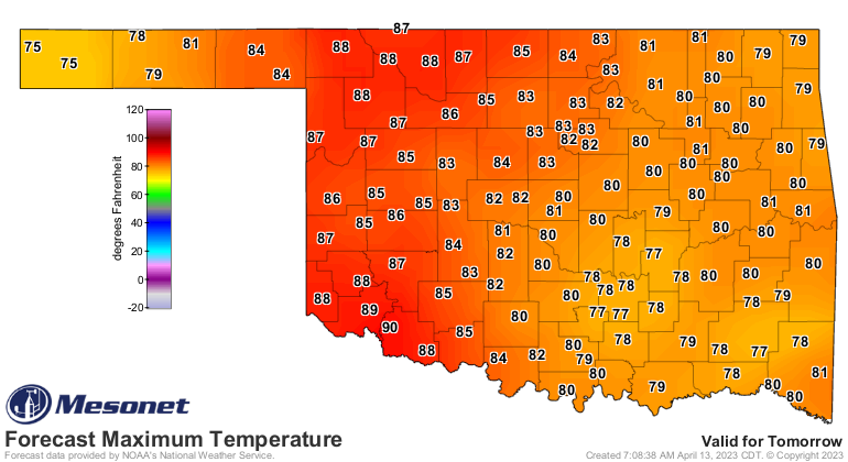
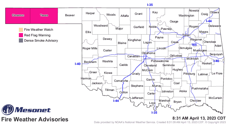
Sorry, this is how droughts work. It's in the manual.
Gary McManus
State Climatologist
Oklahoma Mesonet
Oklahoma Climatological Survey
gmcmanus@mesonet.org
April 13 in Mesonet History
| Record | Value | Station | Year |
|---|---|---|---|
| Maximum Temperature | 99°F | ALTU | 2025 |
| Minimum Temperature | 19°F | BOIS | 2004 |
| Maximum Rainfall | 4.11″ | CHER | 1999 |
Mesonet records begin in 1994.
Search by Date
If you're a bit off, don't worry, because just like horseshoes, “almost” counts on the Ticker website!