Ticker for April 12, 2023
MESONET TICKER ... MESONET TICKER ... MESONET TICKER ... MESONET TICKER ...
April 12, 2023 April 12, 2023 April 12, 2023 April 12, 2023
No cap fr fr
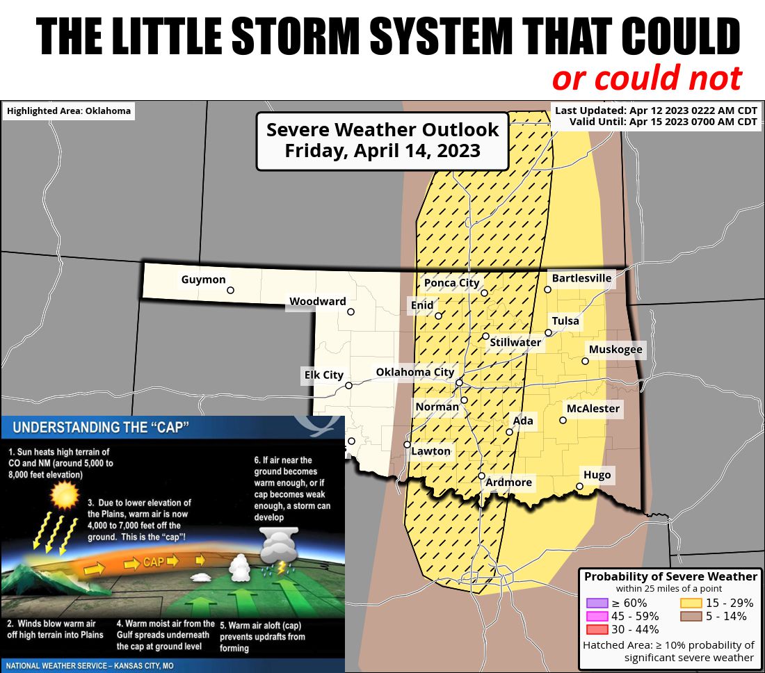
Ahhh, the good old cap. No, not what I need anytime I go out in the sun lest my
scalp start to look like a red-bellied sapsucker (not sure if that's a real bird,
I heard it on a Bugs Bunny cartoon once). No, this is that layer of warm air that
resides above the surface several thousand feet in the atmosphere that keeps a
lid on our thunderstorm development from time to time, especially across western
Oklahoma. Our acquaintances (I would say friends, but that would be presumptious,
or presumptuous for those that like correct spelling) at the NWS office in Kansas
City spell it out in this graphic. It's embedded in the above graphic, but I'll
show again for added clarity (Added Clarity was my band's name in grad school!).
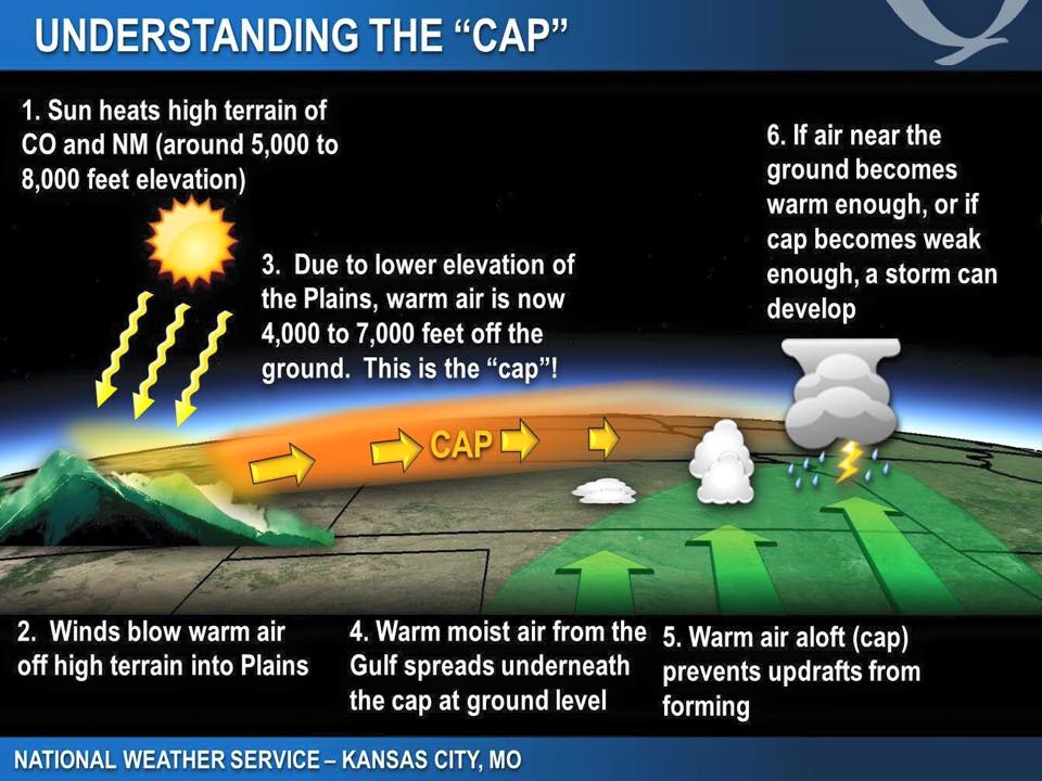
As the ground is heated by the sun, it heats the air above it, which then rises
due to buoyancy (sort of like JayZ, who is raised by Beyoncé). If it hits a layer
of warmer air above it, SPLAT! Yes, that's an official scientific term. SPLAT! The
buoyancy is killed and the air is prevented from rising. No rising motion, no
storms. That's an extremely simplified explanation from an extremely simplified
brain. So our chances for severe weather, but more importantly...rain, are
all hinged on enough daytime heating on Friday to have those air parcels be able
to overcome that cap of warm air above and continue explosive growth into
storms. Now there are enough ingredients in place that if the cap is overcome,
we could see supercells and high-end severe weather. Here is SPC's take on it:
"At the surface, a low initially over the western KS/NE border
vicinity will likely develop southward/southwestward. A dryline will
extend southward from this low across central KS and western OK into
western parts of central TX throughout much of the day. Robust
low-level moisture advection is anticipated east of this dryline,
with low 60s dewpoints likely reaching central OK by Friday evening.
Strong capping will be in place during much of the day, but
continued moisture advection amid strong diurnal heating is expected
to weaken the cap enough for isolated convective initiation during
the late afternoon/early evening along the dryline. Moderate bulk
shear and steep mid-level lapse rates will support the potential for
discrete supercells capable of all severe hazards, including very
large hail. Any storms that develop should be able to persist
eastward for a few hours before succumbing to nocturnal
stabilization."
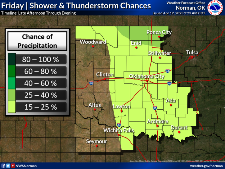
"Succumbing to nocturnal stabilization" means lose the daytime heating, lose
the rising motion and lose the storms. So it's all pretty iffy. Our FRIENDS
over at the Norman NWS office don't like those odds, but they're not discounting
them either.
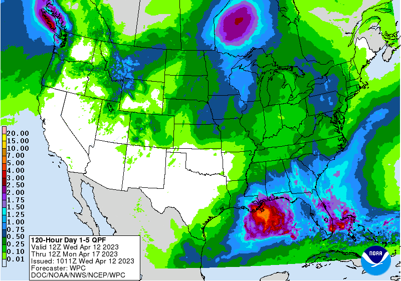
The fine folks at the WPC don't like those odds either...they're not even
painting us with a tenth of an inch through the weekend, meaning no storms
and no rain.
And we desperately need the rain, because as my mirror is fond of saying...things
ain't pretty right now! Even areas south and east of I-44 are starting to see
a dry spell growing longer and longer, approaching 3 weeks without at least a
quarter-inch of rainfall.
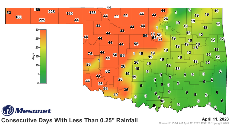
So let's doff that cap on Friday, get some rain and deal with whatever comes
with it.
Gary McManus
State Climatologist
Oklahoma Mesonet
Oklahoma Climatological Survey
gmcmanus@mesonet.org
April 12 in Mesonet History
| Record | Value | Station | Year |
|---|---|---|---|
| Maximum Temperature | 102°F | MANG | 2018 |
| Minimum Temperature | 14°F | BOIS | 1997 |
| Maximum Rainfall | 3.14″ | CHEY | 2015 |
Mesonet records begin in 1994.
Search by Date
If you're a bit off, don't worry, because just like horseshoes, “almost” counts on the Ticker website!