Ticker for April 4, 2023
MESONET TICKER ... MESONET TICKER ... MESONET TICKER ... MESONET TICKER ...
April 4, 2023      April 4, 2023      April 4, 2023      April 4, 2023


World of Hurt


Well I'm not going to belabor the weather setup as much today since we've already
covered it some yesterday and even more so last week in advance of Friday's
wildfire outbreak that saw as many as 70 fires pop up. Heck, I'm not even sure
the Simpson fire that burned more than 30 homes in Logan County has been 100%
contained yet. So here's a quick synopsis for today:

-- Strong low pressure system moving to our north will drag a dryline and a front
through Oklahoma.

-- The dryline should surge back westward tonight but then get overtaken by cold
front overnight.

-- Relative humidity values in the teens and single digits behind the dryline will
make for prime wildfire conditions thanks to much above average temperatures.

-- Strong mixing behind the dryline will transport high wind speeds downwards,
so watch for winds once again gusting from 50-70 mph. Some damage is expected
in areas with higher wind speeds.

-- Storms *might* fire along dryline, but strong capping inversion makes it
pretty iffy.

-- Better chance of storms in far eastern Oklahoma, where all modes of severe
weather are possible, including a chance for strong (EF2-EF5) tornadoes.

-- Cold front will bring in a wind shift overnight with strong northerly winds.

-- Drought conditions in the High Plains create ample opportunity for blowing
dust, and we could see several waves of dust move east across the state
later today.

Fun fun fun, right? So it's just a "nasty" day, with lots of nasty conditions.

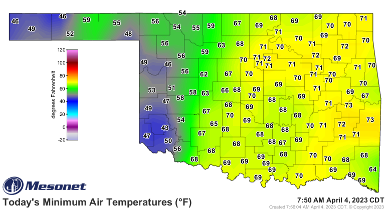
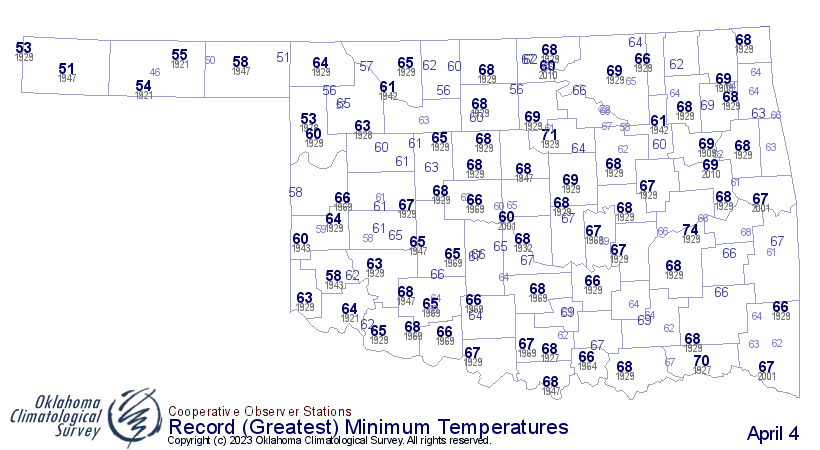
Hey, did ya know we potentially set records today for high minimum temperatures?
Depends on the timing of the cold front and how much we cool down by midnight
tonight, but lots of humidity, oddly enough, and wind kept the heat mixed down
close to the surface overnight, giving us almost summer-like low temperatures.


Hey, did ya know we had a summery day yesterday, especially down in SW OK where
highs reached up to 96 degrees in Mangum...the highest such temperature seen
in the state since Oct. 22, 2022?


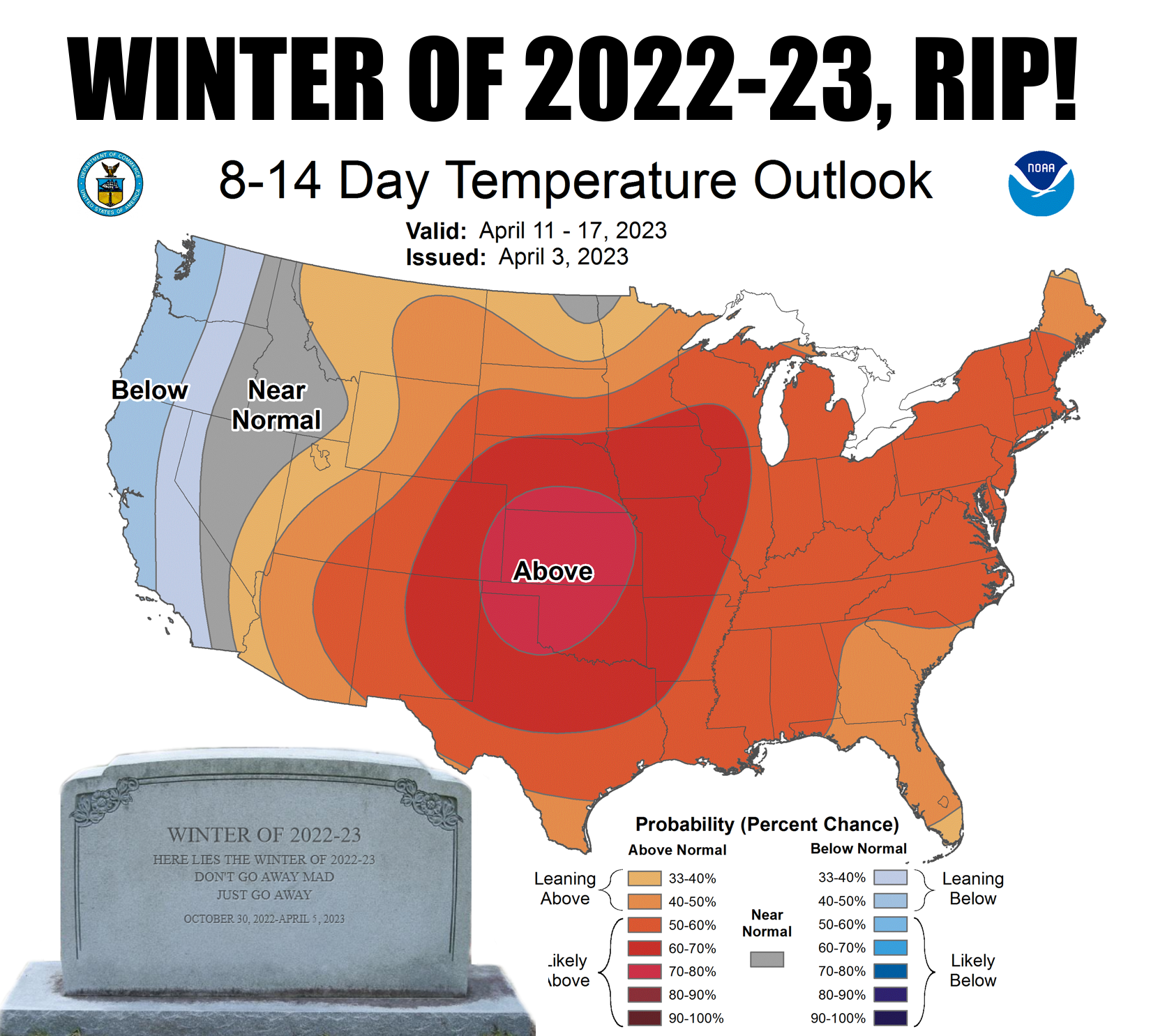
Hey, did ya know that although we'll cool down for a couple of days, and even
see a freeze in NW OK the next couple of days, winter is probably dead for good,
and we're going to go into more of a late-spring temperature regime?


Hey, did ya know hair is wayyyy overrated?


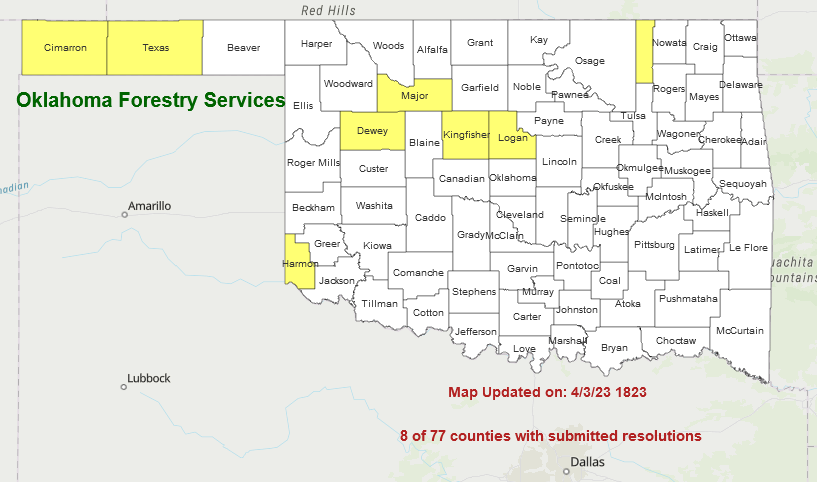
Hey, did ya know there are more county burn bans in place, and if you start a
fire that gets out of hand in one of these counties, you will be in a world of
hurt?


Hey, did ya know "World of Hurt" was my punk band's name in college?

Well, now ya do.

Gary McManus
State Climatologist
Oklahoma Mesonet
Oklahoma Climatological Survey
gmcmanus@mesonet.org
April 4 in Mesonet History
| Record | Value | Station | Year |
|---|---|---|---|
| Maximum Temperature | 94°F | ALTU | 2023 |
| Minimum Temperature | 16°F | BUFF | 2018 |
| Maximum Rainfall | 4.31″ | TALI | 2025 |
Mesonet records begin in 1994.
Search by Date
If you're a bit off, don't worry, because just like horseshoes, “almost” counts on the Ticker website!