Ticker for April 3, 2023
MESONET TICKER ... MESONET TICKER ... MESONET TICKER ... MESONET TICKER ...
April 3, 2023 April 3, 2023 April 3, 2023 April 3, 2023
Let's go again
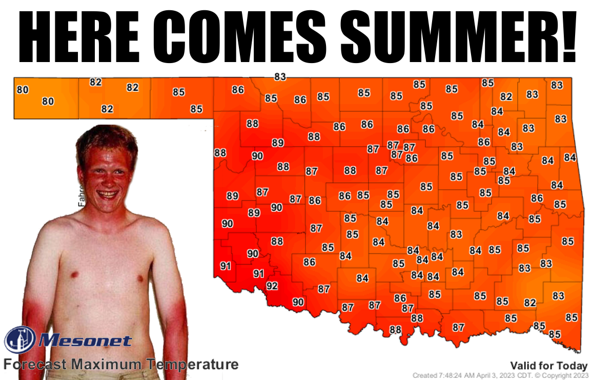
What, you want I should lead with the depressing stuff? How about this? The
statewide average rainfall for Oklahoma for January through March was 6.66 inches.
Yeah, let THAT simmer (even as you're simmering today)! Here's the deal, though...
today's brief-but-inevitable slide into summer, continued to a lesser extent
into tomorrow, is pretty darned depressing when you consider the bigger picture.
Here's a bigger picture.

Hey, these are the jokes! I might have missed April Fool's Day, but that doesn't
mean I'm not an April fool.
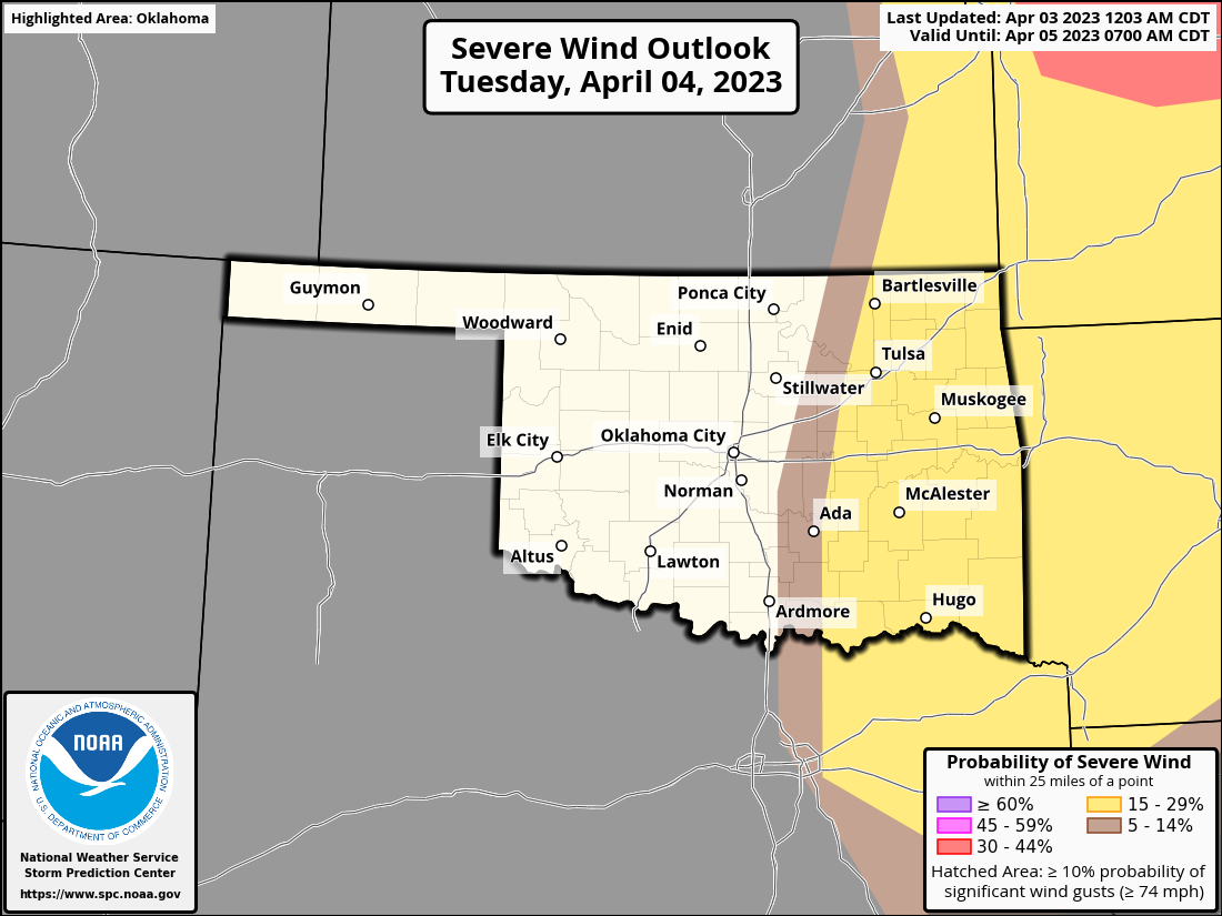
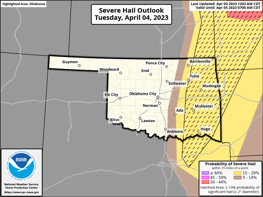
Now, here's OUR bigger picture...another storm system that will graze far eastern
Oklahoma with bigtime storms and rainfall, while the western two-thirds of the
state get wind, dust, and wildfire danger. The fire danger begins today but
intensifies tomorrow for another setup like last Friday, of wildfire outbreak
infamy.
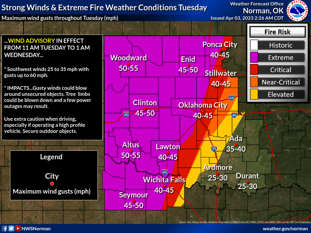
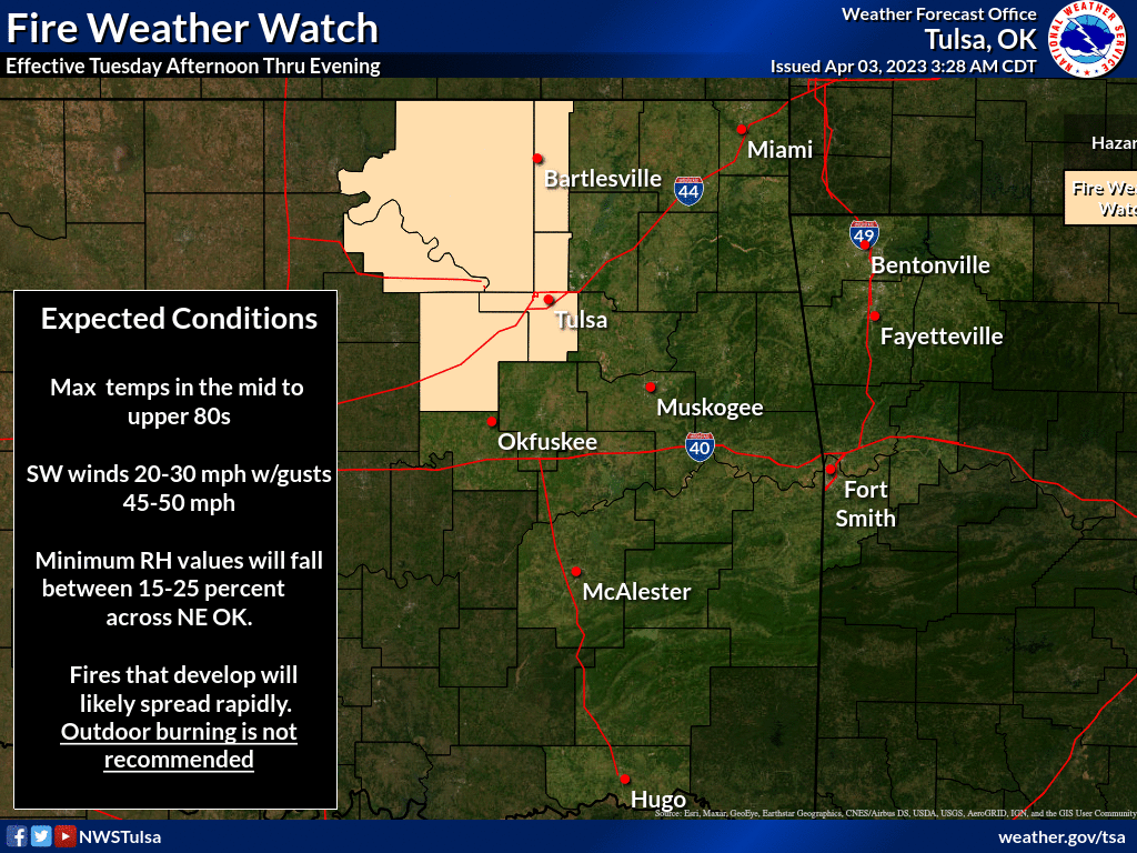
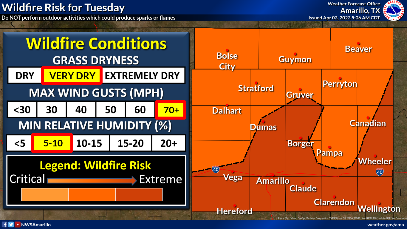
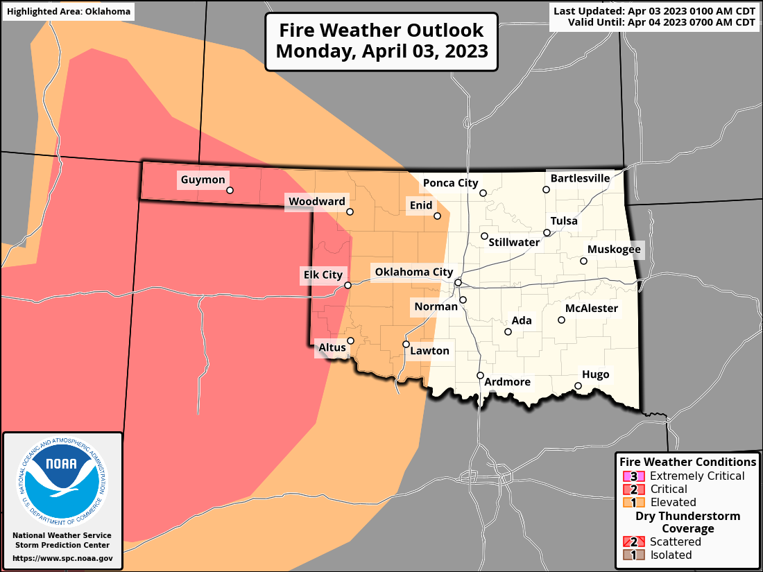
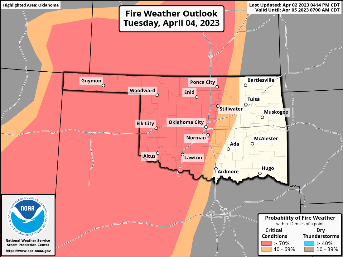
Hard to say who's gonna have it worse tomorrow...would you take fire over large
tornadoes and giant hail? Well, at least one comes with rainfall!
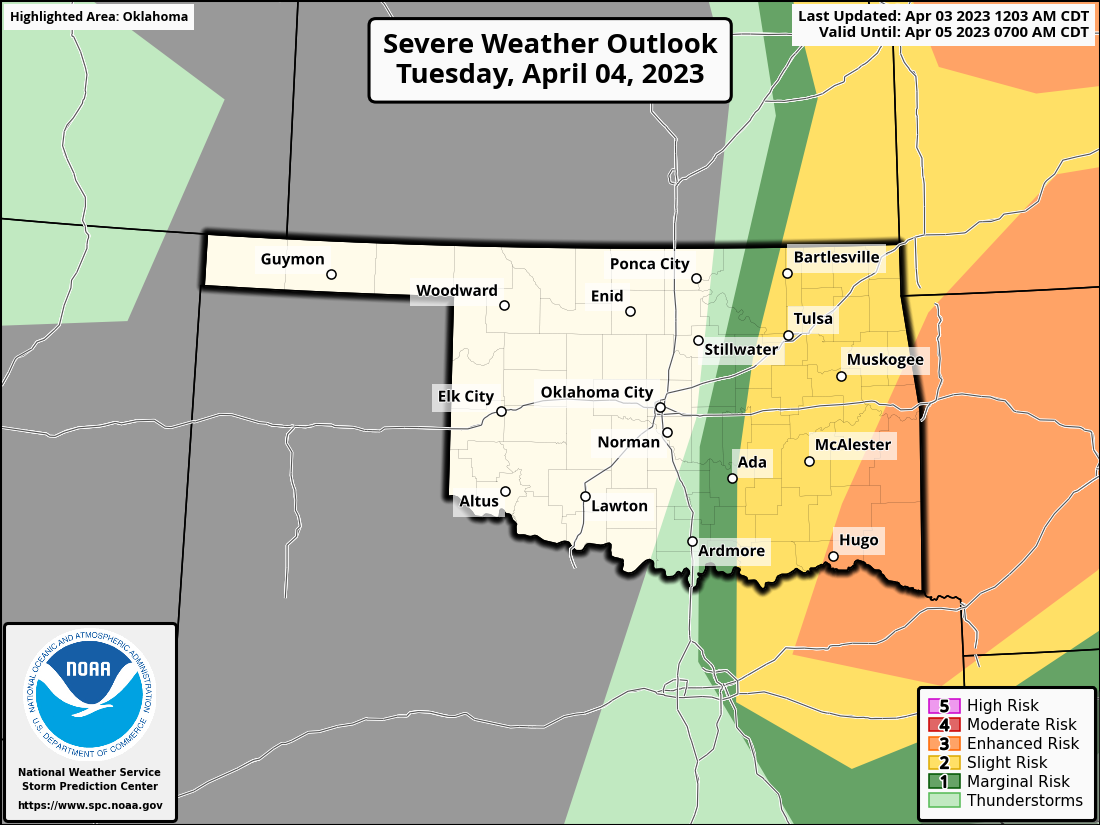
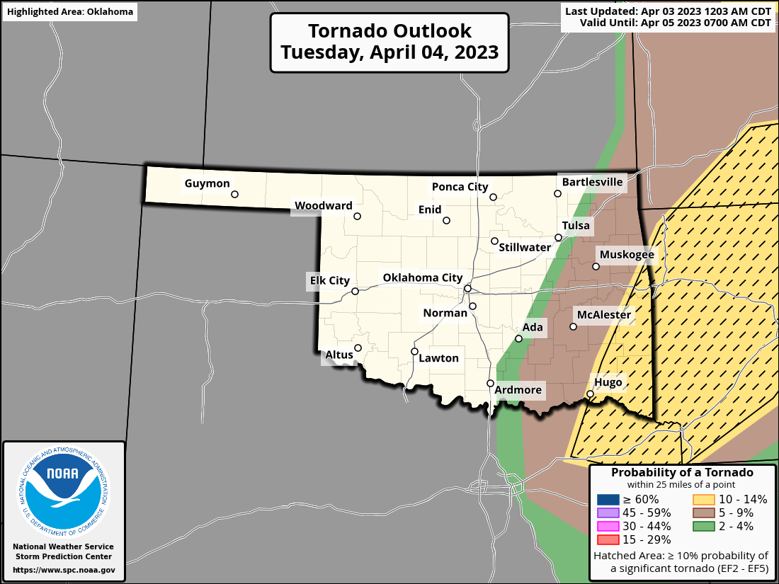
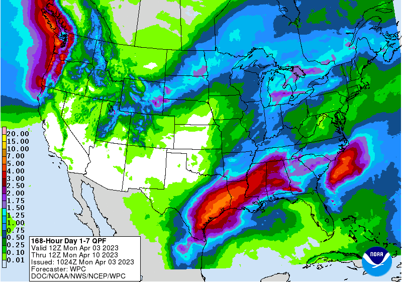
In a worn our refrain (and we all know just how painful that can be), the rains
will fall mainly in the plains...of eastern Oklahoma.
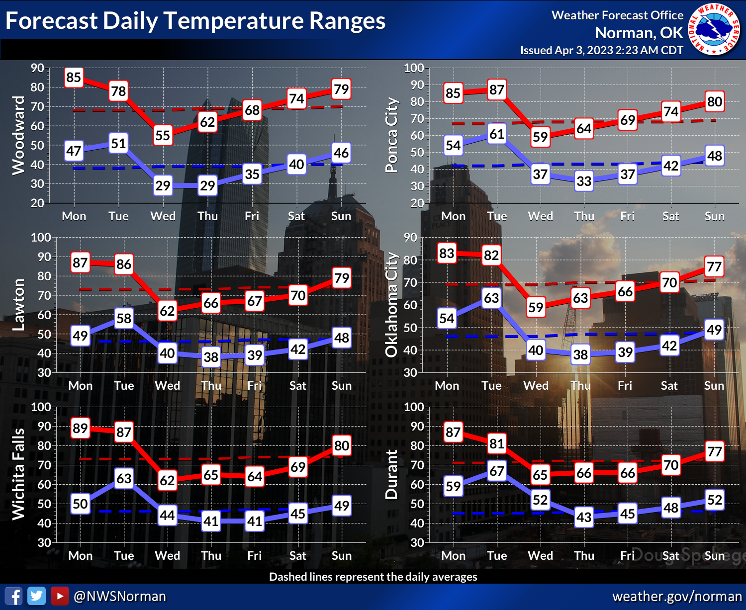
Anyway, a brief cooldown later tomorrow into Wednesday...back to early spring,
not winter. But then another warm up to finish the week.
If you're a glutton for punishment (like my mirror is), stick around below for
a look back at the unpleasant weather of March. Until then, see ya on the beach!
----------------------------------------------------------------------------------
Oklahoma Sees March Rainfall Divide
April 3, 2023
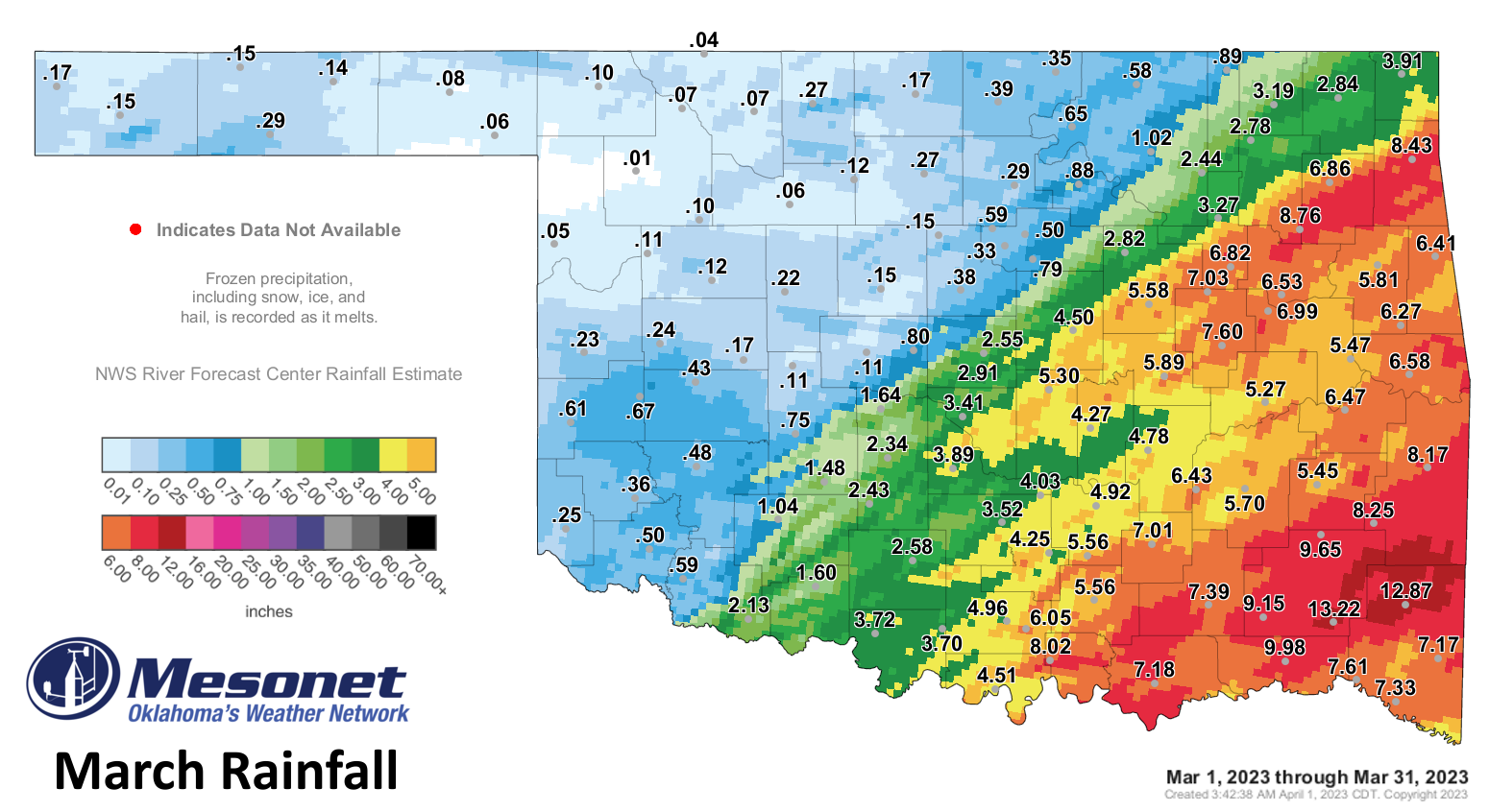
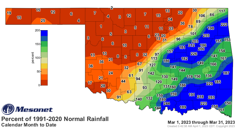
Oklahoma’s oddly persistent caste-like rainfall pattern—with those to the north
and west of Interstate 44 seeing near-record dryness and those to the south and
east experiencing abundance—continued during March. Rainfall totals to the
northwest of I-44 were generally a half-inch or less, while amounts of 5-8
inches were quite common to the southeast. Ten Oklahoma Mesonet sites in far
northwest Oklahoma failed to record more than a tenth of an inch of rain for
the month, with another 17 stuck below the quarter-inch line on the rain gauge.
The 0.07 inches at the National Weather Service’s observing site in Ames broke
the previous record of 0.17 inches for their driest March set back in 1900. The
observer in Weatherford recorded a trace for the month. The persistent dry
weather continued to hinder early spring green up in that half of the state and
exacerbate dangerous wildfire conditions. The month’s final day saw winds
gusting up to 77 mph combine with relative humidity in the teens and single
digits to create the prime ingredients for a wildfire outbreak. At least 36
homes were destroyed by a wildfire in Logan County according to local and state
Emergency Management officials, as well as at least seven homes in Washington
County. Another three homes were burned in Oklahoma City. Several other homes
were either damaged or destroyed by wildfires that day across the state. The
Oklahoma State Department of Health reported 32 injuries related to the fires
and the accompanying weather. There was one confirmed tornado during the
month—an EF1 twister near Broken Bow on March 2—bringing the 2023 total to 18,
well ahead of the January-March average of 4.9. It was also the first month
since October 2022 with a below average tornado total.
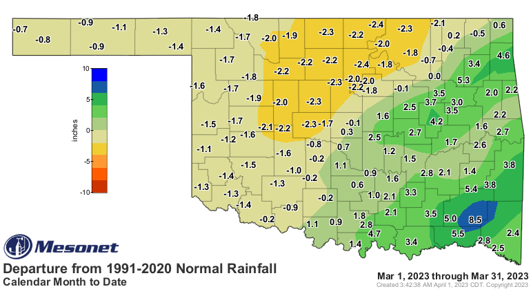
The statewide average precipitation total of 3.04 inches was 0.26 inches above
normal and ranked as the 38th wettest March since records began in 1895. March
Mesonet rainfall totals ranged from a 13.22 inches at Cloudy to a scant
hundredth of an inch at Woodward. Forty-six of the Mesonet’s 120 sites recorded
at least 4 inches for the month, all within the southeastern half of the state.
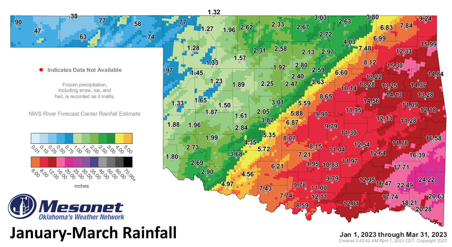
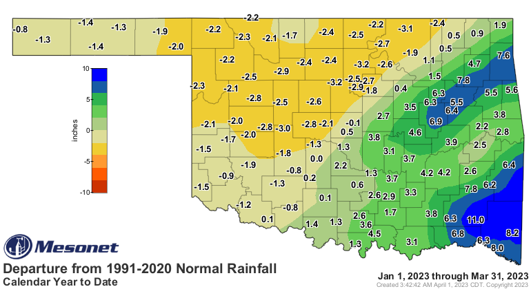
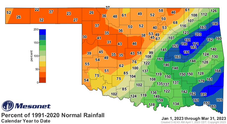
The statewide average precipitation total for the first 3 months of the year
was 6.66 inches, 0.62 inches above normal and ranked as the 39th wettest
January-March on record. January-March totals across the southeastern half of
the state ranged generally from 10-20 inches, with Mt. Herman leading the way
at 24.22 inches. Surpluses for the 3-month period ranged from about an inch to
more than 12 inches in that part of the state. The northwestern half of the
state fared much worse with totals of less than an inch to 3 inches, and
deficits of an inch to 3 inches. Eva had the lowest total with 0.38 inches.
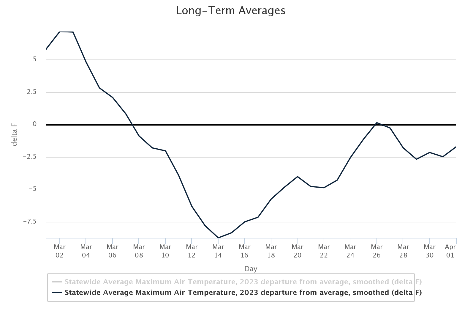
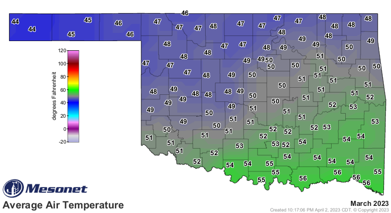
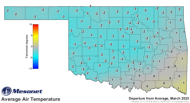
Oklahoma spent much of March with below normal temperatures, including a
downright frigid Spring Break. The statewide average temperature for the month
finished at 50 degrees, 1.2 degrees below normal and ranked as the 60th warmest
March since records began in 1895. Temperatures ranged from 90 degrees at Altus
and Mangum on March 11, to 5 degrees at Eva on March 19. Oklahoma suffered a
statewide hard freeze on March 18-19 with low temperatures in the teens and 20s,
although some areas in northwest Oklahoma saw temperatures drop into the single
digits. The January-March period finished at 45.5 degrees, 1.5 degrees above
normal and ranked as the 22nd warmest such period on record.
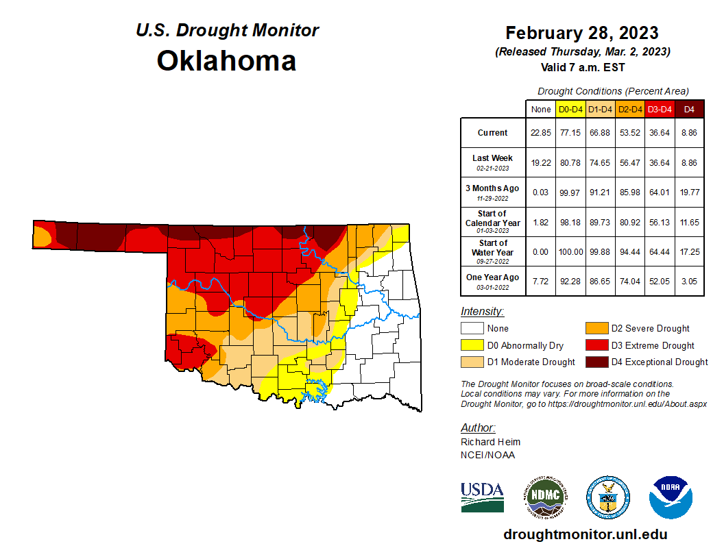
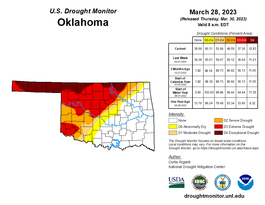
Drought coverage in Oklahoma dropped from 67% at the end of February to 54% at
the end of March according to the U.S. Drought Monitor with nearly all of those
improvements coming in the southeastern half of the state. The amount of
extreme-to-exceptional drought—all within the northwestern half of the state—
remained about the same at 37%, however. The highest intensity category alone
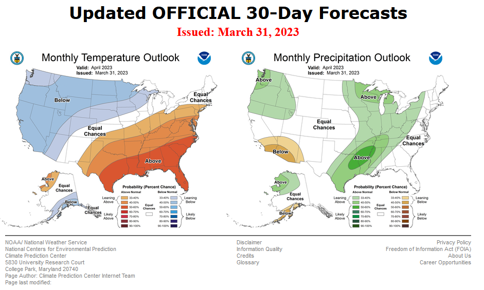
rose from 9% to 13% during the month. Prospects for drought reduction during
April look slim according to the Climate Prediction Center. CPC’s temperature
outlook calls for increased odds of above normal temperatures across the entire
state. The precipitation outlook indicates increased odds for above normal
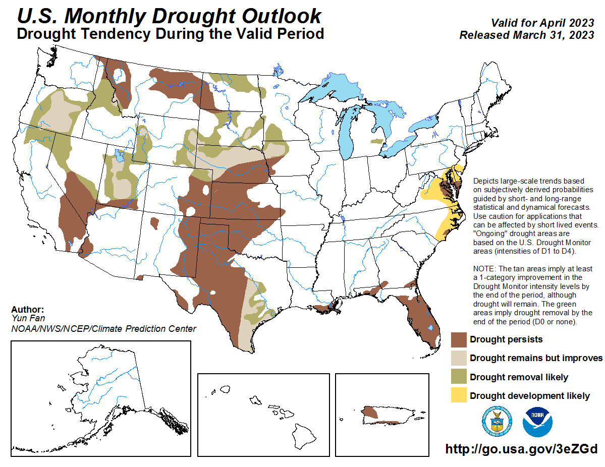
precipitation across the southeastern one-half of the state. The April drought
outlook shows the current drought conditions persisting through April.
###
Gary McManus
State Climatologist
Oklahoma Mesonet
Oklahoma Climatological Survey
gmcmanus@mesonet.org
April 3 in Mesonet History
| Record | Value | Station | Year |
|---|---|---|---|
| Maximum Temperature | 103°F | ALTU | 2011 |
| Minimum Temperature | 15°F | KENT | 2002 |
| Maximum Rainfall | 3.12″ | WAUR | 2012 |
Mesonet records begin in 1994.
Search by Date
If you're a bit off, don't worry, because just like horseshoes, “almost” counts on the Ticker website!