Ticker for April 5, 2023
MESONET TICKER ... MESONET TICKER ... MESONET TICKER ... MESONET TICKER ...
April 5, 2023 April 5, 2023 April 5, 2023 April 5, 2023
Wait for it...
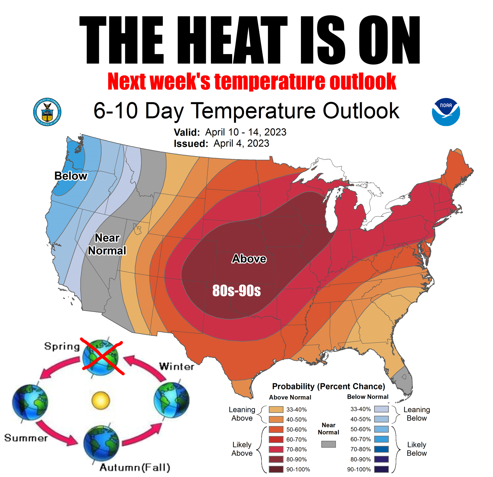
Yesterday was a bust, to some degree (and to some mph), and that's a good thing,
right? Maybe using 3 commas in a sentence isn't a good thing either, but you come
here for weather info, not writing that is gooder than good. But yesterday had
the possibility to become last Friday, part deux, but instead it became last
Friday lite. We did have some gusty winds, 40-50 mph, as high as 60 mph in the
western Panhandle.

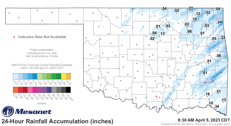
And we did have (still ongoing, actually) some big fires, but nothing to the
degree and number that we had last Friday. Not much severe weather to speak of
either (but also not much rainfall).
So why didn't we have a sequel to Friday (in reality there were 3 sequels to
"Friday"..."Next Friday," "Friday After Next," and "Last Friday"...the finest
entertainment Ice Cube has to offer!)? Well, you can pay a big thanks to our
cirrus cloud deck that stretched over the state yesterday. Yes, cirrus clouds,
the Ringo Starr of cloud categories. We THINK they're useful and good, but
it sometimes escapes us. The cirrus deck blocked enough of the sun's rays to
keep our temperatures down a good 5-10 degrees, which helped prevent the mixing
down of those higher momentum winds from higher up in the atmosphere. So we
had a windy Oklahoma spring day instead of last Friday. It still got pretty
warm, however.
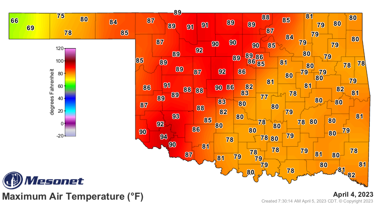
And it has started to impact one of my favorite Mesonet maps. I know how some
of you dread this...but you had your fun the last 5-6 months.

While I appreciate the warm weather, I'm afraid it's going to coincide with a
very much UNWELCOME weather pattern. We're about to go into a bit of a boring
weather pattern, especially for springtime in Oklahoma, for the next 7-10
days. Our chances for rain are really looking bleak through next week.
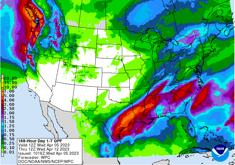
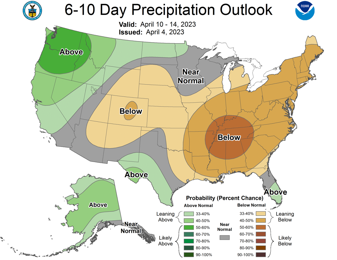
That lack of storm systems means doom for rain chances, but at least we
shouldn't see any bigtime fire weather outbreaks either.
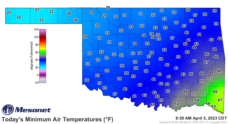
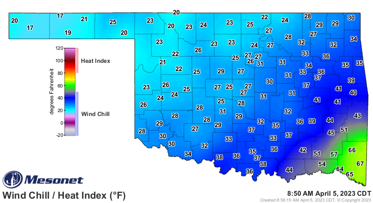
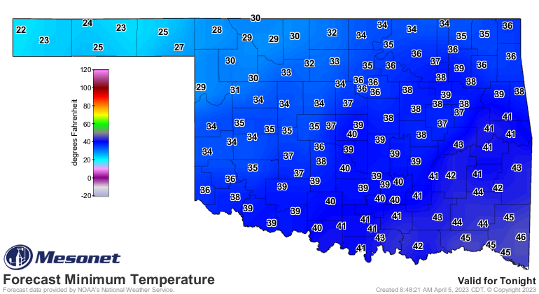
We do have to get by a couple of days with chilly mornings as we begin our
march towards spring...I mean summer, next week. Sprummer? We're taking it on
the chin this morning, then again tomorrow, but after that it's a steady march
upwards.
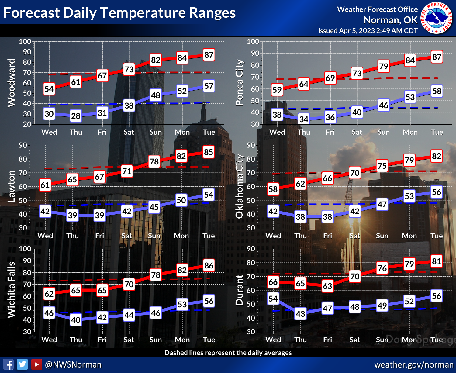
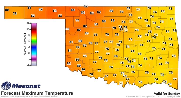
Easter looks nice though.
Gary McManus
State Climatologist
Oklahoma Mesonet
Oklahoma Climatological Survey
gmcmanus@Mesonet.org
April 5 in Mesonet History
| Record | Value | Station | Year |
|---|---|---|---|
| Maximum Temperature | 95°F | TIPT | 2022 |
| Minimum Temperature | 21°F | EVAX | 2023 |
| Maximum Rainfall | 2.95 inches | CLOU | 2025 |
Mesonet records begin in 1994.
Search by Date
If you're a bit off, don't worry, because just like horseshoes, “almost” counts on the Ticker website!