Ticker for March 27, 2023
MESONET TICKER ... MESONET TICKER ... MESONET TICKER ... MESONET TICKER ...
March 27, 2023 March 27, 2023 March 27, 2023 March 27, 2023
Great Scott!
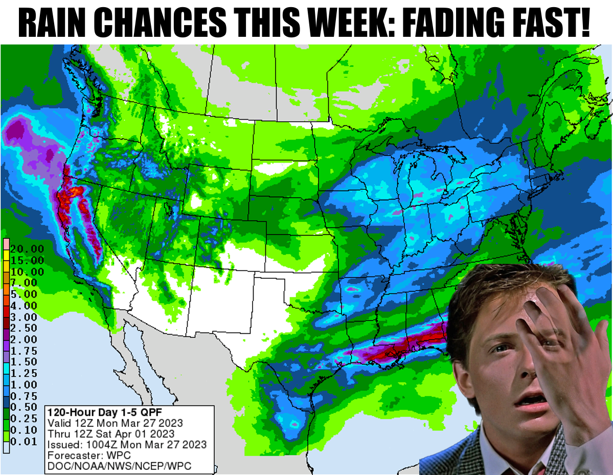
It all looked so much better last week. No, not my view in the mirror, I'm talking
this week's storm system for Thursday-and-maybe-Friday. Now it looks like it's a
late-Thursday-early-Friday storm with questionable moisture and timing. However,
to look for the silver lining, at least the severe threat seems to have diminished
considerably, at least according to those smarter than me (which is basically
99.99% of the population. Hey, I'm proud to be in the 1% (see, I told ya...math
required to get joke).
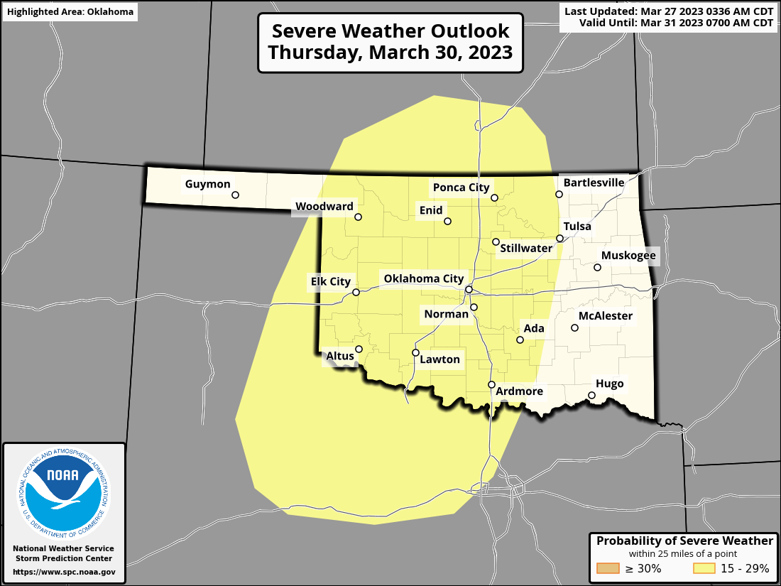
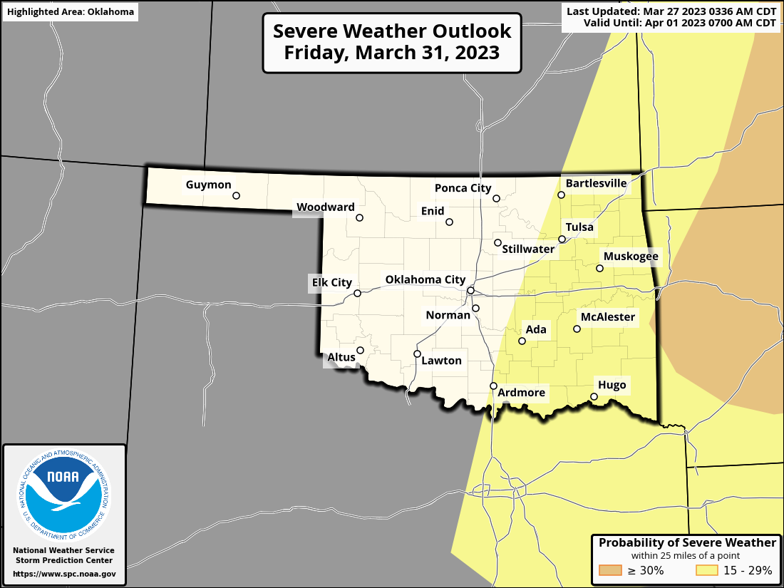
Now the good news is this Ticker is almost finished and you can quit reading soon.
Even BETTER news is with the severe threat diminished, maybe less worry going
into those two days. However, the bad news is in springtime, less severe weather
chances in Oklahoma generally means less of a rain chance, since we take the
good with the bad (You take them both and there you have the facts of life...
the facts of life...youngsters, google it). However, late-March, storm system
coming in, still getting freezes keeping the green up down and also drought in
place across the NW half of the state...that generally leads to lots of warmth,
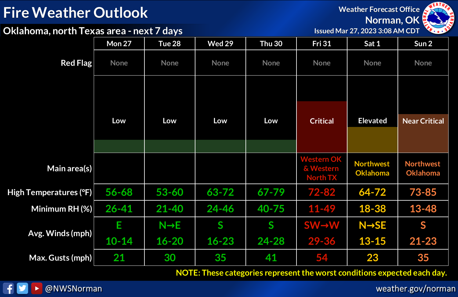
wind, and dry air. So Friday could be a doozy of a day with strong W-SW winds
and low humidity.
That's right, fire danger. And don't be shocked if we see a pretty substantial
dust storm move across the state. Lots of bare soil still looking for some
vegetation to our west.

Even though we had a pretty good freeze up north this morning, and expect
another one tomorrow, temperatures are starting to rise along with the spring
season accordingly.
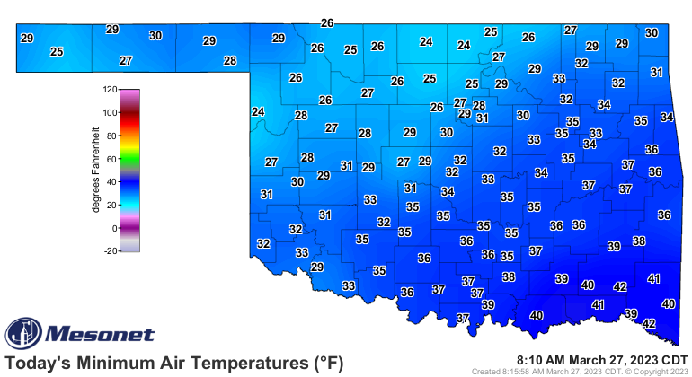
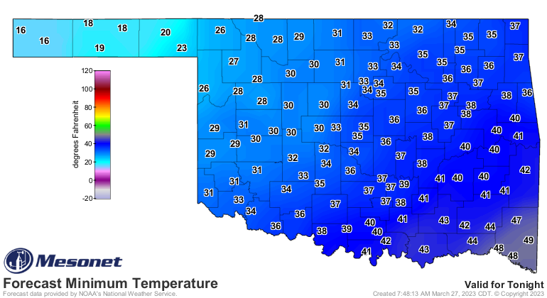
So each successive week our "below-normal" temperature weather gets a bit
higher, and our "above normal" temperatures get closer to those 90s. It's
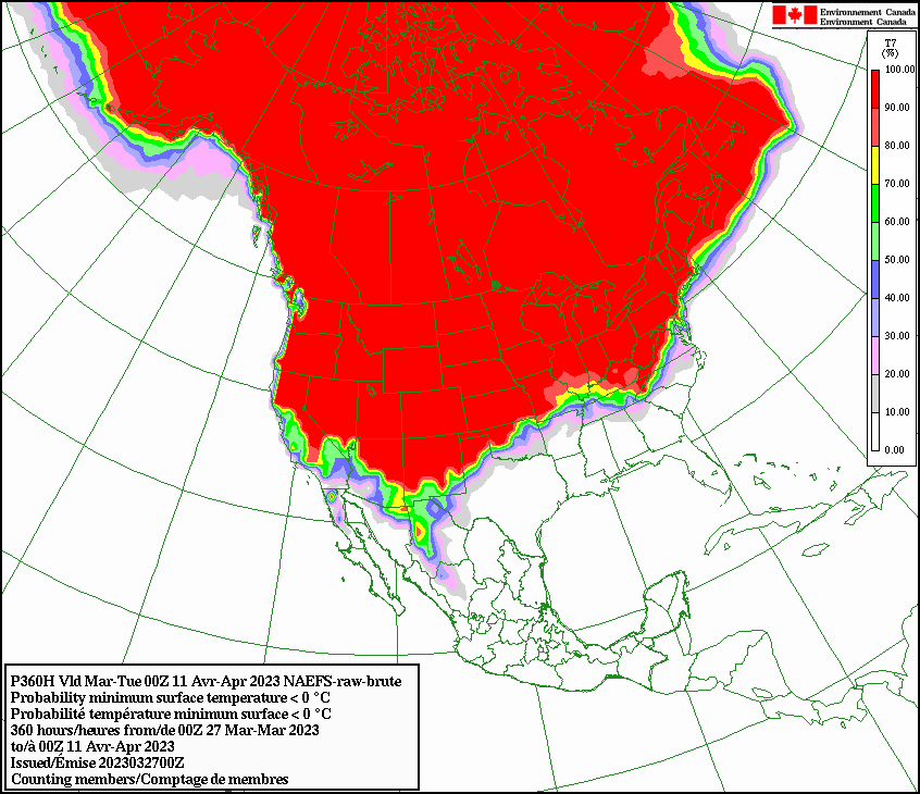
inevitable. We once again turn to our Canadian friends for a look at our chances
of a freeze as we go through the next couple of weeks. Those hoseheads show us
that across the NW half of the state, it's virtually certain, but across the
SE half of the state, getting less and less probable.
NOW watch us have a bigtime severe weather day Thursday or Friday, and a hard
freeze mid-April. Just don't blame it on me! I faded years ago.
Gary McManus
State Climatologist
Oklahoma Mesonet
Oklahoma Climatological Survey
gmcmanus@mesonet.org
March 27 in Mesonet History
| Record | Value | Station | Year |
|---|---|---|---|
| Maximum Temperature | 91°F | WAUR | 2008 |
| Minimum Temperature | 11°F | KENT | 2005 |
| Maximum Rainfall | 3.74″ | STIG | 2018 |
Mesonet records begin in 1994.
Search by Date
If you're a bit off, don't worry, because just like horseshoes, “almost” counts on the Ticker website!