Ticker for March 24, 2023
MESONET TICKER ... MESONET TICKER ... MESONET TICKER ... MESONET TICKER ...
March 24, 2023 March 24, 2023 March 24, 2023 March 24, 2023
Unbelievable
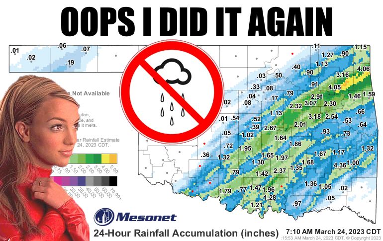
In a remarkable display of stubbornness (no, I didn't know that was how you
spelled stubborness), Mother Nature ONCE AGAIN left the NW half of the state--
roughly to the north and west of I44--high and dry whilst the SE half of the state
got a drenching. I haven't seen such an uncanny (English to Okie translation:
"weird") pattern since God was handing out looks and brains and I got skipped
over for both. And uncannily odd it is, with our 90-day moisture divide between
the haves and have-nots continuing to grow.
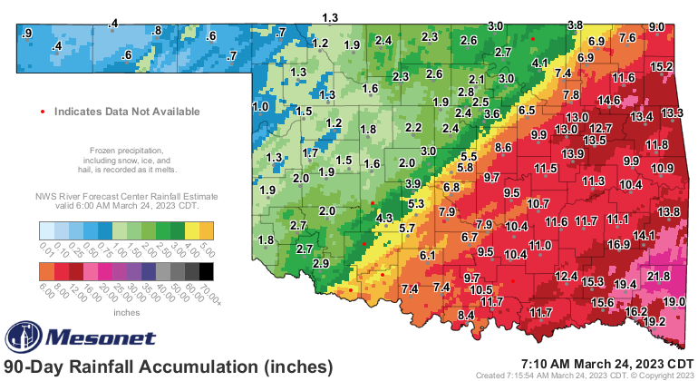
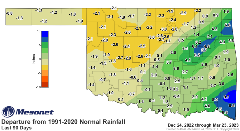
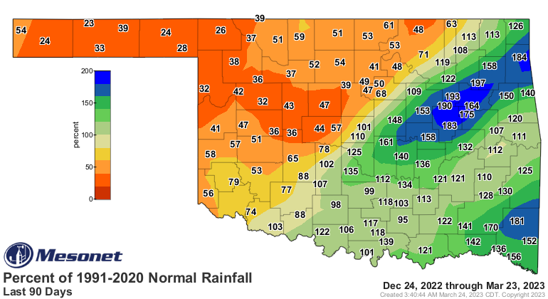
It's actually worse than that shows because those departure and pct of normal maps
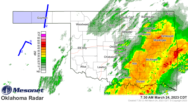
are made each morning, and it has continued to rain since then. Heck, it's raining
right now for crying out loud!
I don't know what else to say. No, seriously. I guess we'll just make do with
some minor chances of rain over the next couple of days until we see better
chances late next week. I'll give you two guesses where the heaviest totals
look to be.

WRONG! Oh, you are correct...eastern Oklahoma. Now back to our regularly
scheduled drought. Oh, final congrats to Goodwell in the central OK Panhandle,
too. That 0.19 inches...(checks notes)...doubles your total over the past 30
days.
Gary McManus
State Climatologist
Oklahoma Mesonet
Oklahoma Climatological Survey
gmcmanus@mesonet.org
March 24 in Mesonet History
| Record | Value | Station | Year |
|---|---|---|---|
| Maximum Temperature | 88°F | ALTU | 2003 |
| Minimum Temperature | 12°F | KENT | 2013 |
| Maximum Rainfall | 5.00 inches | CLAY | 2023 |
Mesonet records begin in 1994.
Search by Date
If you're a bit off, don't worry, because just like horseshoes, “almost” counts on the Ticker website!