Ticker for March 28, 2023
MESONET TICKER ... MESONET TICKER ... MESONET TICKER ... MESONET TICKER ...
March 28, 2023 March 28, 2023 March 28, 2023 March 28, 2023
Is it over?

I didn't ask for it, did you ask for it? Somebody had to ask for it. The "it" I
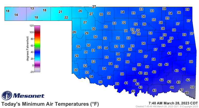
Tock about is the BONE-CHILLING COLD THIS MORNING! Now granted these are wind
chills, but take away the wind (PLEASE??) and it's still pretty darned cold,
with another hard freeze up in NW OK and just a soft (I guess??) freeze across
the western one-fifth of the state.
Now, the question is, why do people sit and stare at each other at 4-way stops in
Oklahoma? And while I don't know the answer to that one (I suspect it's the
presence of at least two Helper McHelpertons trying to wave everybody through
before they'll go), nor can I answer the REAL question...is this winter's last
gasp? Evidence points to "no," but darned if I'm going to say so here on March
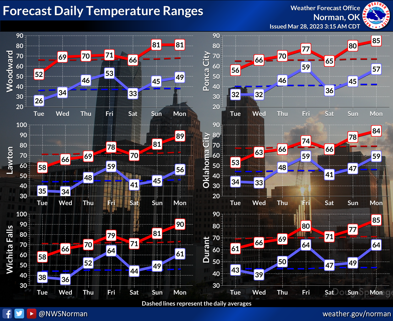
28. We do see the temperatures after today starting to climb Spring Mountain
here in Oklahoma over the next week, and then the outlooks point towards above
normal temps through the first week of April.
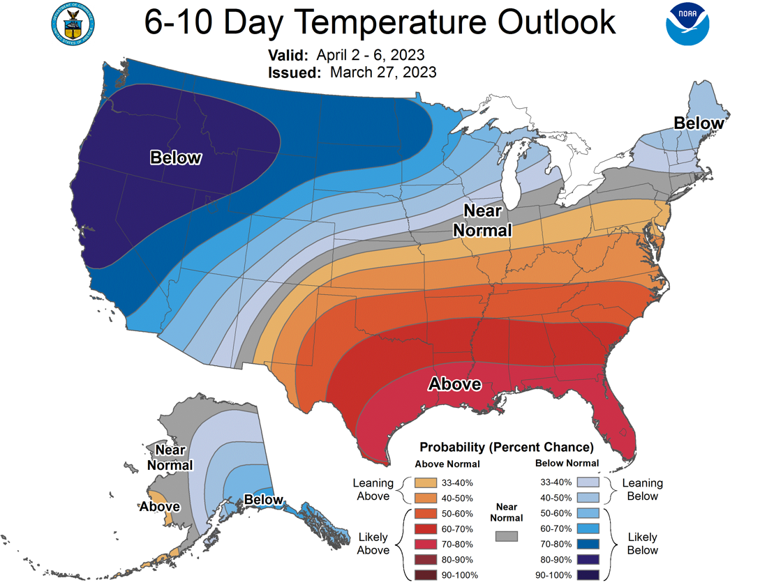
Take that for what it's worth (factor in inflation), but that doesn't preclude
(English to Okie translation: prevent) us having another blast of cold air
later on in April. In fact, Mother Nature seems to have that feature built in
every year. There is a hint of another blast of cold air right there on
April 5-6 in the Fantasy-casts, but we have a long way to go before that starts
to look more likely. And the outlook above that extends through April 6 doesn't
mean there can't be cold air in there somewhere, just that particular period
looks like it will finish with above normal temperatures averaged over it.
With any wintry weather starting to be overwhelmed by spring, we've almost
certainly seen the last of our big snows--emphasis on "almost certainly"...it
IS Oklahoma after all. If that's the case, here's how our season shook out as
far as totals go.
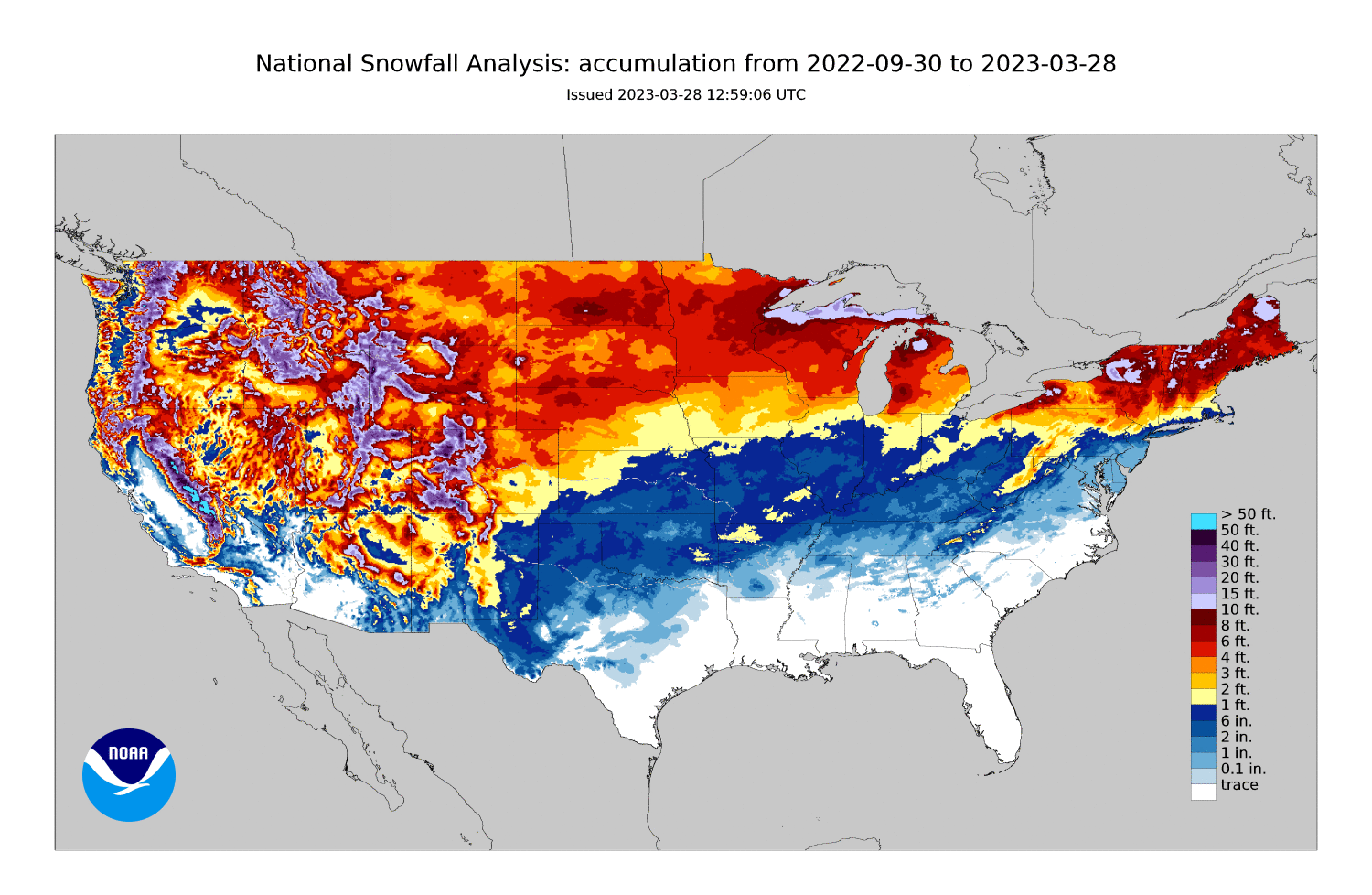
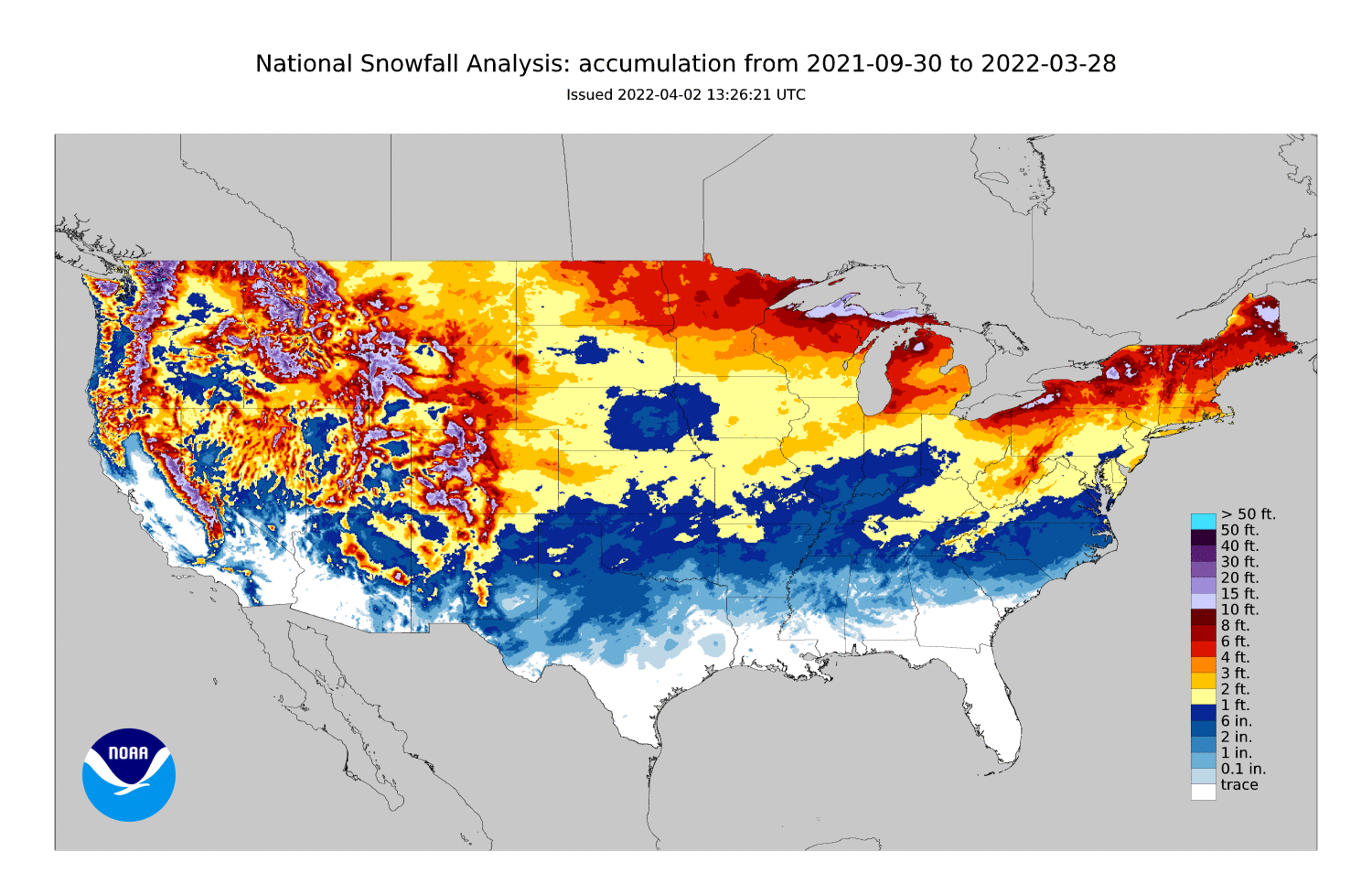
Pretty sad looking for our neck of the woods. Erick in far western Oklahoma
had the highest official total of 13.4 inches, very localized, but that
are in eastern Oklahoma pinging the yellow colors had over a foot as well. Still,
a bit on par with the totals from last year.
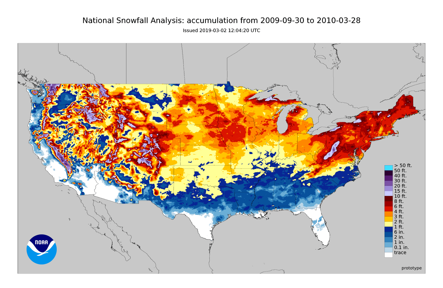
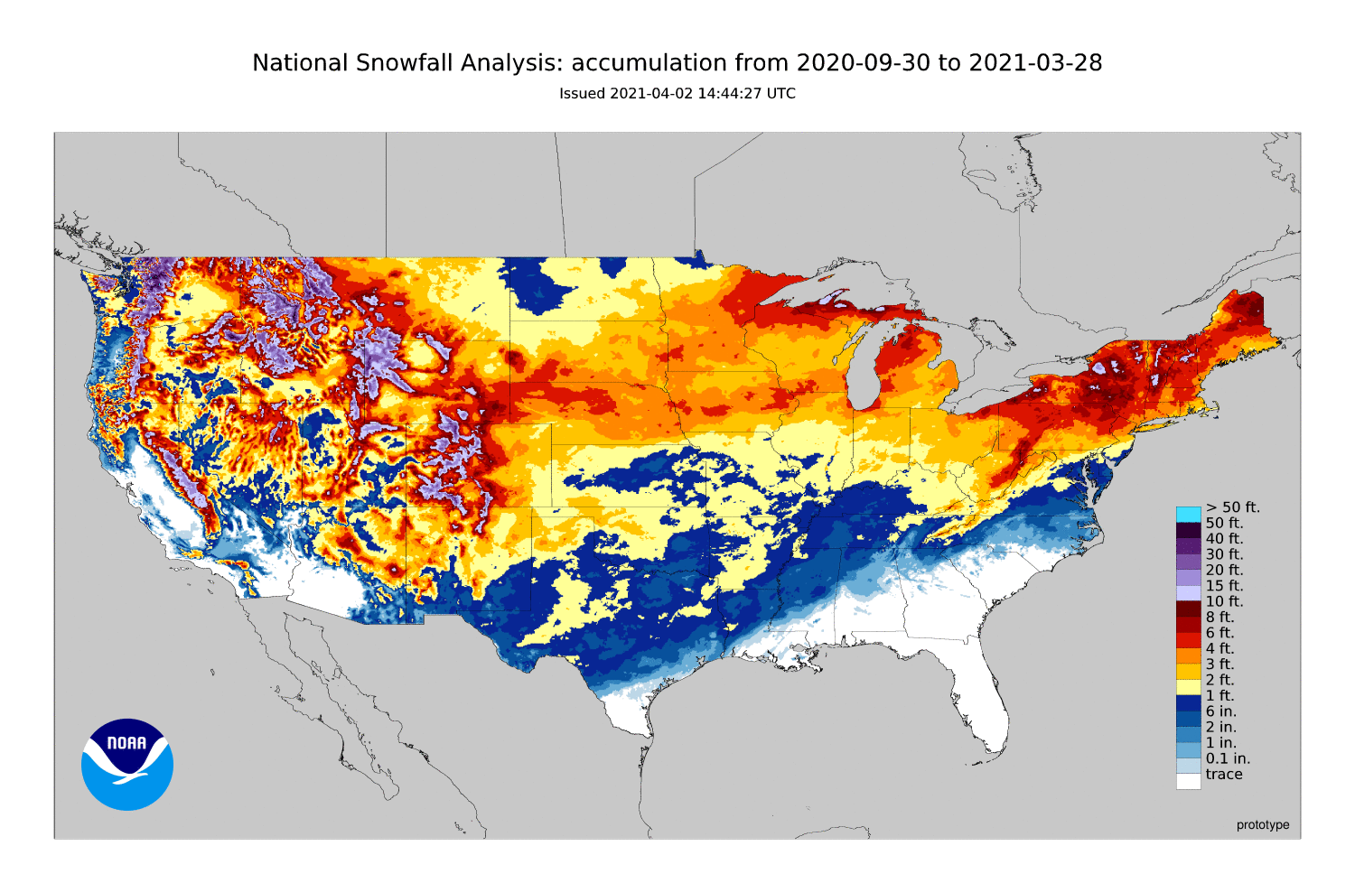
Snow lovers (you know who you are) will have to remember fondly the bigtime snows
of years past, like the 2009-10 season, as well as the more recent 2020-21
season.
All of this previous info is merely a stall tactic as I try to avoid talking
about our supposed storm system set for Thursday into Friday. Why make everybody
feel bad, like I do when I run my hand through my hair...I mean over my scalp!

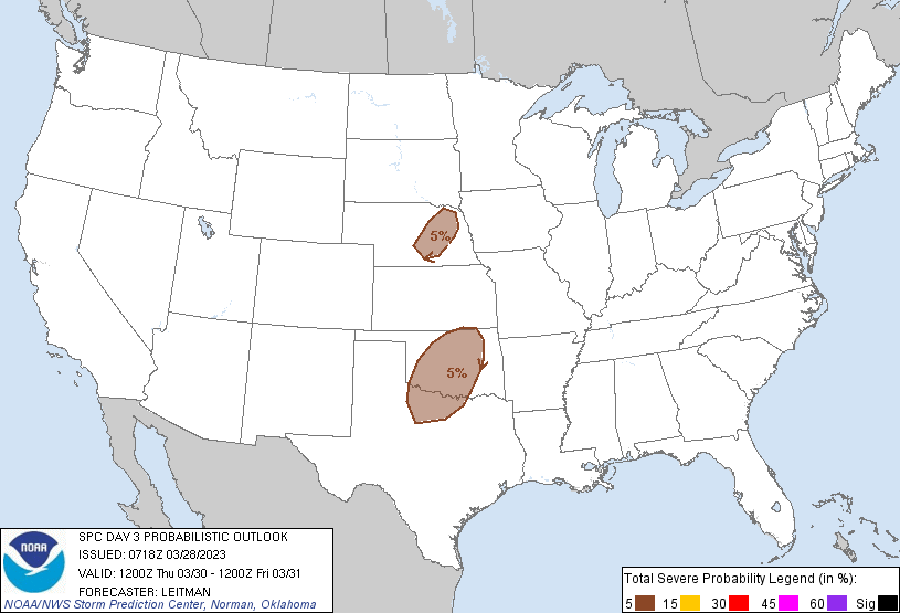
Yeah, pretty sad. And the chances for severe have gone down considerably along
with those rain totals.
Next rain chances look to be way out in Fantasy-cast territory later next week.
In fact, looks like Fire Weather is the big concern now as we go forward.
But hey, coming next week...the 80s!
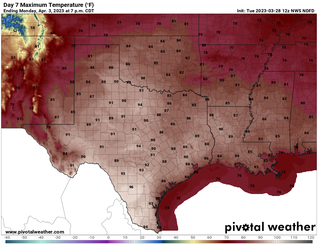
Break out the Jams and the hairspray.
Gary McManus
State Climatologist
Oklahoma Mesonet
Oklahoma Climatological Survey
gmcmanus@mesonet.org
March 28 in Mesonet History
| Record | Value | Station | Year |
|---|---|---|---|
| Maximum Temperature | 90°F | TIPT | 2022 |
| Minimum Temperature | 11°F | BOIS | 2009 |
| Maximum Rainfall | 4.20 inches | ACME | 2017 |
Mesonet records begin in 1994.
Search by Date
If you're a bit off, don't worry, because just like horseshoes, “almost” counts on the Ticker website!