Ticker for March 23, 2023
MESONET TICKER ... MESONET TICKER ... MESONET TICKER ... MESONET TICKER ...
March 23, 2023 March 23, 2023 March 23, 2023 March 23, 2023
Spacedrought
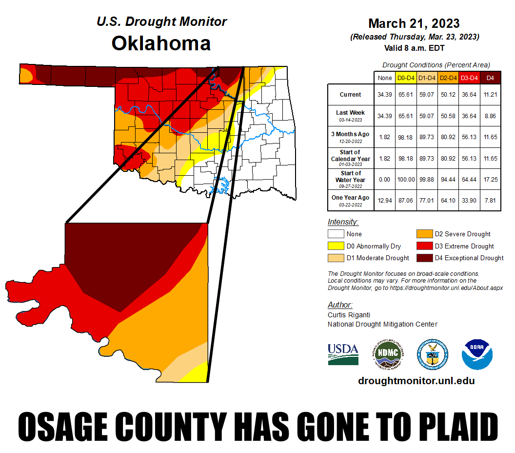
Severe weather? You want to talk about severe weather? Now listen here, drought
IS a climatologist's severe weather! Oh, those smug meteorologists get all the
sexy stuff, like hail, tornadoes, flash floods, etc., while us climatologists get
left with the table scraps, like drought and heat waves.
Wait, I'm now being told I have two meteorology degrees. Well, in that case, I
guess I do have to take today's severe threat seriously...not only because I
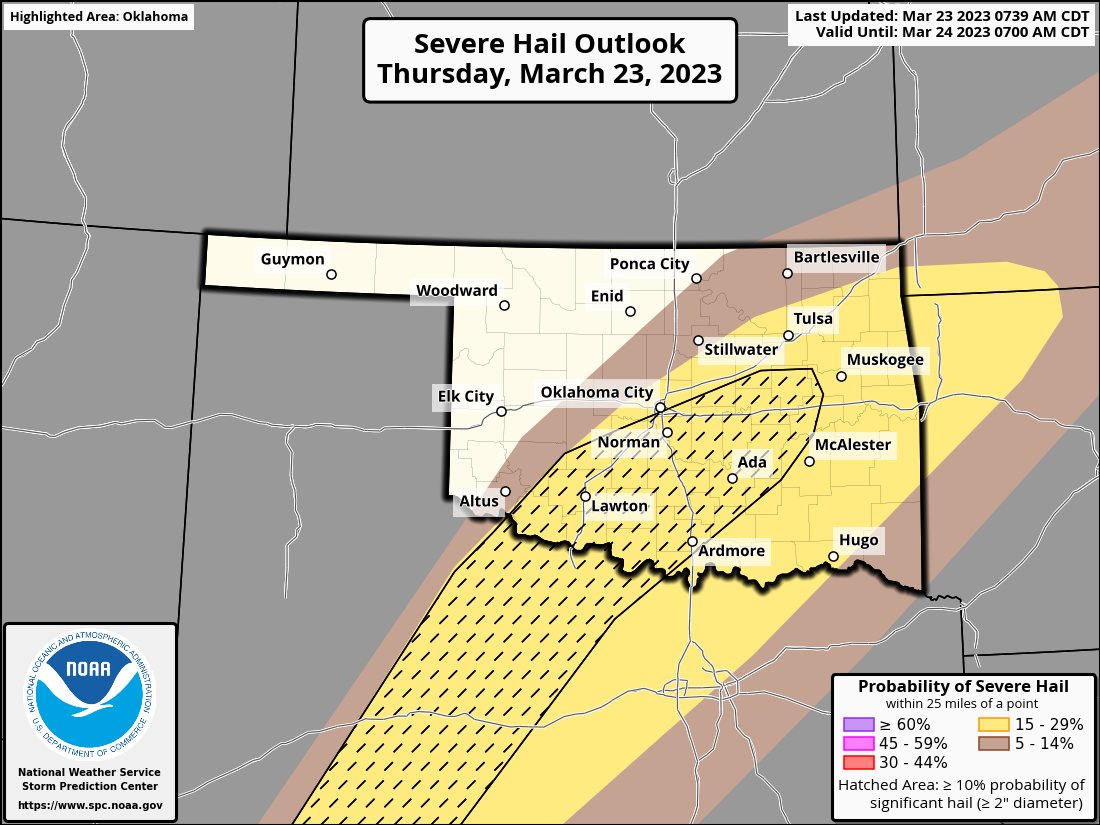
have meteorology degrees, but also because I'm a car owner. Hail looks to be
a primary threat today, with 2 inch-plus (2+ inch??) hail being possible in a
pretty good swath of the state. There is also a wind and tornado threat, but
those are pretty low.
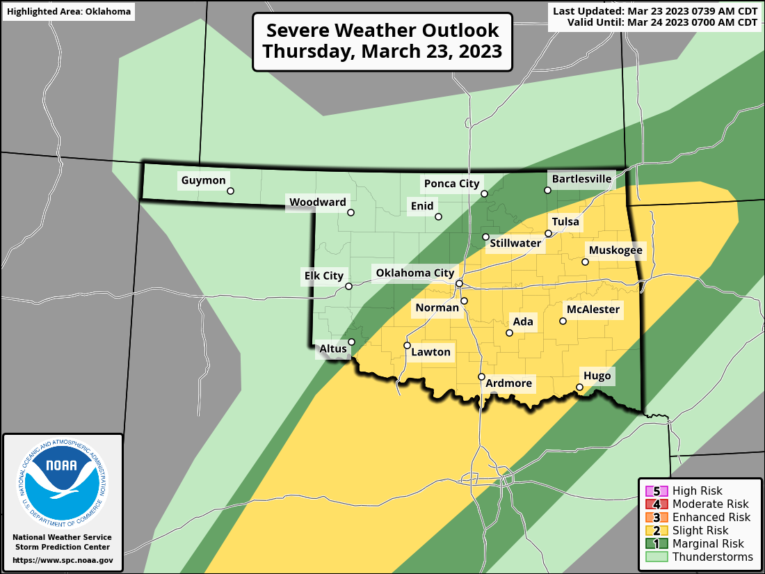
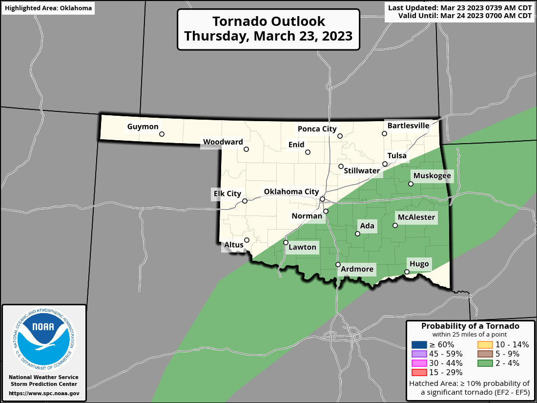
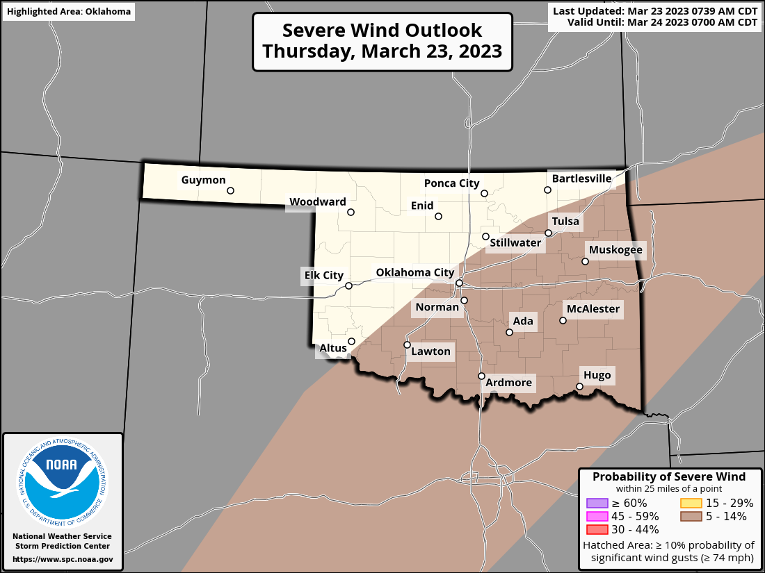
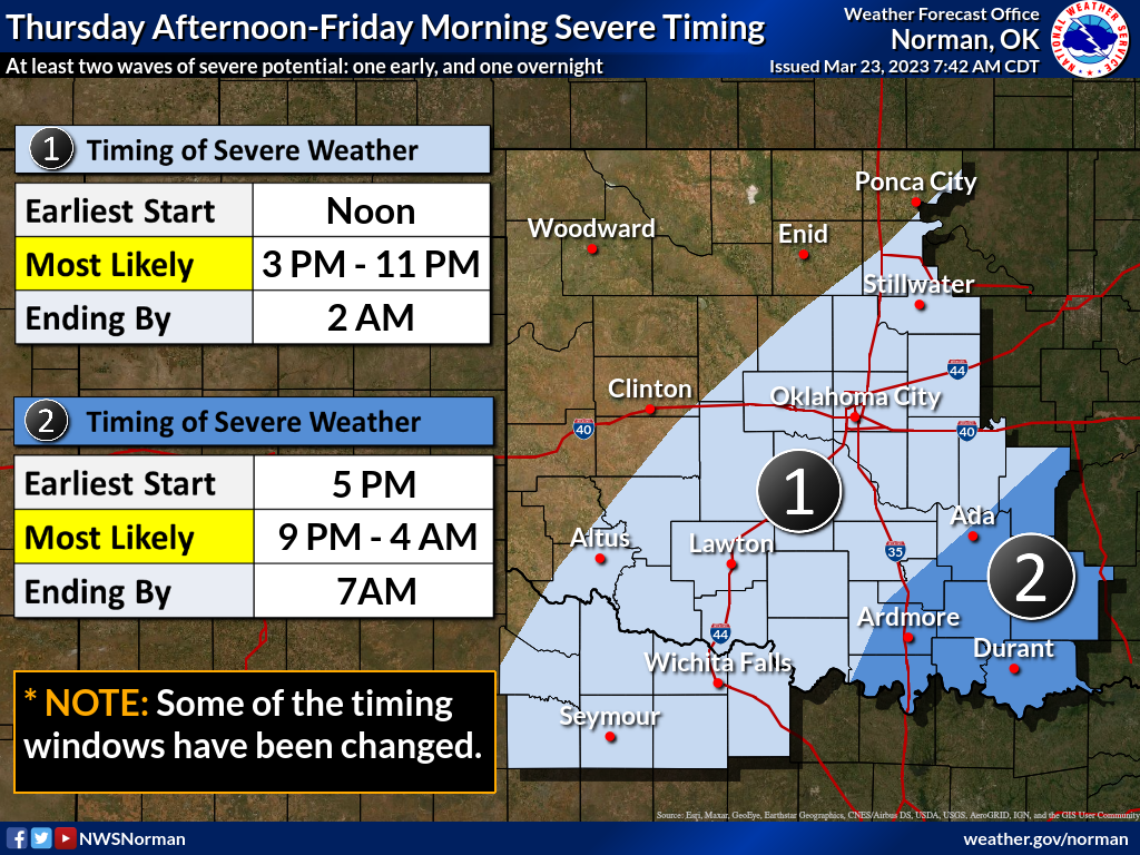
The timing on this can vary today, but this afternoon looks to be prime time.
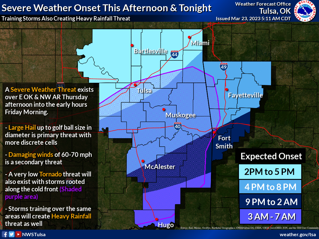
So definitely a day to start being weather aware--tune into your favorite
media weather source, as well as your local NWS office. Now let's go back to
that drought. Well, we're not going back since we've BEEN there for over 18
months, but you know what I mean.
The state is basically divided down the diagonal from SW to NE, with the SE half
of the state in fairly moist conditions, vs. pretty drastic-if-not-catastrophic
drought in the NW half. The 2023 rainfall patterns I've showed you are to blame,
and March has been no different.
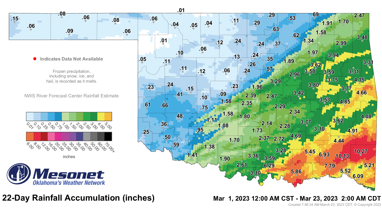
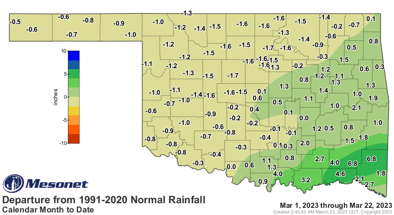
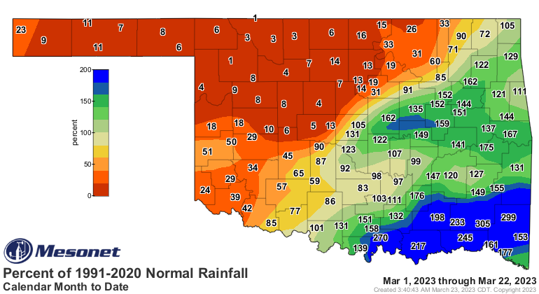
That's the same general pattern we've seen through the year thus far as well.
The saving grace is that January through March is not the time in Oklahoma to
look for bigtime moisture. Check out these maps showing both the short-term
and long-term contributions to our annual precipitation totals for the January
through March months.
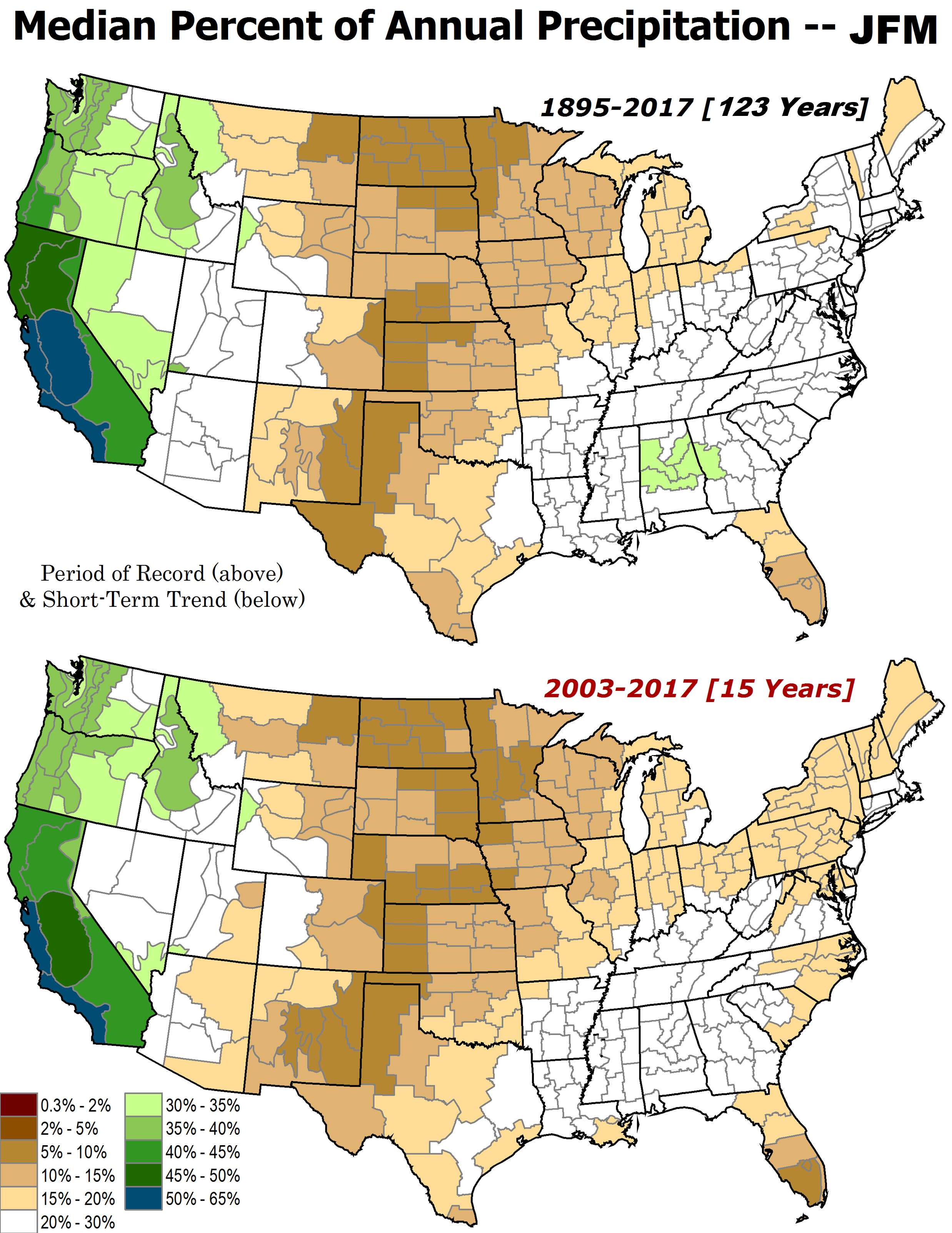
So that shows us that, at least through 2017 (starting both in 1895 and 2003),
the Jan-March period contributes 5-20% of our annual totals, historically. Now
contrast that with the upcoming April-June period.

Aha! That shows us, historically speaking (also in English), that the upcoming
3-month period has brought us from 30-40% of our annual rainfall total. So it's
certainly more damaging to miss out on our April-June rains vs. our January-March
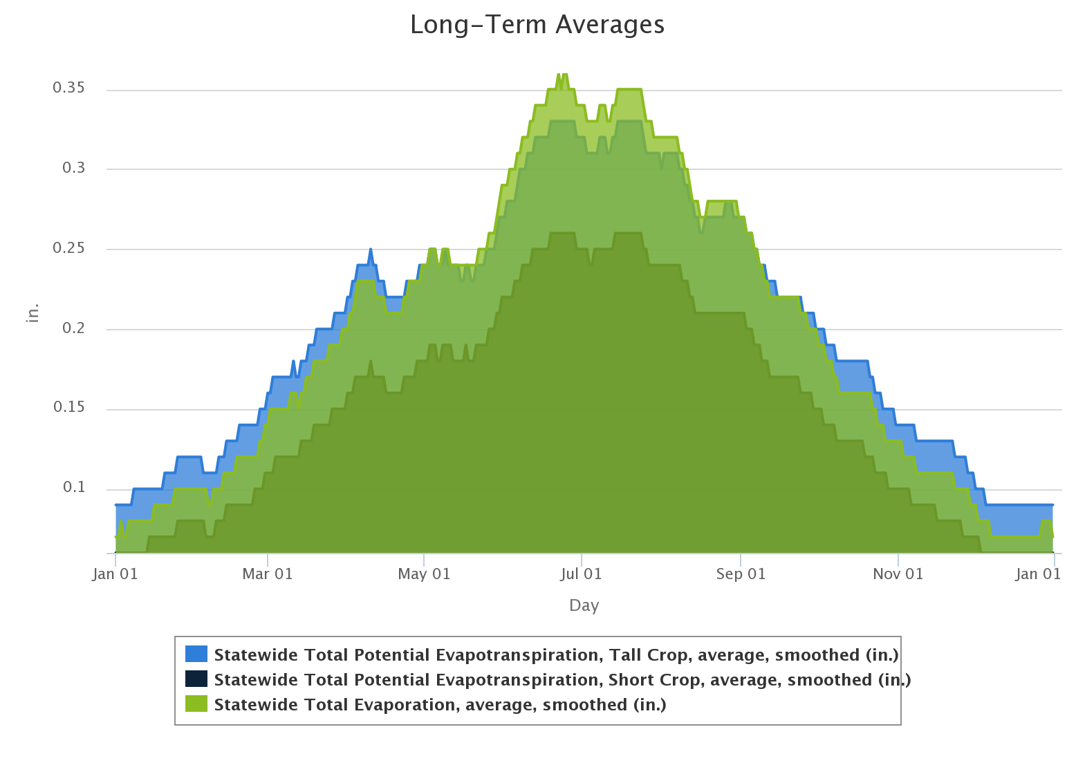
moisture, but here's the kicker: the DEMAND for that moisture is higher during
the April/May/June period as well. Plants are coming out of dormancy, the weather
is getting hotter, humans are filling up swimming pools and watering lawns...
those factors increase the demand through both water usage and evapotranspiration
needs. But that also means that even though not as bountiful, that cool season
precipitation is extremely important for recharge because most of those factors
are NOT happening during that time frame.
At any rate, the damage has been done in Oklahoma, both in the short-term and
long-term. There will be some bountiful rains today and tomorrow in the state,
but once again reinforcing that broad pattern of dry in the NW half of the state
vs. wet in the SE half.
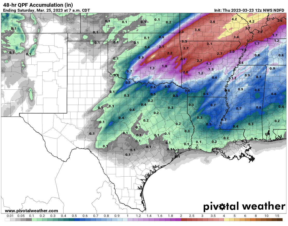
I really can't explain this weird pattern, to tell you the truth, although it
certainly exists on the synoptic scale, which is impacting us in the mesoscale
(large-scale pattern vs. smaller-scale pattern). Consider it a combination of
storm systems "coming together" farther east before any good return moisture
can make it into western Oklahoma, and just plain bad luck.
But, remember...we still have April through June coming up, so hope is still
there!
Gary McManus
State Climatologist
Oklahoma Mesonet
Oklahoma Climatological Survey
gmcmanus@mesonet.org
March 23 in Mesonet History
| Record | Value | Station | Year |
|---|---|---|---|
| Maximum Temperature | 95°F | BEAV | 2018 |
| Minimum Temperature | 17°F | BOIS | 2013 |
| Maximum Rainfall | 3.91 inches | INOL | 2023 |
Mesonet records begin in 1994.
Search by Date
If you're a bit off, don't worry, because just like horseshoes, “almost” counts on the Ticker website!