Ticker for February 24, 2023
MESONET TICKER ... MESONET TICKER ... MESONET TICKER ... MESONET TICKER ...
February 24, 2023 February 24, 2023 February 24, 2023 February 24, 2023
Attention!
It was some 22 years ago, almost to the date, that my wife and I took off from
our SW OKC home to travel up to Quails Spring Mall to eat and then catch a movie
at the AMC Theatre up that way. It was a cold day, and not a hint of any freezing
precipitation had been mentioned in any of the weather "stuff" I had looked at.
So we enjoyed our fine meal at some mall establishment...trying to remember what
was there at the time. A Mexican joint named "Marco's," maybe? Was it El Chico by
then? Or maybe we went to Garfield's? No, not the cat! Central OK Okies will
remember. At any rate, by the time we got out of the movie around 9 p.m., we exited
the mall to be greeted by an icy nightmare. All I remember is us sliding sideways
in stopped traffic along the airport curve on I-44 after a treacherous drive south.
We eventually made it to the back roads, which were more safe due to less cars
careening around.
Now why do I take you on this trip down not-your-memory lane? Well, because
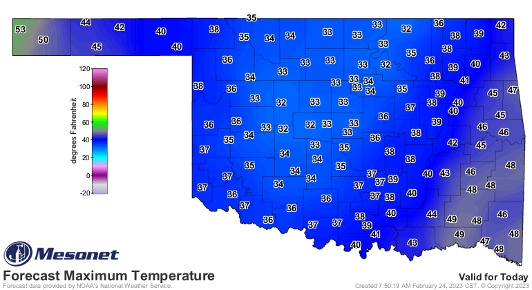
everybody is staring at Sunday when today might hold some unpleasant impacts as
well. There is a chance for freezing mist/drizzle/rain throughout the day where
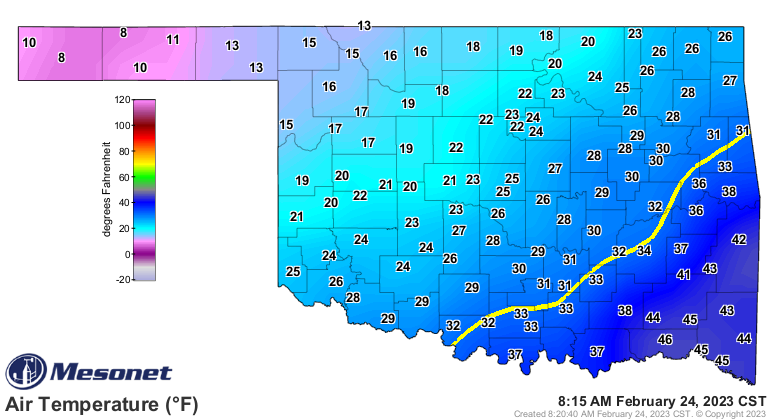
the temperatures remain below freezing, and it has been cold enough lately to
allow some accumulation on at least bridges and overpasses. Here are the
pertinent graphics from our NWS friends.
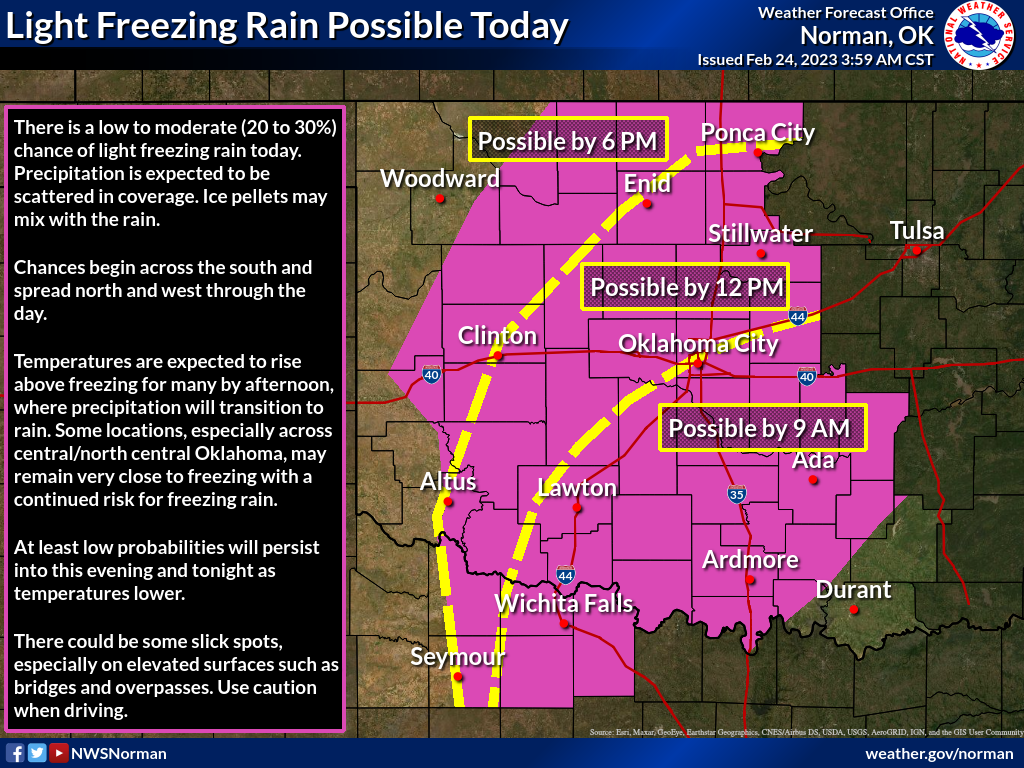
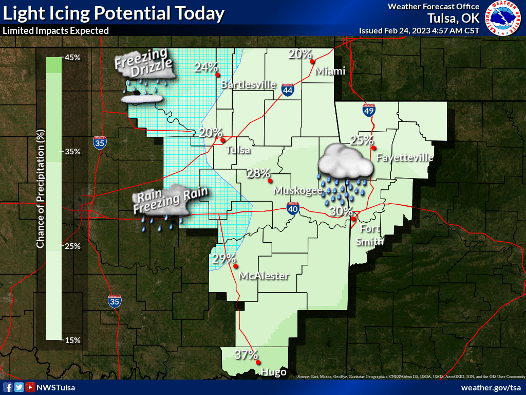
No, this isn't a sure thing, but wasn't even a "thing" 22 years ago and so we
were caught unawares. I'm also unawares if "unawares" is the correct usage, but
that doesn't send you sliding sideways on I-44! So be awares (humor me) that if
YOU are headed out to eat and see a movie today, you might need to slow down.
There are no winter weather advisories just yet, but that doesn't mean they
aren't coming. Double negative or not!
So there are several layers of "has to happen" for inclement driving conditions,
from "will it be cold enough" to "will it precipitate" and also "will it
precipitate when it is cold enough." But 100% certainty is that it is cold
regardless, and it's gonna stay cold for the next couple of days.

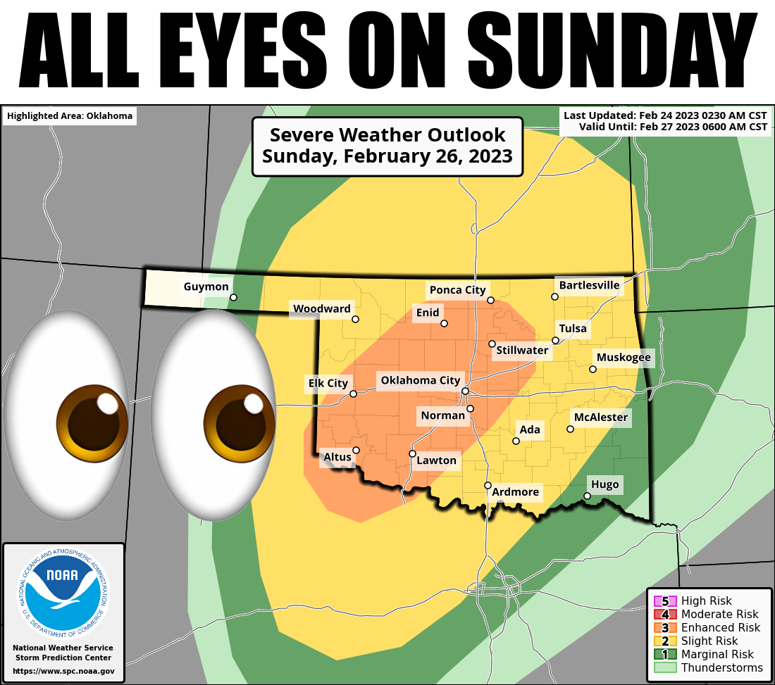
Now to Sunday, which would be sad if you skipped today and Saturday since you
might miss out on a pretty good meal and movie either day. The potential for
severe weather is still there, and the Storm Prediction Center across the hall
from me has issued an "Enhanced" risk for that day, surrounded by "Slight" and
"Marginal" risks, as seen in the top graphic, and the one below.
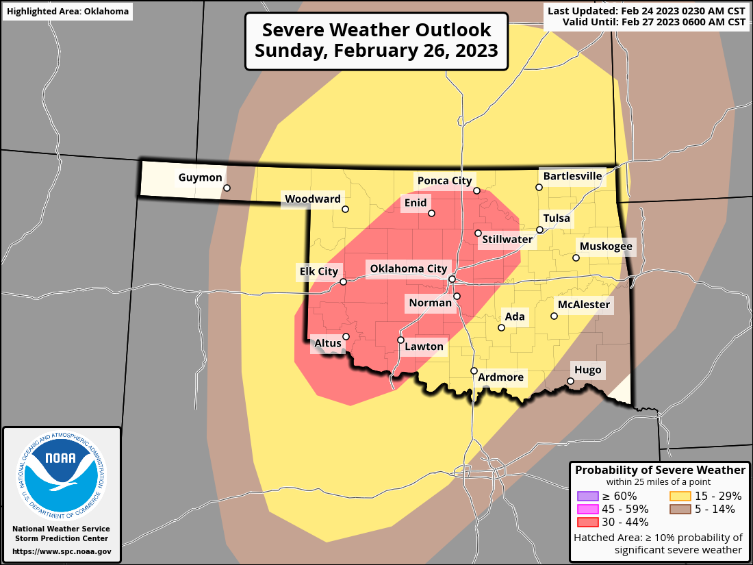
Still uncertainty 3 days out, but here is the current thinking by SPC.
"NAM forecast soundings at 03Z on Monday have weak instability in
place across the moist sector with peak SBCAPE near 500 J/kg. In
addition, wind speeds increase from near 15 knots at the surface to
about 70 knots at 850 mb. This strong speed shear should be
favorable for supercell development. Although mid-level lapse rates
will be steep enough for isolated large hail, the threat will likely
remain somewhat isolated, due to a late afternoon and early evening
capping inversion. The cap is expected to weaken by mid evening.
This, combined with a strengthening low-level jet, should allow for
robust convective development. The most favorable area for organized
severe storms will be from northwest Texas extending northeastward
into north-central Oklahoma. In addition to a threat for large hail,
wind damage will also be possible. The wind-damage threat should be
maximized with the strongest of storms during the evening. The
threat could linger into the overnight if a severe convective
cluster can remain organized."
Hey, Severe Convective Cluster was my band's name in elementary school! It's also
what happens after you eat at Taco Bell, but that's another story. But the
takeaways from that discussion, with its current thinking, is that it might take
a bit longer for severe storms to get going, and when they do large hail and
damaging winds look to be the primary threats. Much of that could change as
the storm finally makes it ashore out West and we get it better sampled, and the
models start to come into better agreement. Still, even though no mention of
tornadoes, the severe threat cannot be taken lightly. Well, it CAN, but at your
own possible peril.
"Possible Peril." Hmmm, that might make a good band name!
Gary McManus
State Climatologist
Oklahoma Mesonet
Oklahoma Climatological Survey
gmcmanus@mesonet.org
February 24 in Mesonet History
| Record | Value | Station | Year |
|---|---|---|---|
| Maximum Temperature | 82°F | HOLL | 2002 |
| Minimum Temperature | -3°F | EVAX | 2022 |
| Maximum Rainfall | 2.61 inches | MTHE | 2018 |
Mesonet records begin in 1994.
Search by Date
If you're a bit off, don't worry, because just like horseshoes, “almost” counts on the Ticker website!