Ticker for February 26, 2023
MESONET TICKER ... MESONET TICKER ... MESONET TICKER ... MESONET TICKER ...
February 26, 2023 February 26, 2023 February 26, 2023 February 26, 2023
DANGER DANGER
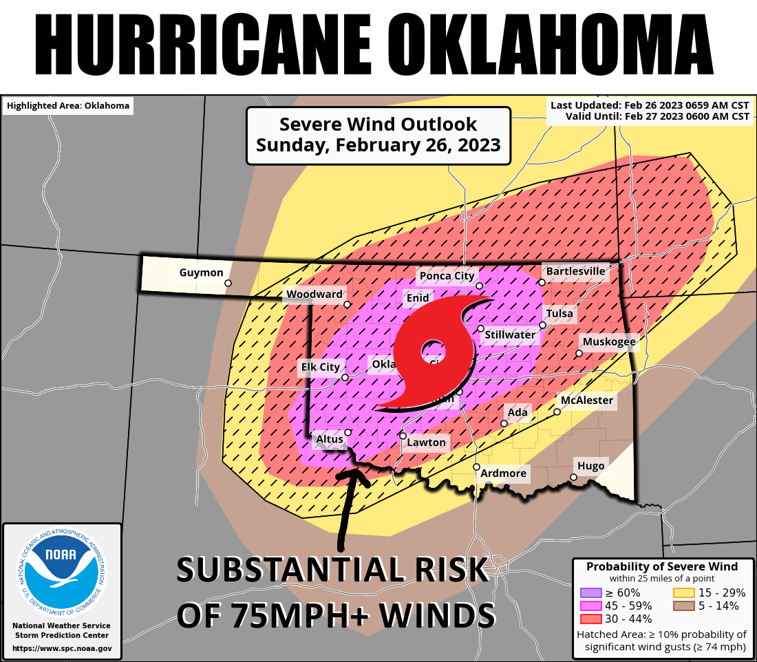
Special Sunday Ticker for one of THOSE days in Oklahoma. You know the ones, when
you wake up in the morning and go outside and despite the chill in the air, you
know what could be coming later today. The south winds are gonna crank up, the
moisture (which is already increasing) is gonna return on that southerly flow,
and with a big storm system, all Oklahoma...I mean "heck," is gonna break loose.

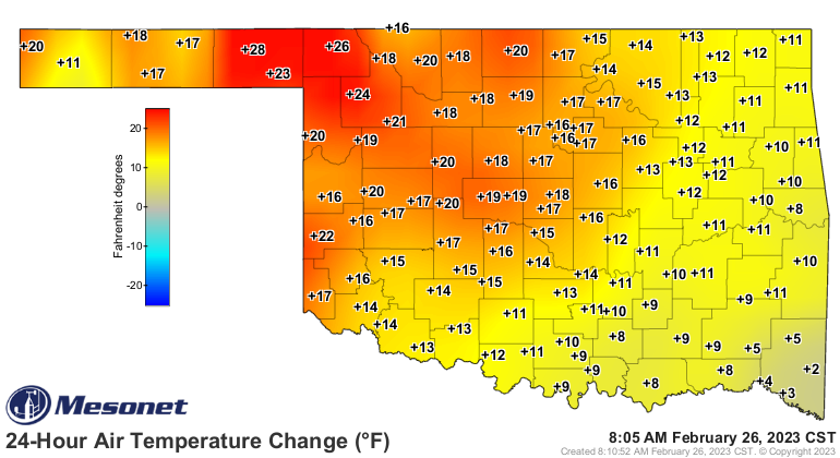
So we're already warmer, and headed to "warm," and those dewpoints down along the
Gulf are streaming up this way. We won't get to 70s that are down there...heck,
we might not even get the 60s, but as ole Mercutio said to Romeo of Tybalt's
blade slipping into his chest: "...'tis enough, 'twill serve."
That was my Oscar moment! Anyway...those dewpoints.
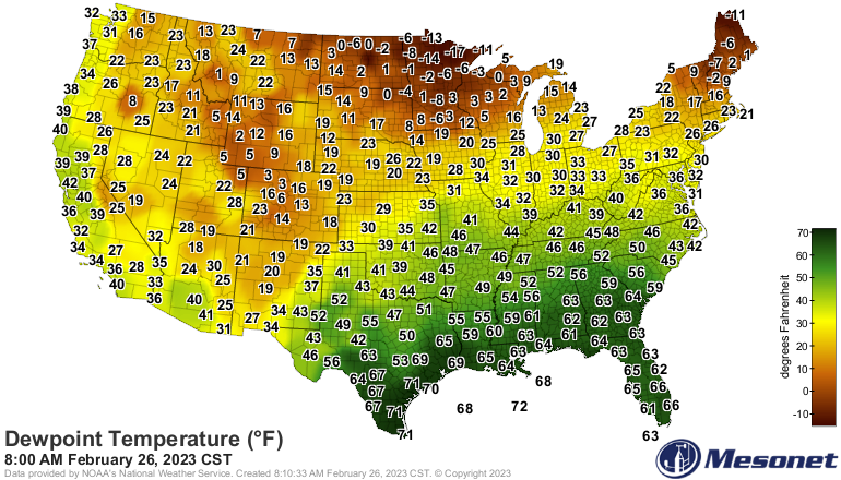
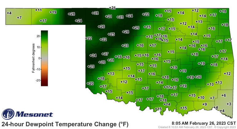
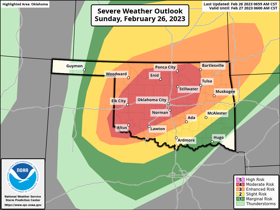
It's setting us up for our most substantial severe threat of the season later
this afternoon into tonight. You can see from the above graphic at the top that
severe winds are going to be a doozy tonight as we see a squall line develop
and help transport momentum downward from above the surface, bringing us those
big winds from above, aided by storms moving along at a pace that'd get you
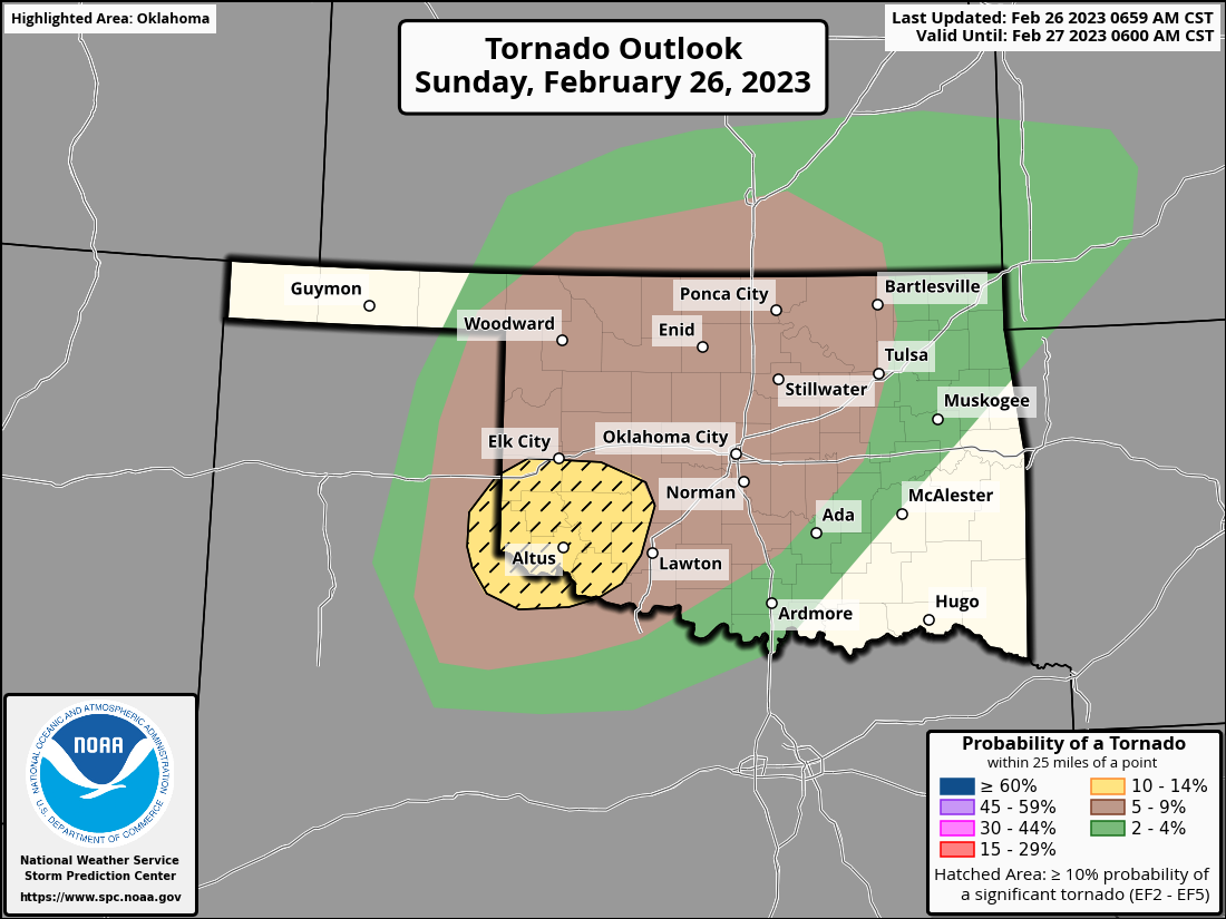
a nice ticket on some of our highways. But wait, there's more, unfortunately.
There is also a non-zero tornado risk, and also a risk of significant tornadoes
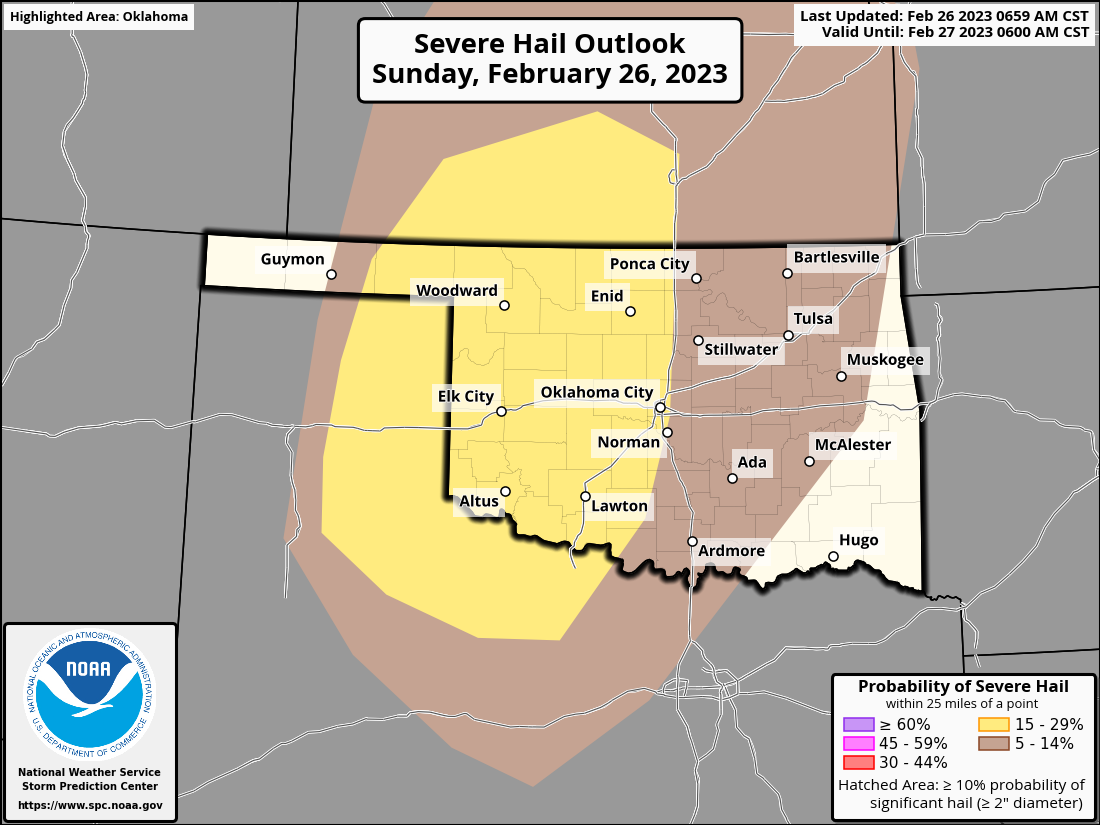
across SW OK. And hail, of course.
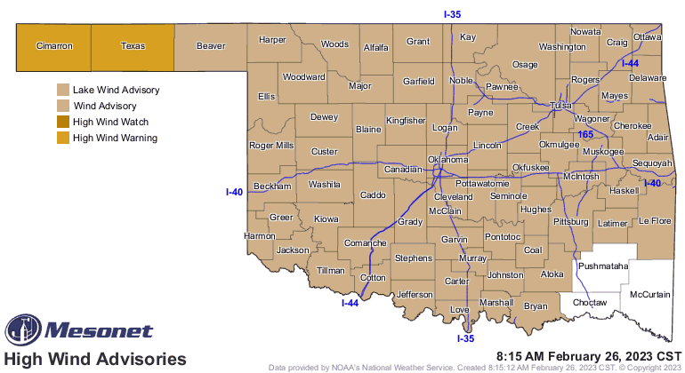
To add insult to possible injury, expect damaging winds to be possible a few
hours AFTER the storms move through, without the aid of any storms. So a
possible double-dose of hurricane force winds...or maybe hurricane force with
the storms, then tropical storm force winds.
One of the keys for today's storms is the speed of movement. With them trucking
along at 60-80 mph, you will have much less time from when they start to move
into your area vs. when they arrive, so when those warnings start to go up,
be ready to act fast.
So there you go, the first possible big severe weather event for the state.
We can hope, of course, that this is a bust, and nothing substantial happens,
but that often doesn't work in this state. In fact, as we've noted before,
it often gets WORSE instead of better as the forecasts evolve. So start
preparing yesterday, but if you've procrastinated, start now. Grab some bottled
water, batteries, and have several ways to get warnings...particularly a way
if you lose power. Charge those phones.
Tune into your local NWS office's social media feeds, and turn on your favorite
local media weather source. All are eminently qualified to keep you warned
and we have the best in the country right here in Oklahoma.
Gary McManus
State Climatologist
Oklahoma Mesonet
Oklahoma Climatological Survey
gmcmanus@mesonet.org
February 26 in Mesonet History
| Record | Value | Station | Year |
|---|---|---|---|
| Maximum Temperature | 93°F | MANG | 2024 |
| Minimum Temperature | 0°F | BOIS | 2002 |
| Maximum Rainfall | 1.61 inches | NOWA | 1997 |
Mesonet records begin in 1994.
Search by Date
If you're a bit off, don't worry, because just like horseshoes, “almost” counts on the Ticker website!