Ticker for February 23, 2023
MESONET TICKER ... MESONET TICKER ... MESONET TICKER ... MESONET TICKER ...
February 23, 2023 February 23, 2023 February 23, 2023 February 23, 2023
ZOUNDS!
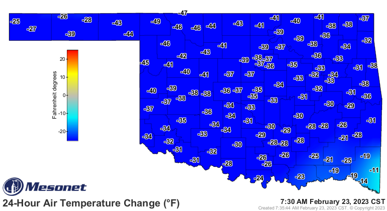
Zounds indeed. For a little transparency, here's a pic of the top of my head. Well,
no, not really...I wouldn't subject you to that. But here's something even more
gruesome...today's forecast low temperatures from yesterday vs. what actually
occurred.
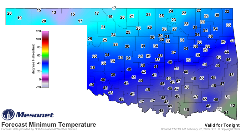

I know, right? Brings out the Okie in me..."that forecast done blowed up by 15-20
degrees!" And there's nothing worse than it being 15-20 degrees colder than you
thought it would be, except for maybe spilling your popcorn at the beginning of
"The Empire Strikes Back" at the Lakeside Theatre in Woodward on opening night
back in 19whatever and not being able to get up and go get more because you'd miss
some of the movie.
Yes, you can cry for me, it really happened.
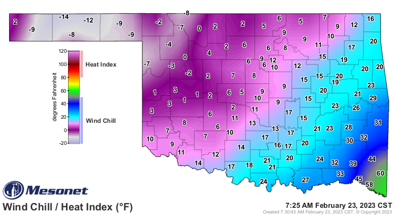
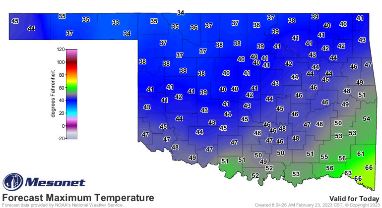
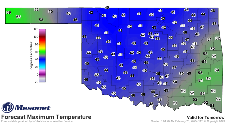
So it's colder than expected. A LOT colder. And that's without the wind. It's
even worse when you look at the wind chills.
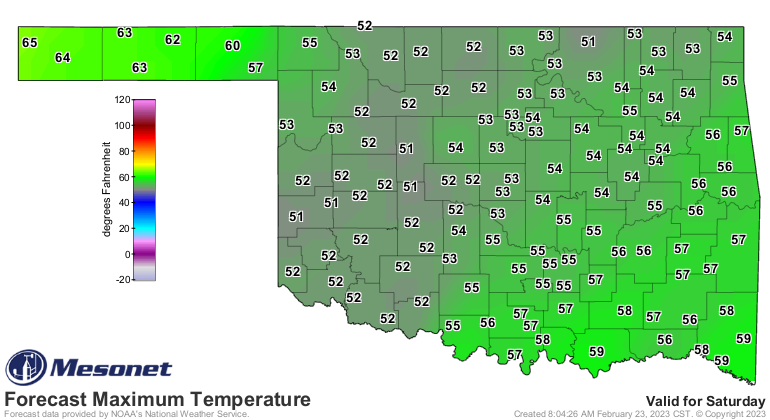
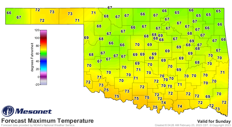
What makes it even worser (work with me here) is that we've been so warm lately.
Now we have to wait until Sunday to REALLY warm back up, and Sunday comes with
some not-so-nice things. Yeah, so here's some warmth for ya, with a side of
tornadoes.
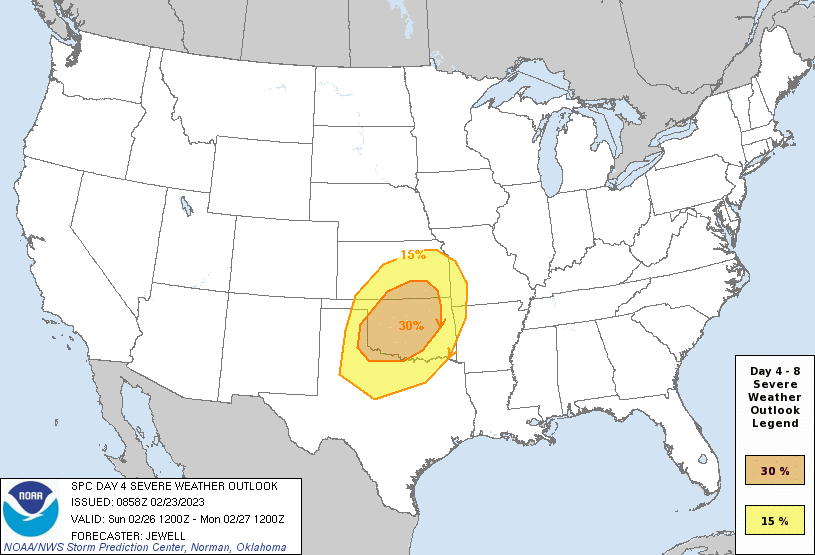
While things can certainly change, here's a bit of what the SPC forecast
discussion says about Sunday:
"The most likely scenario appears to be for a few supercells
initially across western parts of the risk area, from the TX
Panhandle and northwest TX into western OK, with large hail and
tornado risk in proximity to steeper low-level lapse rates. A rapid
transition to linear mode is expected as the system pushes
east/northeast across OK and KS, with both damaging winds and QLCS
tornado risk given 0-3 km shear over 50 kt and effective SRH over
300 m2/s2. Other severe storms along the cold front will be possible
farther south into TX which is south of the stronger large-scale
ascent. Still, the strong cold front and sufficient instability may
counteract capping concerns to produce areas of damaging wind
potential. Last, lack of instability will be the main factor across
northern areas toward Kansas City, but a conditional severe risk may
develop there as well should sufficient SBCAPE develop."
So while things can and probably WILL change, this much concern 4 days out is
reason enough to go ahead and start planning for spring severe season, because
there is another possible storm system later next week that could impact us the
same way. Buy battrys (Okie to English translation: "batteries"), clean out
your storm cellar if you have one (you know there's a snake down there!), buy
some bottled water and whatnot. You know the drill. But still, we're gonna have
to put up with a bit of extended chill before we have to put up with spring
and the weather it brings.
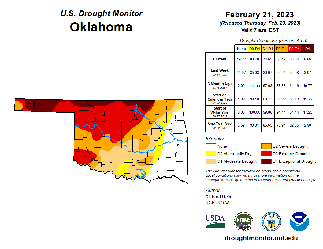
We do need the rain, though, especially across NW OK. Today's Drought Monitor
shows what we've seen for the last few weeks...improvements to the SE of I-44 and
worsening to the NW...with a bit of fuzzy boundaries implied.

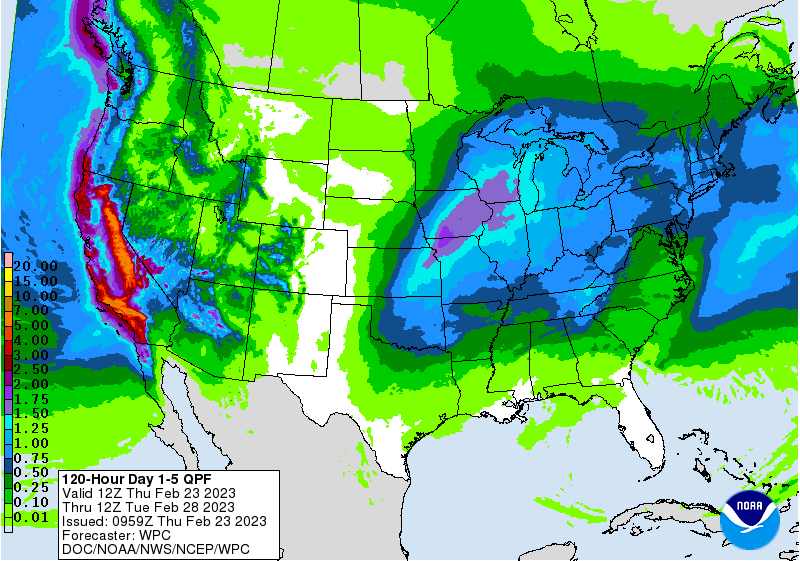
This once again looks better across eastern OK, at least as far as moisture goes,
but there is some rainfall forecast for western OK as well.
So winter, then springtime severe weather, all with the backdrop of drought,
and the haunting memory of a pile of buttered popcorn on the floor of the
Lakeside Theatre in Woodward.
That's a lot to digest.
Gary McManus
State Climatologist
Oklahoma Mesonet
Oklahoma Climatological Survey
gmcmanus@mesonet.org
February 23 in Mesonet History
| Record | Value | Station | Year |
|---|---|---|---|
| Maximum Temperature | 91°F | WAUR | 2017 |
| Minimum Temperature | -2°F | BOIS | 2022 |
| Maximum Rainfall | 3.61″ | EUFA | 2018 |
Mesonet records begin in 1994.
Search by Date
If you're a bit off, don't worry, because just like horseshoes, “almost” counts on the Ticker website!