Ticker for February 22, 2023
MESONET TICKER ... MESONET TICKER ... MESONET TICKER ... MESONET TICKER ...
February 22, 2023 February 22, 2023 February 22, 2023 February 22, 2023
Bye for now
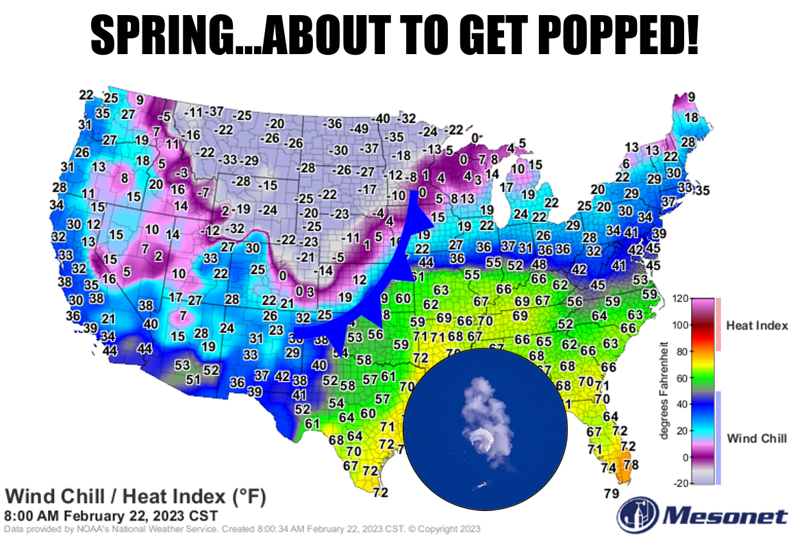
Somebody requested a balloon meme, so there ya go. I don't normally do requests,
since most of the time they boil down to "Hey Gary, can I please request you stop
writing the Ticker?" or "Hey Gary, can you wear a mask when you film 'Sunup'?" But
before I continue down low-self-esteem road, let's talk about another
disappointment...last night's rain. Not like we expected much, but pretty
underwhelming for most.

And while the current radar looks pretty impressive, much of this is light
preicp, but it IS raining right now, for crying out loud!
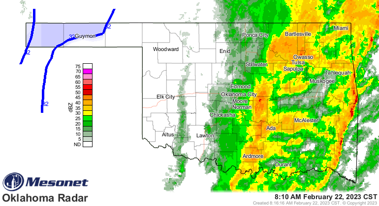
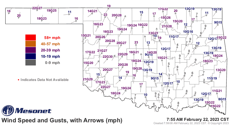
I guess the big news, as that line of heavier storms exits to the east, is the end
of our spring preview, at least for a couple of days. The threatened cold front
(I swear I heard Mother Nature scream "DO I HAVE TO PULL THIS SPRING OVER??") is
already through the Panhandle and will slowly move through the state overnight
into tomorrow, dropping us back into more seasonable weather.
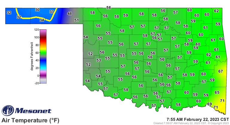
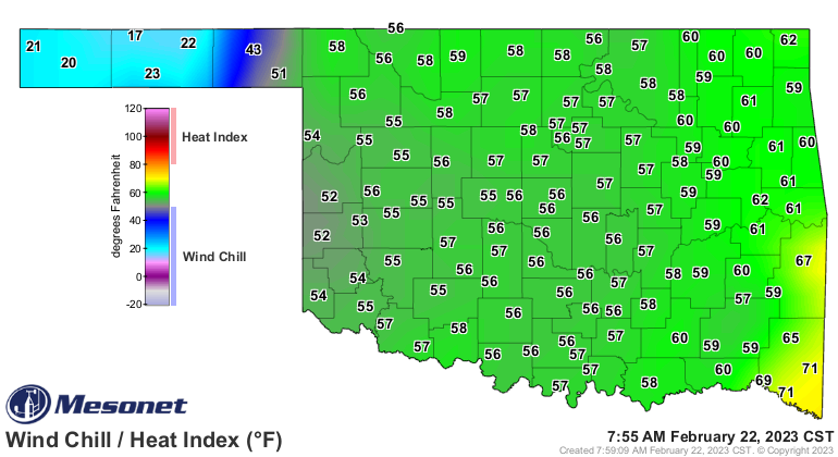
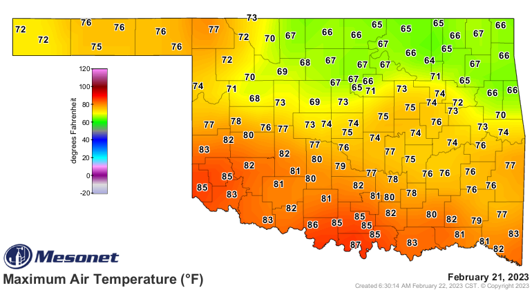
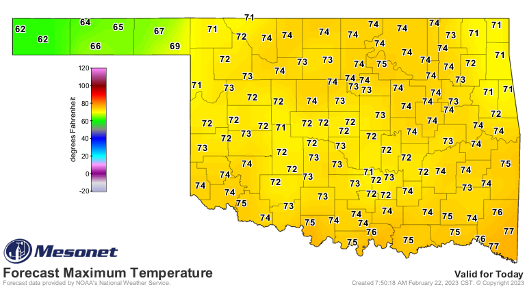
This is after yesterday's glorious (if not downright HOT in S OK) springtime
weather, and today's a bit less glorious but still glorious temperatures.
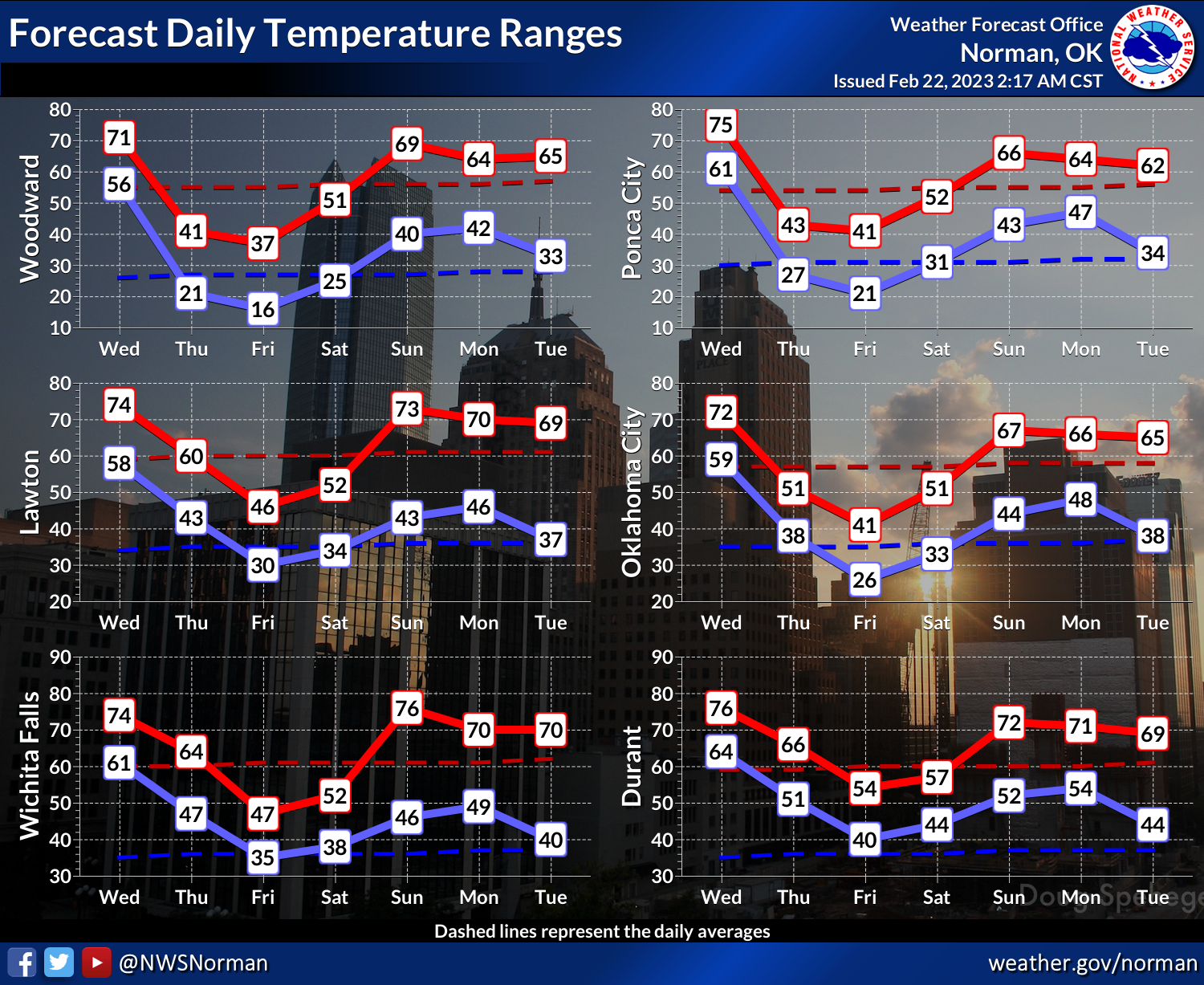
It's not like we're headed back to Feb. 2021 or anything, it's just gonna be
cold for a couple of days. Other than this coming minor detour, it seems to me
as if we are fully transitioning into spring, with just a few minor winter
intrusions in store as we go through the end of February and into March.
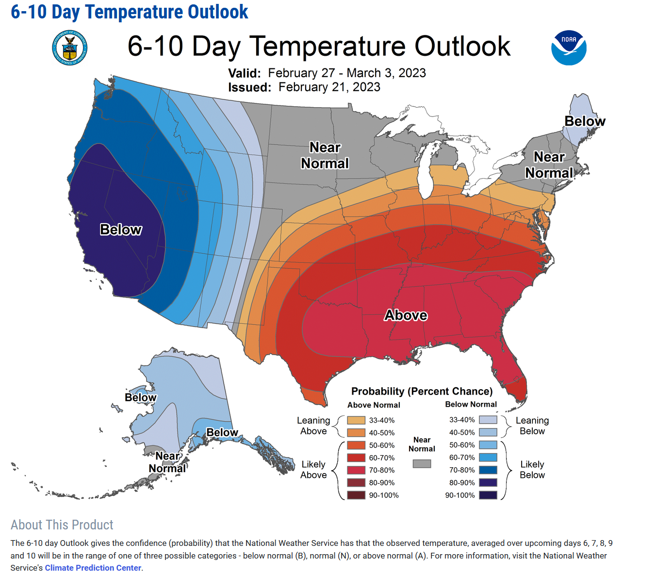
Even the weather is screaming "GARY IS AWESOME"...whoops, I hate when it does
that. Even the weather is screaming "IT'S SPRING" with severe weather on the
upswing. Next Sunday could be one of THOSE days in Oklahoma.
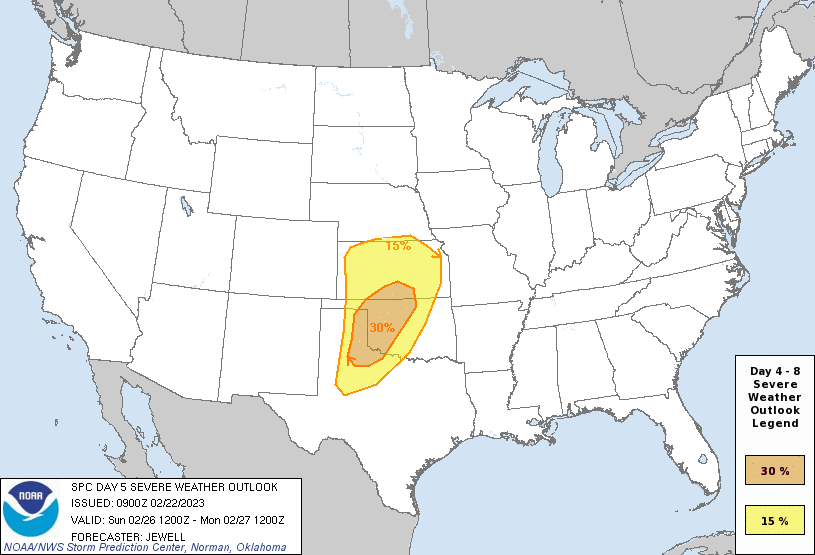
That's a pretty hefty outlook for 5 days out, so preparations should start soon.
Let's also understand that my irrational exuberance for spring is not THAT
irrational, but March can certainly change on a dime and return to a more wintry
pattern. We still have lots of consternation amongst climate scientists about
the Sudden Stratospheric Warming even going on over the Arctic, and the
implications for weather in the Continental U.S. These events *can* lead to
prolonged bouts of cold weather in the Eastern U.S. due to disruptions in the
polar jet stream, but not always. And how it would impact us depends on where
that dividing line between the upper-level trough (cold air) vs. the
upper-level ridge (warm air).
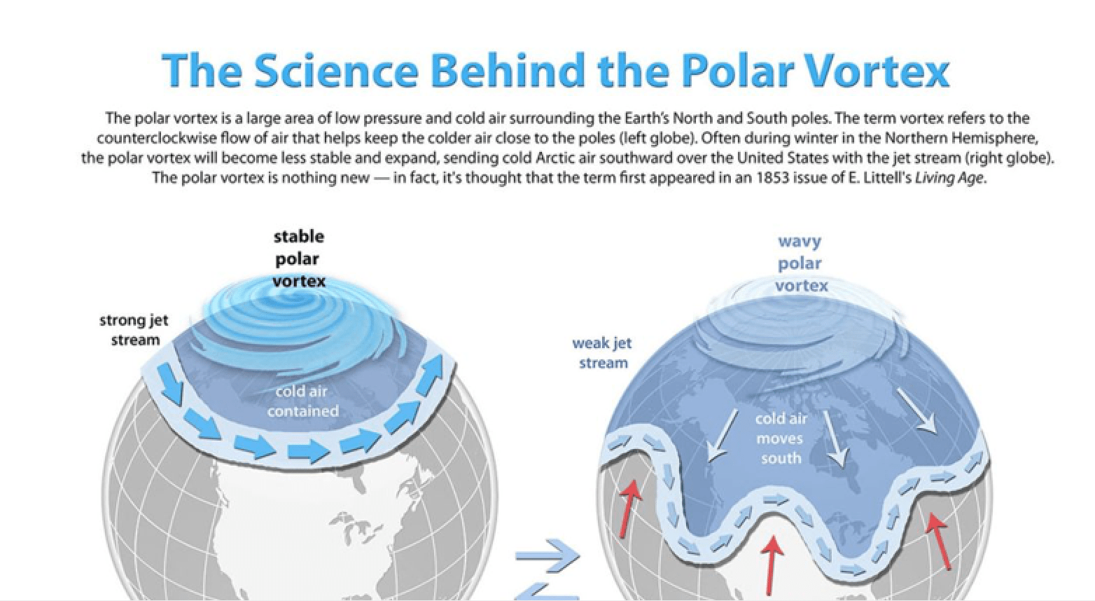
Get stuck under that trough, more winter. Get stuck under a ridge, spring
arrives even earlier. That's a very simple explanation of a very complicated
atmospheric phenomenon, admittedly from a very simple(minded) person.
If it happens, I vote ridge!
At any rate, what we have NOW is par for this time of year, with a strong cold
front coming in with lots of wind, fire danger, and possibly blowing dust.
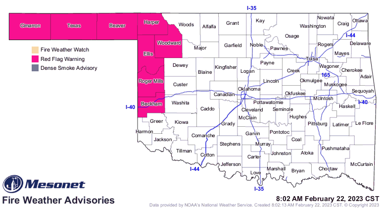
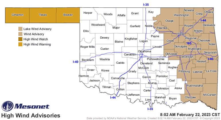

I will also place a very strong vote AGAINST DUST!
Gary McManus
State Climatologist
Oklahoma Mesonet
Oklahoma Climatological Survey
gmcmanus@mesonet.org
February 22 in Mesonet History
| Record | Value | Station | Year |
|---|---|---|---|
| Maximum Temperature | 86°F | HOLL | 2017 |
| Minimum Temperature | -2°F | HOOK | 2013 |
| Maximum Rainfall | 2.74″ | BROK | 2018 |
Mesonet records begin in 1994.
Search by Date
If you're a bit off, don't worry, because just like horseshoes, “almost” counts on the Ticker website!