Ticker for February 21, 2023
MESONET TICKER ... MESONET TICKER ... MESONET TICKER ... MESONET TICKER ...
February 21, 2023 February 21, 2023 February 21, 2023 February 21, 2023
FIRE FIRE!
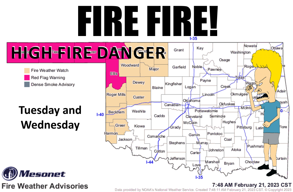
No, I'm not gonna lead with the chance for rain, because that's exactly what you'd
expect me to do.

This is our annual Beavis "FIRE FIRE!" post, which will stand from this point until
we see enough green up to quash (English to Okie dictionary: "suppress") wildfire
danger once and for all this spring.
Spring, you say? Well, that's coming too, if it's not already here. A pretty darned
good preview is in store for most of us today and tomorrow.
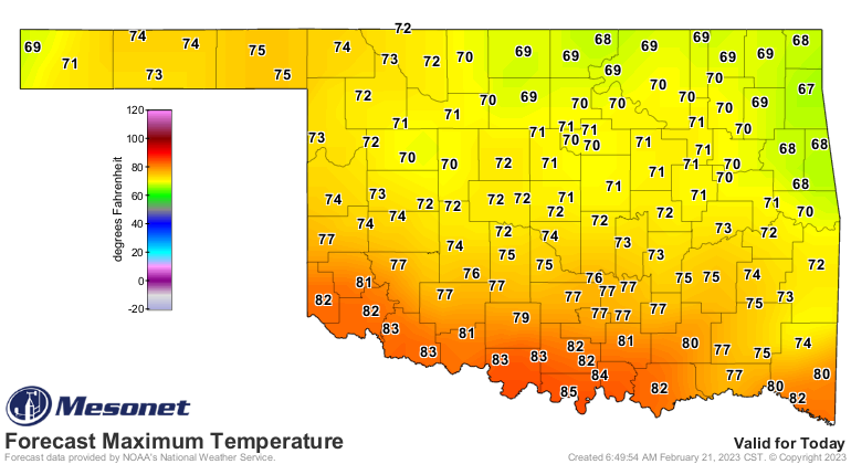
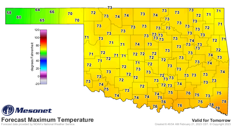
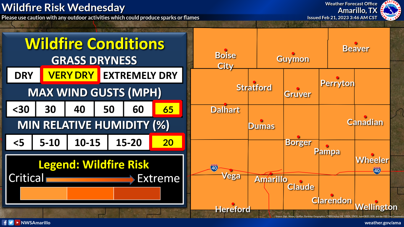
That heat is a pretty important component of today's Red Flag Fire Warning today,
and Fire Weather Watch tomorrow, and it's customary and/or common to see these
types of conditions in late winter/early spring ahead of a storm system here
in the Southern Plains. The low humidity, strong winds and above normal
temperatures are an unpleasant trifecta that produces perfect conditions for a
spark to get quickly out of control in the dead and dormant vegetation that is
so plentiful this time of year.
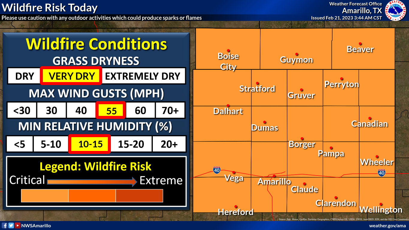
Day-to-day weather conditions rule our cool season fire danger, and this time of
year is perfect for perfecting those perfect conditions perfect. The vegetation
has had months to cure in the drier air of winter, the jet stream is dipping
down our way again more and more, and the heat is becoming more plentiful. But
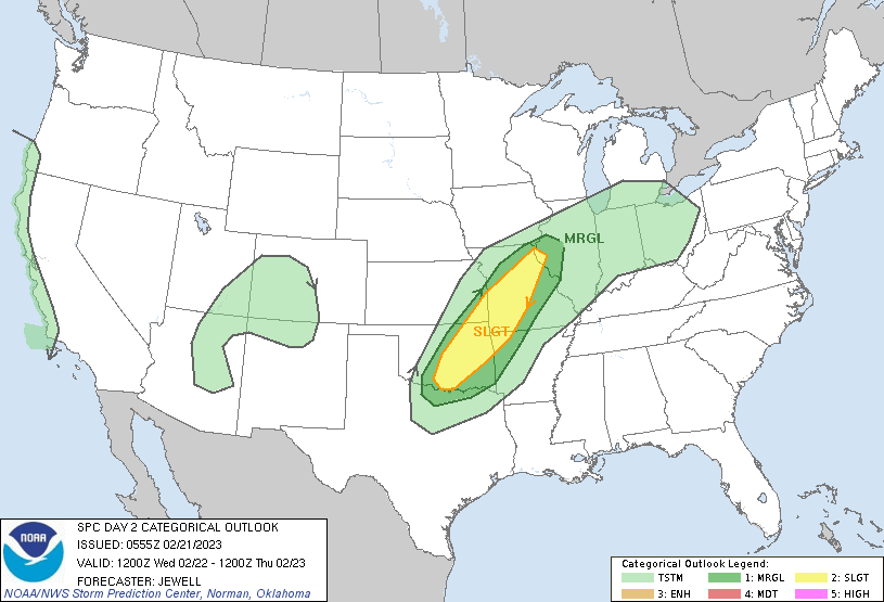
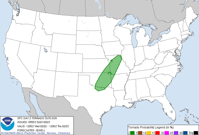
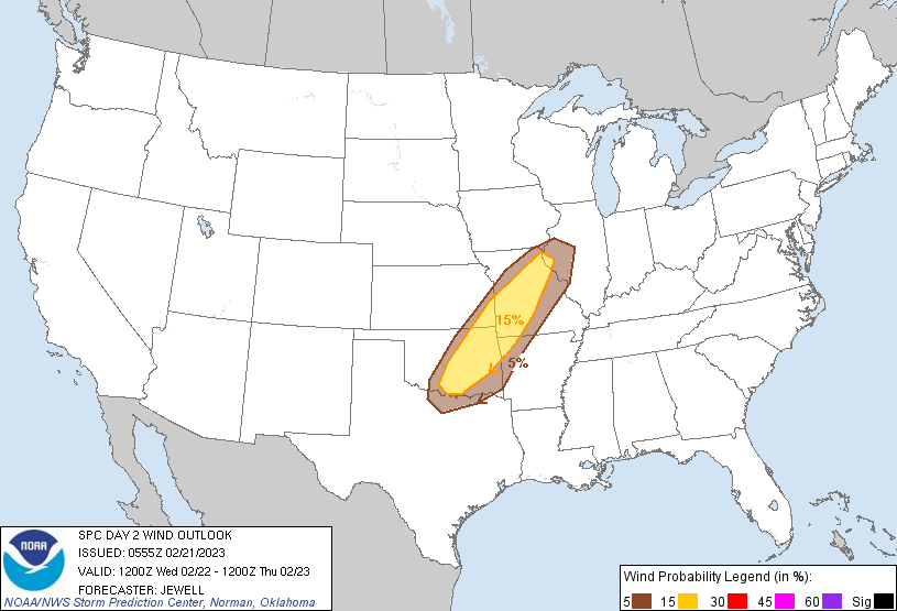
what about that storm system? Well, there's actually a couple of them this week,
but the first is expected to generate showers and storms late tonight into early
tomorrow morning, sending convection marching across the state, possibly severe
at times. A low tornado threat, but not zero. Wind and hail are the larger
threats (but nothing Oklahoma can't handle...pretty wimpy for around here).

Then we clear out and cool down before ramping things back up again into early
spring mode as we go into and through the weekend. A short visit from winter,
whose days are definitely numbered, before we see a better chance of severe
weather on Sunday. That day looks more like a classical Southern Plains severe
weather day, so go ahead and start your springtime severe weather preparations
now, just in case. Clean the cellar, buy batteries for your NOAA weather radio,
shave your cats and dogs, and throw dirt on all your windows.
Those last two are recommendations, only.
Here's the 6-days early outlook from SPC, and their take from this far out.
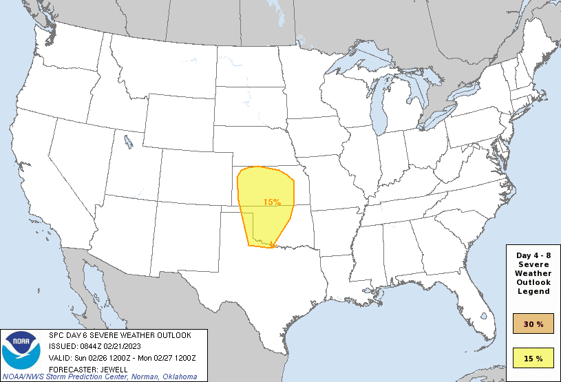
"By Sun/D6, models are in relatively good agreement showing the upper
low moving east across the Four Corners states with height falls
into the central and southern Plains by 00Z Mon. Surface
moisture/60s F dewpoints will likely surge northward ahead of the
shortwave trough, with low pressure over the central High Plains
Sun/D6 afternoon, deepening as it pivots into IA during the evening.
MUCAPE around 1000 J/kg appears likely from parts of western KS into
OK, and shear will favor supercells beneath a 50 kt low-level jet.
Initial supercells from the surface low southward along the dryline
will favor large hail and a few tornadoes, with damaging wind threat
extending eastward across KS and OK through evening as storms
possibly become linear. As such, a 15% severe area has been added."
1000 J/kg of MUCAPE...we all know just how painful that can be. At least we can
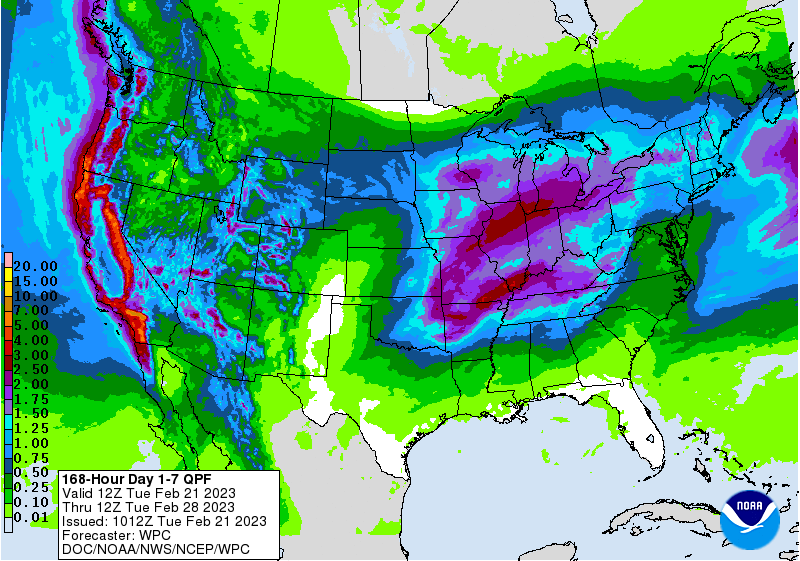
expect some rain from these storm systems...more across eastern OK, of course.
Wouldn't want to spoil the drought across NW OK, WOULD WE???
So lots of wind and fire danger the next couple of days. Don't be shocked if we
get another dust storm like last week. Storms overnight tonight into tomorrow
morning. Briefly cold with some low wind chills, then back to spring mode by
the weekend. Still not seeing signs of true winter returning other than the
brief visit this week. No prolonged cold weather in sight, at least.
Gary McManus
State Climatologist
Oklahoma Mesonet
Oklahoma Climatological Survey
gmcmanus@mesonet.org
February 21 in Mesonet History
| Record | Value | Station | Year |
|---|---|---|---|
| Maximum Temperature | 87°F | BURN | 2023 |
| Minimum Temperature | 2°F | HOOK | 2013 |
| Maximum Rainfall | 2.90 inches | BROK | 2018 |
Mesonet records begin in 1994.
Search by Date
If you're a bit off, don't worry, because just like horseshoes, “almost” counts on the Ticker website!