Ticker for February 17, 2023
MESONET TICKER ... MESONET TICKER ... MESONET TICKER ... MESONET TICKER ...
February 17, 2023  February 17, 2023  February 17, 2023  February 17, 2023


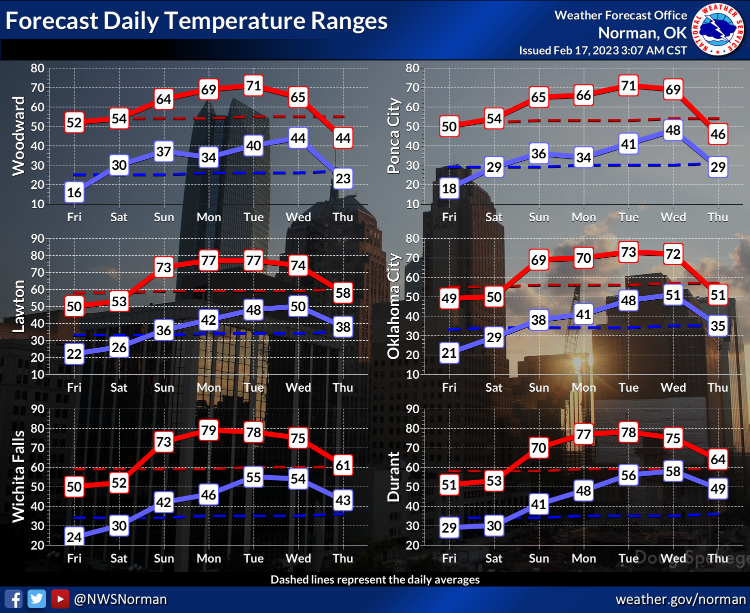
Has spring sprung?


Coming from the guy who infamously pronounced summer over on August 15 of last
year, and also told my friends my receding hairline was just an optical illusion
back in my 30s...I will probably doom us to a snowy, arctic-like March, but it sure
appears the worst that winter has to offer is receding (again with the hair??)
in our rear-view mirror. Each cold front seems to last less and less (also my
favorite law firm..."Less and Less, We'll Get You More!") long as it is quickly
replaced by warmer weather. Now we do have another blast of frigid air being
forecast for the end of next week, but that's also near-Fantasycast territory.


The end of winter is inevitable, of course. Each day the sun gets higher in the
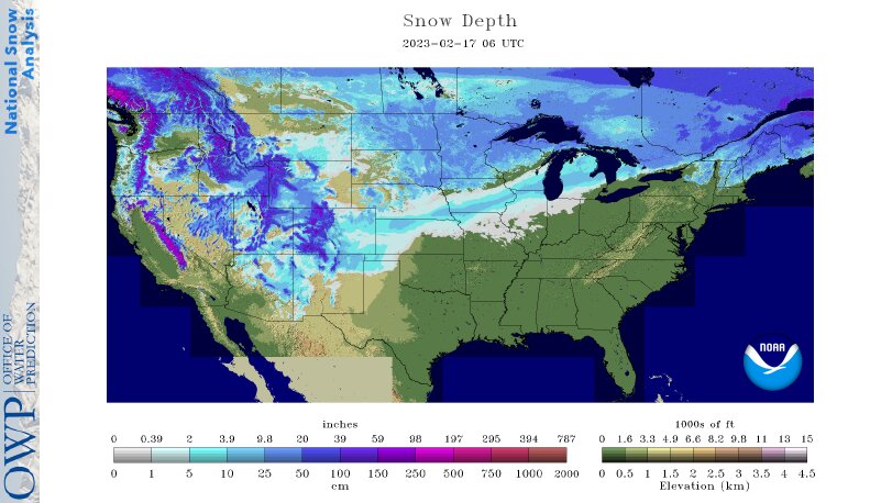
sky, and for a larger part of the day. There's not a lot of snowpack to our north,
so any cold air masses tend to modify more quickly.


That could change with a big storm or two, but that's another important piece of
the puzzle. So while most of my death-of-winter forecast is just wishful thinking,
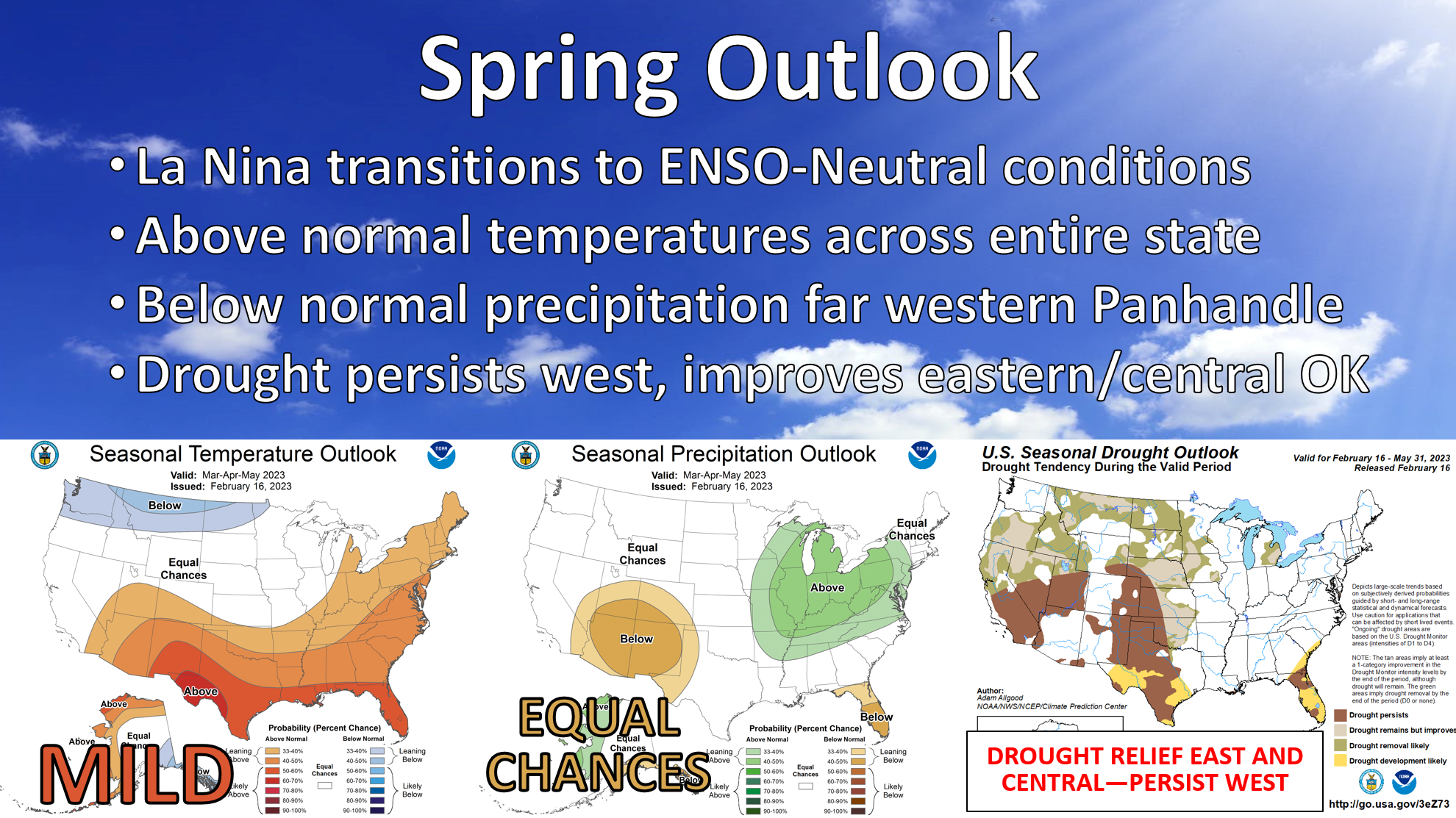
time is definitely on my side. Now as for the drought, as you can see there
in the top graphic, time is also on our side...at least for eastern OK. With no
clear below-normal precip signal in place, climatology favors increasing
precipitation totals as we go through spring, so drought improvement is favored
across eastern OK. Western OK, which is just drier naturally, will need a bit
more help...so climatology favors drought persistence there.

Here is how our friends at the Climate Prediction Center sees it:

"During the past month, widespread heavy rainfall fell across
northeastern Texas, southeastern Oklahoma, and the lower Mississippi
Valley outside of the immediate Gulf Coast region. While this
precipitation eased drought and abnormal dryness, the core drought
areas of the Southern Region over much of Oklahoma and portions of
Texas were too far west to benefit. Drought conditions have begun to
expand across Texas due to increasing precipitation deficits,
particularly across southern Texas, while a small area of drought
remains in place in southern Louisiana. Precipitation deficits have
also begun to grow across the Tennessee Valley. Over the next week,
a potent storm system is expected to erase the precipitation deficits
across Tennessee, and bring some beneficial rainfall to northeastern
Texas and southeastern Oklahoma; the same regions that have received
precipitation during the last month. The 8-14 day ERF favors
below-average precipitation across the Southern Region. The March
outlook shows a dry signal across southern Texas and along the Gulf
Coast, and increased chances for above-normal precipitation across far
eastern Oklahoma, Arkansas, and Tennessee. Based on these outlooks,
drought persistence and expansion is favored across southern and
western Texas. Across Oklahoma, increasing climatological precipitation
during the spring months should provide opportunities for drought
reduction across the eastern half of the state, with persistence a
more likely outcome for western Oklahoma."

This would not be good news for western OK. More drought prevents green-up, which
extends the wildfire season, the height of which we're still approaching later
this month into March.

So we now await a cold, icy March. But don't blame me! Blame hope and sanity.

Gary McManus
State Climatologist
Oklahoma Mesonet
Oklahoma Climatological Survey
gmcmanus@mesonet.org
February 17 in Mesonet History
| Record | Value | Station | Year |
|---|---|---|---|
| Maximum Temperature | 85°F | ALTU | 2011 |
| Minimum Temperature | -2°F | HOLL | 2021 |
| Maximum Rainfall | 1.56″ | TULN | 2022 |
Mesonet records begin in 1994.
Search by Date
If you're a bit off, don't worry, because just like horseshoes, “almost” counts on the Ticker website!