Ticker for January 30, 2023
MESONET TICKER ... MESONET TICKER ... MESONET TICKER ... MESONET TICKER ...
January 30, 2023 January 30, 2023 January 30, 2023 January 30, 2023
Icelahoma

How did I know I wanted to be a meteorologist as a kid? I literally thought that
was the AC/DC lyric! Yeah, pretty dumb, that's probably why I got two meteorology
degrees but then became a climatologist.
Come on, I know you can hear it!
"Dirty deeds, THUNDERSLEET,
Dirty deed and they're thundersleet!"
It's a shame out thunder has to come with ice, though...much prefer the liquid...
WAIT! Much prefer the liquid that STAYS liquid variety of precip. Almost got me
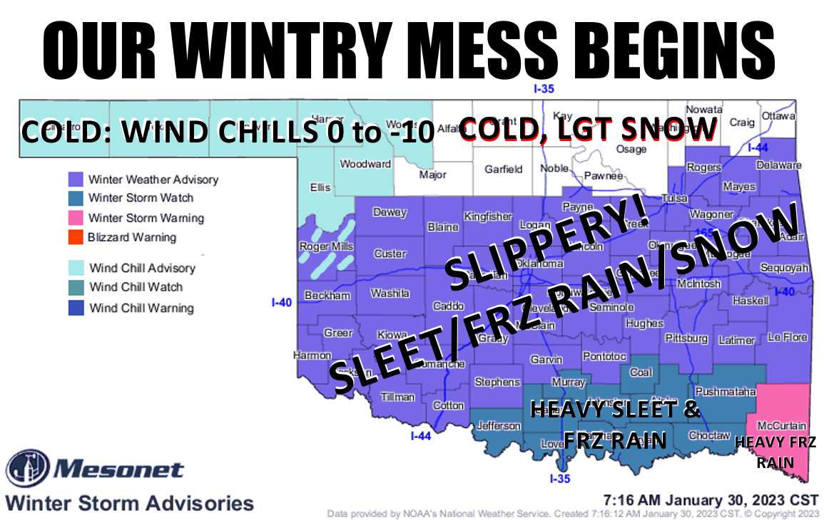
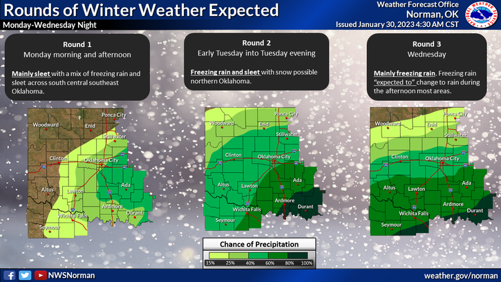
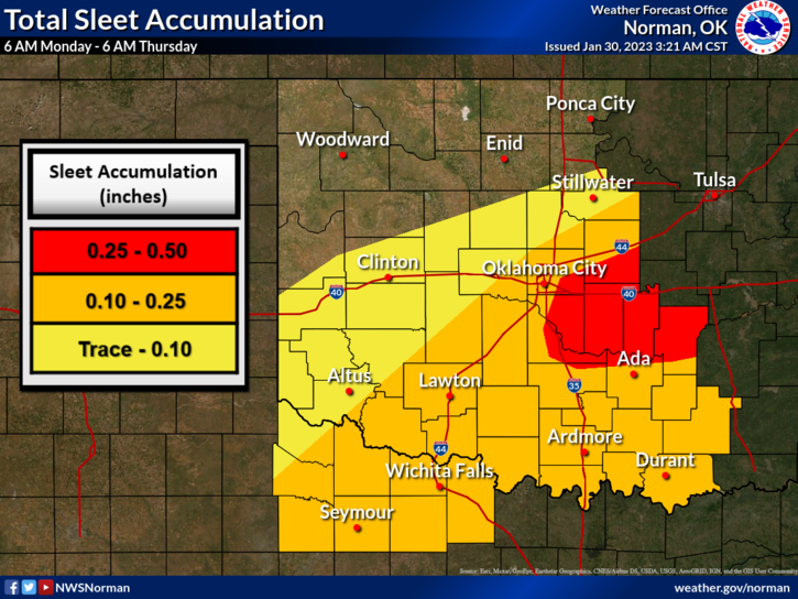
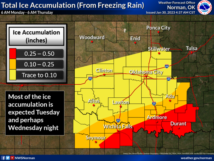
on a freezing rain technicality there. So we start off our winter storm with
waves of sleet and freezing rain today, get another dose tomorrow, then a third
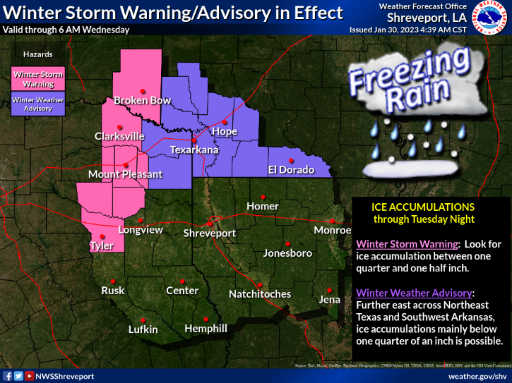
dose Wednesday into early Thursday. Instead of me blabbering on (I know, too late)
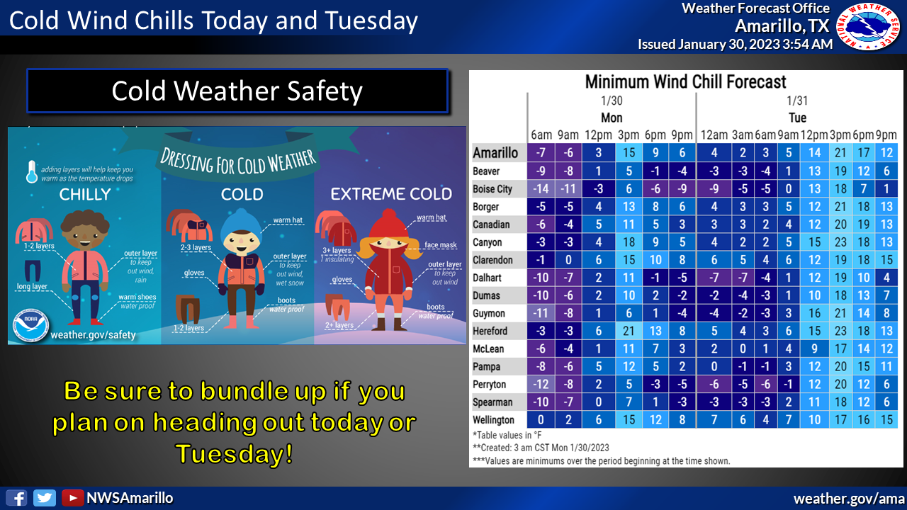
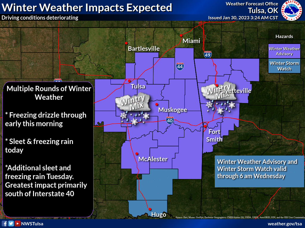
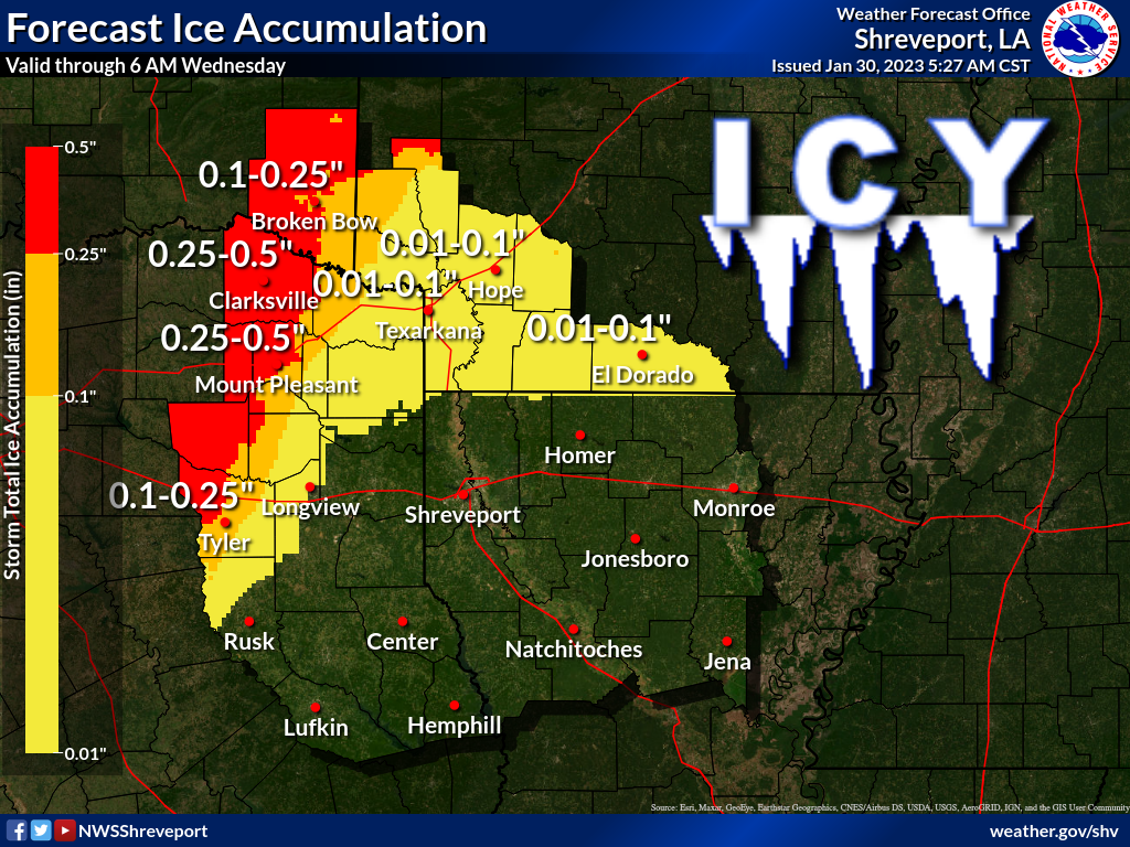
and on, I'll just let the NWS folks describe the situation with graphics for
their particular coverage areas.
OK PANHANDLE
EASTERN OK
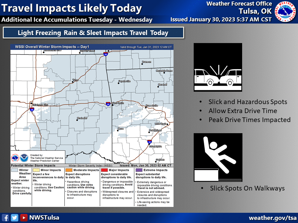
WESTERN AND CENTRAL OK
MCCURTAIN COUNTY
In a weird paradoxical turn of events, the storm is both colder and warmer than
what it looked like last week. So colder at the outset in the vertical layers
of the atmosphere, so we're getting sleet instead of freezing rain. And warmer
later on this week, so we're getting rain instead of freezing rain/sleet/snow.
There will still be some around on Wednesday and Thursday, but it does look
like we will warm up enough to melt everything and see just plain liquid rain.
COLD, but not the freezing variety.

We will be getting some decent moisture across the SE half of the state or so,
but the NW half misses out mostly.

Would rather get it in some more palatable form, but it's Oklahoma...when does
that ever happen?
Gary McManus
State Climatologist
Oklahoma Mesonet
Oklahoma Climatological Survey
gmcmanus@mesonet.org
January 30 in Mesonet History
| Record | Value | Station | Year |
|---|---|---|---|
| Maximum Temperature | 85°F | HOLL | 2016 |
| Minimum Temperature | -3°F | HOOK | 2010 |
| Maximum Rainfall | 3.50″ | VALL | 2025 |
Mesonet records begin in 1994.
Search by Date
If you're a bit off, don't worry, because just like horseshoes, “almost” counts on the Ticker website!