Ticker for January 27, 2023
MESONET TICKER ... MESONET TICKER ... MESONET TICKER ... MESONET TICKER ...
January 27, 2023 January 27, 2023 January 27, 2023 January 27, 2023
Ice Ice Baby?
I hate to transfer my anxiety into my work, AND to you folks, but I just DON'T DO
ICE! Oh, I love me some iced tea, especially the sun-made variety, and I even like
me some Ice-T, whose gnarly scowl has scared many a perp into confessing on
"Law and Order: SVU."
THUNG-THUNG!
Hey, if you know how to spell the Law & Order series' closing-cell-door sound, let
me know...I'm going with "THUNG THUNG!"
Okay, now you've gotten me completely off subject. Oh yeah, ICE! With even the hint
of some freezing drizzle and freezing rain, I'm just preparing you to STAY OFF THE
ROADS. Ice is not to trifle with. Trust me, I've trifled and it caused me nothing
but truffles...errr, troubles. The setup for next week is pretty simple, but also
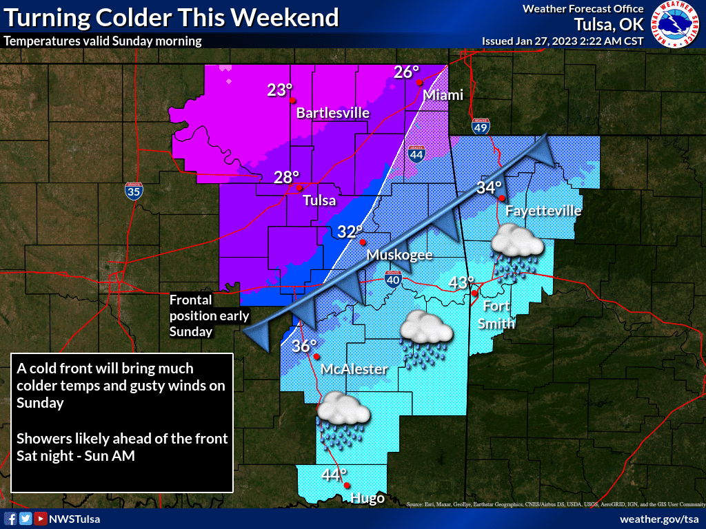
extremely complicated. Simple version: big arctic air blast moves through Saturday
into Sunday and gives us the coldest air of the year thus far (but not the season...
that's still late-December's mark). Then we have the big upper-level trough out
West throwing out smaller systems our way before it moves to the east and passes
over the Southern Plains somewhere, causing at least a couple of rounds of
precipitation.
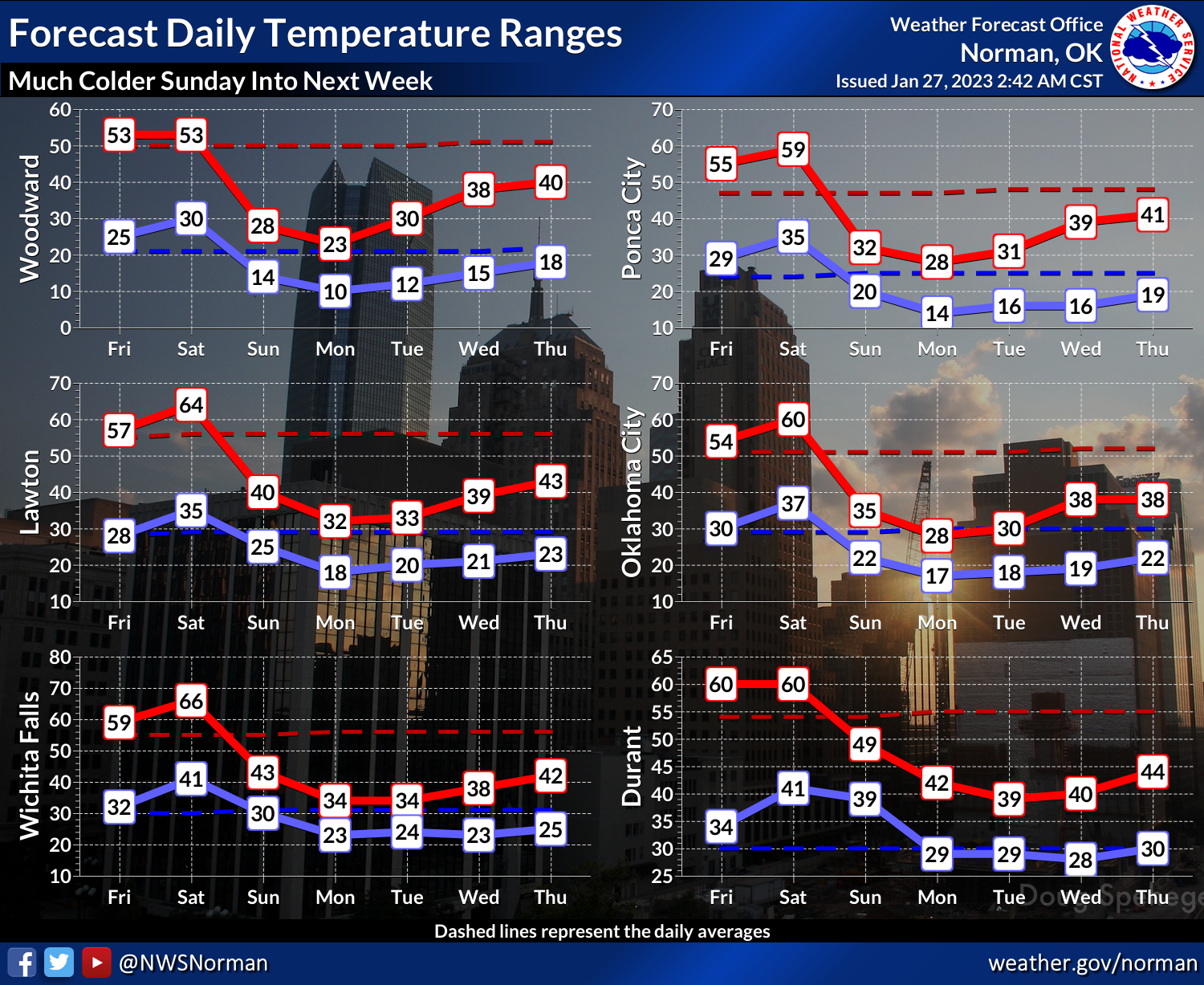
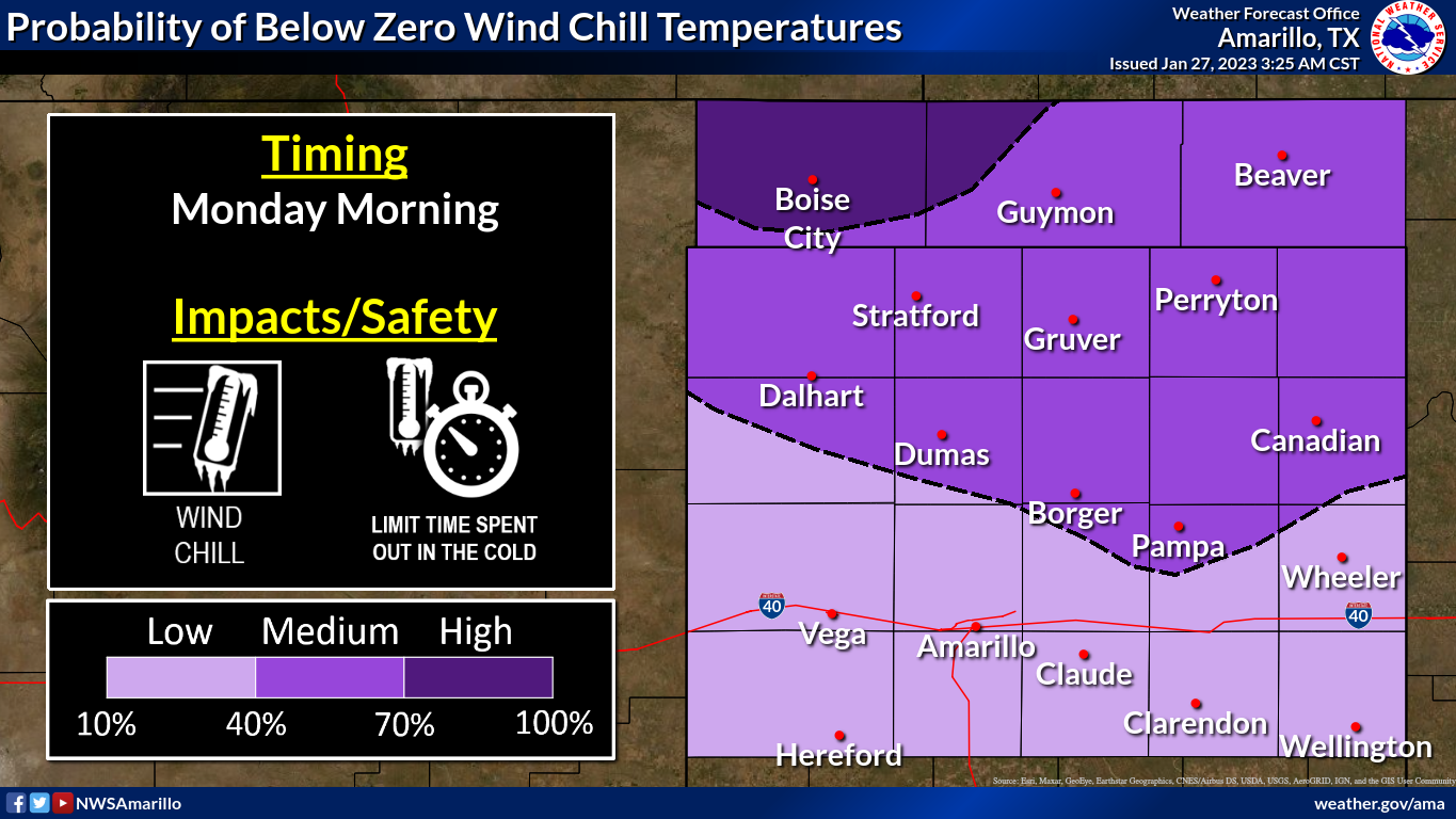
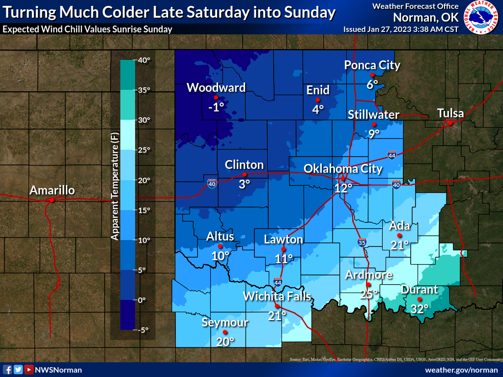
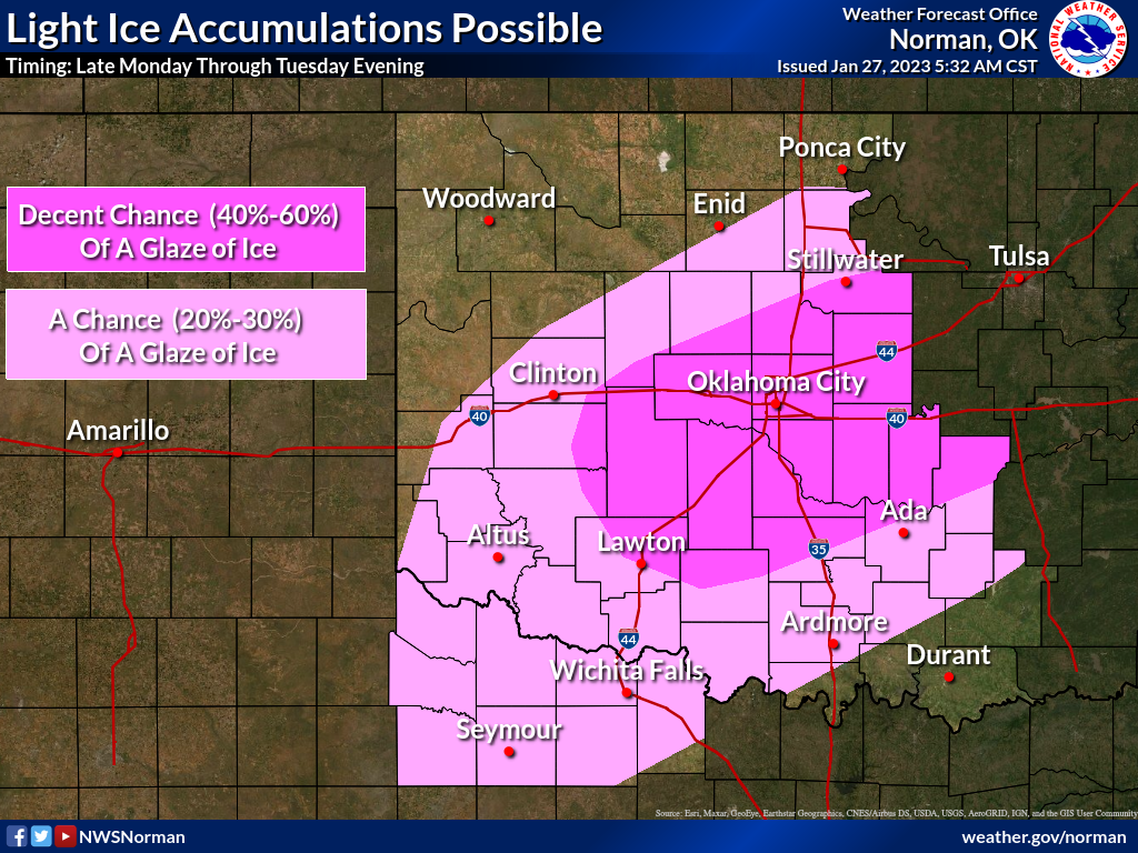
Given the shallow nature of the Arctic air, that could mean the most dreaded
form of wintry precip: freezing rain (or even freezing drizzle). Well, worst
next to frozen giant wombats, but that's not usually a problem here.

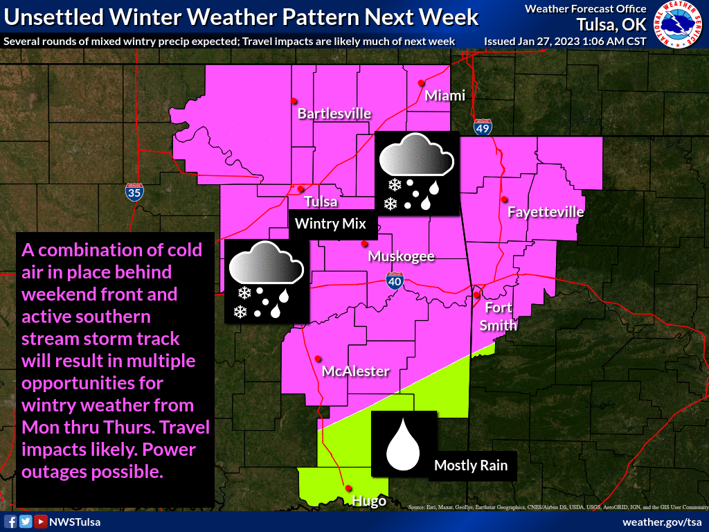
Tulsa NWS' remarks: "The combination of cold air in place behind weekend
front and an active southern stream will bring multiple opportunities for
wintry weather Monday thru Thursday of next week. Travel impacts are likely,
and power outages are possible."
Again, even a light glaze of ice can send you spinning into the ditch.
But here's the complicated part. There is simply no good model consensus yet
on many aspects of this storm, so the fine points are simply not there at this
time. How deep will the cold air be, and how warm will it be in the important
icing area in SE OK where heavier precip is being forecast? What is the track,
and strength, of the main storm system as it moves over us? Remember our
admonitions on how difficult it is to try and make sense of the chaos of even
short-term forecasting due to lack of model consensus.

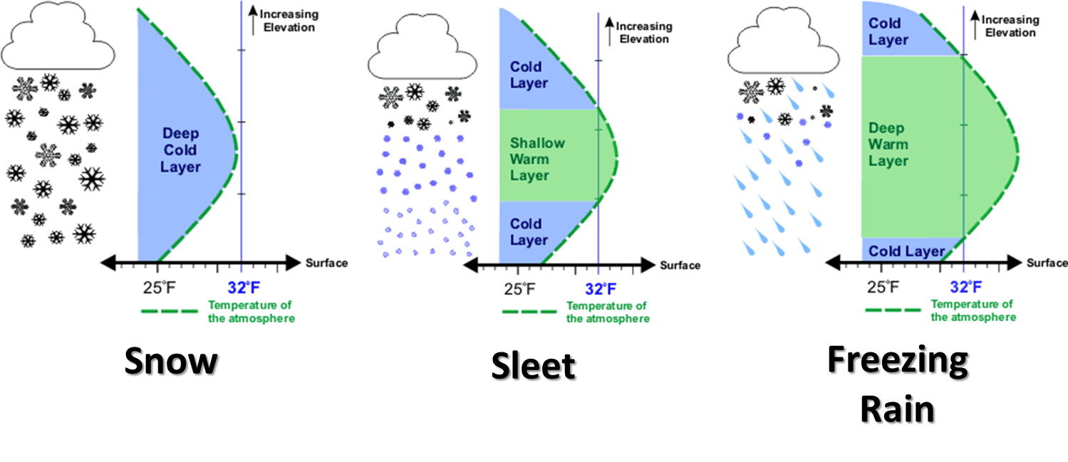
That's what it looks like now, and with each different type of frozen precip
type so precariously dependent on that vertical temperature profile, it's a tall
order to forecast for next week to say the least.
So that's why we're just going with the simplified version of next week's
forecast for now: there will be a large frigid air mass over our area and
at least a couple of chances of precipitation to go along with it. So take our
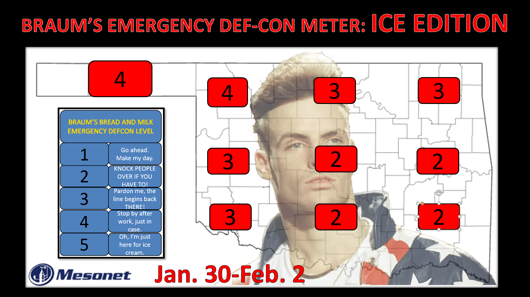
BRAUM'S EMERGENCY DEF-CON METER for what it is...a somewhat satirical take on
weather panic to get you to take notice of some possible inclement weather
coming up so you can prepare accordingly and NOT PANIC.
Now let's get back my categorical fear (Categorical Fear was my band's name in
Junior High!) of glaze ice. Let's do it in song, so sing along with this to the
opening theme of "The Beverly Hillbillies."
"Come and listen to my story about a man named Gary (not Jed),
A poor Climate-eer barely kept hair on his head,
And then one day he was driving to the movies,
when down from the sky came some frozen cooties.
Freezing drizzle, that is. Black ice. Oklahoma glaze.
Well the first thing you know ol' Gary's having trouble,
The kinfolk said 'Gary, hate to burst your bubble,'
Said 'Off the road is the place you ought to be.'
So he exited off the Interstate and missed his movie."
So yeah, it wasn't a sit-com...it was a tragedy! Don't make your own tragedy
by fooling with ice...might be worse than just missing a movie (although that's
pretty high on the tragedy list!).
Gary McManus
State Climatologist
Oklahoma Mesonet
Oklahoma Climatological Survey
gmcmanus@mesonet.org
January 27 in Mesonet History
| Record | Value | Station | Year |
|---|---|---|---|
| Maximum Temperature | 84°F | ALV2 | 2015 |
| Minimum Temperature | 0°F | KENT | 2009 |
| Maximum Rainfall | 3.39 inches | SALL | 2009 |
Mesonet records begin in 1994.
Search by Date
If you're a bit off, don't worry, because just like horseshoes, “almost” counts on the Ticker website!