Ticker for January 26, 2023
MESONET TICKER ... MESONET TICKER ... MESONET TICKER ... MESONET TICKER ...
January 26, 2023 January 26, 2023 January 26, 2023 January 26, 2023
Winter is the winner
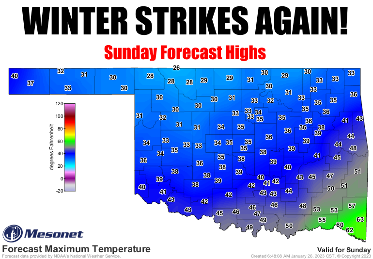
The snow is history. No, literally, the snow is history...at least where I'm
standing (and that's all that matters, right?). But it did bring us some decent
moisture (ever seen indecent moisture...it's not a pretty sight!) across most of
the state. Sadly, the Panhandle missed out for the most part. Again.
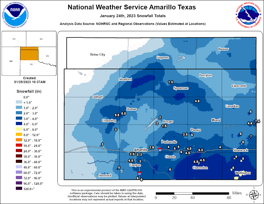

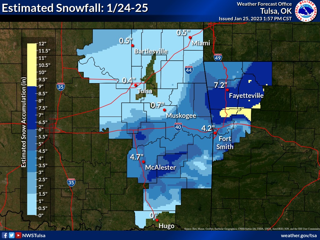
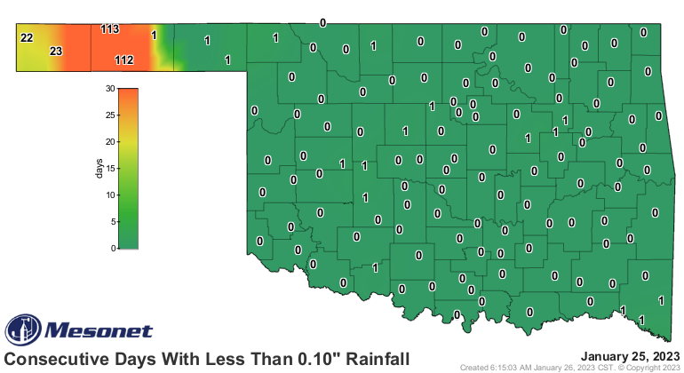
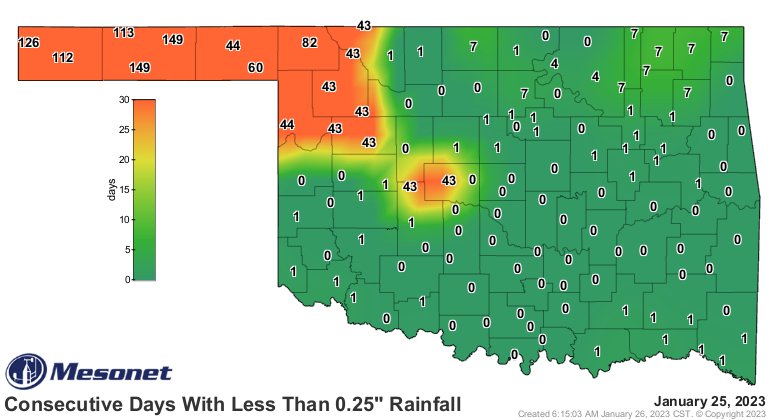
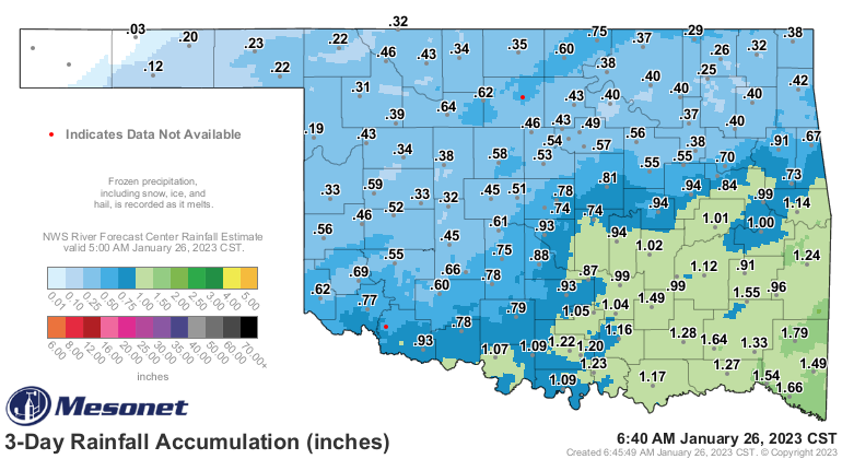
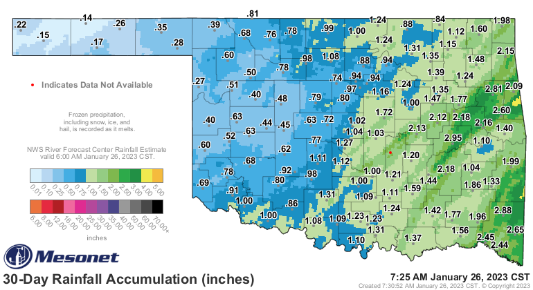
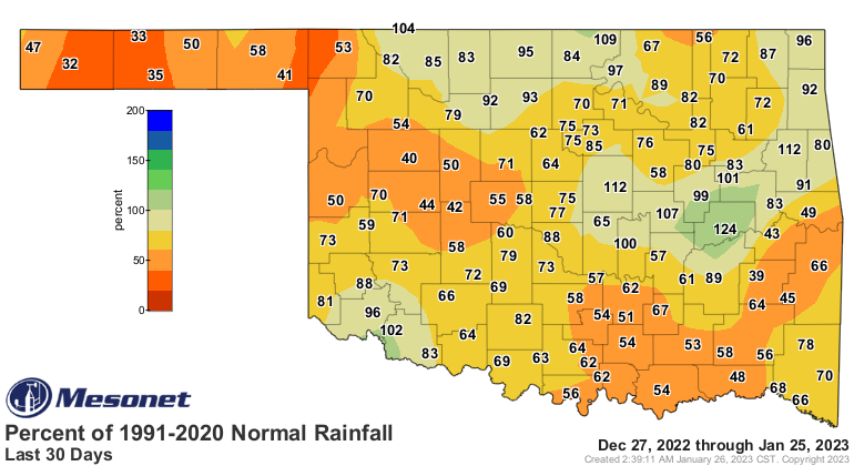
While certainly welcomed, even that moisture leaves us on the dry side of the last
30 days, going back to late-December, and still a precarious drought situation.

Now remember, any precip that fell after 6 a.m. on Tuesday, which is basically
all of it, could not be considered for this week's Drought Monitor map, so any
improvements will show up on next week's map.
So what do we have coming up? Well, as the top graphic suggested (okay, SCREAMED),
winter's not done, not by a long shot. We will have a true Arctic front blast
through the state over the course of the weekend...late Saturday night into
Sunday, and drop high temperatures back down to below or close to the freezing
mark for several days. We should also see a pretty good storm system approach
with some moisture return from the Gulf of Mexico. Now normally we'd be yelling
about snow, and that's not out of the question just yet, but the problem is with
good southerly flow from the Gulf, that tends to suggest a warm tongue of air
above the surface. So any snow that forms up above will likely have a layer to
melt it back to liquid for a brief period, where it will then fall once again
into that freezing air at the surface.
Go ahead and *GULP* because it's coming. Yeah, the dreaded words. That precip
type that shall not be named. VOLDEMORT! Whoops, how Muggle of me. I meant
"FREEZING RAIN!" Yeah, I named it. Remember our past discussions on how winter
precip forms, and how the vertical profile of the atmosphere, including the
depths of the melting and freezing layers determine your choice between snow,
freezing rain, sleet, or just a really cold rain.
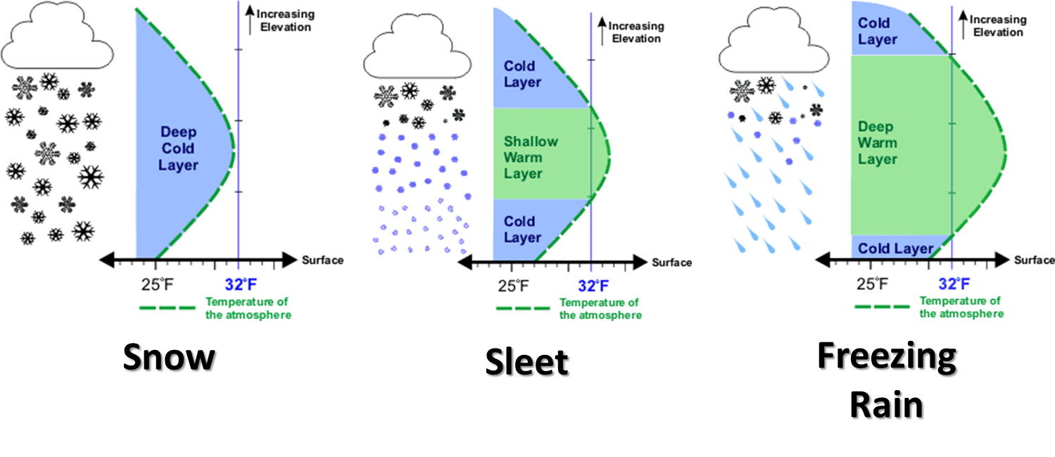
It sure looks like that last one there on the graphic is going to be the
predominant precip type 96-hours out, but that's a LONG time with this type of
uncertainty in play. However, those folks in SE OK have to know that even this
far out, the models are starting to paint their area with some significant
freezing rain amounts. At least the surface temperatures down that way should
be a bit closer to freezing, However (part 2), the temperature will hover around
that magical 28-30 degrees range of magical (but more diabolical...think
Voldemort again) significant freezing rain accumulations.
However, once again let's remember it's early, and I mean WAY early, to try
and determine precip amounts, let alone precip type.
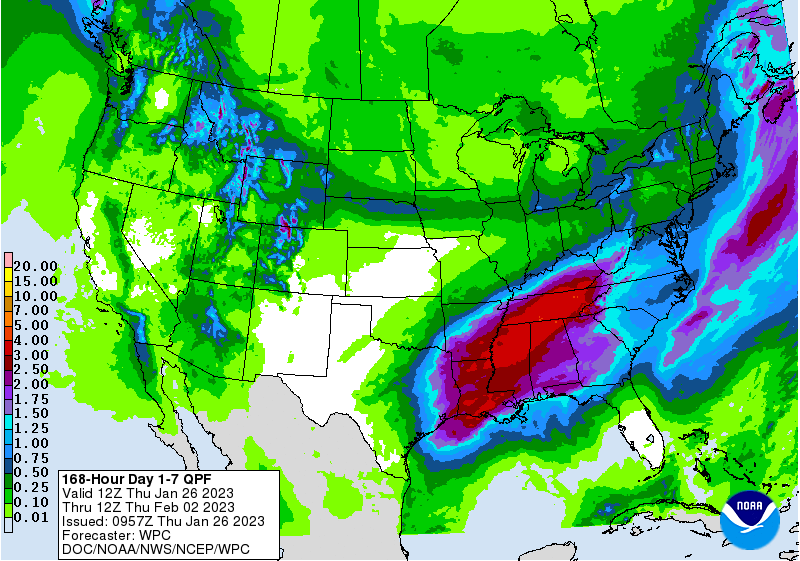
It certainly wouldn't hurt to start preparing now, however (part 3). All modes
of winter precip are possible next week.
Gary McManus
State Climatologist
Oklahoma Mesonet
Oklahoma Climatological Survey
gmcmanus@mesonet.org
January 26 in Mesonet History
| Record | Value | Station | Year |
|---|---|---|---|
| Maximum Temperature | 81°F | MANG | 2015 |
| Minimum Temperature | 4°F | BUFF | 2004 |
| Maximum Rainfall | 3.45 inches | CLAY | 1994 |
Mesonet records begin in 1994.
Search by Date
If you're a bit off, don't worry, because just like horseshoes, “almost” counts on the Ticker website!