Ticker for January 24, 2023
MESONET TICKER ... MESONET TICKER ... MESONET TICKER ... MESONET TICKER ...
January 24, 2023 January 24, 2023 January 24, 2023 January 24, 2023
Please?

Well, it's all over but the shouting now, and trust me, there will be shouting
aplenty if the snow doesn't materialize. Heck, it's snowing right now for crying
out loud!
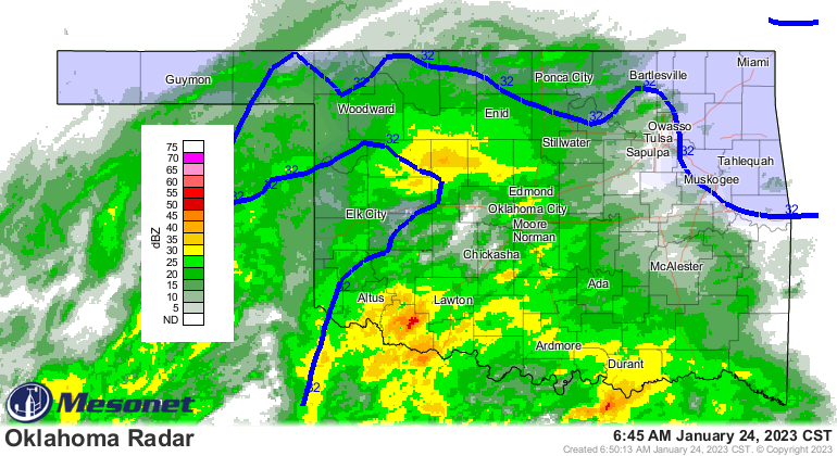
I'm short on time, but I'm also short on brains, so why stop now? Here's the deal...
we're relying on some pretty funky (SCIENCE!) physical processes to cool us down
enough to snow. Instead of some ham-fisted attempts by me to explain it, I'll let
our NWS friends show us in this here handy dandy info-graphic! Let's call it "The
making of snow when the cold air just ain't there."
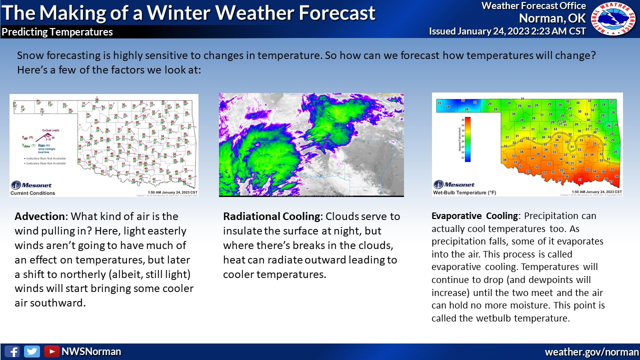
So in those areas where it has cooled down to the wet-bulb temperature, it's
snowing and it's snowing hard! There are reports of a couple of inches already
out in western Oklahoma. Here is that current temperature map, AND the current
wet-bulb temperature map.
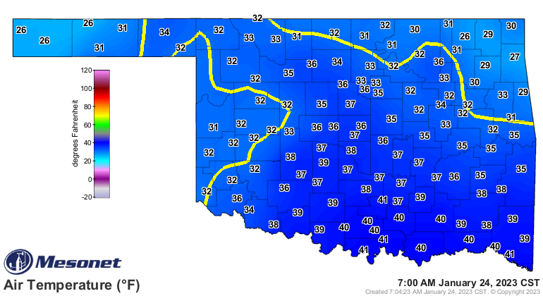
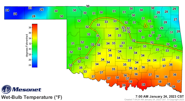
So where those wet-bulb temps are 32 or below, that's where the greatest odds
of starting out as snow will be as the precipitation starts to fall. We should
see that 32-degrees wet bulb temp line continue to shift to the south as
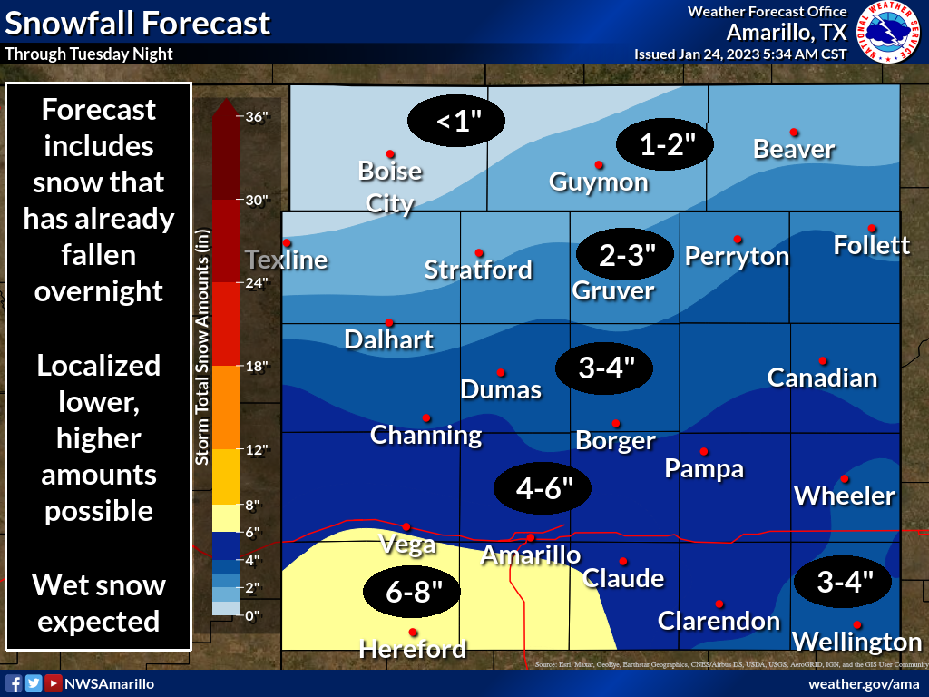
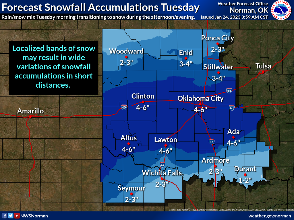
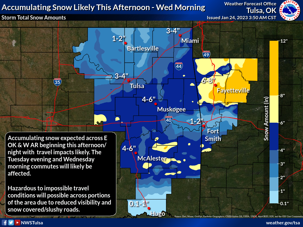
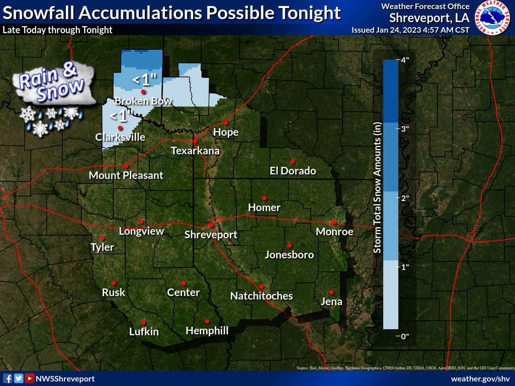
heavy precipitation starts to fall. Here are what the local NWS offices are
showing for forecast snowfall amounts. Remember, BUST POTENTIAL IS HIGH if we
don't see the thermodynamics line up, both above and below the surface.
Still a very wet system, just waiting for those thermodynamics to line up
more favorably.
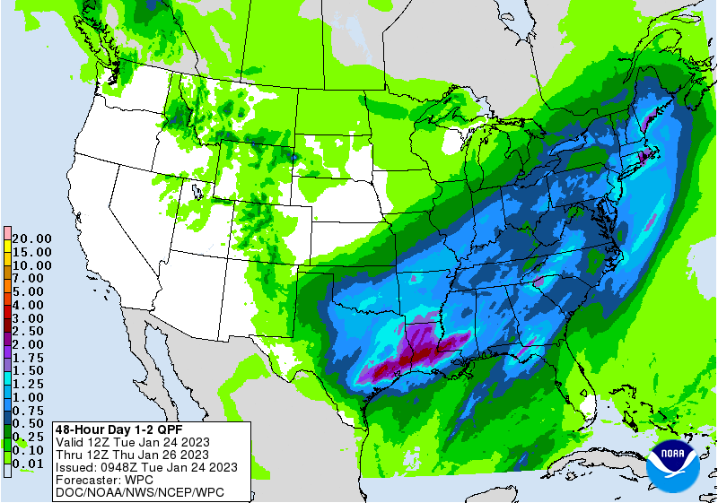
Okay, commence to shouting!
Gary McManus
State Climatologist
Oklahoma Mesonet
Oklahoma Climatological Survey
gmcmanus@mesonet.org
January 24 in Mesonet History
| Record | Value | Station | Year |
|---|---|---|---|
| Maximum Temperature | 80°F | WAL2 | 2017 |
| Minimum Temperature | -3°F | BRIS | 2014 |
| Maximum Rainfall | 1.81 inches | DURA | 2012 |
Mesonet records begin in 1994.
Search by Date
If you're a bit off, don't worry, because just like horseshoes, “almost” counts on the Ticker website!