Ticker for January 23, 2023
MESONET TICKER ... MESONET TICKER ... MESONET TICKER ... MESONET TICKER ...
January 23, 2023 January 23, 2023 January 23, 2023 January 23, 2023
Snowgames
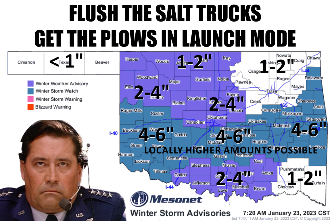
In our feeble attempts to inject some acknowledgement of uncertainty into
forecasts, especially winter weather forecasting in Oklahoma, the weather
enterprise often leaves folks with the impression that forecasts often can AND
WILL bust. Granted, the bust potential with this winter storm watch is
substantial. After all, we're counting on some pretty precarious (Pretty Precarious
was my band's name in college!) physical processes to take place. There's not a lot
of really cold air with this storm system, so we need some adiabatic cooling magic
to occur to get us to the freezing level throughout the vertical structure of the
atmosphere, and low enough near the surface so the snow that might possibly form
doesn't melt. And even then we might see a lot of that snow melt as it hits the
ground at first. So again, the bust potential where we don't get anything close
to the forecast (NOT "FORECASTED") amounts depicted above (and below).
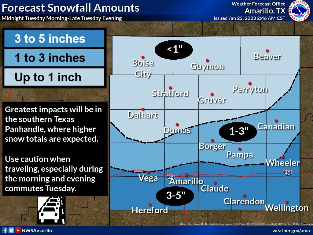
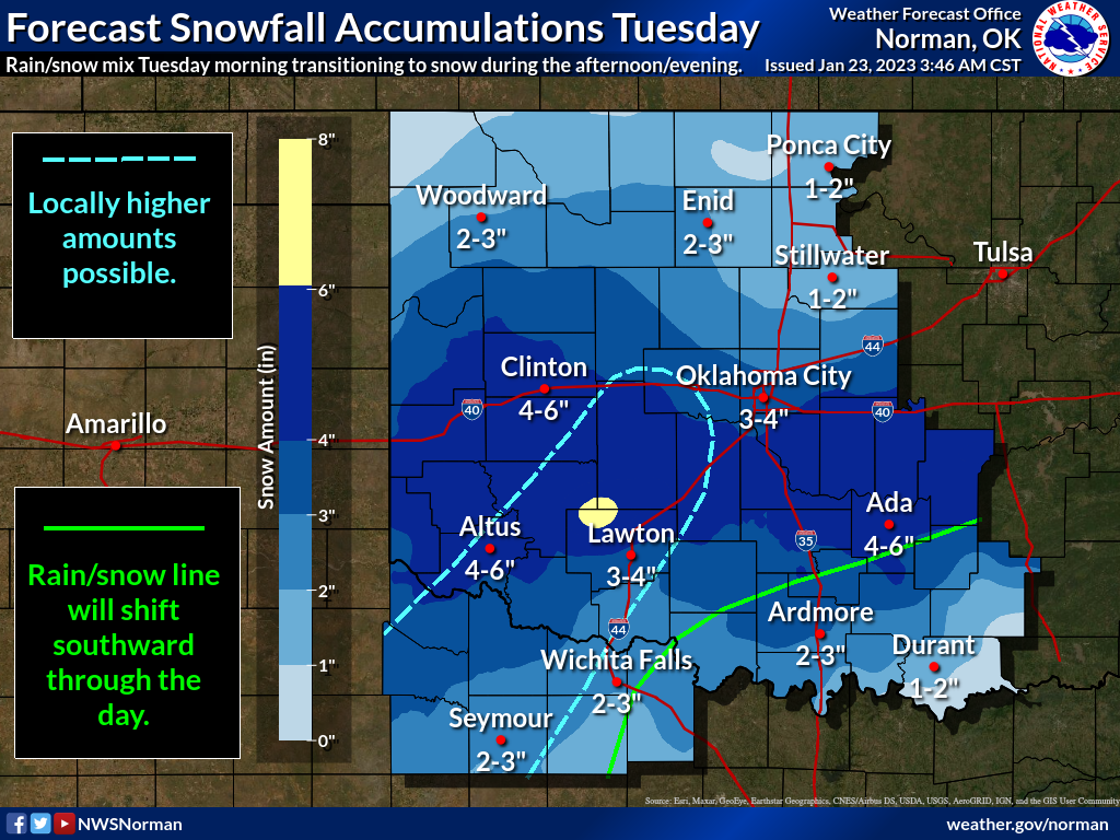
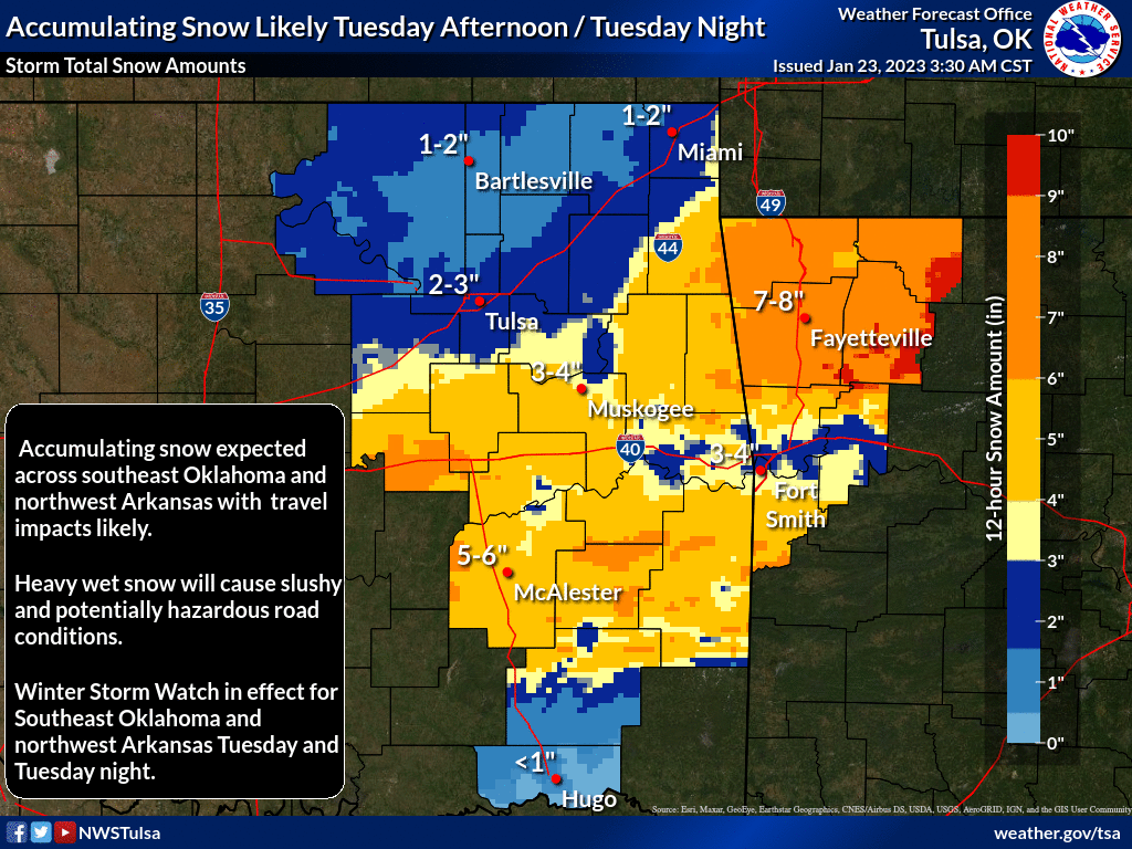
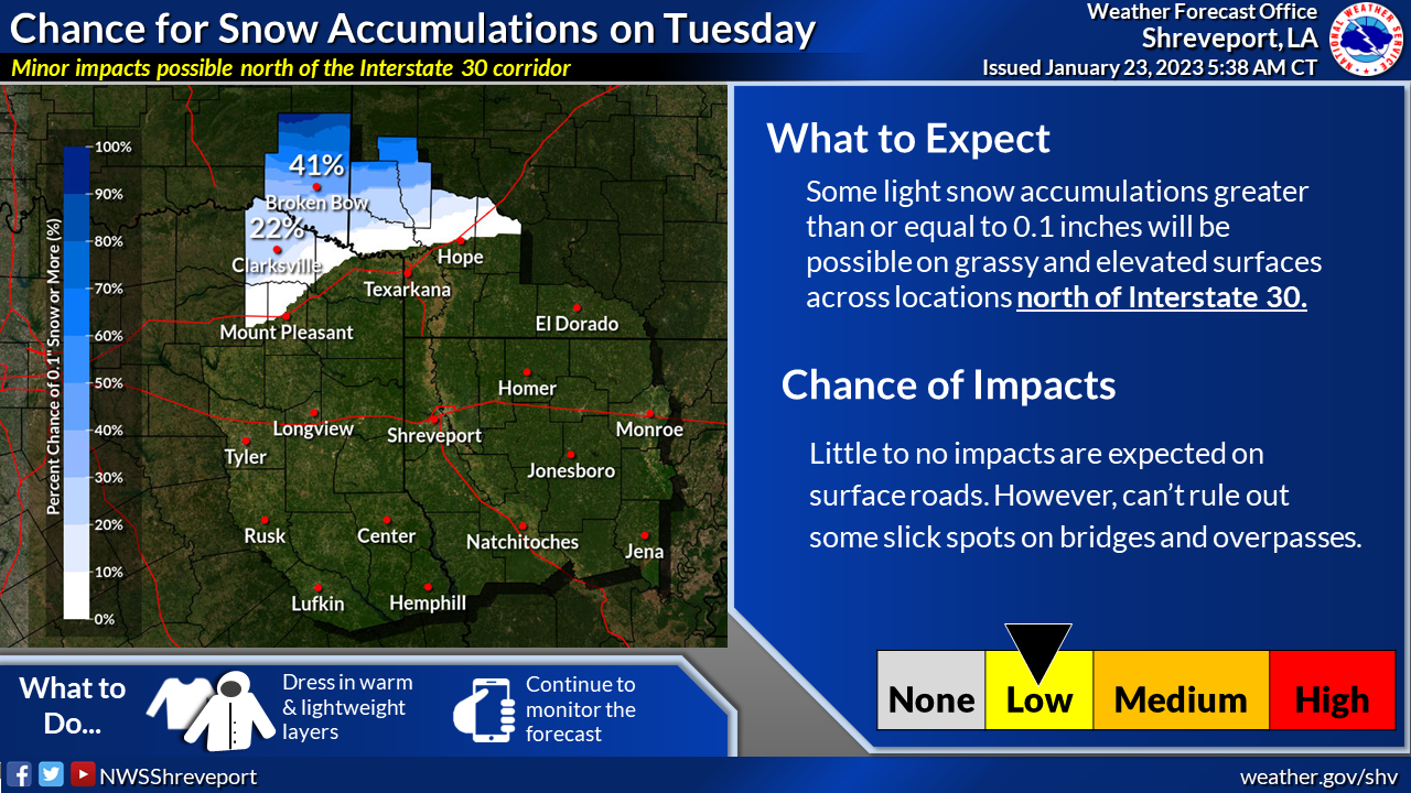
But here's the deal...what if that bust is in the "WORSE" direction? Granted (that's
twice I've granted, and I don't even have the power to grant once!), what's
considered worse is in the eye of the beholder ("Eye of the Beholder" was my
band's biggest hit in college!). If you're taking care of streets, or you are
a school official, the more we get the worse it is. But if you're just a member
of the general public, or a kid...the more we get the better it is. So yeah,
we could see a lot less, but we could also see more, right?
Some folks could see a LOT more (or less, obviously) with convective elements
within the broader storm possible, meaning thunder-snow. Again, lots has to
happen to get all these things working in the same direction, but those areas
will have the potential to see greater than 6-8" in localized areas. Originally
it was thought the roads would remain pretty clear during the event because of
the air and ground temperatures, but with the possibility of heavy snow of the
large, wet flake variety, those roads could go downhill pretty quickly. And we
ain't talking about slope! Thus the Winter Storm Watch as well as the Winter
Weather Advisory.
Watch for upgrades and downgrades later today to a Winter Storm Warning, as well
as some counties coming in and out of both advisories.
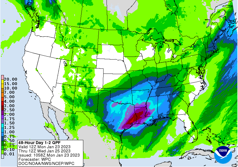
There is a lot of moisture available for this storm, so regardless of whether
we see lots of snow or just a really really cold rain--or a mix--this will be
very beneficial moisture for most of the state, save for the Panhandle and far
northern OK.
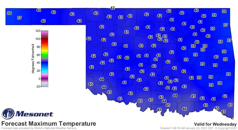
Whatever falls, it won't last long as temperatures are forecast to zoom back up
the thermometer the following day.
So this is what we've been waiting for since the first half of December...a big
storm system sitting out to our west and spinning our way, cranking up the winds
from the south and bringing good moisture back from the Gulf. Doesn't really
matter how it falls at this point, or in what form.
Except it really does to most of us, now doesn't it?
COME ON SNOW!
Gary McManus
State Climatologist
Oklahoma Mesonet
Oklahoma Climatological Survey
gmcmanus@mesonet.org
January 23 in Mesonet History
| Record | Value | Station | Year |
|---|---|---|---|
| Maximum Temperature | 78°F | WEBB | 2002 |
| Minimum Temperature | -3°F | HOOK | 2014 |
| Maximum Rainfall | 1.90″ | STIG | 2002 |
Mesonet records begin in 1994.
Search by Date
If you're a bit off, don't worry, because just like horseshoes, “almost” counts on the Ticker website!