Ticker for January 3, 2023
MESONET TICKER ... MESONET TICKER ... MESONET TICKER ... MESONET TICKER ...
January 3, 2023 January 3, 2023 January 3, 2023 January 3, 2023
Winterus Interruptus
Wow, here it is 2023 already, and I'm still writing 2022 on all my imaginary
checks! And wouldn't you know it, the second day of the new year and we have
another Oklahoma Mesonet site flirting with a disaster of the mesocyclone
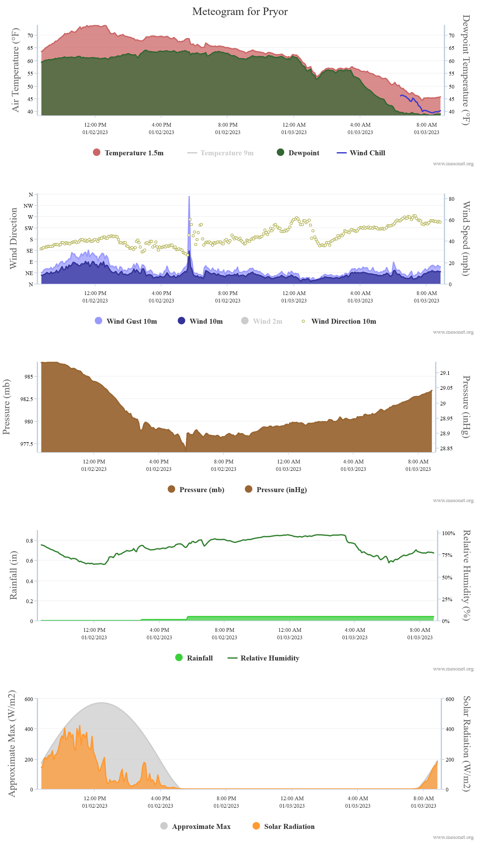
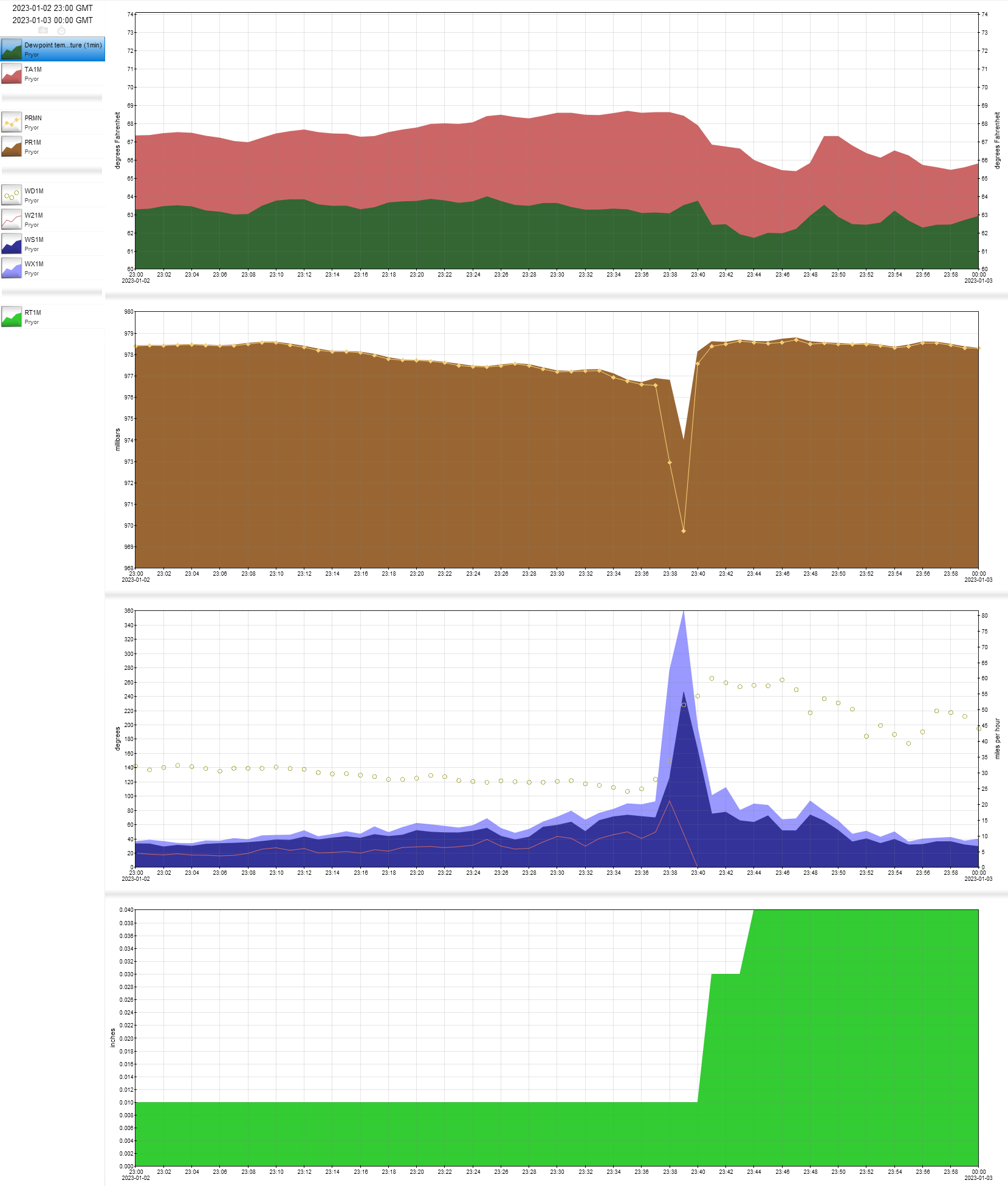
variety? You can see here at 5:40pm our Pryor Mesonet site had a wind gust of
81.2 mph, and we had a corresponding rapid drop in pressure that you'd expect
with a tornadic circulation. AND we lost our 2-meter wind sensor, so we're not
exactly sure what happened...a brief touchdown (no, not 6 points...a BAD
touchdown), straight-line winds, cow toots? Are Mesonet sites the new trailer
parks?

Definitely warrants further inspection, so we'll await word from the NWS
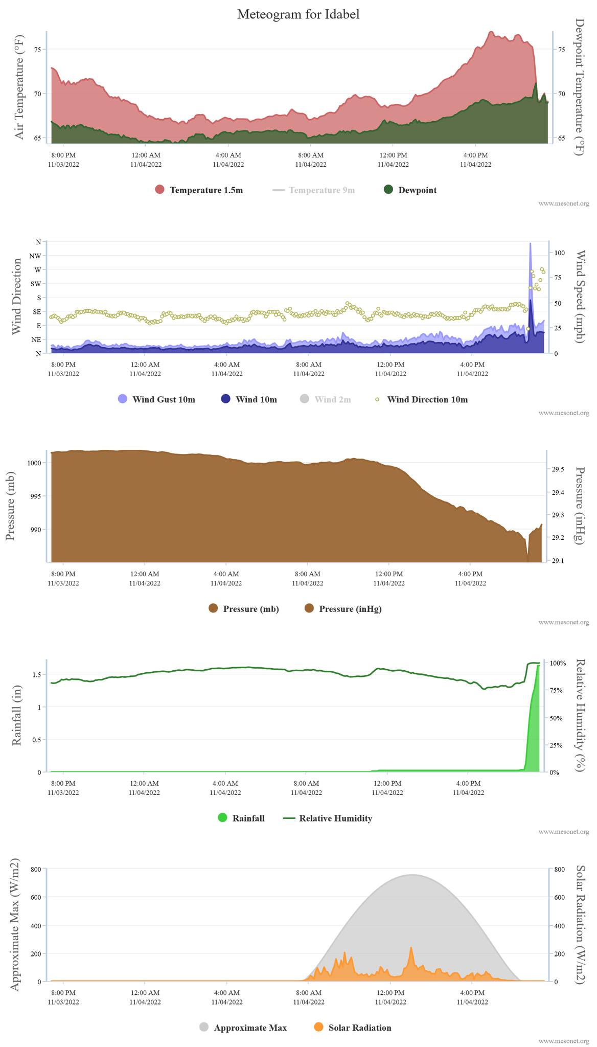
Tulsa office if they go out and survey the area. Remember, it was just about
2 months ago that Idabel became the fifth Mesonet site directly impacted by a
tornado, joining El Reno (5/24/2011), Tipton (11/7/2011), Fort Cobb
(11/7/2011), and Inola (8/9/2018).
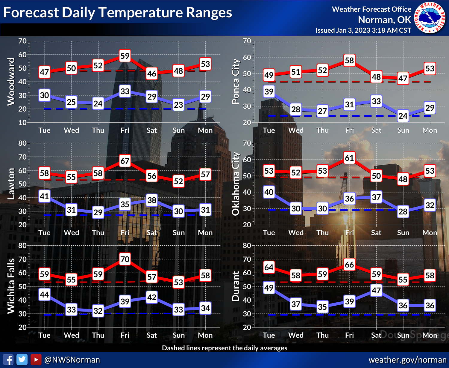
As we look forward, actually a fairly tranquil period of weather in store for
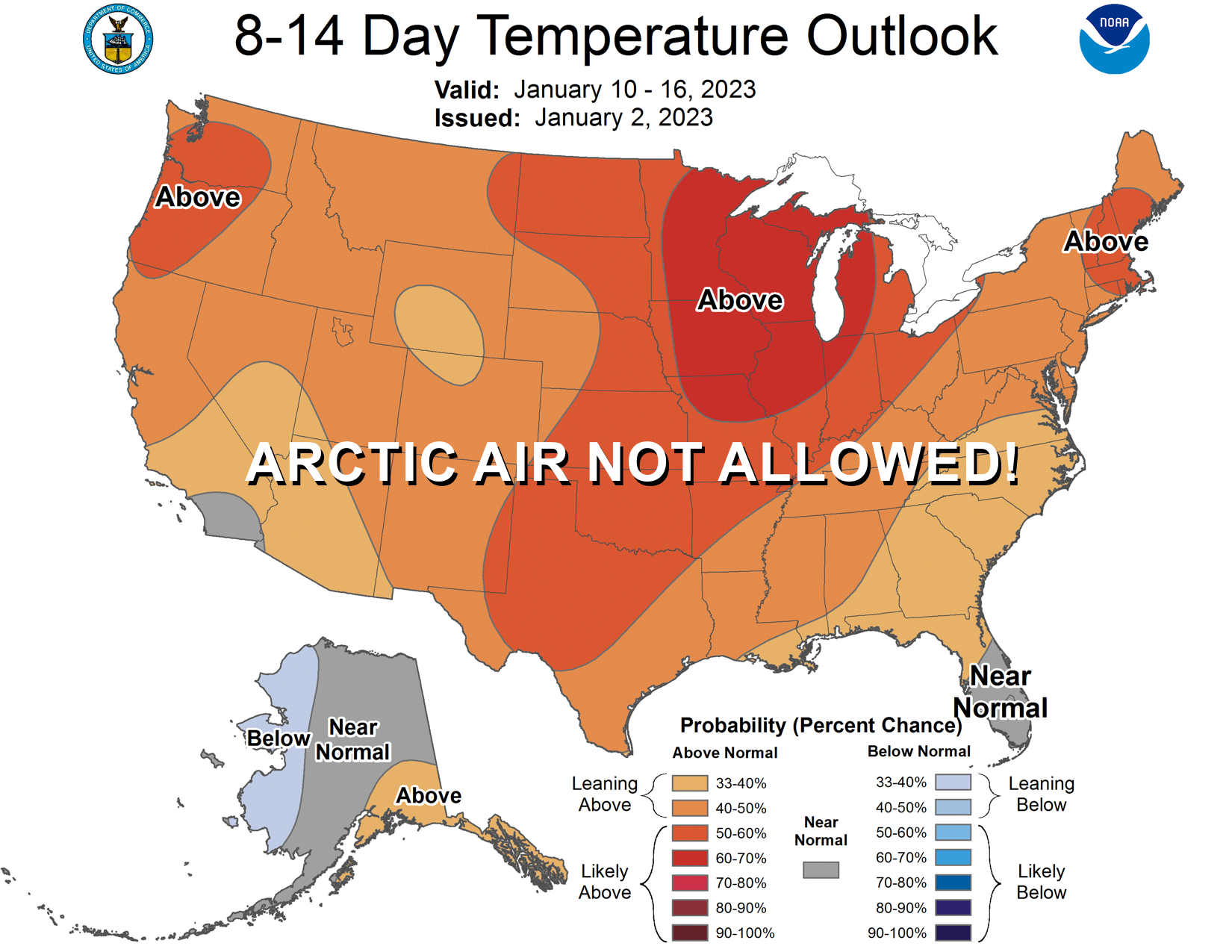
the state. No arctic air is showing up, nor any big storm systems just yet.
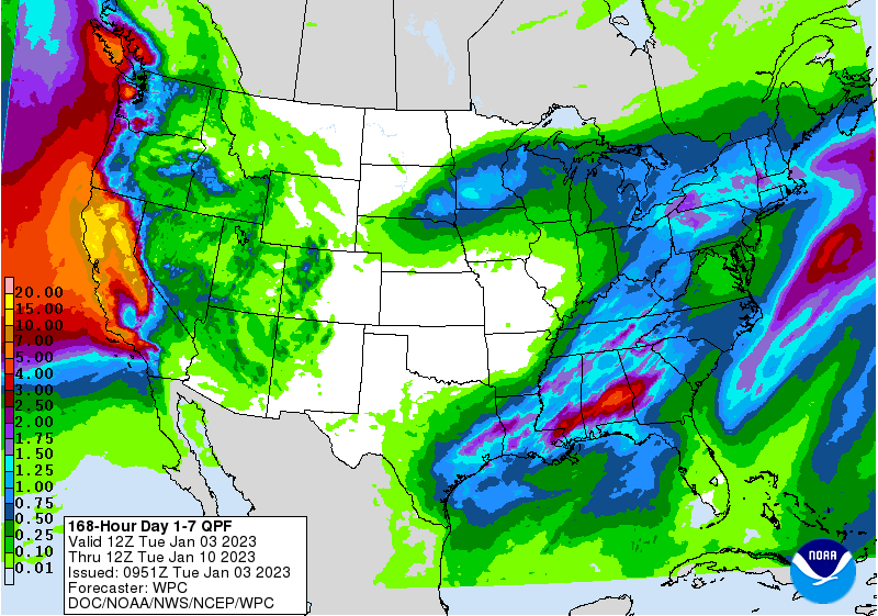
All the action is out across California, where those atmospheric rivers continue
to inundate the Sierras and northern California.
Well, time to recap December 2022 (below) and move onto 2022.
I MEAN 2023! Now where's that checkbook...
----------------------------------------------------------------------------------
December Caps 2022 Rain Record
Jan. 3, 2023
December provided a fitting end to Oklahoma’s tumultuous 2022 weather story. This
final chapter came complete with a half-dozen tornadoes, the coldest December day
in 32 years, and the finishing touches on an all-time Oklahoma rainfall record.
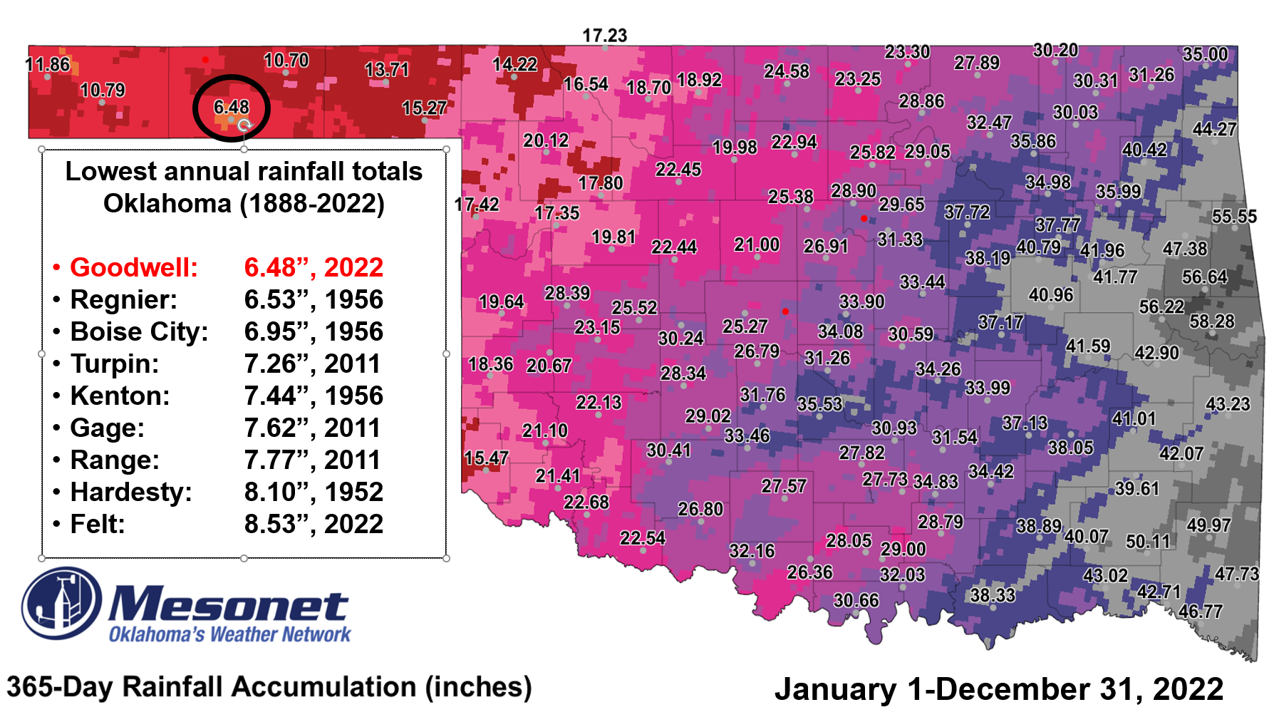
The Oklahoma Mesonet site at Goodwell finished 2022 with 6.48 inches of rain,
breaking the previous all-time lowest annual rainfall record for any location
in Oklahoma of 6.53 inches from Regnier in 1956. Those data go back to the late
1880s. The site recorded a hundredth of an inch during December, a paltry
amount that helped solidify its claim on the dubious honor. While December
finished just a tad above normal temperature-wise statewide, that parameter’s
big story was the mid-month blast of frigid air that originated within the
Arctic Circle in Siberia. The classic Blue Norther barreled down the lee of the
Rockies and plunged all the way to the Gulf of Mexico, dropping temperatures
below zero in Oklahoma and producing widespread wind chills in the minus teens
and twenties. Dec. 23 was the coldest of the 3-4 day frosty visit with a
statewide average temperature of 10.8 degrees, the lowest of any December day
since 1990’s Dec. 22 value of 6.5 degrees. December also saw at least six
tornadoes touch down during the month, including two EF2 rated twisters in
central Oklahoma. One EF2 tornado touched down near Wayne and damaged trees,
power lines, and structures within the town. The other EF2 tornado struck a
home north of Cox City causing significant damage to the structure. The
additional December tornadoes bring Oklahoma’s preliminary 2022 total to 57,
closely matching the 1950-2021 annual average of 57.2.
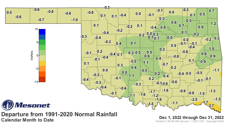
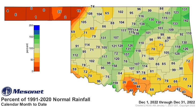
The statewide average precipitation total for the month was 1.85 inches, 0.26
inches below normal and ranked as the 47th wettest December since records began
in 1895. Sallisaw had the highest total with 4.52 inches for the month, while
Eva and Hooker brought up the rear with no measurable precipitation. Four other
Panhandle locations also received less than a tenth of an inch. The 2022
statewide average finished at 29.42 inches, 6.94 inches below normal and ranked
as the 31st driest year since records began in 1895. The Panhandle was
particularly dry during 2022 at 7.57 inches below normal, their fourth driest
year on record. Localized annual deficits ranged from 6-12 inches over most of
the state. The only surpluses occurred in far east central Oklahoma where heavy
rains led to amounts 6-10 inches above normal for the year. The Mesonet site at
Sallisaw led the state for 2022 with 58.28 inches of rain.



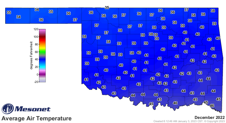
The statewide average temperature was 40.2 degrees, 0.1 degrees above normal
and ranked as the 57th warmest December since records began in 1895.
Temperatures ranged from 83 degrees at Tipton on Dec. 5 to minus 7 degrees at
Talala and Vinita on Dec. 22, and again at Foraker and Vinita on Dec. 23. Wind
chill values plummeted during the late-month arctic blast, dropping to a
2022-low of minus 33.2 degrees at Hooker on Dec. 22. That was one of 292 wind
chill values that fell below zero during the month at the Mesonet’s 120 sites,
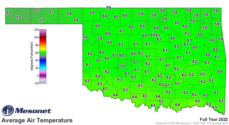
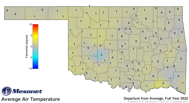
and one of 21 below minus 25 degrees. The year finished with a statewide
average of 61.1 degrees, 0.7 degrees above normal and ranked as the 19th
warmest on record. The highest temperature of 2022 was 115 degrees at Mangum
back on July 19, and the lowest was -12 degrees at Kenton on Feb. 4. The
highest heat index of 120 degrees occurred at Webbers Falls on June 12.

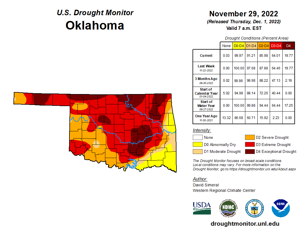
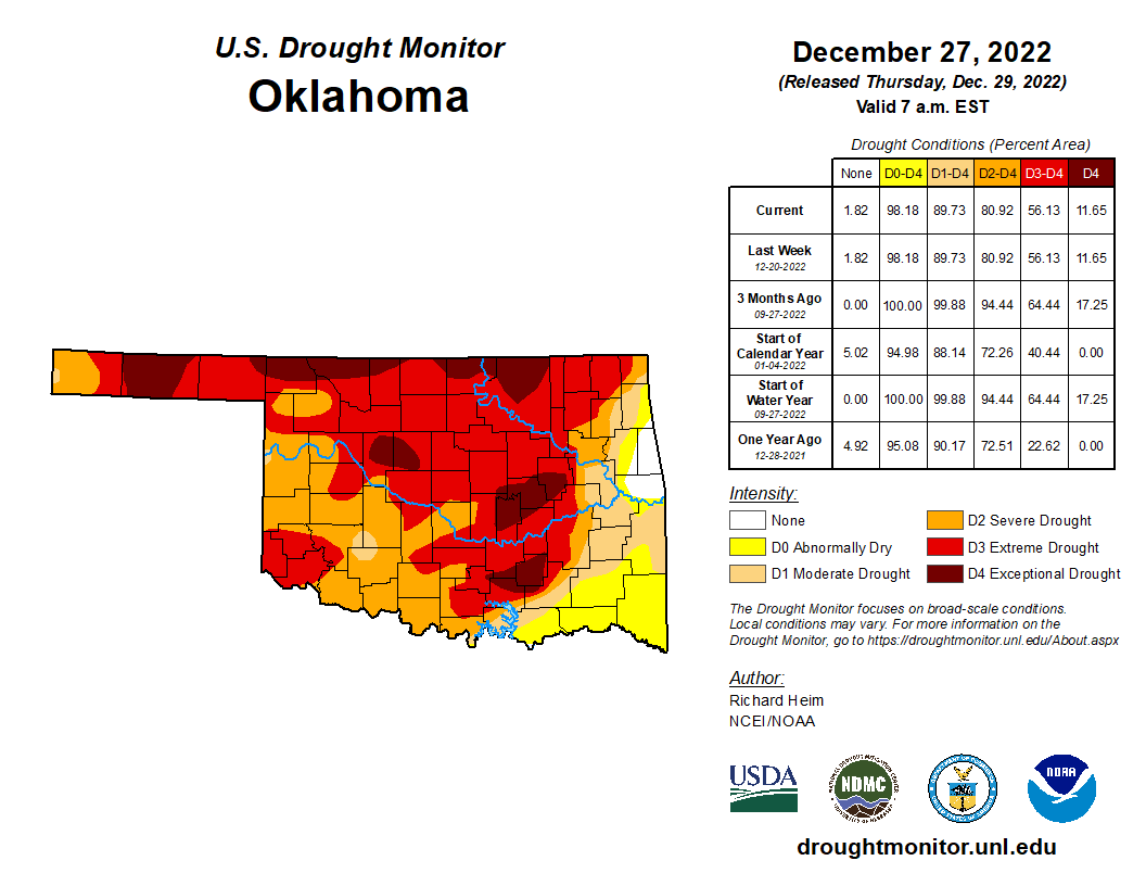
The drought’s coverage decreased only slightly during December—from 91.2% to
89.7%—according to the U.S. Drought Monitor, but its intensity had more robust
improvements. Extreme and exceptional drought fell from 64% at the end of
November to 56% at the end of December. Those two categories covered only 22%
of the state at that same time in 2021, and peaked at 86% in October 2022. The
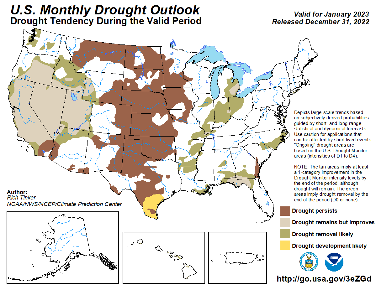
Climate Prediction Center’s January 2023 drought outlook indicates drought is
expected to persist through the month, but no new development is expected.
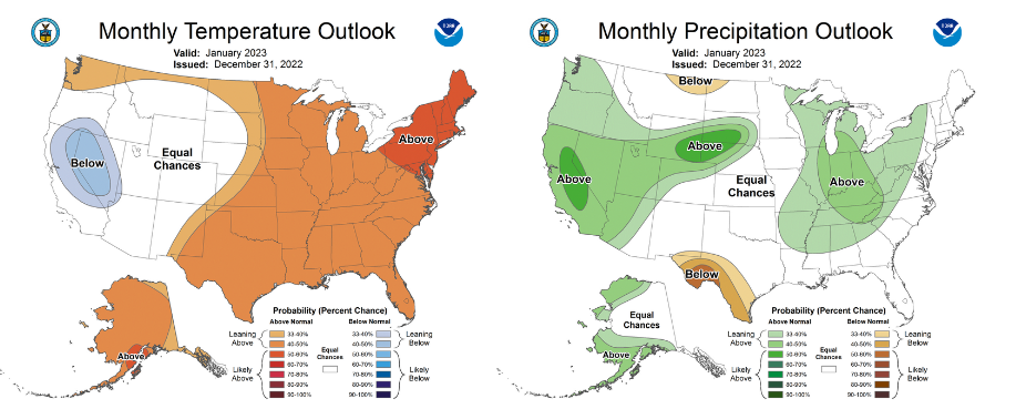
CPC’s January 2023 temperature outlook shows increased odds for above normal
temperatures across the entire state, but equal chances for above-, below- and
near-normal precipitation.
###
Gary McManus
State Climatologist
Oklahoma Mesonet
Oklahoma Climatological Survey
gmcmanus@mesonet.org
January 3 in Mesonet History
| Record | Value | Station | Year |
|---|---|---|---|
| Maximum Temperature | 87°F | ALTU | 2006 |
| Minimum Temperature | -8°F | KENT | 2002 |
| Maximum Rainfall | 3.32″ | CENT | 2005 |
Mesonet records begin in 1994.
Search by Date
If you're a bit off, don't worry, because just like horseshoes, “almost” counts on the Ticker website!