Ticker for January 2, 2023
MESONET TICKER ... MESONET TICKER ... MESONET TICKER ... MESONET TICKER ...
January 2, 2023 January 2, 2023 January 2, 2023 January 2, 2023
Extremities
I'M BACK! Yes, I was very busy over the break. While you clodhoppers were busy
trying to board Southwest Air jets and squabbling over how many Chili's gift
cards you got for Christmas, I was making history.
You know how much wood a woodchuck could chuck if a woodchuck could chuck wood?
Well, I chucked one more than that.
(spits)
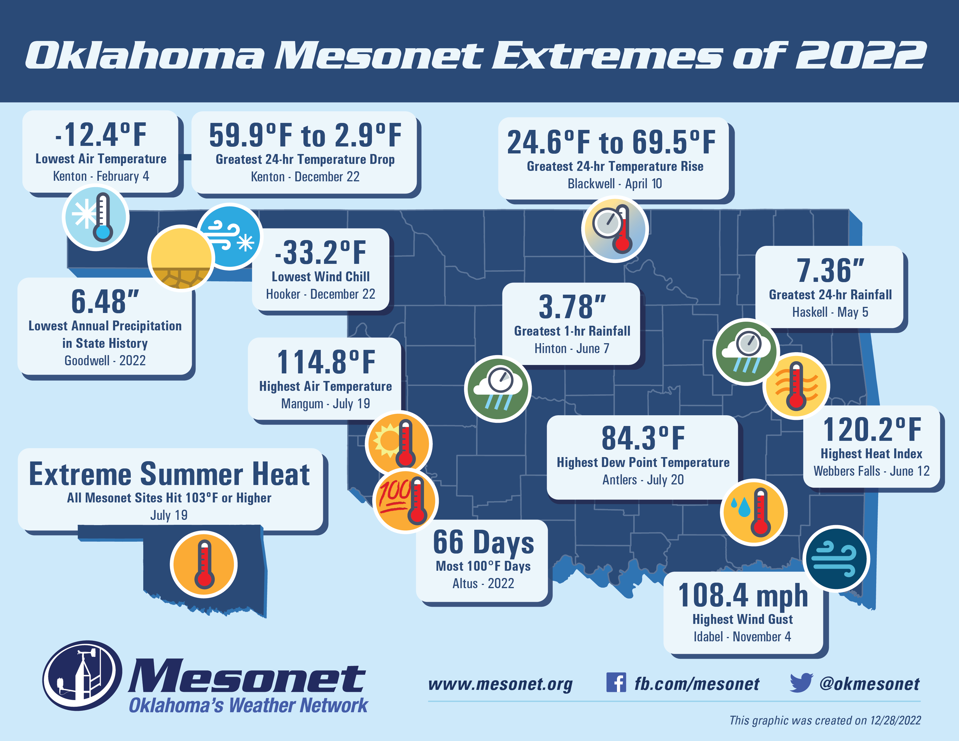
Anyways, here we are with the Mesonet's 2022 Extremely Extreme Extremes. It was
another banner year in the Bender household, AND Oklahoma's weather (no, I didn't
need a comma there but that's just the first grammatical monstrosity of the year
for me). As I've said before, our extremely extreme extremes would be normal if
not for some extremely extreme happenings each year, and this year's biggie which
make our extremely extreme extremes extremely extreme is that 6.48 inches of
precipitation measured by Goodwell. Much to their chagrin AND chagroan (I told you
there'd be more!), that becomes the lowest rainfall total in state history, and
we're talking back to the 1880s. Preliminarily speaking, of course.
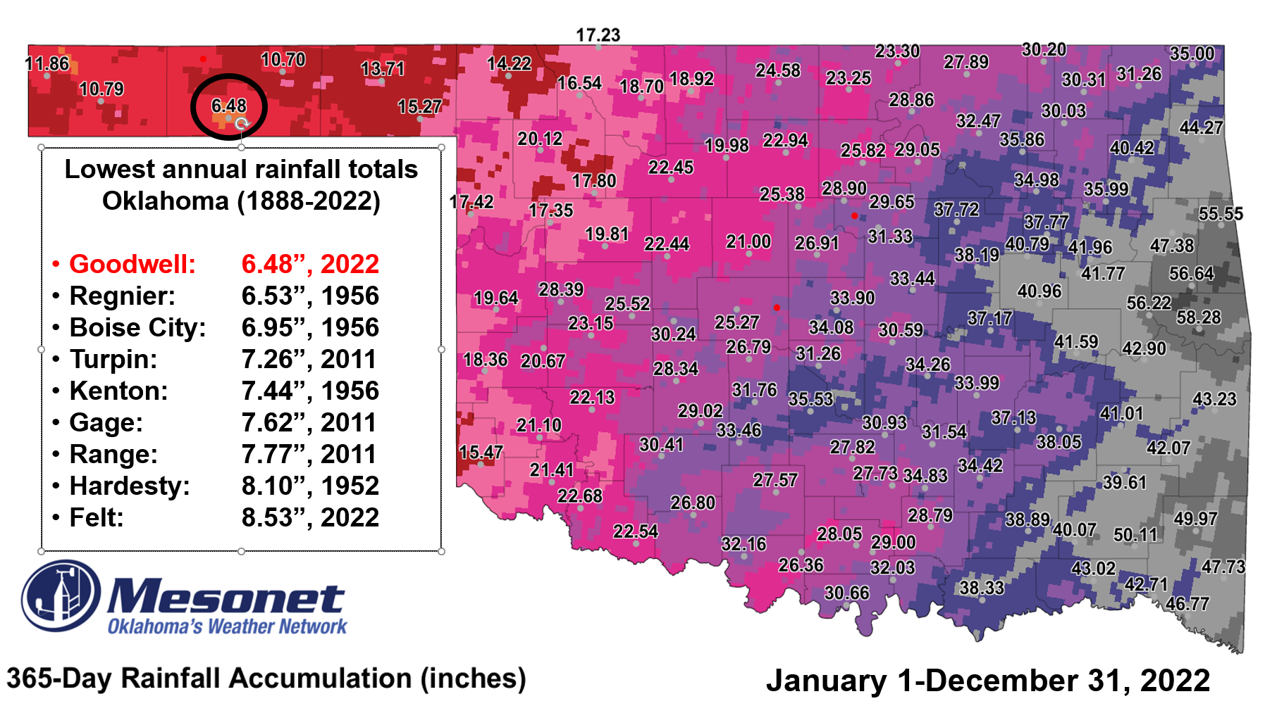
As you can see there, that tops Regnier, a NWS COOPerative observing site, which
had 6.53 inches of rainfall back in the lovely drought year of 1956. You go
back through out history and you see those other low totals, all within some
of the most horrible drought periods on record for the state. If things all check
out with this total (i.e., make it through all final Quality Assurance checks,
no missing precip events are found, etc.), we will ask to convene the State
Climate Extremes Committee to certify this as an all-time record for low annual
precipitation for the state of Oklahoma. You can read about that committee's
works here:
https://www.ncei.noaa.gov/access/monitoring/scec/
Let me repeat that...AN ALL-TIME RECORD FOR LOW ANNUAL PRECIPITATION FOR THE
STATE OF OKLAHOMA!
Goodwell had a long time to avoid this. We first alerted folks about this possible
record way back on Dec. 8 when they had 6.47 inches of rain for the year up
to that point, and they managed another measly hundredth of an inch after that.
About a sixth of their annual total fell in one day on July 29 when they
received a whopping 1.14 inches of rain.
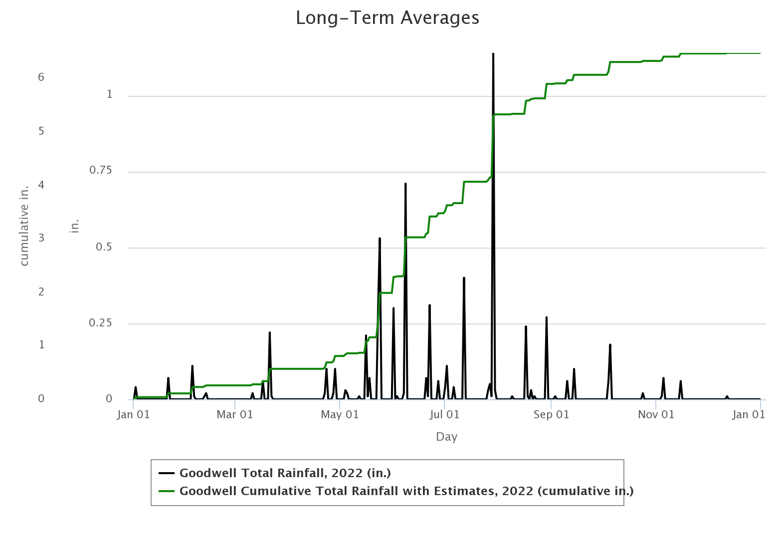
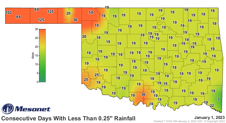
Heck, it's been 88 days since they've even seen a tenth of an inch in a single
day, and 125 for a quarter-inch.
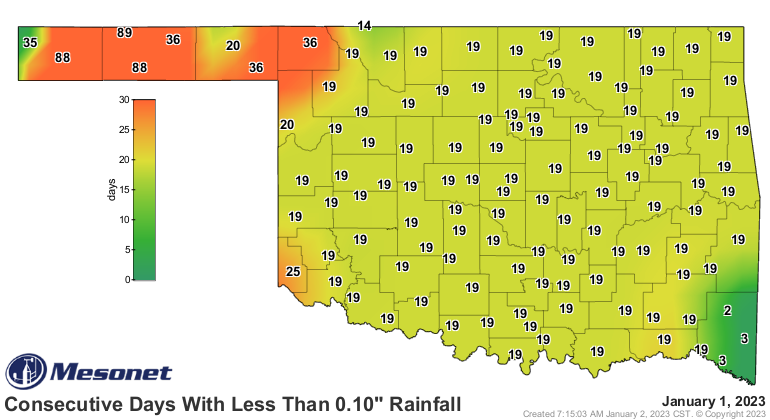
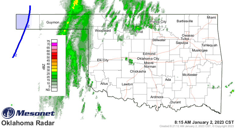
Heck, it's raining right now out there and it missed them completely, for crying
out loud!
We've had some other totals come close, like Hooker's 6.2 inch total back in
2011. That was found to be a bit iffy due to our rain gauges under-catching
a bit of snowfall in a blizzard situation. We've always talked about that total
from then at Hooker as "one of the lowest in state history," but sadly could not
put it forth as as THE lowest to the Extremes Committee.
--------------------------------------------------------------------------------
Now for those other extremely extreme extremes, there are some good (or bad)
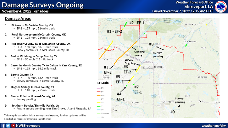
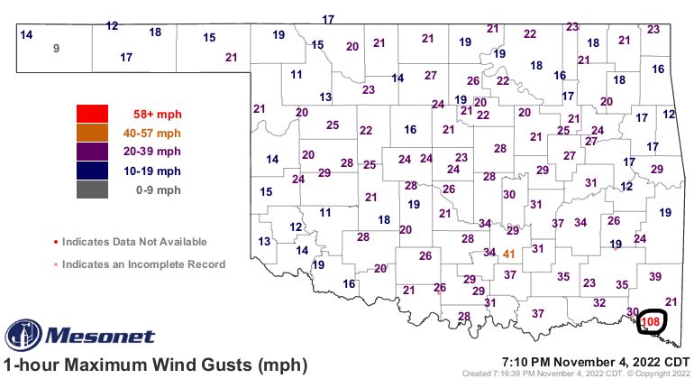
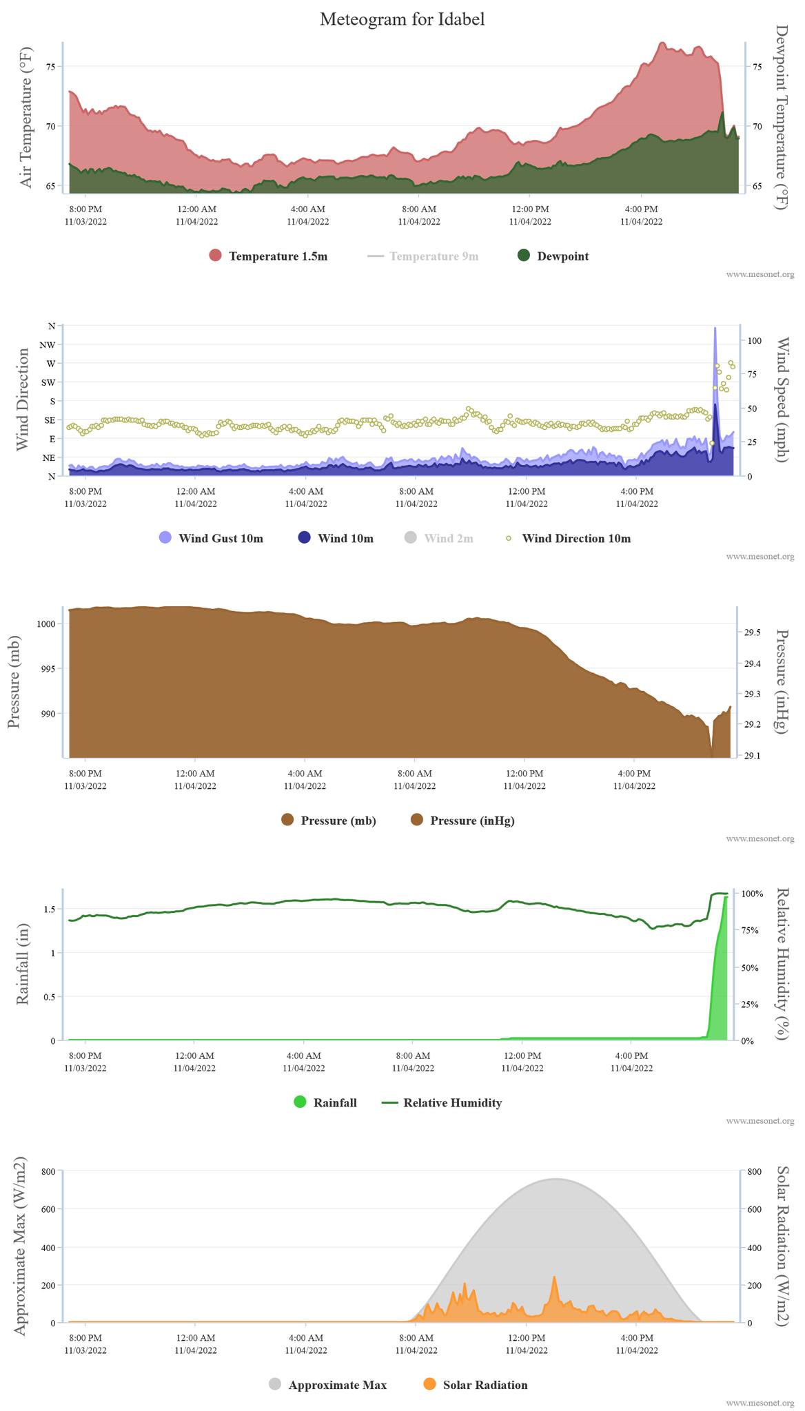
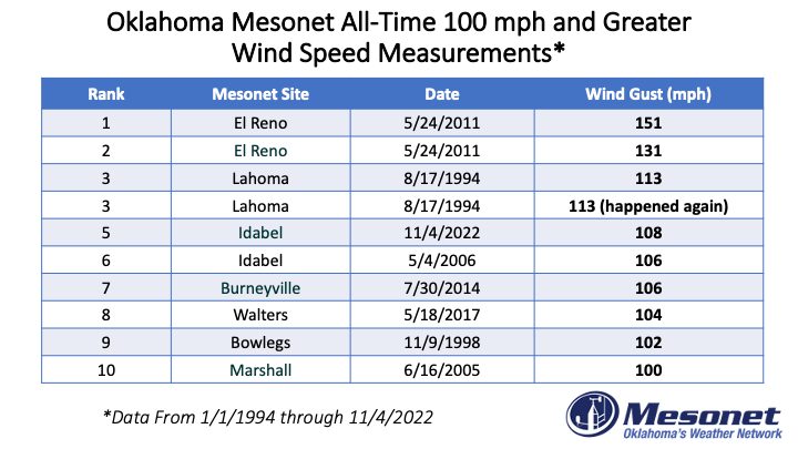
ones on there, like the 108.4 mph wind gust from Nov. 4 at Idabel. That was
associated with the EF4 monster twister than ravaged Idabel and clipped our
Mesonet site.
-------------------------------------------------------------------------------
We also see another all-time Mesonet biggie off to the lower-left (and we all
know just how painful that can be), the Extreme Summer Heat representing the
day all our Mesonet sites hit 103 degrees or higher, first time in Mesonet
history (for temperatures, 1997-present).
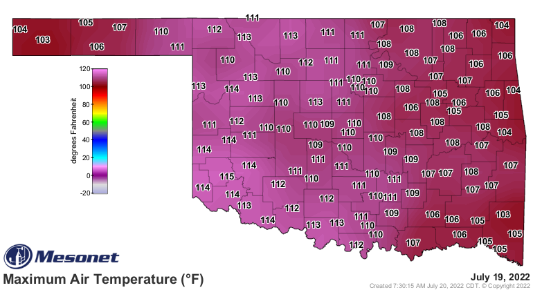
We'll just tie in the 114.8 degrees from that day on the the extremes map at
Mangum as well, which tied for the highest temperature ever recorded by the
Mesonet, at least rounded to whole numbers of 115. Buffalo holds the actual
lead at 115.2 degrees from July 9, 2009. We have a lot more from July 19 on
this Ticker.
https://ticker.mesonet.org/select.php?mo=07&da=20&yr=2022
-------------------------------------------------------------------------------
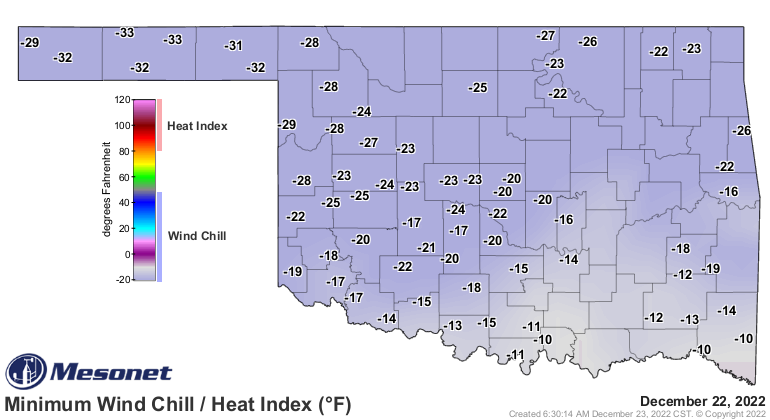
Going in the opposite direction (towards well-written...I HEARD THAT!), we have
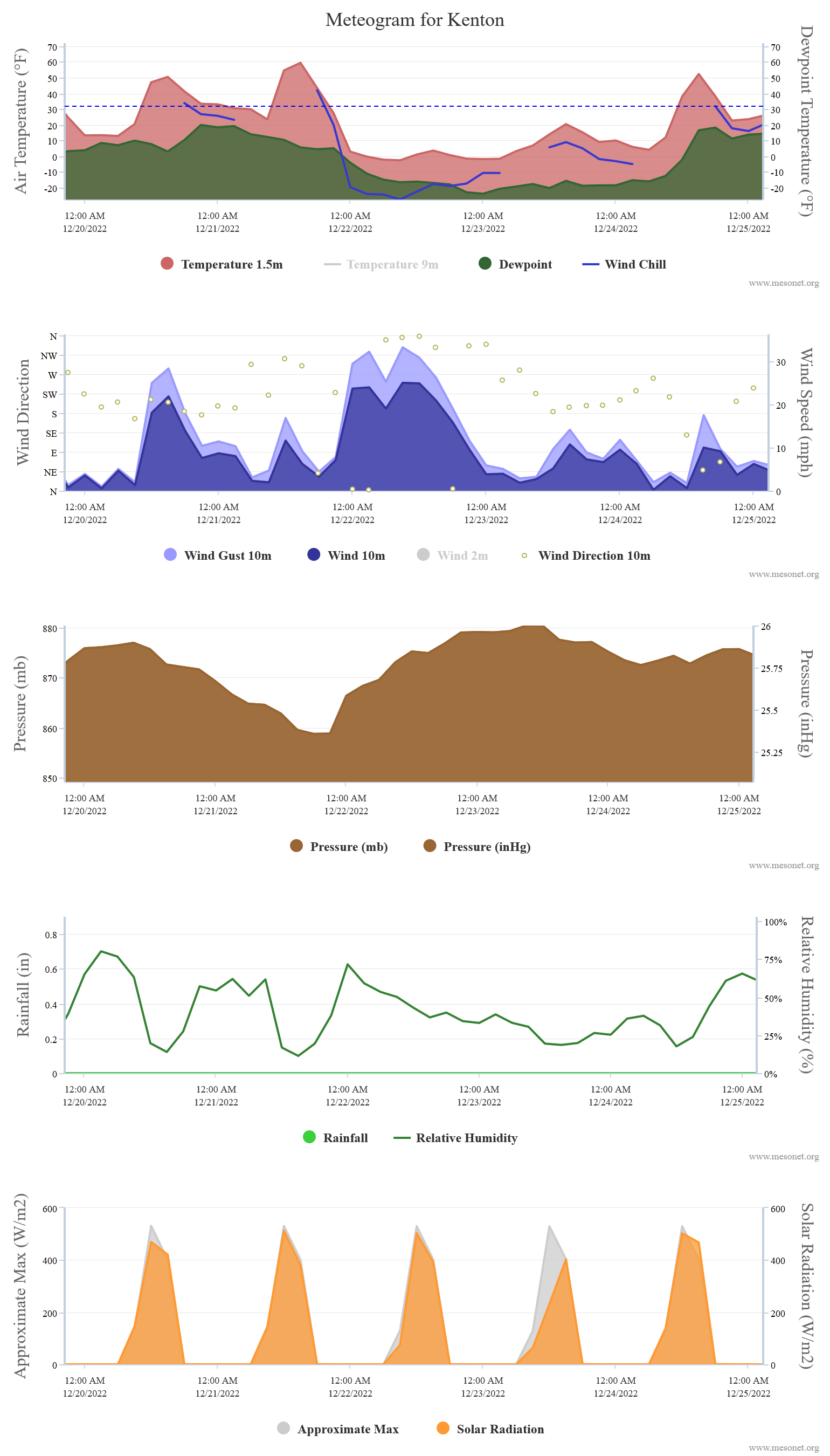
the -33.2 degrees wind chill from just a couple of weeks ago on Dec. 22. The
previous extreme was -27.2 degrees from Hooker on Feb. 4, but that blast of
Siberian air from the arctic circle region late in the year erased that one.
Luckily, the -12.4 degrees lowest air temperature of 2022 managed to hold from
that day back in February at Kenton. We hit -7 four times in December's cold
blast, so not even close really, but more wind obviously. December's blast
(which should always be a Sonic Oreo Blast, amirite?) also gave us our greatest
24-hour temperature drop of 59.9 to 2.9 degrees at Kenton when that front
smashed through.
-------------------------------------------------------------------------------
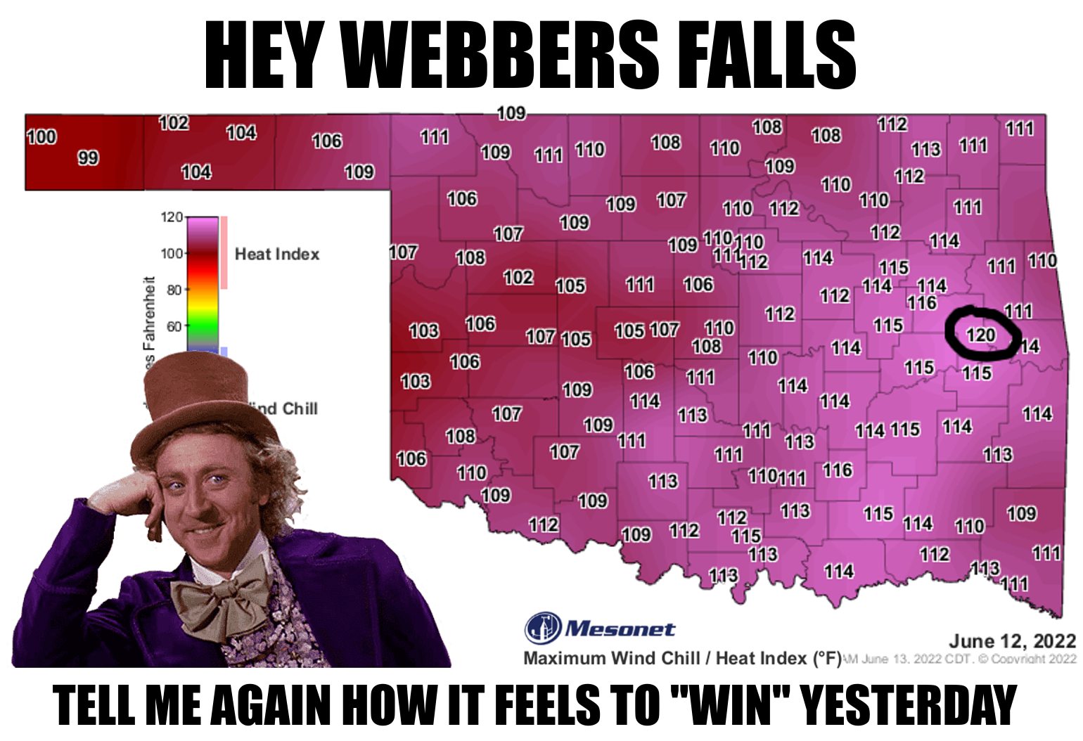
Then we have the just plain nasty ones, like the 84.3 degrees dewpoint at
Antlers from July 20, and the 120.2 heat index from Webbers Falls on
June 12.
And then there's the 66 days of 100 degrees at Altus from 2022, the highest
amount we've seen in the state since 2011 (Grandfield had 101 that year for the
all-time record in state history), in what was the hottest summer since 2011.

-------------------------------------------------------------------------------
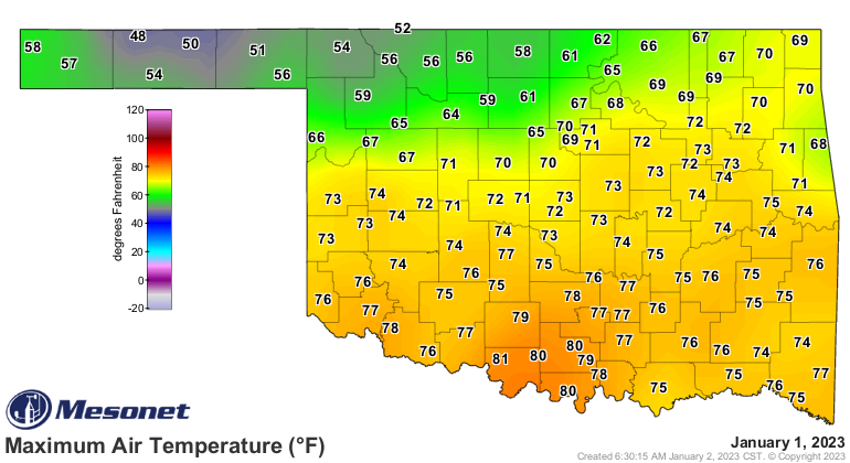
Our current weather? Well, yesterday's highs were extremely nice, at least in
the southern two-thirds of the state.
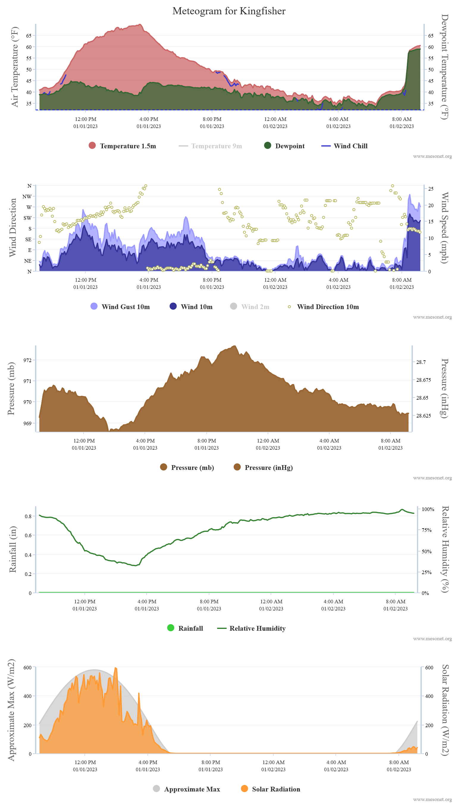
A warm front has brought a surge of moisture (and warmth...it's in the front's
name, for crying out loud!) into the state, setting us up for the possibility of
severe storms later today as we see yet another cold front fire through the
state tonight. Kingfisher's temperatures went up 25 degrees over the last 3
hours!
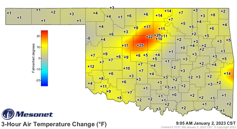
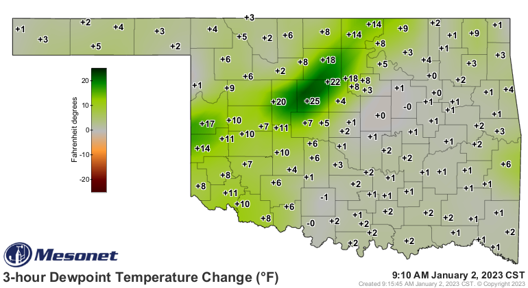
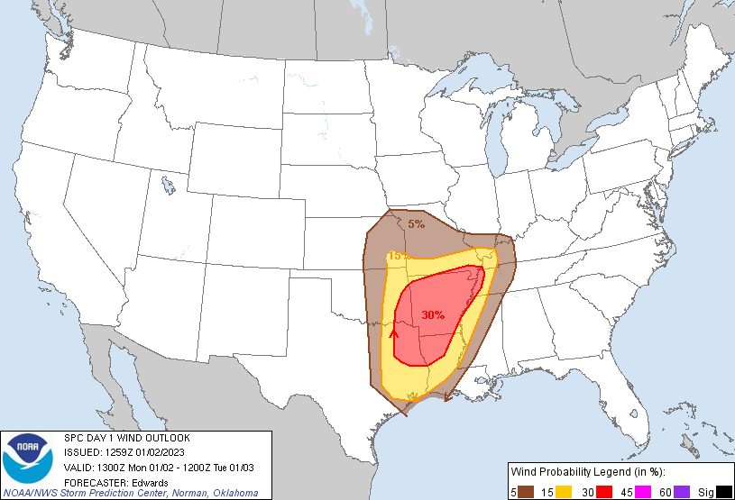
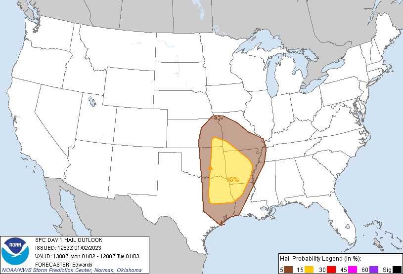
So we have the risk for some pretty hefty storms tonight, especially to the east
of I-35. And the possibility of strong tornadoes is there across SE OK.
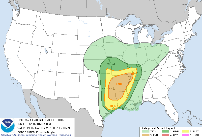
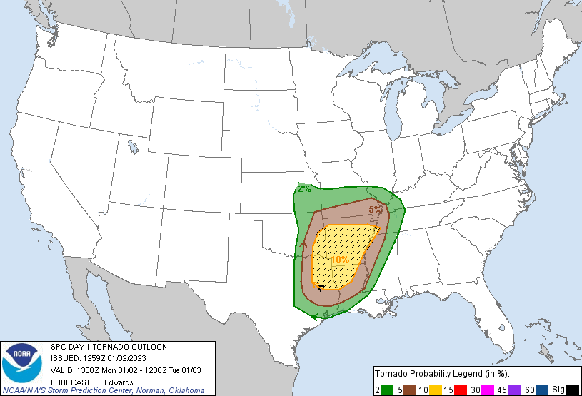
Another day to be weather aware, as are a lot of days in Oklahoma. After all,
you never know when the next extremely extreme extreme will show up. Or where.
Gary McManus
State Climatologist
Oklahoma Mesonet
Oklahoma Climatological Survey
gmcmanus@mesonet.org
January 2 in Mesonet History
| Record | Value | Station | Year |
|---|---|---|---|
| Maximum Temperature | 80°F | BURN | 2004 |
| Minimum Temperature | -10°F | KENT | 2013 |
| Maximum Rainfall | 2.55 inches | CLOU | 2005 |
Mesonet records begin in 1994.
Search by Date
If you're a bit off, don't worry, because just like horseshoes, “almost” counts on the Ticker website!