Ticker for January 4, 2023
MESONET TICKER ... MESONET TICKER ... MESONET TICKER ... MESONET TICKER ...
January 4, 2023 January 4, 2023 January 4, 2023 January 4, 2023
Drying out
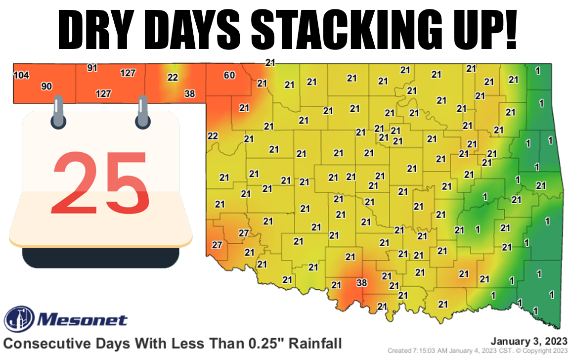
Don't look now (which is usually what I tell myself in front of a mirror), but
Oklahoma is starting to dry out just a bit. Not only has it been two or three
weeks since we've seen a good quarter-inch of precip in a single day, it's been
about that long for a tenth of an inch, too.

Of course, folks out in the panhandle are asking you what you're whining about,
with their numbers starting to pile up into the 120s. And things aren't exactly
looking great over the next week or so, either, with very little chance of any
significant precipitation headed our way.

It's pretty odd when we see such a massive amount of rain hitting the West Coast,
California in particular.
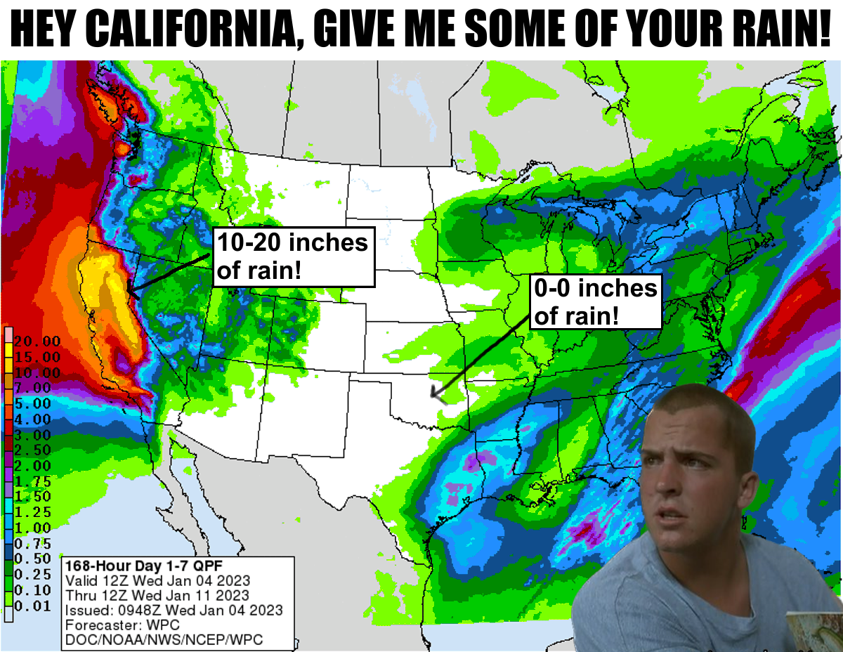
The "atmospheric river," as it's known in meteorological circles (which oddly
enough is full of squares, especially considering your author!) is pumping
tremendous amounts of moisture into that region, quenching drought, which is
helpful, but also causing massive flooding and dangerous mudslides...not so
helpful. There have actually been several of these atmospheric rivers with
extremely strong surface low pressure systems hitting the West Coast, and
these systems intensify rapidly enough to be considered "bomb cyclones."
Bomb cyclones...atmospheric rivers...it doesn't sound too fun to me. Check out
their close-up forecast from one model run for the next 7 days.
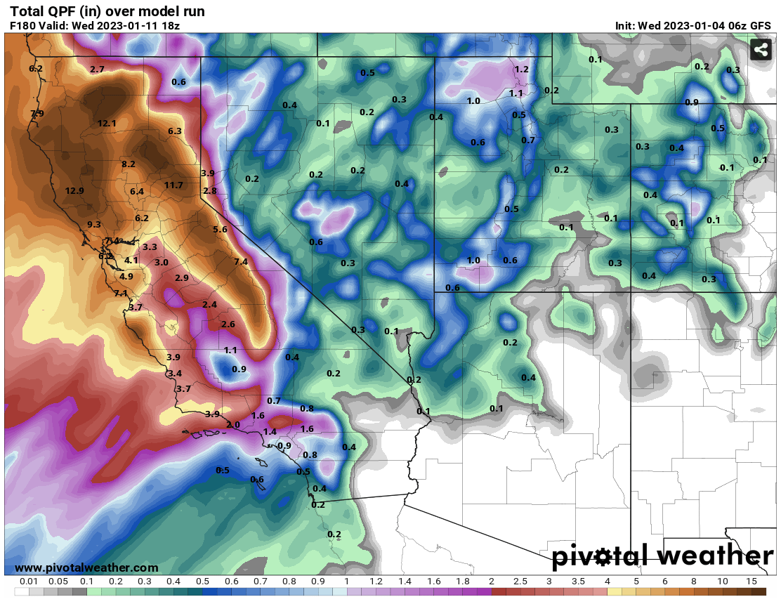
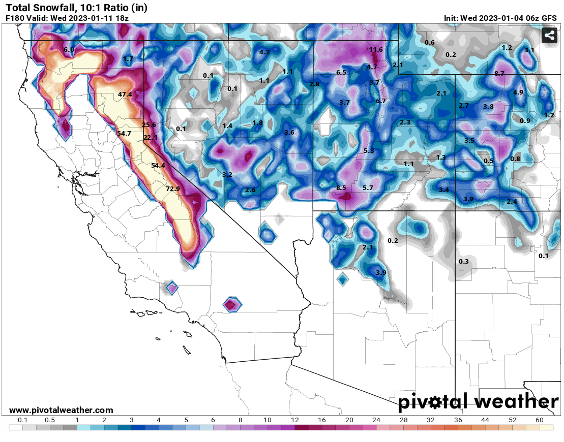
With these bomb cyclones and atmospheric rivers expected to continue over at
least the next 7-10 days, throw this out to the limit of the model and the 16-day
forecast totals would normally be in the fantasy-cast territory, but maybe
closer to reality!
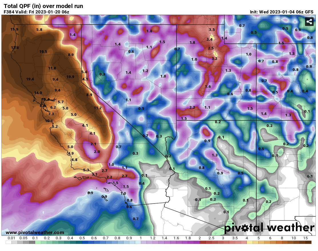
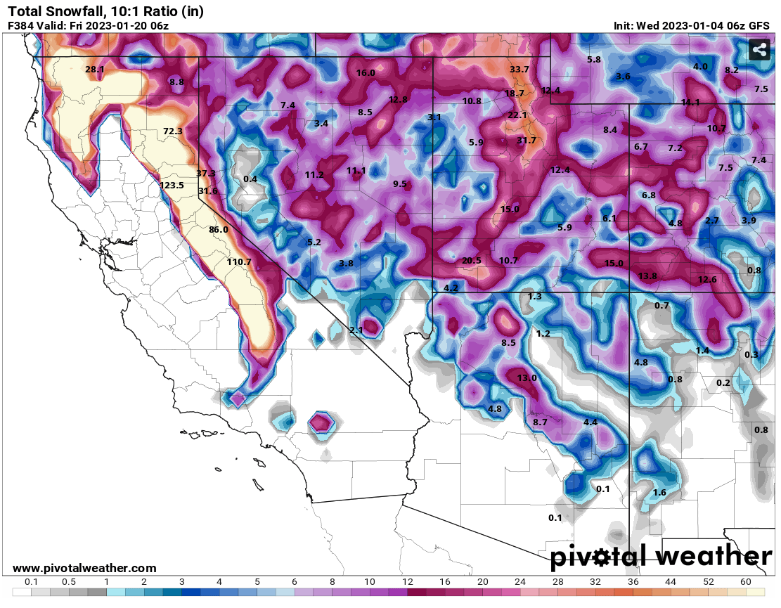
Wow! WOW! Unfortunately, very little of these storm systems make it over the
mountains, and of course we don't really get substantial precipitation from
the Pacific anyway, most of ours comes from the Gulf of Mexico. So all of
that moisture from those atmospheric rivers are squeezed out as the flow
goes up and over the mountains out that way, and the surface systems seem to
want to rotate up and into the Gulf of Alaska region. Our area continues to
be left high and dry (for the most part).
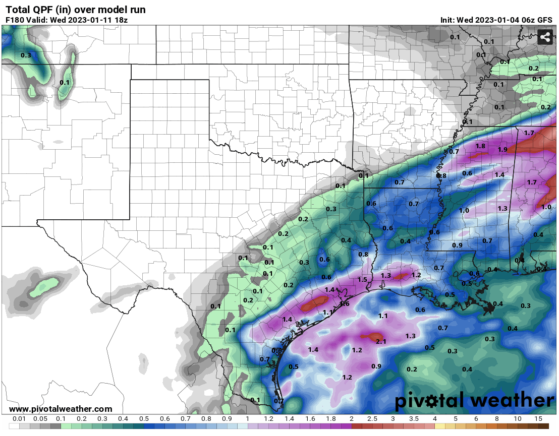
Things aren't quite as dire as they seem for some of the state. It is January,
after all, but the bad part is we are missing out on some prime recharge time
here lately with lower temperatures, less evaporation, and plants being dormant
or dead. And they are very much dire for NW OK and the Panhandle, as well as
other parts of the northern half of the state. The lakes tell the long-term
dryness part of the story.
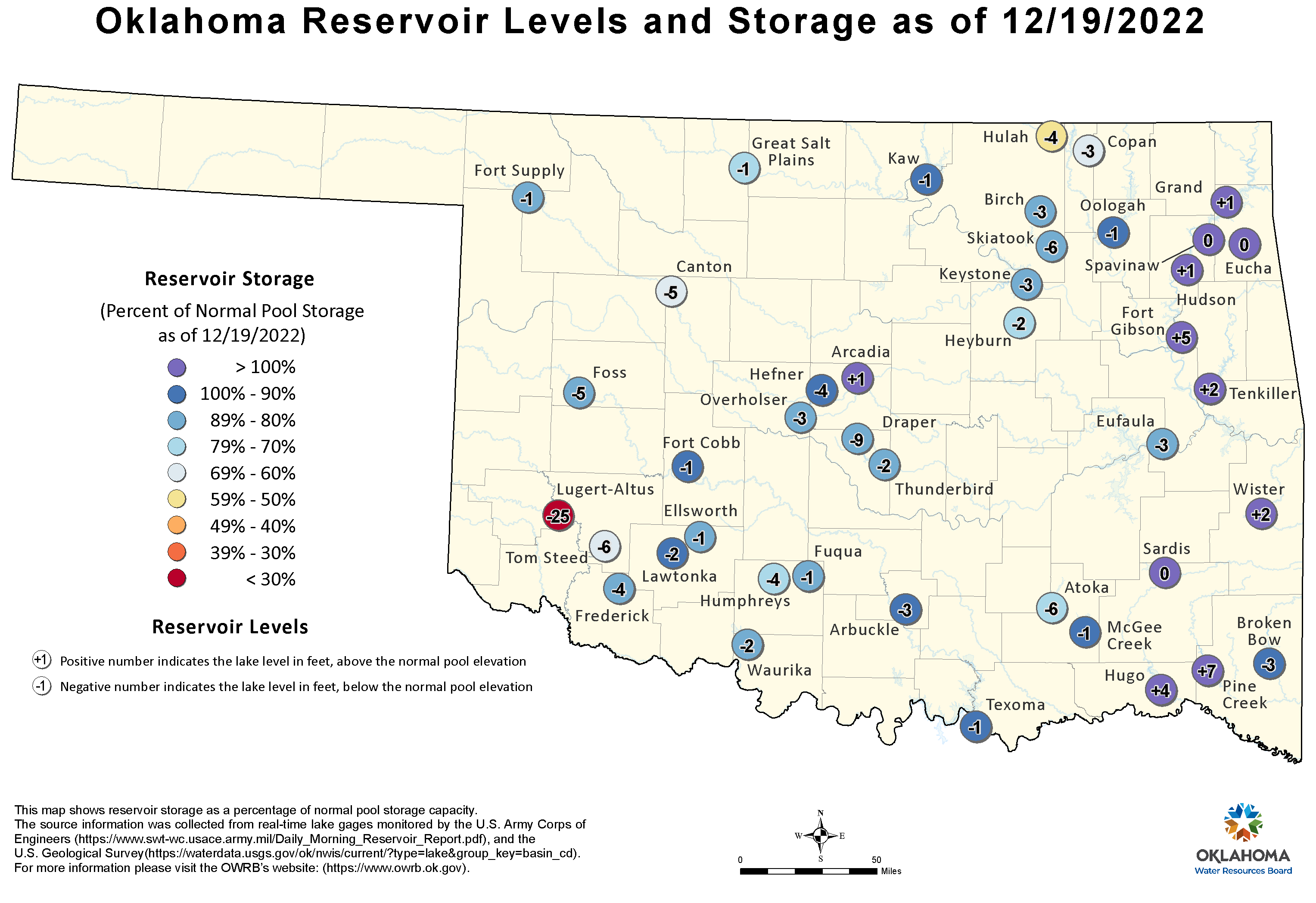
Atmospheric river? We're getting an atmospheric trickle.
Bomb cyclone? Hmmm...we're getting Cap Gun cyclones?
Gary McManus
State Climatologist
Oklahoma Mesonet
Oklahoma Climatological Survey
gmcmanus@mesonet.org
January 4 in Mesonet History
| Record | Value | Station | Year |
|---|---|---|---|
| Maximum Temperature | 72°F | HOLL | 2022 |
| Minimum Temperature | -6°F | BOIS | 2015 |
| Maximum Rainfall | 5.42″ | COOK | 1998 |
Mesonet records begin in 1994.
Search by Date
If you're a bit off, don't worry, because just like horseshoes, “almost” counts on the Ticker website!