Ticker for December 12, 2022
MESONET TICKER ... MESONET TICKER ... MESONET TICKER ... MESONET TICKER ...
December 12, 2022 December 12, 2022 December 12, 2022 December 12, 2022
Awww geeee
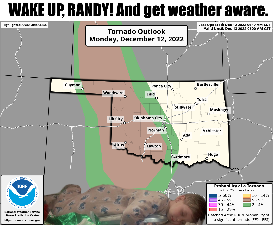
"Alright, a rotating supercell, that's mine!"
Ya see, that's NOT what you want to hear Christmas morning OR 13 days (YIKES)
before Christmas, but as Okies, we know we don't get to pick and choose when
severe weather strikes, it chooses us. And we have another cool-season setup for
severe weather coming in tonight, with a storm system approaching from the west.
That system will drag a cold front through the state that will not only help
propagate storms eastward through the state, but also bring us back down to actual
winter!
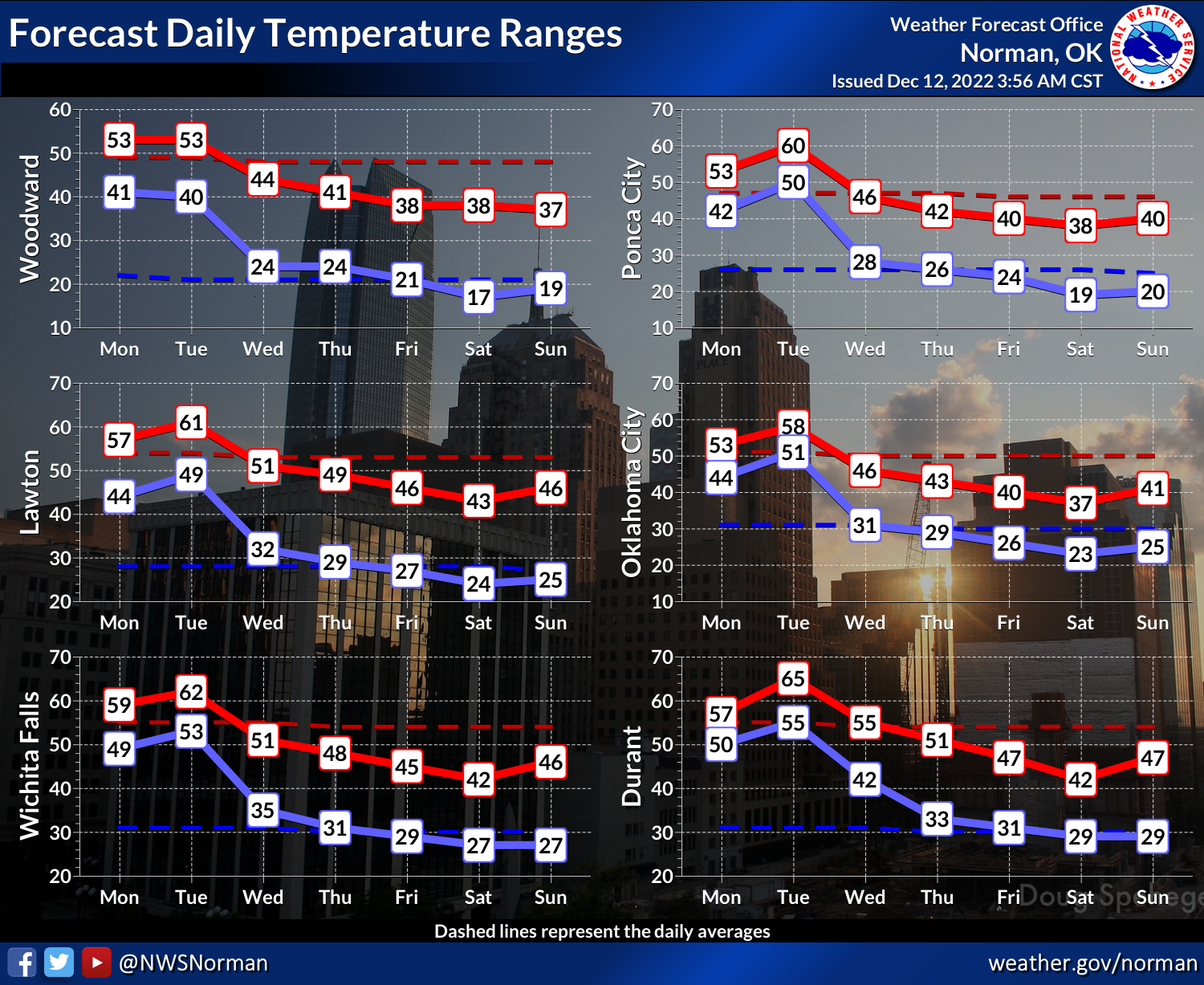
So that about covers the temperatures...not like it's bitterly cold, but below
normal temperatures nonetheless (AND nonethemore). And it does appear that cold
weather will stick around through Christmas, with some oscillation between cold
and REALLY cold occurring here and there.
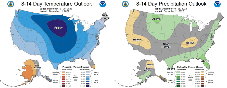
So again, on the snow watch for the next couple of weeks, should a storm system
decide to grace us with its presents (see what I did there?), there should be
cold air in place for some wintry fun. But again, that's fantasy-cast territory.
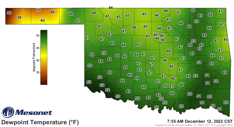
We do have some moisture in place, and while not much, it should help provide
the fuel necessary for big storms later tonight into the morning tomorrow. And
we will see more moisture returning north as the southerly winds kick up in
response to the approaching storm system.
The system should provide yet another dose of drought relief for much of the
main body of the state.
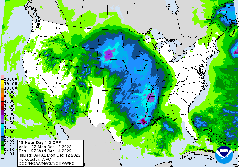
As for the severe weather threat itself, look for the possibility of a tornado
or two out across the High Plains as the storms just get going, and then the
possibility of those usually-weak/usually-brief (BUT NOT ALWAYS) embedded
tornadoes within the line that is forecast to march across the state. And as
is usually the case, all severe hazards are possible across the western half
of the state.
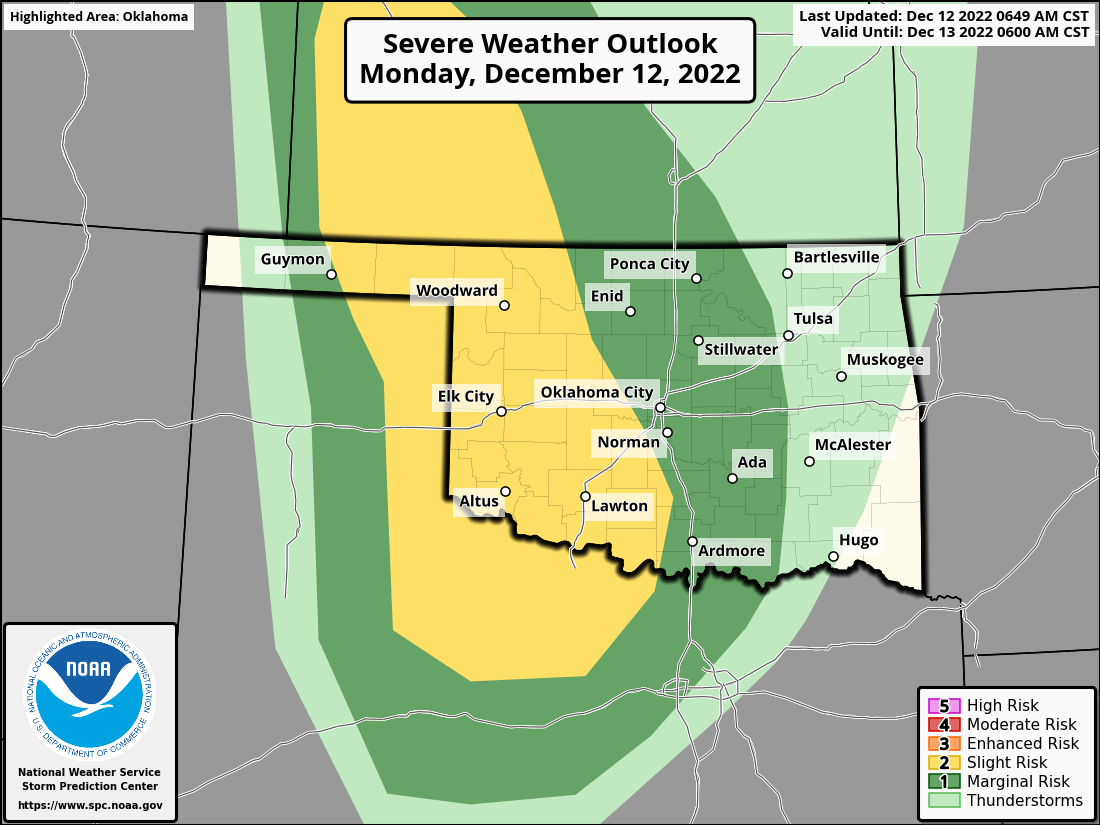

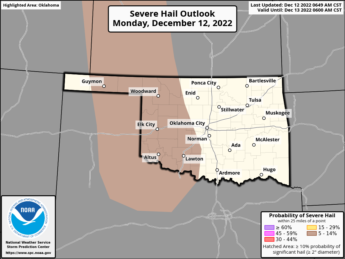
Time to get weather aware, especially across western and central Oklahoma.
Unfortunately, most of this will be in the overnight hours.
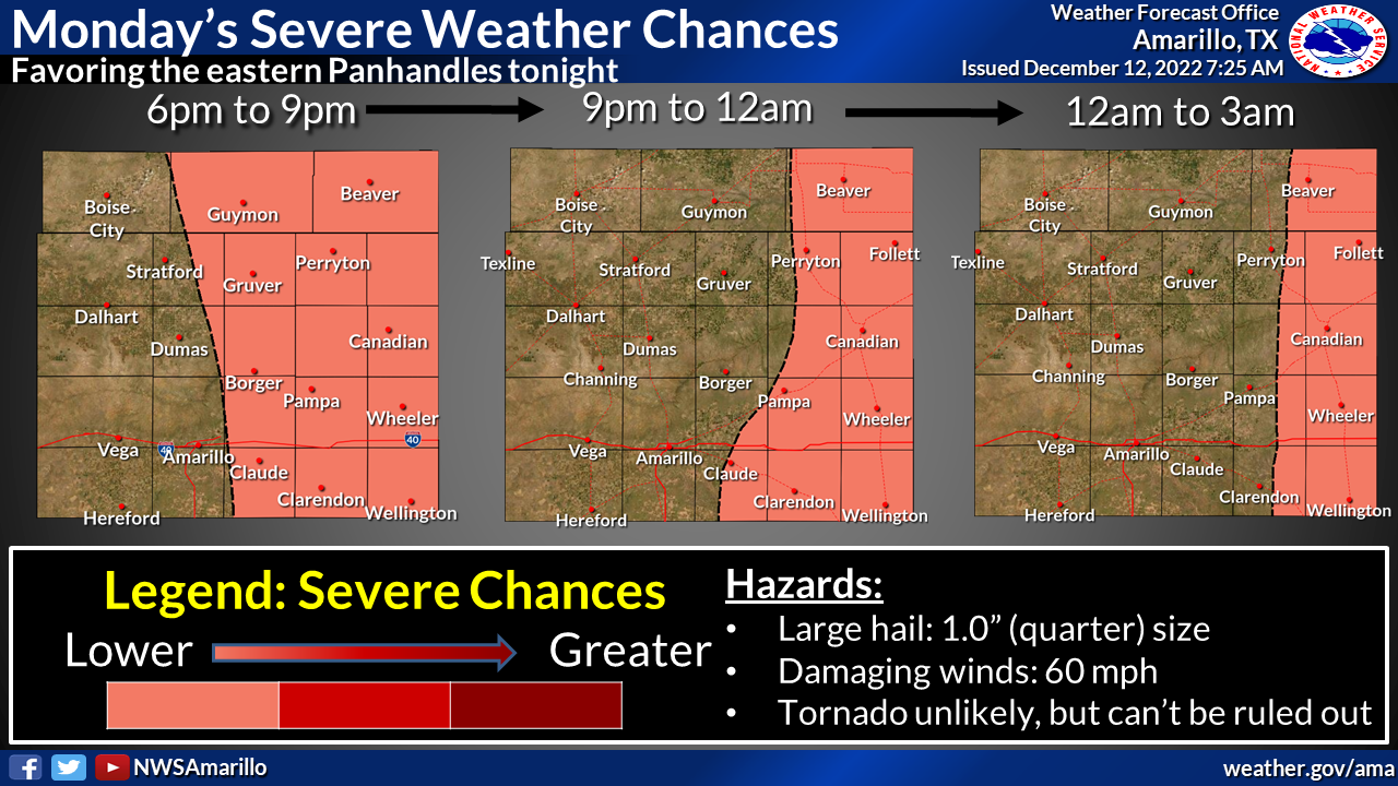
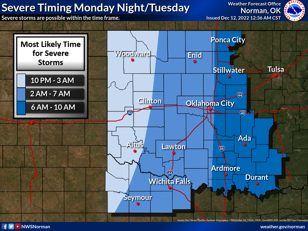
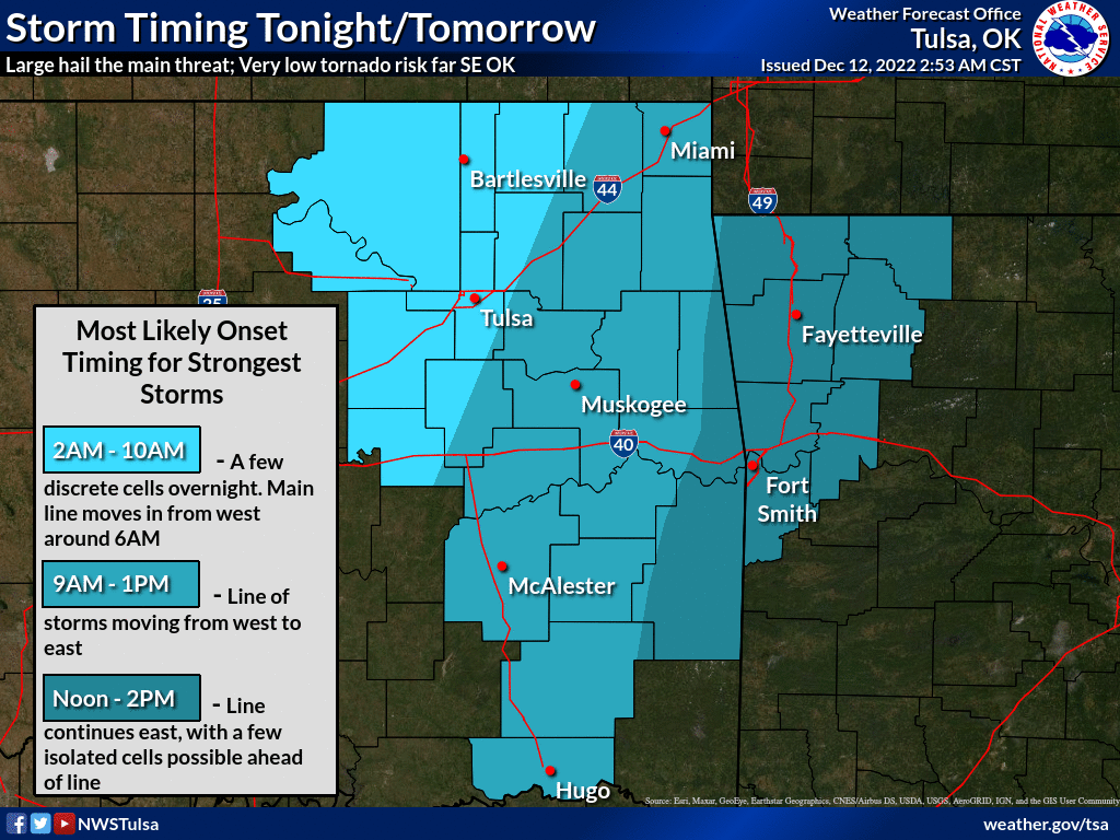
So find a way to get warnings...NOAA weather radio, your local NWS office,
and your favorite media source are a good start!
Gary McManus
State Climatologist
Oklahoma Mesonet
Oklahoma Climatological Survey
gmcmanus@mesonet.org
December 12 in Mesonet History
| Record | Value | Station | Year |
|---|---|---|---|
| Maximum Temperature | 77°F | KENT | 2021 |
| Minimum Temperature | 2°F | BEAV | 2000 |
| Maximum Rainfall | 2.84″ | MTHE | 2015 |
Mesonet records begin in 1994.
Search by Date
If you're a bit off, don't worry, because just like horseshoes, “almost” counts on the Ticker website!