Ticker for December 1, 2022
MESONET TICKER ... MESONET TICKER ... MESONET TICKER ... MESONET TICKER ...
December 1, 2022 December 1, 2022 December 1, 2022 December 1, 2022
The old switcheroo

Wait, so the forecast for December is "Could get ugly"? Now why would I think
that? After the hottest summer since 2011, horrible drought (is there any other
kind?), a frigid November that came with snow AND 6 tornadoes, including an EF4
monster?
Yeah, that's enough proof for me. Oh, not for you? Okay, how about this...the
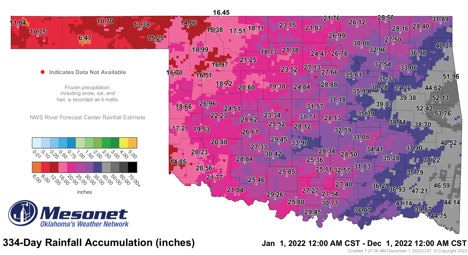
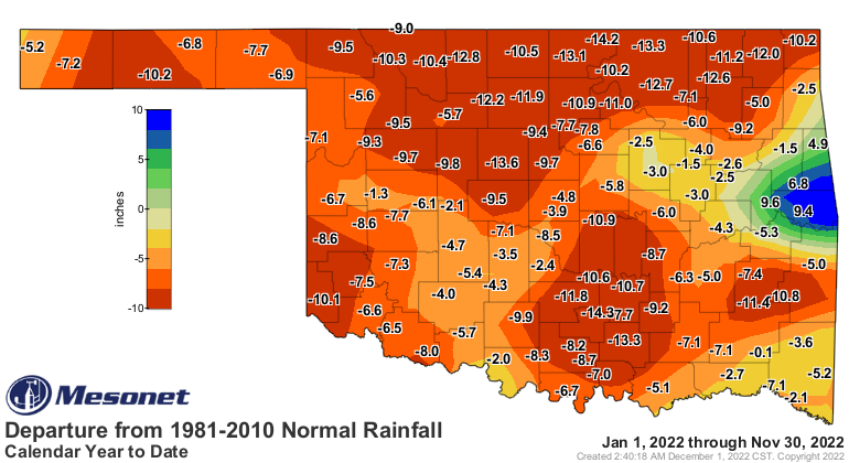
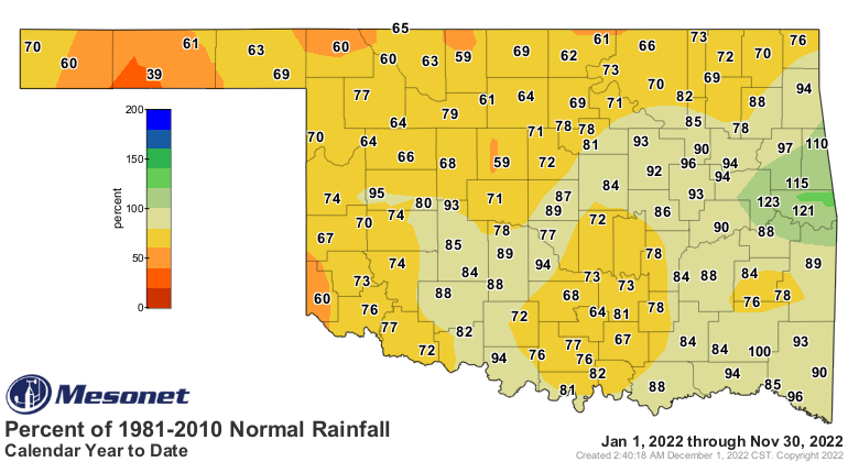
January through November average rainfall total of 27.59 inches across the
state?
6.66 INCHES BELOW NORMAL!!!
(Lightning flashes, thunder roars, maniacal laughter)
Okay, or it could simply be a boring month where not much goes on. THAT'S how
tricky Mother Nature is, I'm telling ya!
We do summarize November for you down below...it was a doozy, as mentioned
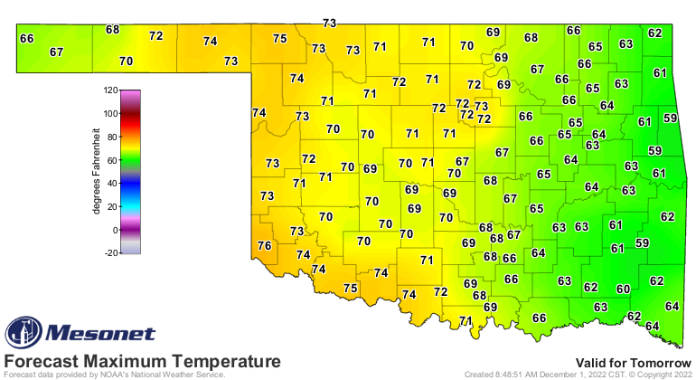
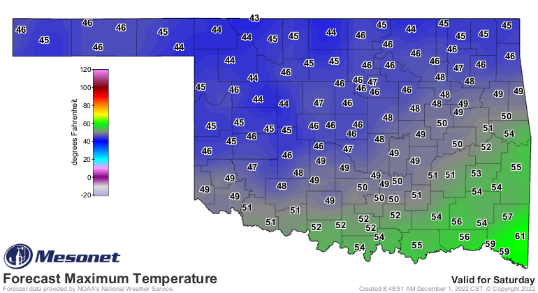
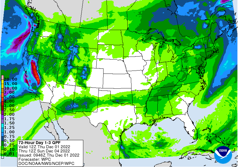
above. For the next few days, however, we're looking at some more warm weather,
another cold front, and a rainy weekend. What else is new.
And now, a look back at November.
(Mild cackling here, nothing maniacal).
---------------------------------------------------------------------------------
November Sees Pattern Change
Dec. 1, 2022
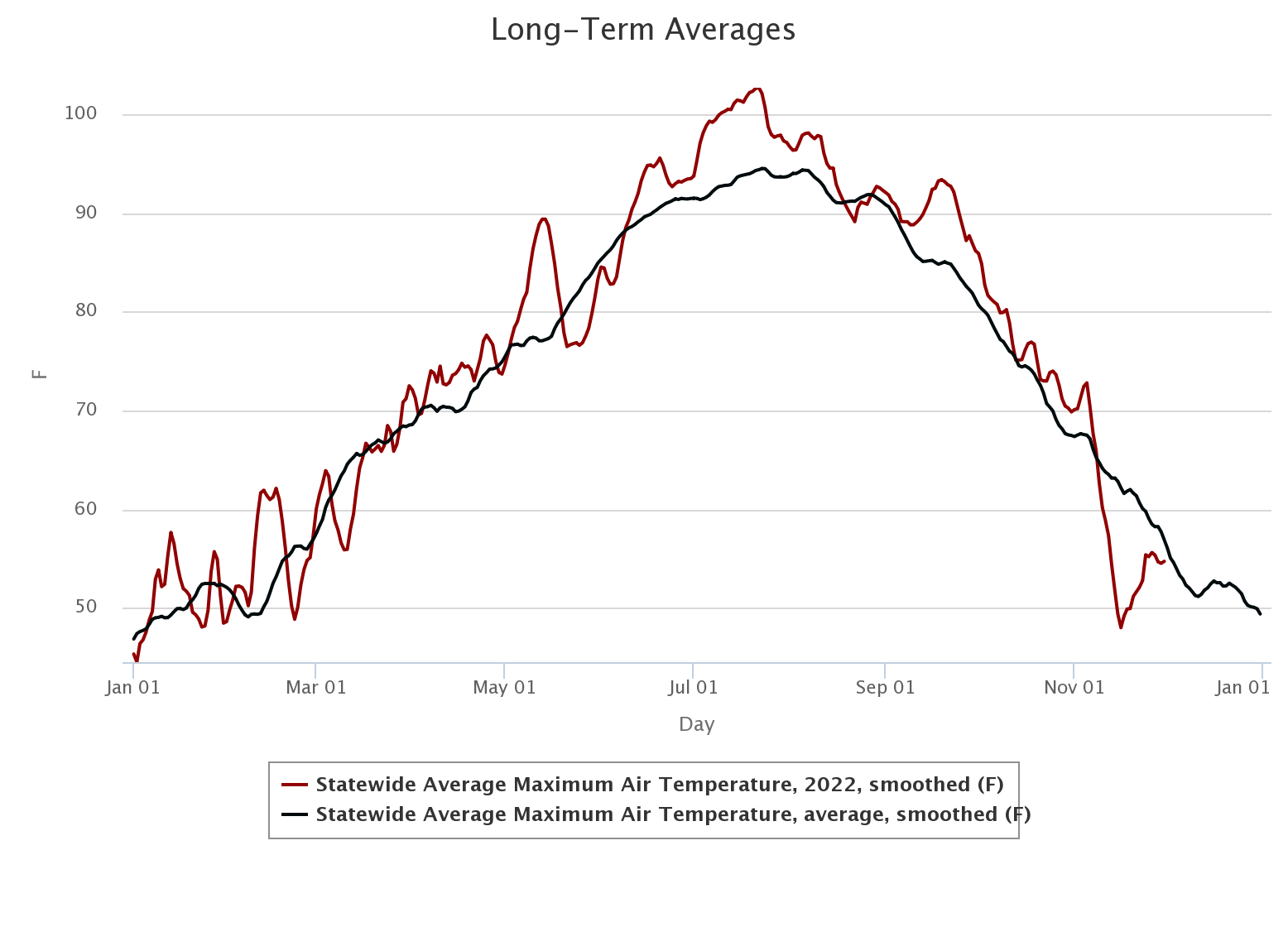
Oklahoma’s extended spate of warmer than normal weather—which began in early
June and continued largely uninterrupted for the next five months—came to an
abrupt halt on Nov. 10 following a clash with the season’s first true arctic
cold front. Highs in the 70s and 80s those first 10 days of November were soon
replaced with highs in the 40s and 50s, and low temperatures below freezing
more often than not. Any hint of a return to the weather’s previous mild ways
was soon quashed by recurring cold fronts throughout the rest of the month. The
continual intrusions of frigid air also brought the state its first widespread
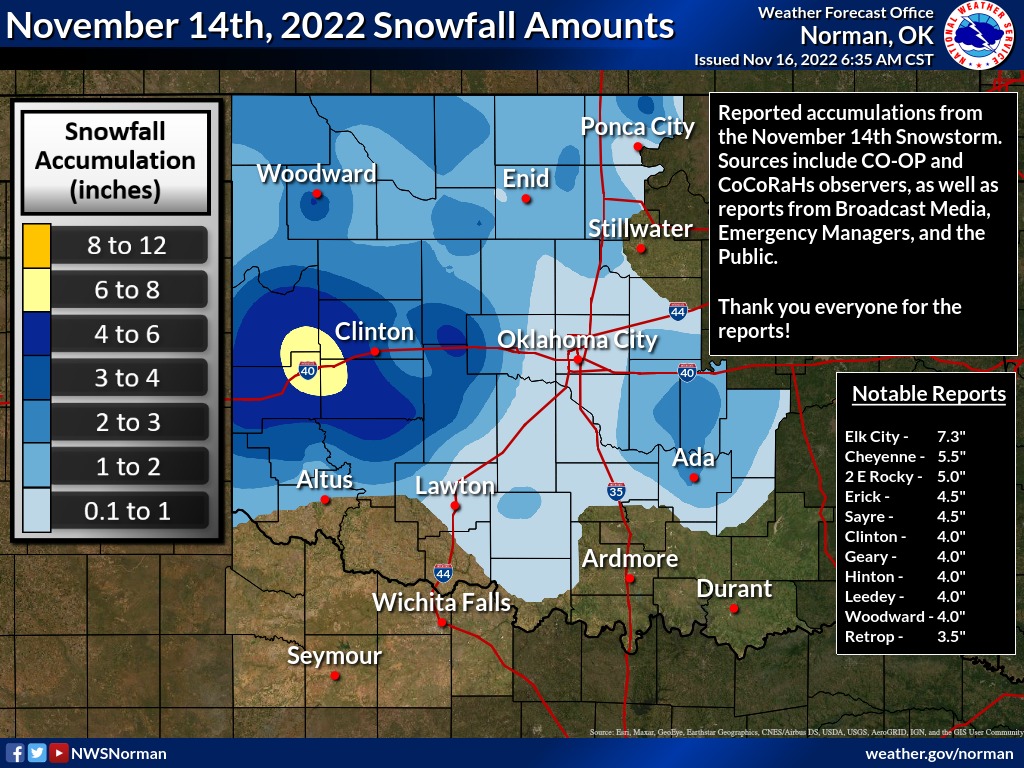
snows of the season. A quick burst blanketed the central Panhandle with a couple
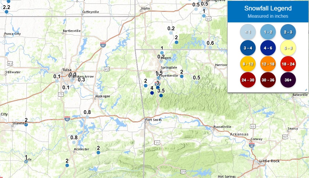
of inches on Nov. 4, but the big show occurred on Nov. 14 across west central
Oklahoma where widespread totals of 3-5 inches were reported. Localized heavier
amounts were also reported with Elk City topping the totals at 7.3 inches.
Lesser amounts were reported to the east, but much of the state received at
least a dusting during the month. The same storm system that brought the snow
on Nov. 4 produced significant severe weather in far southeast Oklahoma,
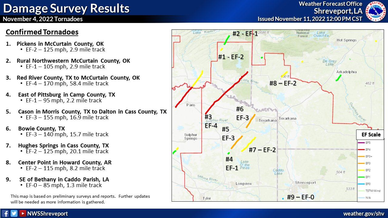
including six tornadoes in McCurtain and Le Flore counties. An EF2 twister
touched down near Pickens in McCurtain County and rolled a mobile home, killing
one person. The most significant tornado in terms of strength was an EF4 monster
that touched down across the Red River in Texas before moving into McCurtain
County. Although most of the damage path in Oklahoma was at EF2 intensity, the
tornado caused significant EF3 damage through Idabel along its path of 61 miles
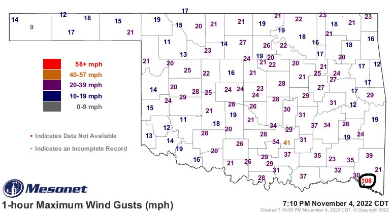
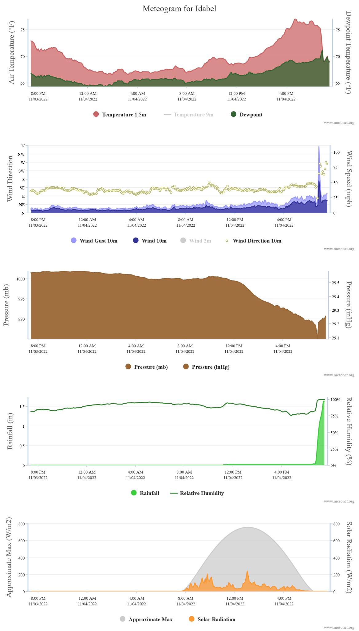
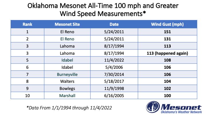
before dissipating near Eagletown. The tornado also sideswiped the Idabel
Mesonet site, producing a wind gust of 108 mph. Idabel became the fifth Mesonet
site to be hit by a tornado since the network’s inception in 1994, and the 108
mph gust was the fifth highest recorded by the network—tops is the 151 mph gust
recorded by El Reno on May 24, 2011, in its brush with an EF5 twister. The
Oklahoma State Department of Health reported at least 30 storm-related injuries
from the Nov. 4 severe weather event in Bryan, Choctaw, Le Flore, and McCurtain
counties.
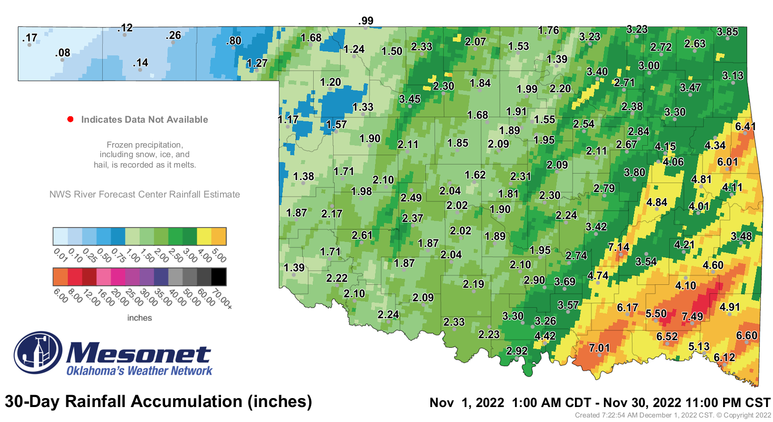
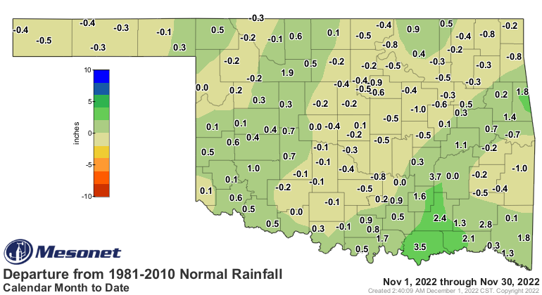
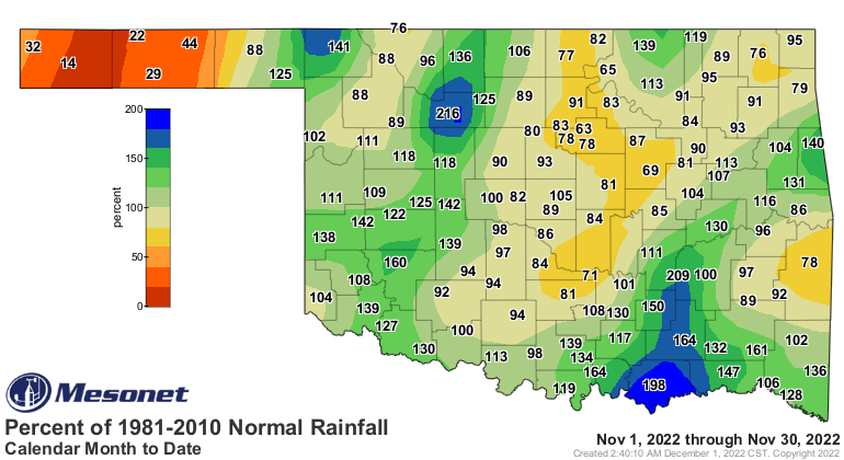
The statewide average precipitation total for the month was 2.69 inches, 0.37
inches above normal and the 42nd wettest November since records began in 1895.
Much of southern and western Oklahoma had a surplus for the month, but the
western Panhandle and parts of central through northern Oklahoma continued with
significant deficits. Totals ranged from 7.49 inches at Cloudy to Boise City’s
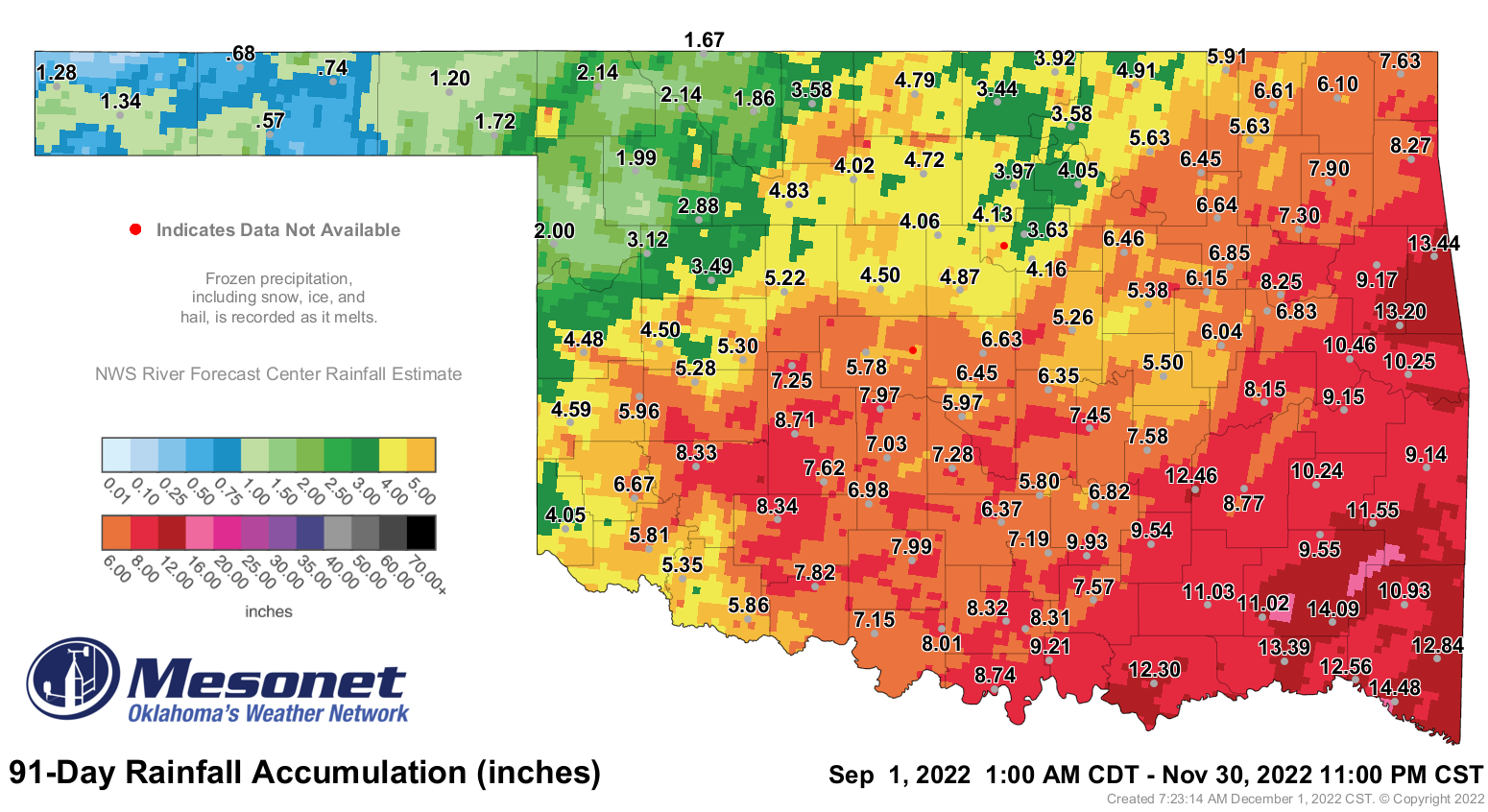
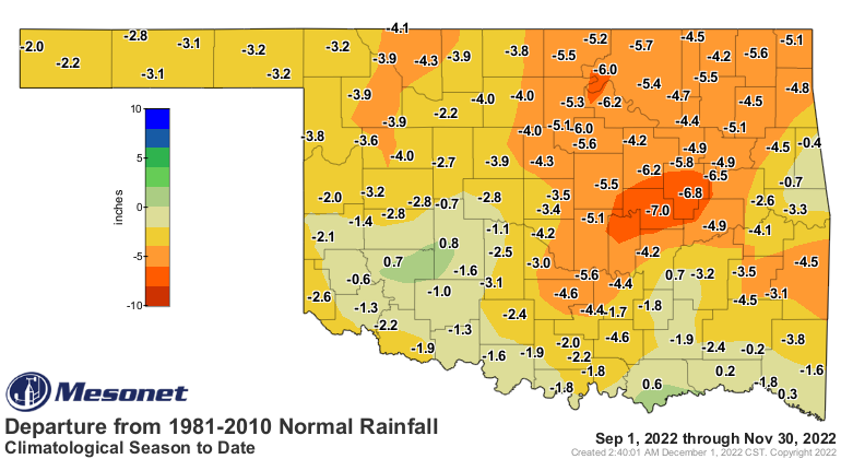
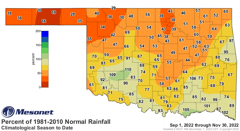
0.08 inches. The climatological fall statewide average finished at 6.27 inches,
2.73 inches below normal and ranked as the 36th driest September-November on
record. Only two of the Mesonet’s sites recorded a surplus for the fall
period—Durant and Medicine Park at 0.9 and 0.8 inches above normal,
respectively. Much of the northeastern quarter of the state fell 4-7 inches
below normal. The first 11 months of the year had an average total of 27.59
inches across the state, 6.66 inches below normal and ranked as the 29th driest
January-November on record.
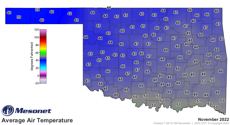
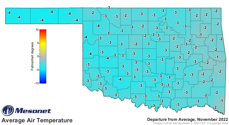
The statewide average temperature was 46.9 degrees, 2.5 degrees below normal
and ranked as the 43rd coolest November since records began in 1895.
Temperatures rose into the 70s and 80s regularly through November’s first 10
days, but were not seen again in the state until the 29th—and abruptly snuffed
out once again by another arctic cold front. Burneyville registered the month’s
highest reading of 84 degrees on Nov. 6, while Kenton came in with the lowest
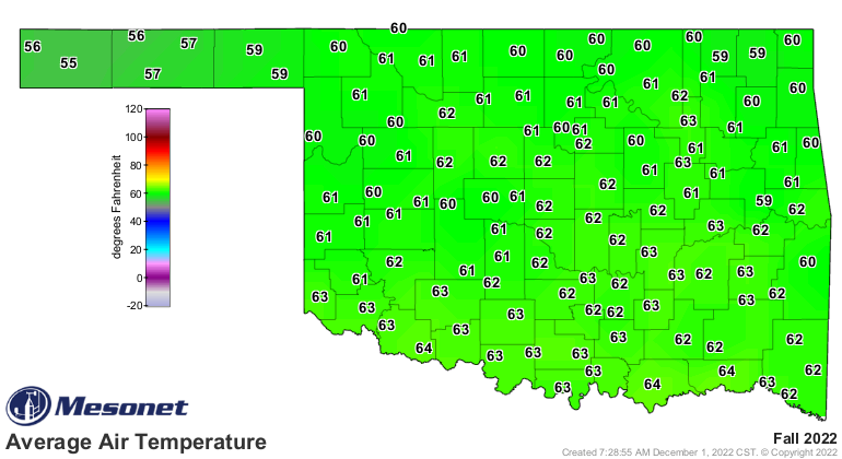
of 6 degrees on both the 19th and 30th. Climatological fall ended as the 51st
warmest on record across the state at 61.5 degrees, 0.3 degrees above normal.
The year was still on track to finish quite warm with a January-November
average of 62.9 degrees, 0.7 degrees above normal and ranked as the 26th
warmest such period on record.

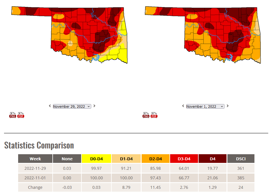
November began with 100% of the state in at least some level of drought, but
that coverage had dropped to 91% by the end of the month. The amount of the two
most intense levels of drought, however—extreme and exceptional—hardly changed
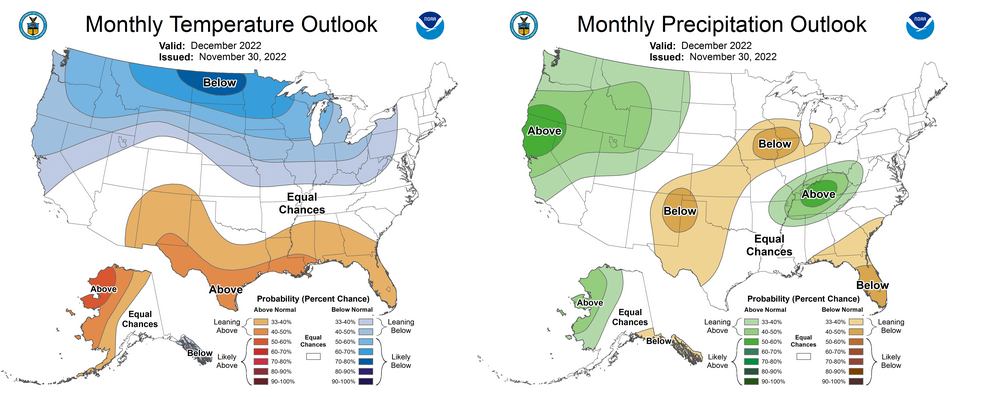
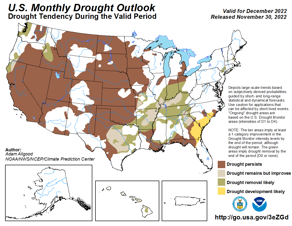
at all, falling from 67% to 64%. Prospects for relief in December are rather
dim according to the Climate Prediction Center. Their December precipitation
outlook shows increased odds for below normal precipitation across the western
two-thirds of the state, especially for the western Panhandle. Their December
drought outlook calls for drought to persist across all but far southeastern
Oklahoma, where further improvement is expected. CPC’s December temperature
outlook sees equal odds for above-, below-, and near-normal temperatures during
the month.
###
Gary McManus
State Climatologist
Oklahoma Mesonet
Oklahoma Climatological Survey
gmcmanus@mesonet.org
December 1 in Mesonet History
| Record | Value | Station | Year |
|---|---|---|---|
| Maximum Temperature | 86°F | HOLL | 2012 |
| Minimum Temperature | 0°F | SEIL | 2006 |
| Maximum Rainfall | 0.75 inches | WATO | 2015 |
Mesonet records begin in 1994.
Search by Date
If you're a bit off, don't worry, because just like horseshoes, “almost” counts on the Ticker website!