Ticker for September 15, 2022
MESONET TICKER ... MESONET TICKER ... MESONET TICKER ... MESONET TICKER ...
September 15, 2022 September 15, 2022 September 15, 2022 September 15, 2022
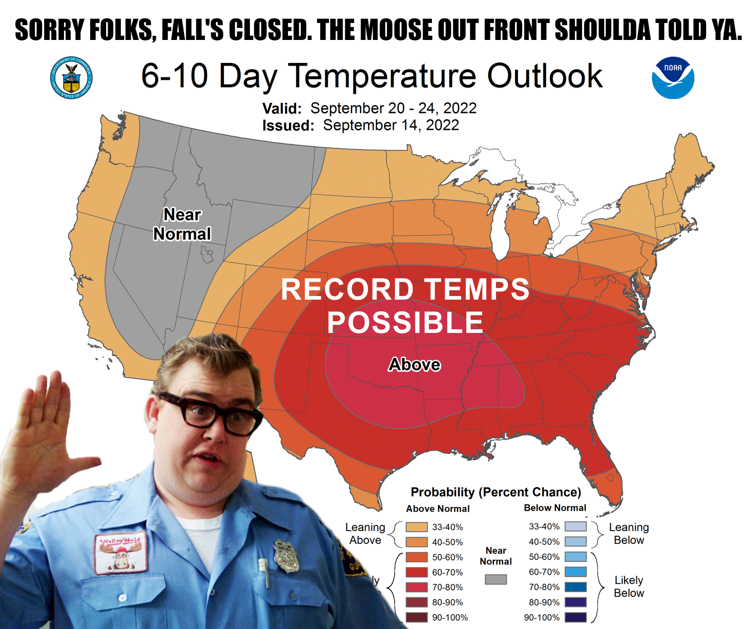
Fall fail
I'm taking time out of my busy schedule to get this out. I'm working on beating my
world powerlifting record of 795 lbs. If I lift another 5 lbs today that will
make 800 lbs total over the last 160 days. It's so weird that others try and lift
that all at once, but I like breaking it up. SCIENCE!
But hey, I catch a lot of heat...
Get it!
HAHAHAHAHAHAHAHAHAHA!!
HAHAHAHAHAHA!
HAHAHA
hahaha
haha
ha
Oh.
Well, I catch a lot of heat for being too optimistic. Yes yes, funny, I know.
Somebody called me cruel for making an optimistic rainfall forecast, but it
wasn't my idea, it was the forecast models! But no such luck this time, I'm
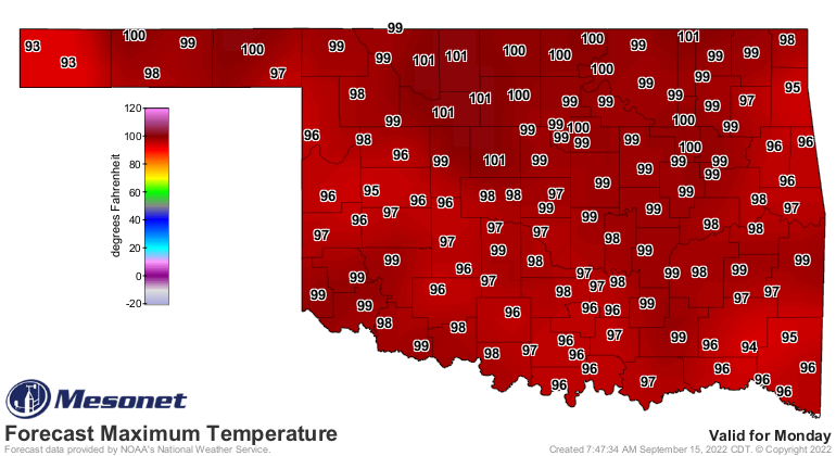
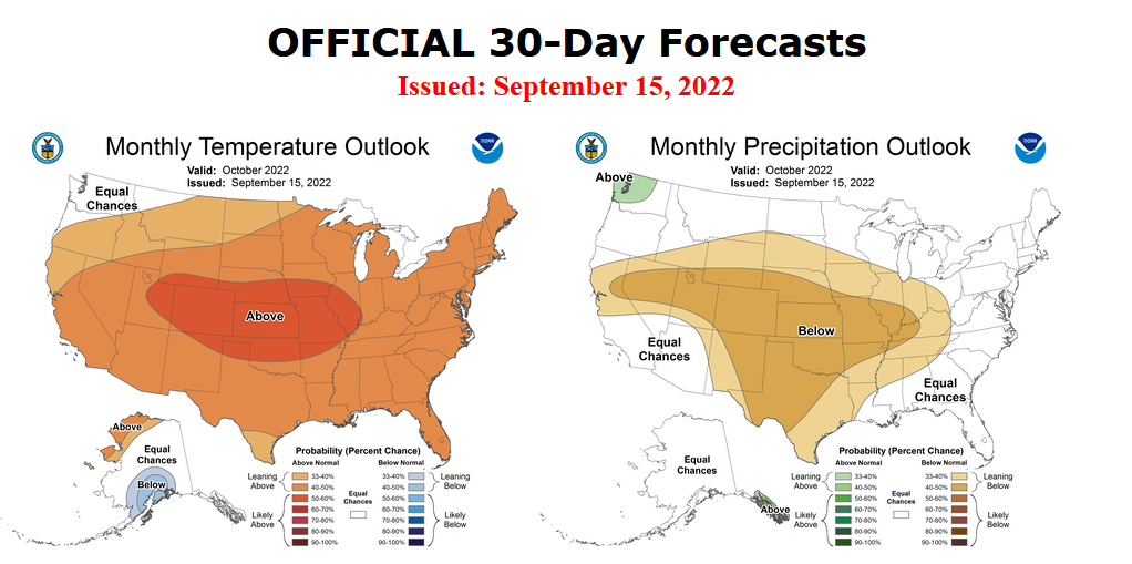
not gonna sugarcoat it. The coming 7-10 days are gonna be nasty. Did ya want
100-degree temps in the 4th week of September? Well, you're gonna get 'em.

Rain? Oh pshaw! I'm not sure what "pshaw" means, but I heard it on some old
movies (no, older than that) so it sounds good.
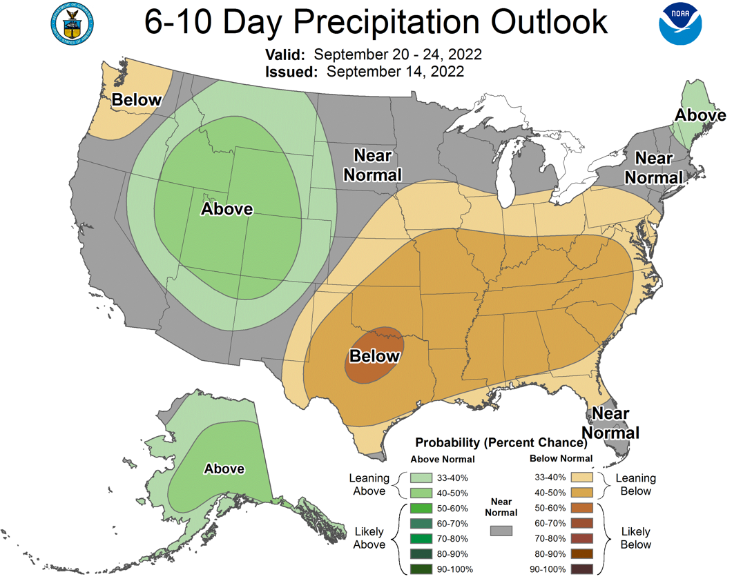
Now there is some hope...dang it, I wasn't supposed to do that, but there is
some hope for a front to drag through here later next week, but I'm just not
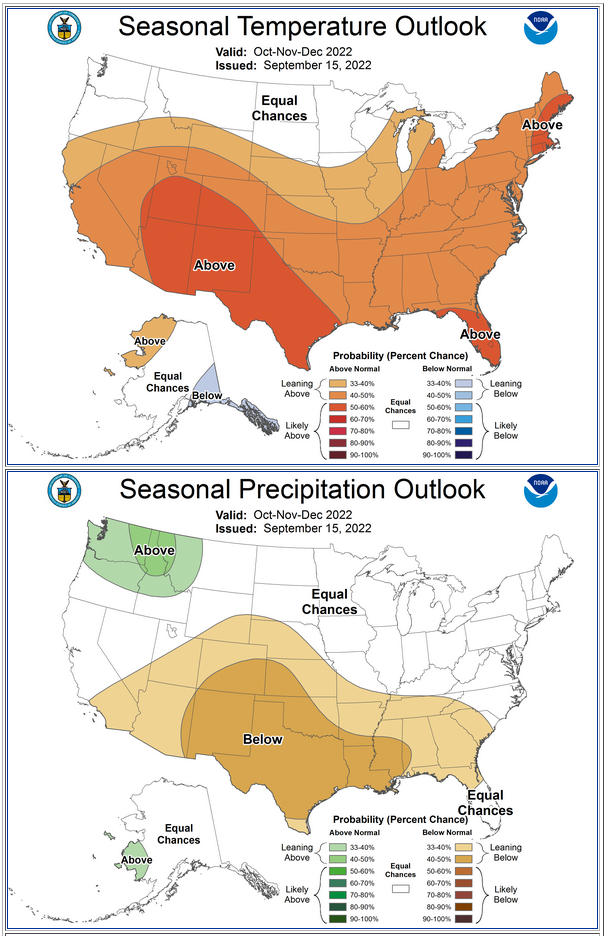
seeing it. We'll still hope for the best, but I think that heat dome dominates
us for the next 10 days at least. And further out? Well, I'd say more of the
same as our triple-dip La Nina settles in and gives us what we've seen for
more than 13 months now...mostly warmer and drier than normal weather.
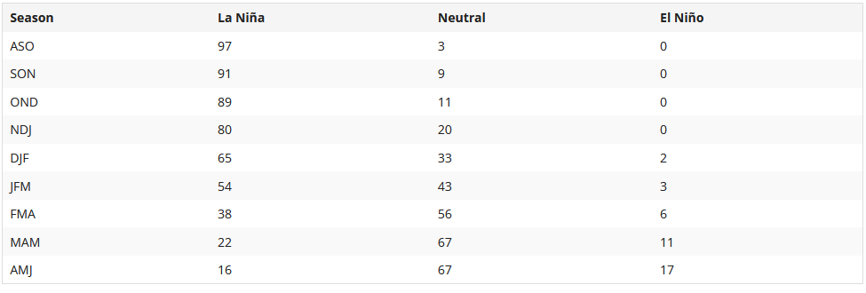
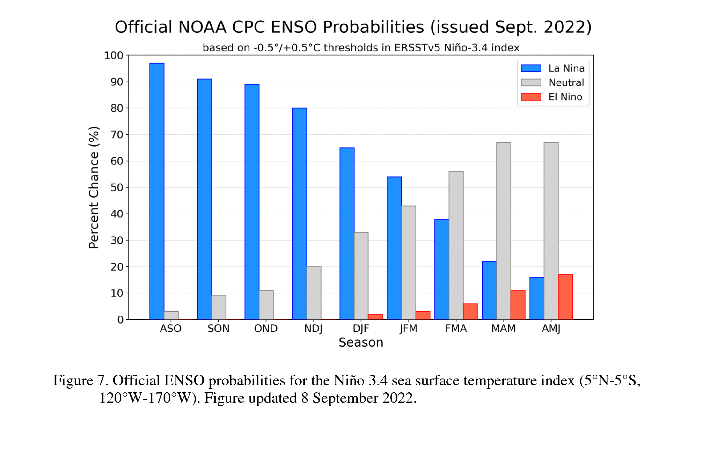
The triple-dip La Nina (or the third consecutive cool season where La Nina
conditions have been met) is expected to last through mid-winter where it will
then start to transition to neutral conditions. However, there is a bit
more uncertainty than I'm used to seeing in those outlooks. Quoting CPC's
ENSO outlook:
"The most recent IRI plume forecast of the Niño-3.4 SST index indicates
La Niña will persist into the Northern Hemisphere winter 2022-23. There
is an interesting split in the dynamical versus statistical model
forecasts, with the latter set suggesting La Niña will persist longer,
through January-March 2023. At this time, the forecaster consensus
sides with the statistical models, although there is still large
uncertainty over how long La Niña will last and when it will transition
to ENSO-neutral (56% chance of a transition to ENSO-neutral during
February-April 2023). In summary, La Niña is favored to continue
through Northern Hemisphere winter 2022-23, with a 91% chance in
September-November, decreasing to a 54% chance in January-March 2023."
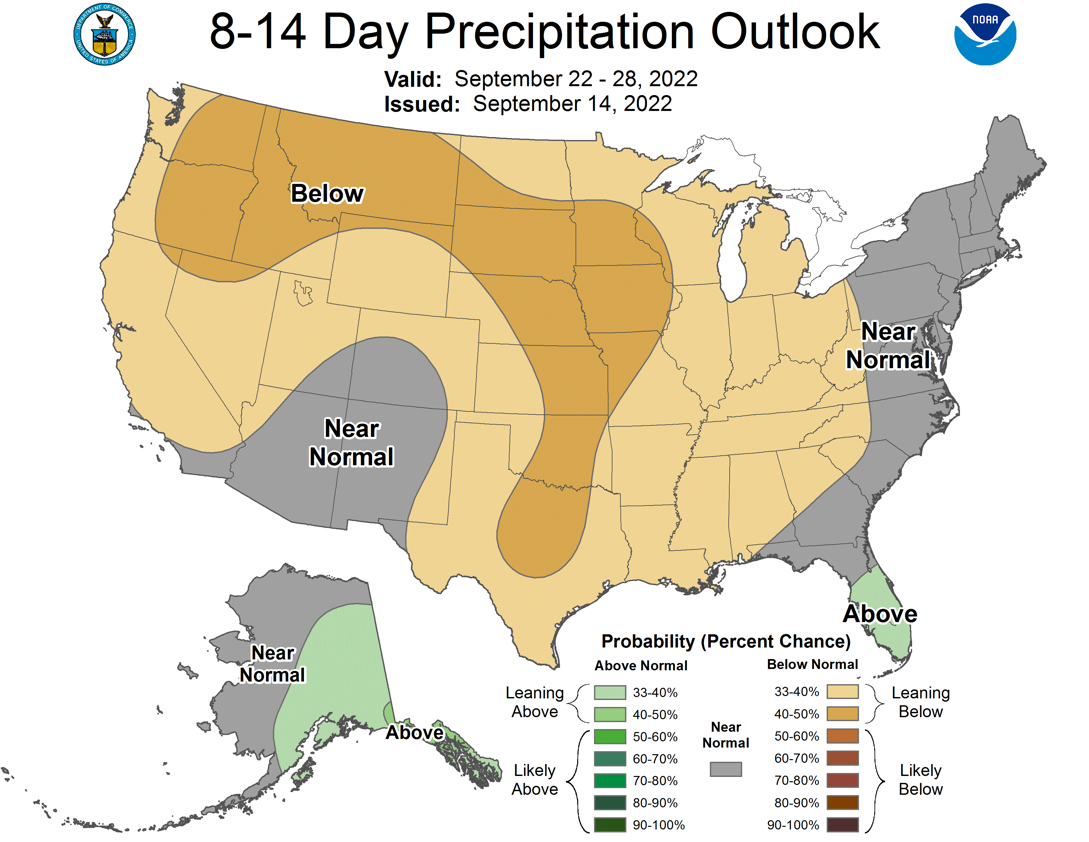
Now obviously all of this, if it comes to fruition, will be exceedingly bad
for our already drought-parched state. Even this week we saw the worst of the
drought expand slightly.
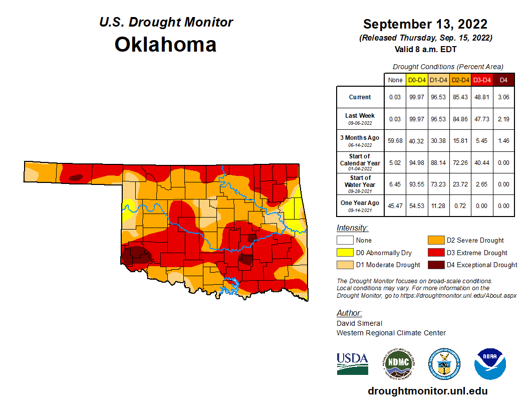
However, don't take that slight expansion lightly. Drought is staged to surge
once again over the next few weeks if we don't see rain. And as we've seen
from the outlooks, it just doesn't look too good, unfortunately.
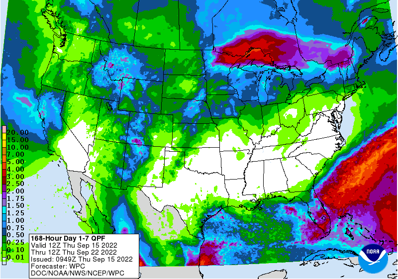
It's not all doom and gloom. NW OK will see another chance for rain tonight and
early tomorrow, like they had last night.

Yeah, I get it. It wasn't much, and most of that will evaporate pretty readily
from the soil in the face of the hot weather and wind, but it's better than
nothing. Maybe a few strong storms up that way, some severe winds are possible.
Fall? Nobody notified this office of anything, Mr. Grizzle.
Gary McManus
State Climatologist
Oklahoma Mesonet
Oklahoma Climatological Survey
gmcmanus@mesonet.org
September 15 in Mesonet History
| Record | Value | Station | Year |
|---|---|---|---|
| Maximum Temperature | 103°F | FREE | 2010 |
| Minimum Temperature | 37°F | BOIS | 2012 |
| Maximum Rainfall | 5.53 inches | SULP | 2001 |
Mesonet records begin in 1994.
Search by Date
If you're a bit off, don't worry, because just like horseshoes, “almost” counts on the Ticker website!