Ticker for September 14, 2022
MESONET TICKER ... MESONET TICKER ... MESONET TICKER ... MESONET TICKER ...
September 14, 2022 September 14, 2022 September 14, 2022 September 14, 2022
Droughtdle
Just a quick Tick to Tock about this whole "lack of rain" boondoggle. I can't type
long (although I literally just typed "long", but you know what I meant), I've
been tasked with beefing up the McDonald's menu world-wide. My first act:
Add beef. Those fries though!
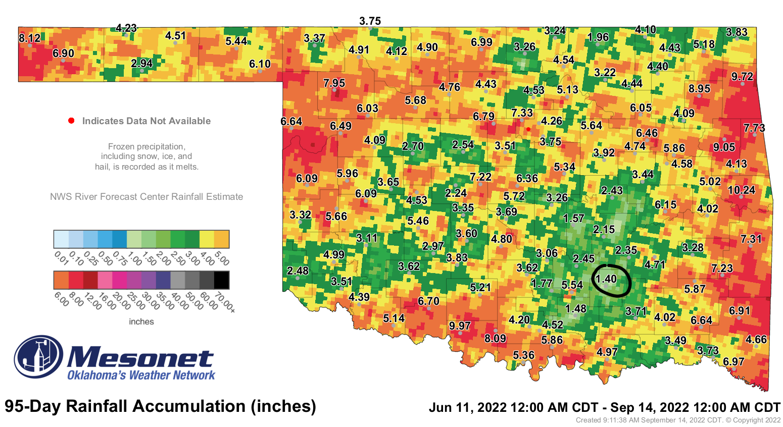
Did you know that Centrahoma has only had 1.4 inches of rain in the last 95 days?
And today ain't looking to good either, and I don't just mean when I look in a
mirrow (Okie to English translation: "mirror").
And that's through a whole crapload (Okie to English translation: "crapload") of
abnormally high heat. I'm talking Nolan Ryan high heat.

Did you know that over that period, that's more than 8 inches below normal, and
also a time when they've probably lost another 8 inches to evaporation and
transpiration due to the heat and normal plant usage?

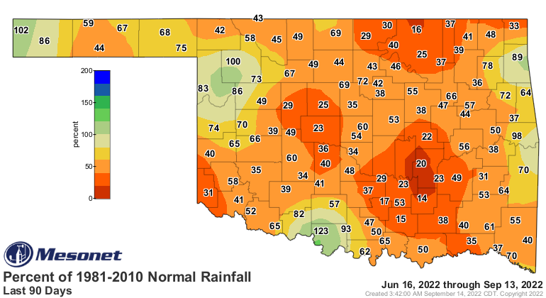
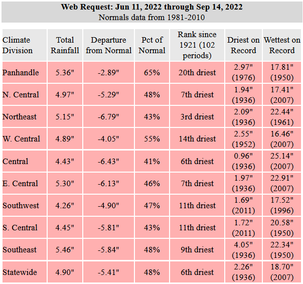
What if I told you (sorry, wrong meme) that statewide, since June 11, the
average rainfall is the 6th driest since at least 1921? And NE OK is
working on their 3rd driest such period?
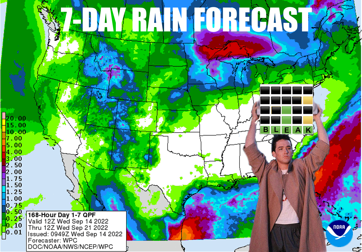
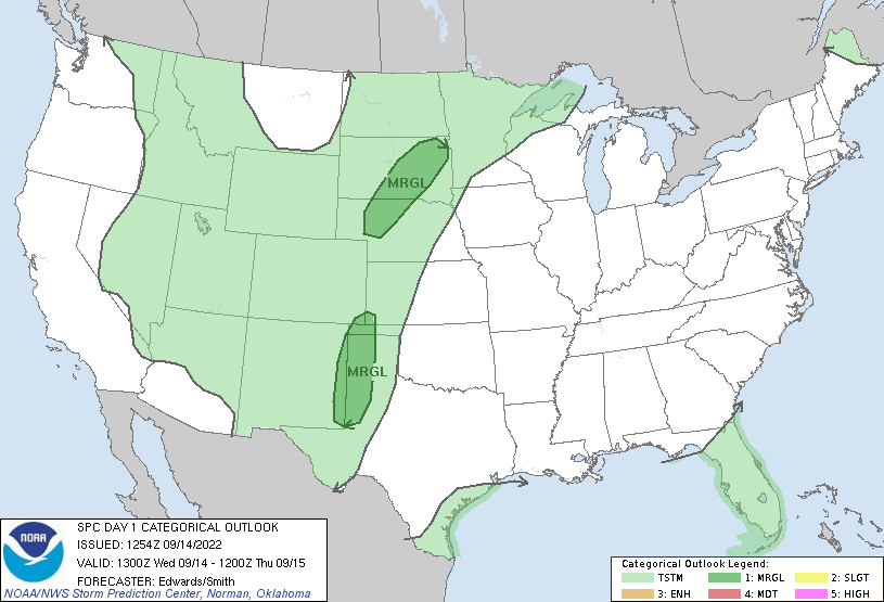
Chances for rain over the next week or so are dismal at best. This isn't new
news, the moose out front should have told ya. We do have a chance for some
storms today and tomorrow, but those chances aren't great, and largely confined
to far NW OK and the Panhandle.
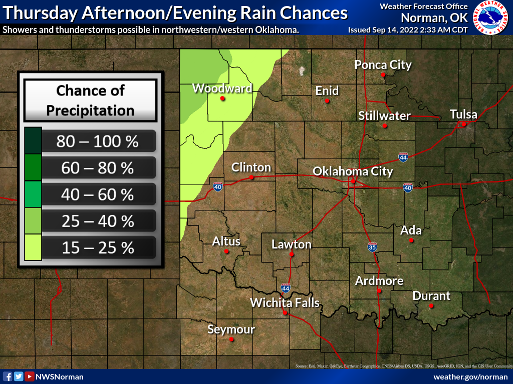
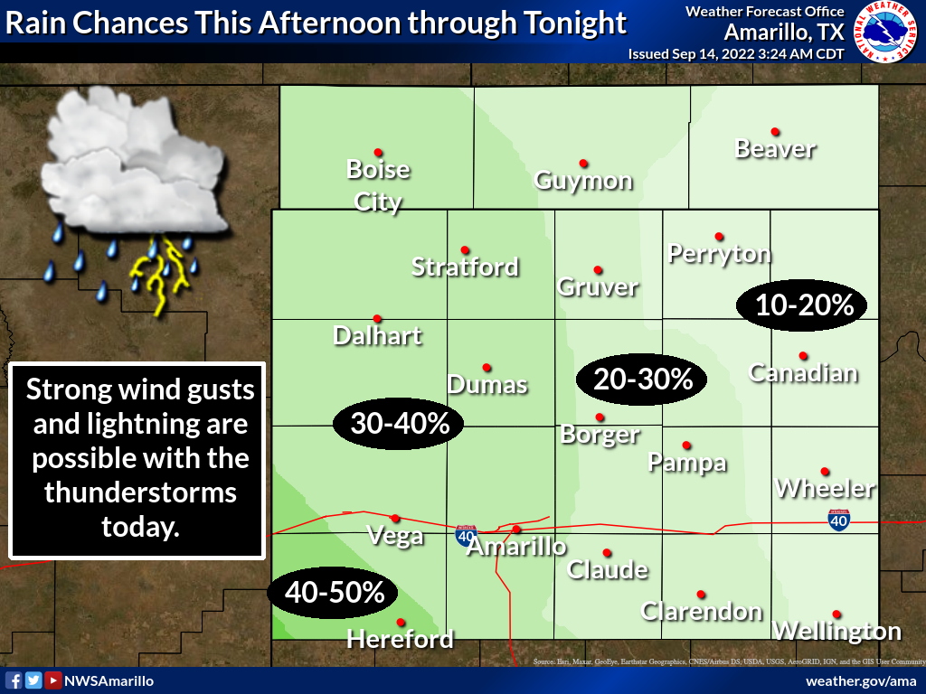
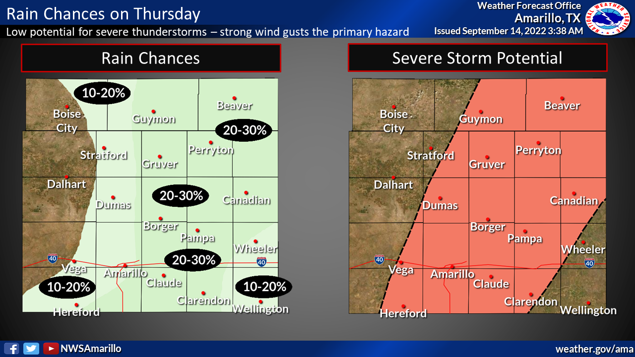
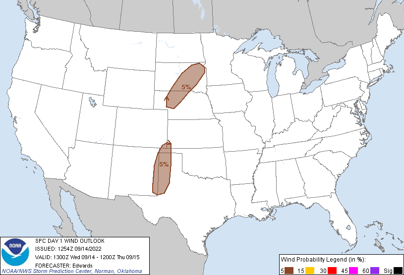
There will be a chance of severe weather if storms fire, especially severe
winds, standard in this type of atmospheric setup.
We spoke (okay, I typed, you MIGHT have read) that we had hopes for a big
upper-level trough to push the death heat dome ridge east and give us a chance
of rain late next week. Those hopes have dimmed just a bit. It's okay, I went
through the same thing a decade ago with my hair...you get used to it.
However, unlike my scalp's chances, the models have taketh away, but maybe
the next few runs wills see them giveth again.
Gary McManus
State Climatologist
Oklahoma Mesonet
Oklahoma Climatological Survey
gmcmanus@mesonet.org
September 14 in Mesonet History
| Record | Value | Station | Year |
|---|---|---|---|
| Maximum Temperature | 103°F | MANG | 2000 |
| Minimum Temperature | 39°F | KENT | 2012 |
| Maximum Rainfall | 3.64 inches | JAYX | 1998 |
Mesonet records begin in 1994.
Search by Date
If you're a bit off, don't worry, because just like horseshoes, “almost” counts on the Ticker website!