Ticker for September 12, 2022
MESONET TICKER ... MESONET TICKER ... MESONET TICKER ... MESONET TICKER ...
September 12, 2022 September 12, 2022 September 12, 2022 September 12, 2022
Well la de fricking fall!
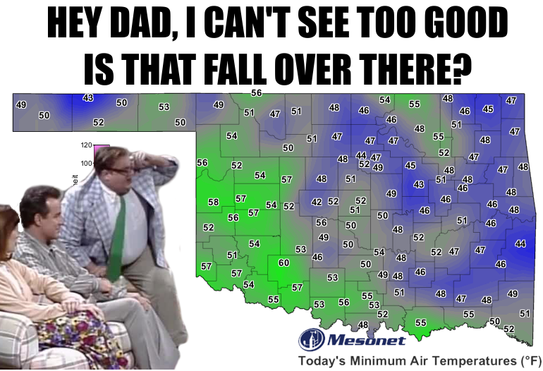
It's always a bit dangerous to try and catalogue the morning's low temperatures
right at sunrise. You know, when the radiational cooling overnight has created
a cold pool of air right at the earth's surface, then the sun comes up and just
barely heats the surface, and that cold pool gets disturbed upwards to the height
of 1.5 meters where it then gets sampled by our thermometers, ESPECIALLY on a
clear, calm night where that cold pool stays relatively unmixed. And that process
will go on throughout the day as the sun's heat mixes the air and wind downwards.
During the night, the winds calm down near the surface in that cold pool of
stable air. That's why we often see our lowest temperatures of the day right at
sunrise or thereabouts. Well, that's what I remember from my classes back when
the abacus was still in vogue. A lot of it is a bit of chicken and egg sort
of process. Not the abacus, the minimum temperature conundrum.
At any rate, part 2, that 42 degrees measured at El Reno is the coldest weather
we've seen since Kenton hit 42 degrees last May 26. Gosh, that's like 3+ months
ago! But yesterday was gloriously fall-like as well, with lows in the 50s
and highs in the 70s. Well, mostly.


And that front did provide a nice blanket of light (sometimes moderate) rain
over the western half of the state, and I say "half" with an air of caution
to those halves that were actually halve-nots.
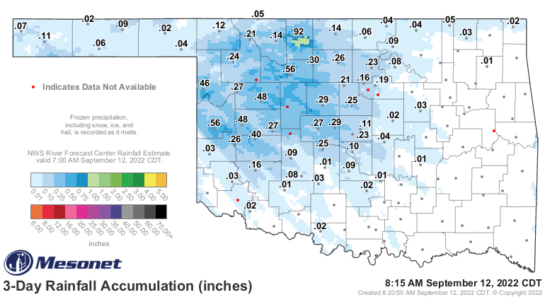
Looks like Cherokee up in Alfalfa County was the winner at 0.92 inches for
the event, although the radar estimated values just to the south of there
point towards 1-1.5 inches. Very localized, of course.
Okay, what to expect this week? Summer returns as we get towards the weekend.
Back to the 90s, so get out the flannel and start listening to Pearl Jam. There
WILL be somebody hit 100 over the next 7 days. My bet is somewhere up in
north central OK.
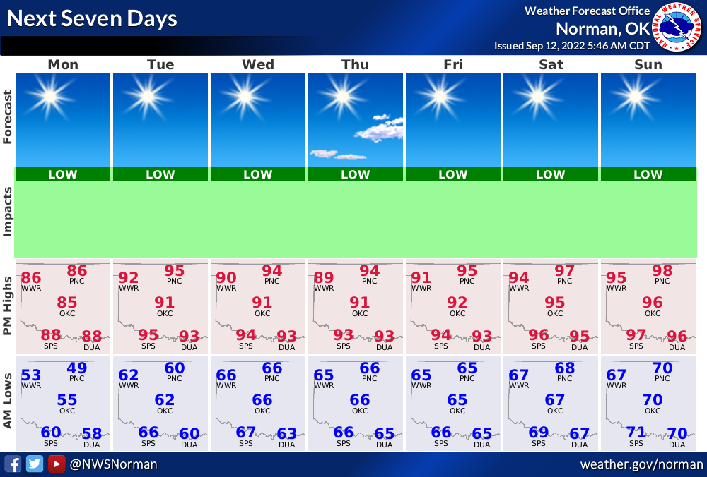
As for rainfall, MAYBE we squeeze some out near the weekend in far northern
OK? That's very iffy, though.
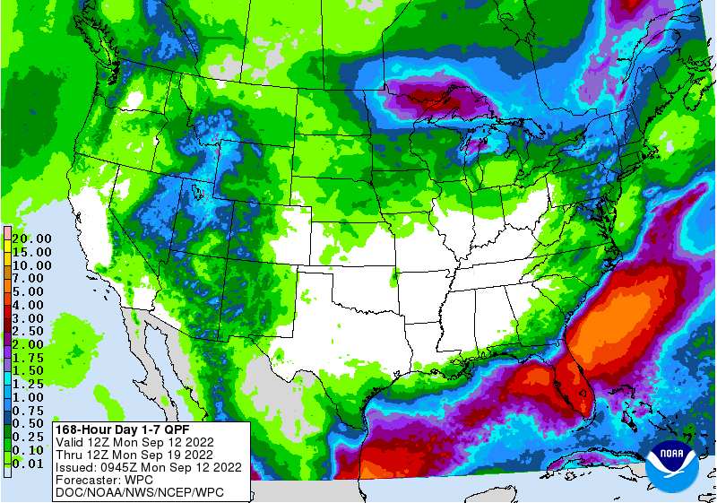
All eyes then turn towards next week, when the forecast models hint at some
sort of cold front type action in our area, but that again is in fantasy-cast
territory. We're desperately dry over much of the state, so we definitely need
to turn this around.
And if you're looking for winter, remember, just go lay on some concrete right
around sunrise and you'll find what you're looking for.
Gary McManus
State Climatologist
Oklahoma Mesonet
Oklahoma Climatological Survey
gmcmanus@mesonet.org
September 12 in Mesonet History
| Record | Value | Station | Year |
|---|---|---|---|
| Maximum Temperature | 105°F | ALTU | 2011 |
| Minimum Temperature | 40°F | BOIS | 2014 |
| Maximum Rainfall | 9.13 inches | FAIR | 2008 |
Mesonet records begin in 1994.
Search by Date
If you're a bit off, don't worry, because just like horseshoes, “almost” counts on the Ticker website!