Ticker for September 8, 2022
MESONET TICKER ... MESONET TICKER ... MESONET TICKER ... MESONET TICKER ...
September 8, 2022 September 8, 2022 September 8, 2022 September 8, 2022
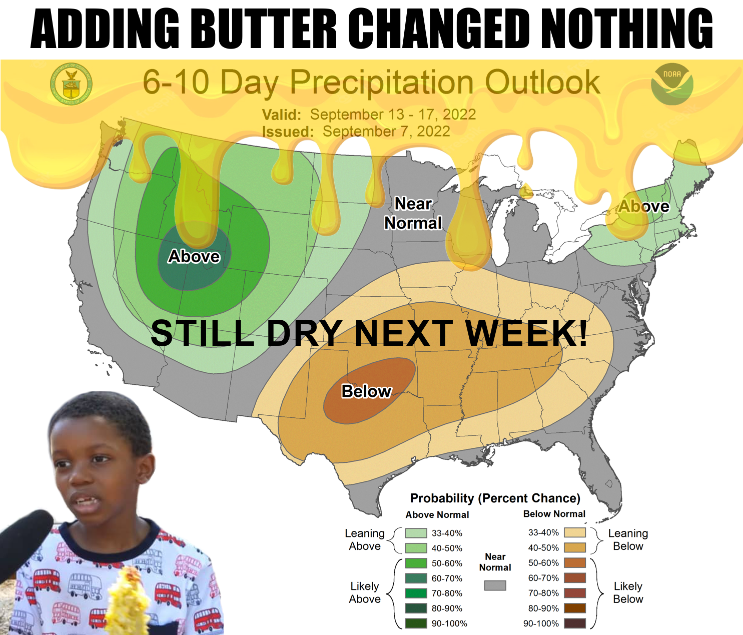
Add butter?
Yeah, I know...we always use these viral memes after they've run their course, but
it's because we're SO cutting edge that we loop back around past their, uhhhh,
viralness to when they're cool again.
Same thing with my hair...just waiting for the loop to complete and then hair like
Stalin!
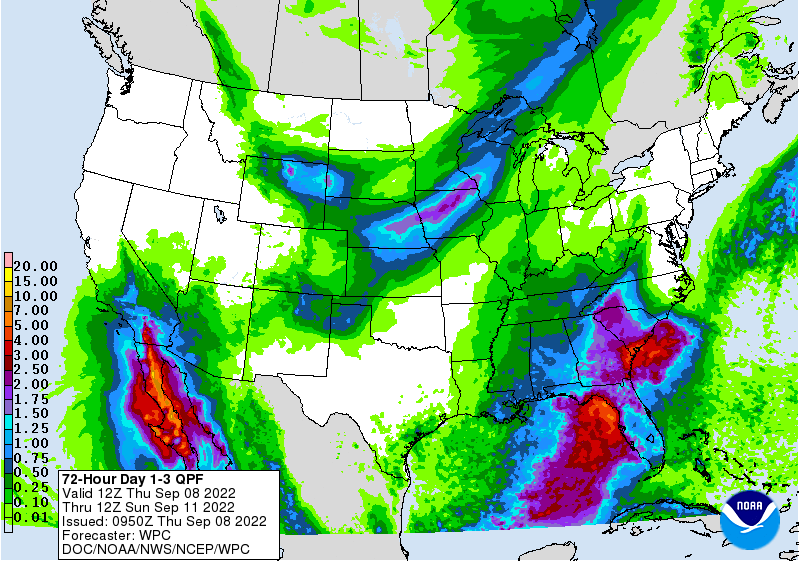
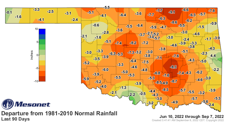
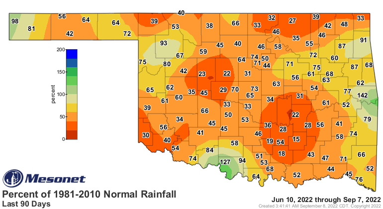
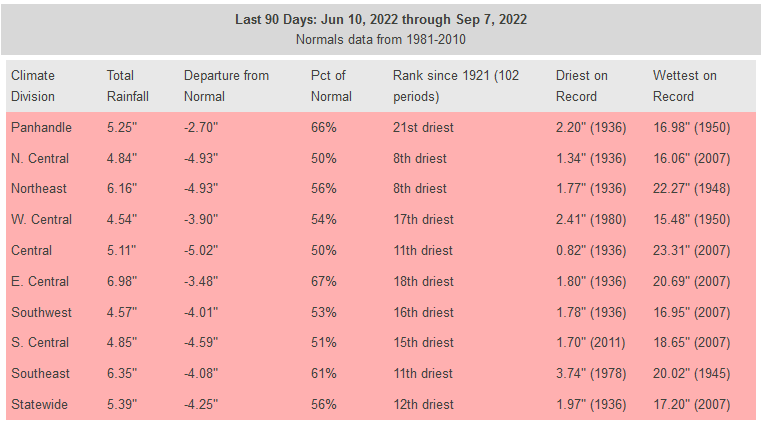
But here's the deal, the rainfall predicted for NW OK this weekend along the front
is probably all we're gonna have for awhile, maybe until the week after next.
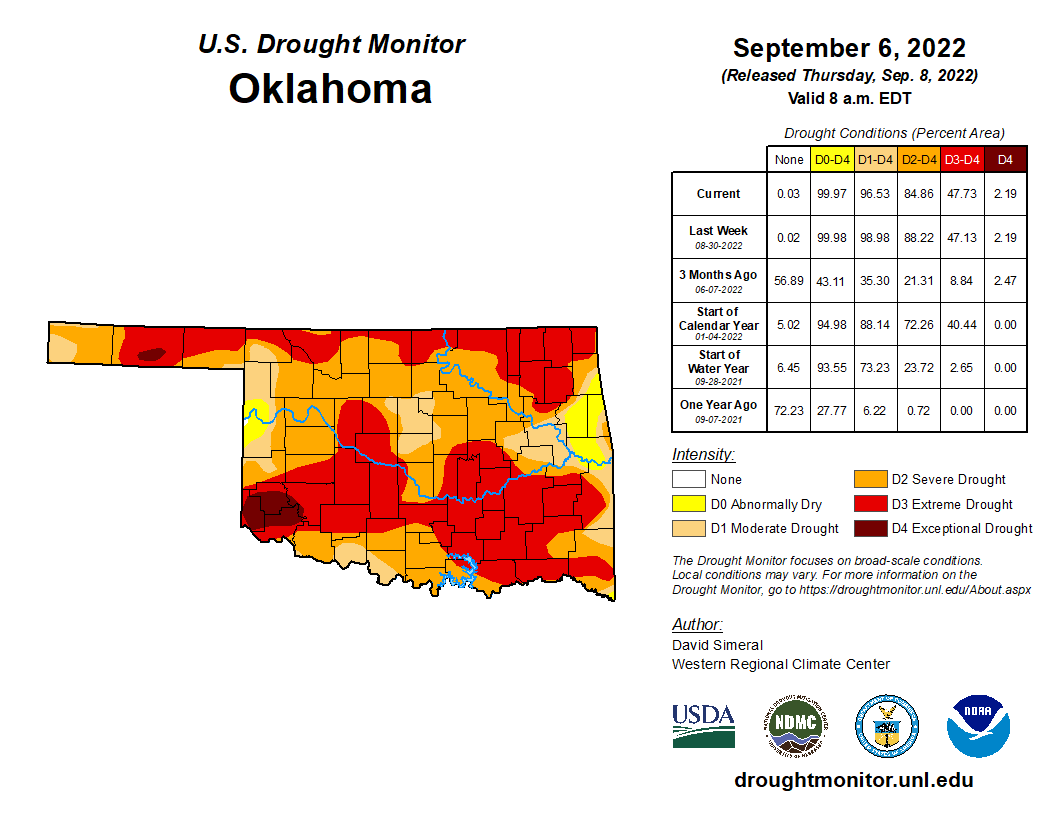
And that's not good for the drought news we continue to get with each U.S. Drought
Monitor map. While we had some improvements with our heavy-but-spotty rains of
the previous week, I'm afraid (you can also be afraid with me...VERY afraid) other
parts of the state saw intensification of drought over the period.

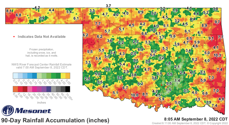
The short-term rains look much better than over the long-term maps show, with
one more day to go before the real beginning of the flash drought on June 11.
When that June 10 rainfall drops off, these maps are gonna crater.
We've already covered the heat, or it has covered us. Even yesterday triple-
digits reared their ugly head again up in the Panhandle, and that's after a
start in the 50s.
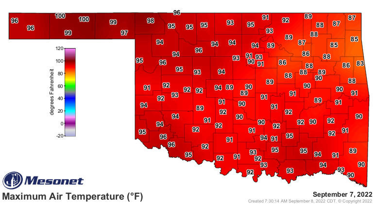

So watch for some stray 100s around through Saturday, then a nice cooldown
Sunday and Monday, then back to the blast furnace...and drought intensification.
Gary McManus
State Climatologist
Oklahoma Mesonet
Oklahoma Climatological Survey
gmcmanus@mesonet.org
September 8 in Mesonet History
| Record | Value | Station | Year |
|---|---|---|---|
| Maximum Temperature | 111°F | GRA2 | 2023 |
| Minimum Temperature | 34°F | KENT | 2020 |
| Maximum Rainfall | 5.37 inches | WILB | 2001 |
Mesonet records begin in 1994.
Search by Date
If you're a bit off, don't worry, because just like horseshoes, “almost” counts on the Ticker website!