Ticker for September 7, 2022
MESONET TICKER ... MESONET TICKER ... MESONET TICKER ... MESONET TICKER ...
September 7, 2022 September 7, 2022 September 7, 2022 September 7, 2022
GOAT
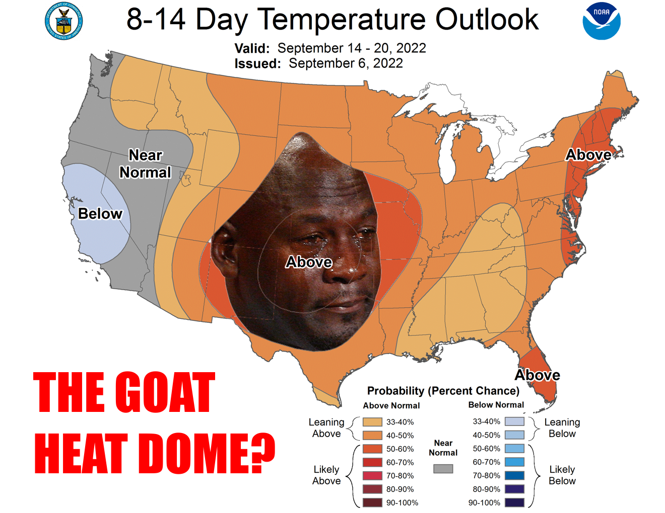
It just keeps coming back over and over again, each time more tiresome and
loathsome as the first. NO, not Batman movies, those are pretty cool (admit it
or we can't be friends...well, if I had friends then we couldn't be friends). It's
the stupid heat dome. I jokingly (haha??) called it the GOAT, but it obviously is
a far cry from our 2011 heat dome, and 1980, and 1954...but given than our summer
was the 9th hottest on record, there aren't many ahead of it. Heat domes, that is.
This one tries to move off for a bit, then it just keeps wandering back our way,
spreading its special brand of love wherever it goes. It's currently working its
wonders in central California where temperatures have soared as high as 116
degrees in Sacramento, its highest temperature ever recorded--record breaking heat
has been widespread across the West.
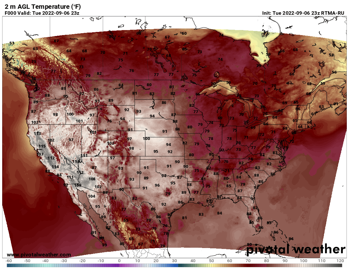
Now as for us, we do have at least a few of hot days, albeit somewhat
seasonable, ahead before we see a cold front late Saturday night which will
bring us the possibility of rain across northwestern OK and a cooler day
on Sunday for the rest of us.
Enjoy that because that head dome does move overhead...maybe just a tad west...
after that. Then we might see our temperatures start to creep up towards that
triple-digit mark again, especially across northern OK, where the rainfall has b
been a tad less beneficial over the last 30 days or so.
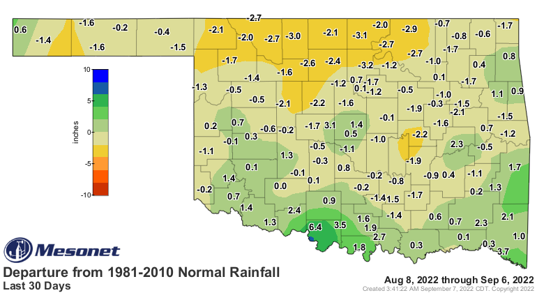

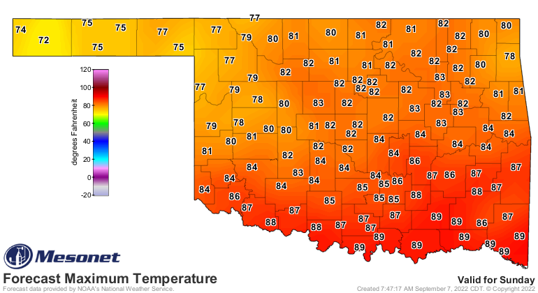
That would be the area I think might be most at risk to see those higher
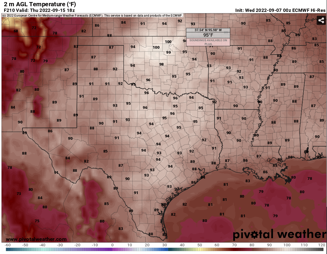
temperatures, but still a ways away. Here's what the European forecast model
shows for next Thursday at 1pm for temps...mind you, just a single run of that
model, but other models are showing similar temps.
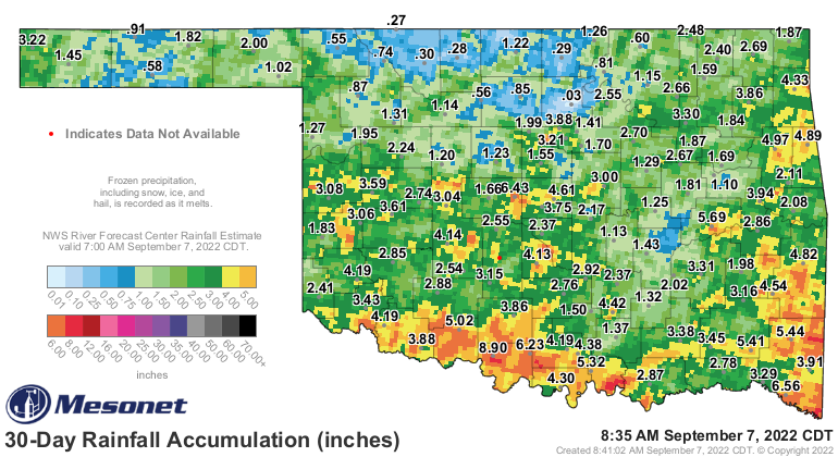
You can also see this in the 16-inch plant available water map from the Mesonet.
This is an area where the sun's energy will be more easily translated into
sensible heat.

And again in the topsoils in our 4-inch fractional water index map.
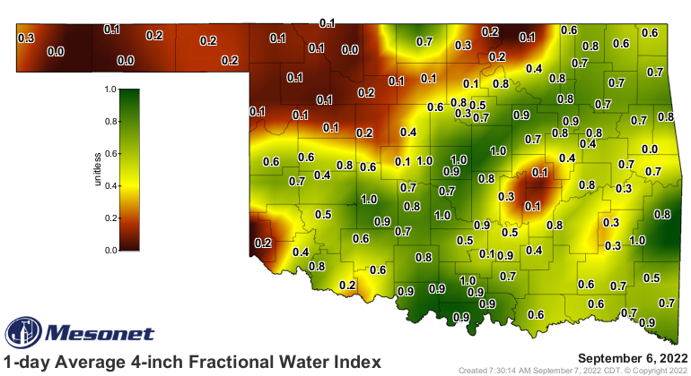
In other words, most of the downwelling solar radiation in the areas with
extremely low soil moisture goes towards heating the surface (sensible heat).
Where the soil moisture appears to be a bit more substantial, more of
that solar radiation goes towards evaporating moisture (latent heat). Simply
put, more of the sun's energy goes towards heating the area where there is
less soil moisture, so the temperatures can really skyrocket.
So we best keep writing on this map with pencil, not a pen.
Gary McManus
State Climatologist
Oklahoma Mesonet
Oklahoma Climatological Survey
gmcmanus@mesonet.org
September 7 in Mesonet History
| Record | Value | Station | Year |
|---|---|---|---|
| Maximum Temperature | 109°F | BURN | 2023 |
| Minimum Temperature | 39°F | BRIS | 2011 |
| Maximum Rainfall | 4.46 inches | BURB | 1995 |
Mesonet records begin in 1994.
Search by Date
If you're a bit off, don't worry, because just like horseshoes, “almost” counts on the Ticker website!