Ticker for September 1, 2022
MESONET TICKER ... MESONET TICKER ... MESONET TICKER ... MESONET TICKER ...
September 1, 2022 September 1, 2022 September 1, 2022 September 1, 2022
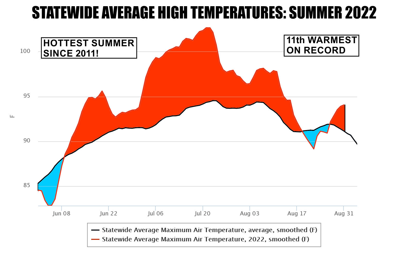
Hottest summer since 2011!
Memes?
We don't have no memes.
We don't need no stinking memes!
That data speaks for itself (and what it's saying is "Gary, we can't speak...
we're just data. Get help!"). But that's okay, we'll just go ahead an tell ya,
we just ended our 11th warmest climatological (meteorological?? Nice try,
meteorologists...climatologists keep the records) summer on record with a
statewide average of 82.7 degrees. Now that's a far cry from the SUMMER OF
2011'S (yes, I'm shouting...summer of 2011 requires yelling in anger and fear)
86.8 degrees, but it also beats out all the summers in between, including the
really nasty summer of 2012. So we have that going for us, right? And in case
you don't read the August/Summer summary down below, the Summer of 2011 tied
Texas for the hottest summer on record, any state, any year, since records began
in 1895. Now that is based on the statewide average, mind you. There isn't a
location in either state that can top somewhere like Las Vegas, or Phoenix,
but their state's also have lots of elevation which means their statewide
averages are a bit cooler.
Now as luck would have it, I'm starting at rain as I Tick (which is probably
why most of this is unintelligible garbage...should probably stare at the
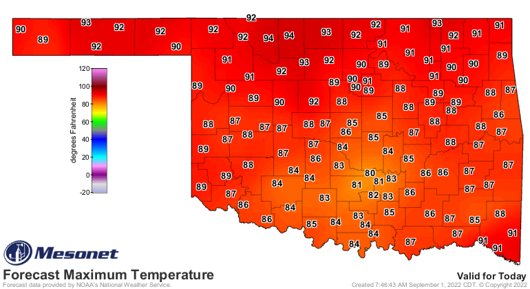
screen), so that's a nice change to start the fall season. And highs, at least
where it's raining, should remain a bit muted today.
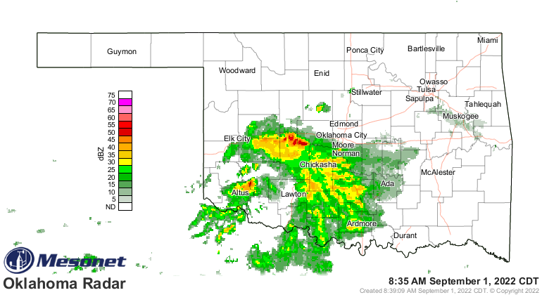
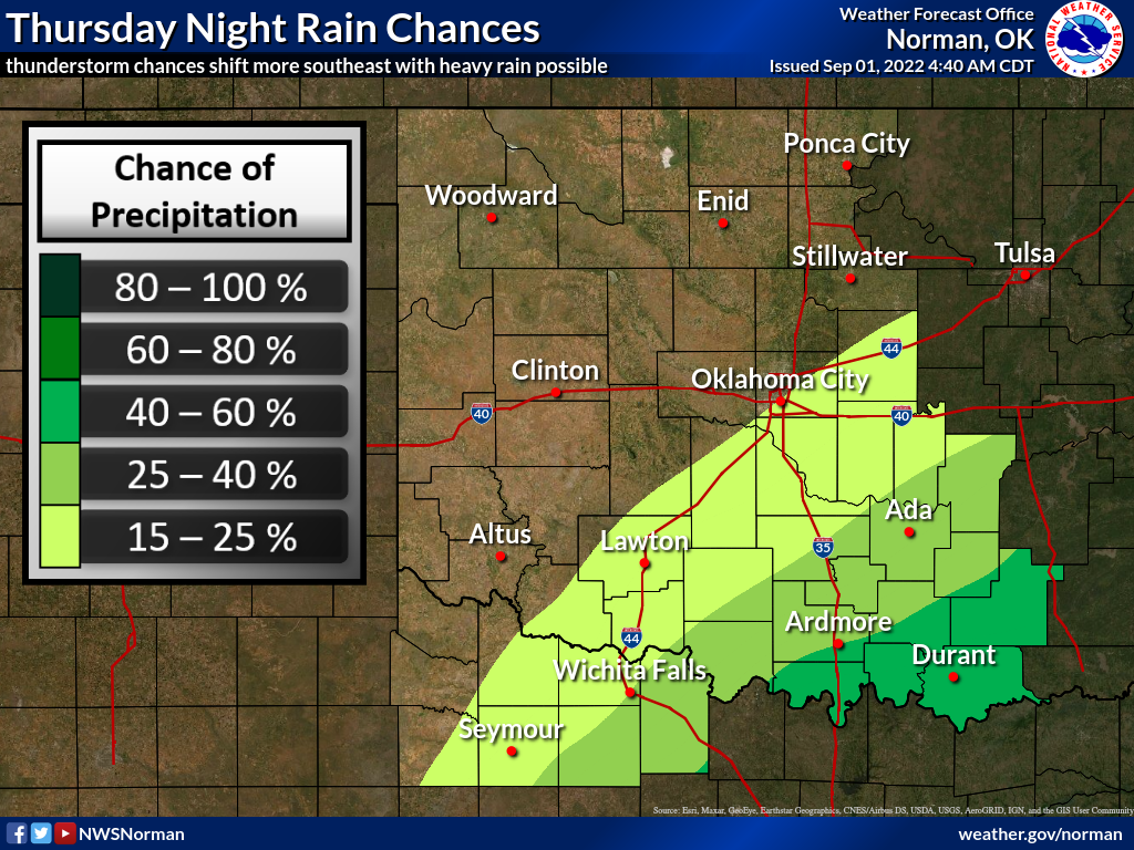
The rain should spread northward throughout the day, then move to the east
tonight. Rain totals could be heavy in Southern Oklahoma, so be mindful of heavy
downpours (and also be mindful of heavy pourdowns...we all know just how
painful those can be).
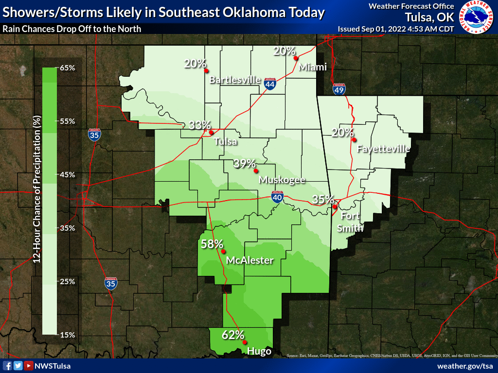
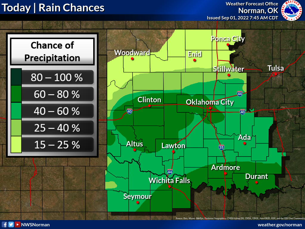
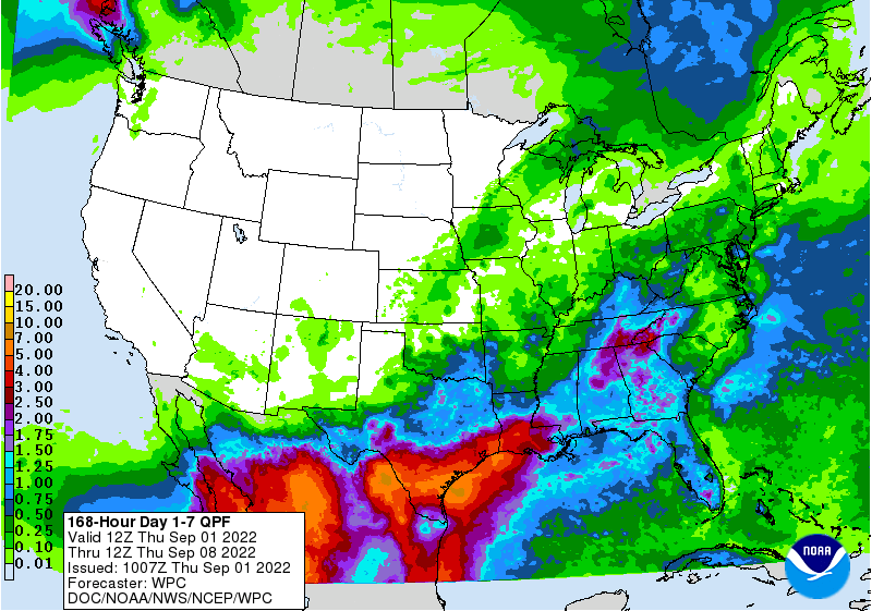
Rain chances will continue on and off for the next week or so, a general
September-ish pattern for now. Rain totals don't look great, but they ain't
zero either.
Okay, let's go back to August and take a peek under the hood. Looks like a
blown engine to me, and the repairs look a bit expensive.
---------------------------------------------------------------------------------
August Heat Adds To Hottest Summer Since 2011
Sept. 1, 2022
August’s heat and drought appeared ferocious at first, with widespread triple-
digit temperatures and moisture deficits throughout the first half of the month.
A strong cold front signaled a pattern change, however, and the heat settled
into more seasonable levels for the last half of the month. On the whole,
August was still well above normal and contributed to the hottest climatological
summer seen in the state since 2011. There was just enough rainfall to provide
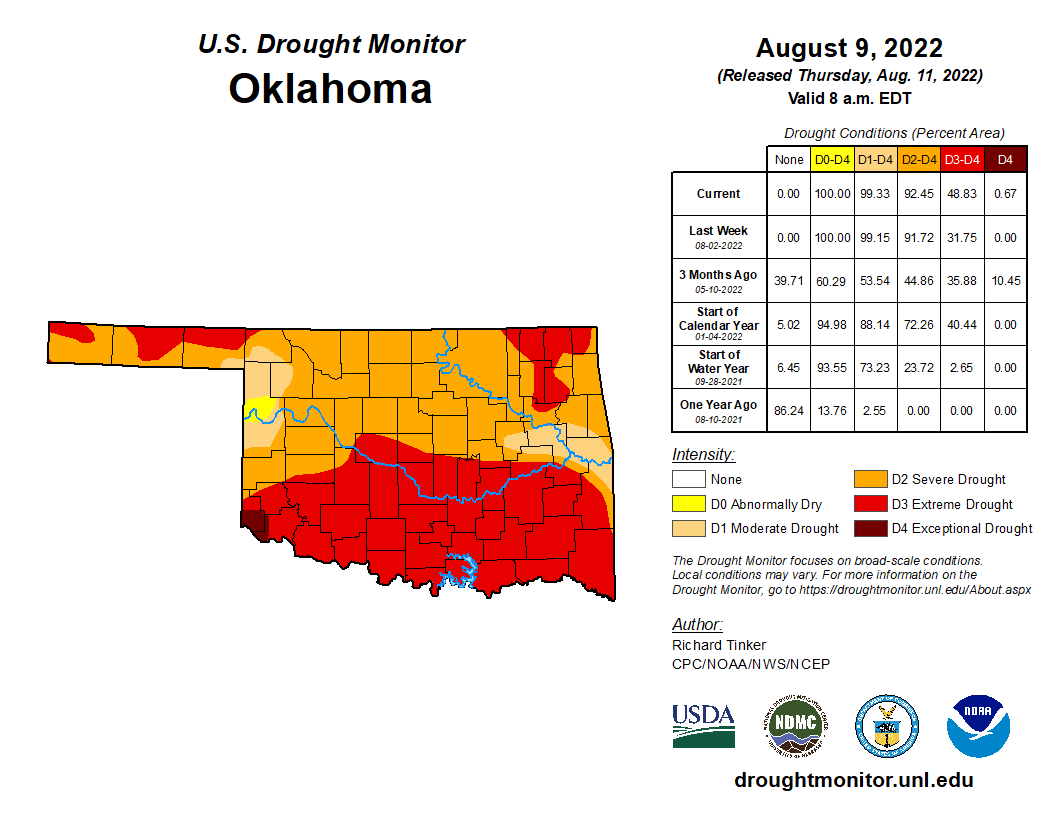
some drought relief near the end of the month, but not before the coverage of
severe drought had expanded to its highest levels in the state since March 5,
2013. The Aug. 9 U.S. Drought Monitor report had 92.5% of the state in at least
severe drought, but that level had diminished to 88% at month’s end. Impacts
reported to the Oklahoma Mesonet included dry farm ponds, cattle sell-offs, a
lack of hay and grazing, and crop failures. There was some severe weather
associated with the rainy periods in the form of damaging winds and hail, but
the more significant impacts came in the way of heavy rains. Widespread flash
flooding occurred over Aug. 22-23 and again on the 29th in parts of central and
southern Oklahoma, and necessitated road closures and water rescues for
stranded motorists.

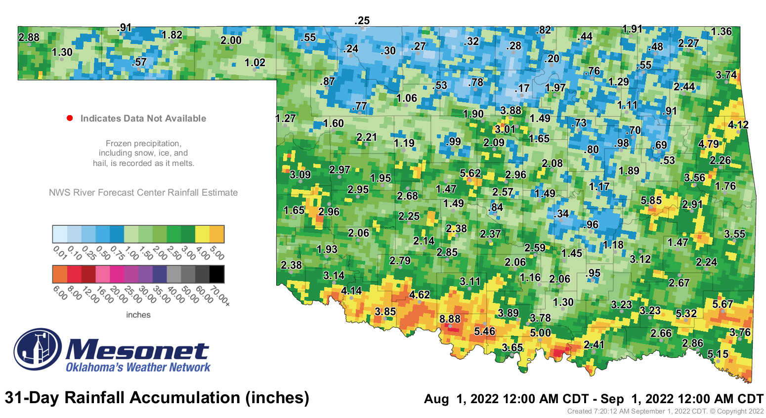
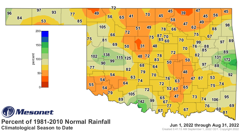
The statewide average precipitation total was 2.13 inches according to
preliminary data from the Oklahoma Mesonet, 1.1 inches below normal and ranked
as the 40th driest August since records began in 1895. As is usually the case
in Oklahoma, some parts of the state fared much better than others. South
central and southwest Oklahoma saw their 38th and 39th wettest Augusts on
record, respectively. Meanwhile, the north central and northeast regions
suffered through their third and ninth driest Augusts, respectively. Waurika
led all Mesonet sites with 8.88 inches for the month while Red Rock’s gauge
measured a measly 0.17 inches. Thirty-two of the Mesonet’s 120 sites failed to
reach at least an inch of rain during August, and 28 sites saw 3 inches or
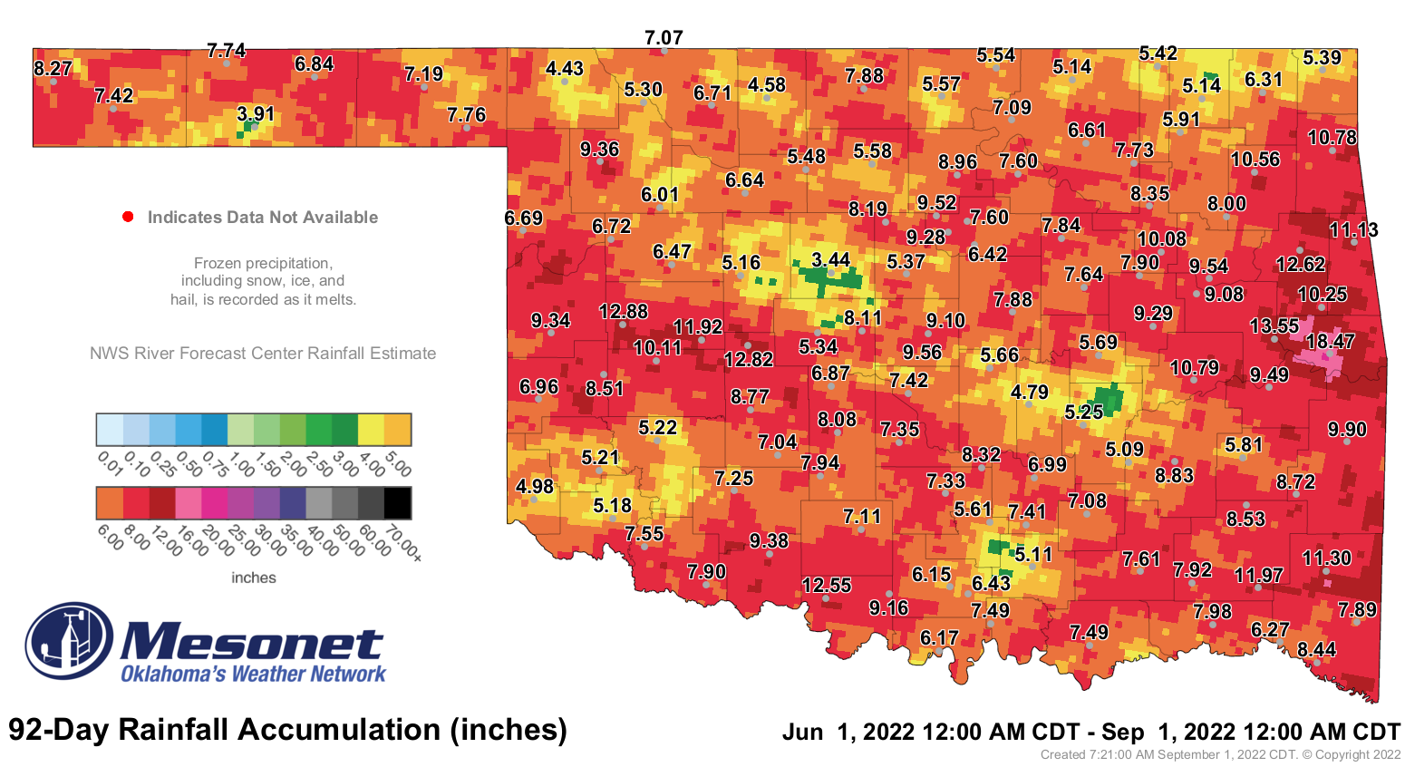
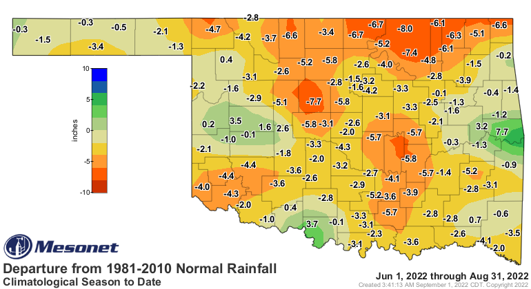
more. The climatological summer—June 1 through Aug. 31—ended as the 30th driest
on record at 7.48 inches, 3.21 inches below normal. Deficits of 2-8 inches were
common across the state, with a few very localized surpluses of 2-8 inches. The
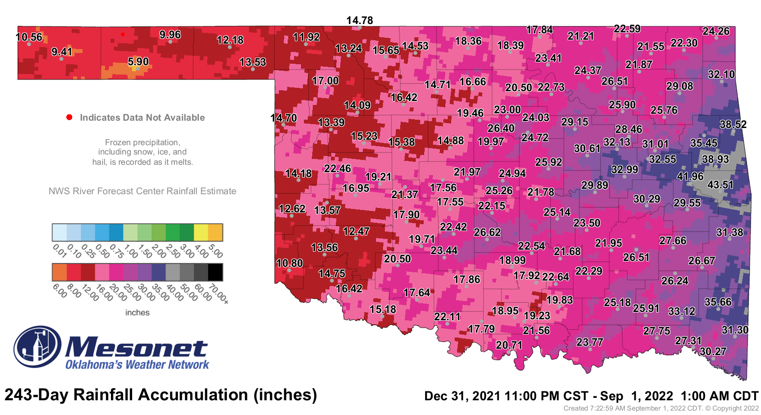
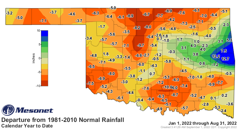
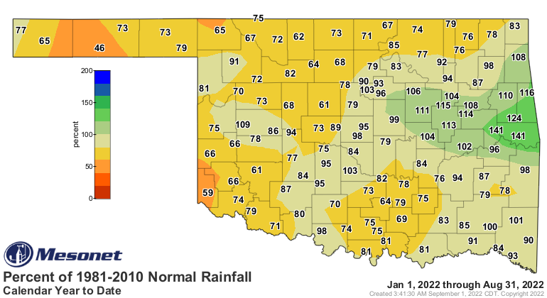
first eight months of the year were equally as dry with a statewide average of
21.34 inches, 3.91 inches below normal and ranked as the 40th driest January-
August on record.

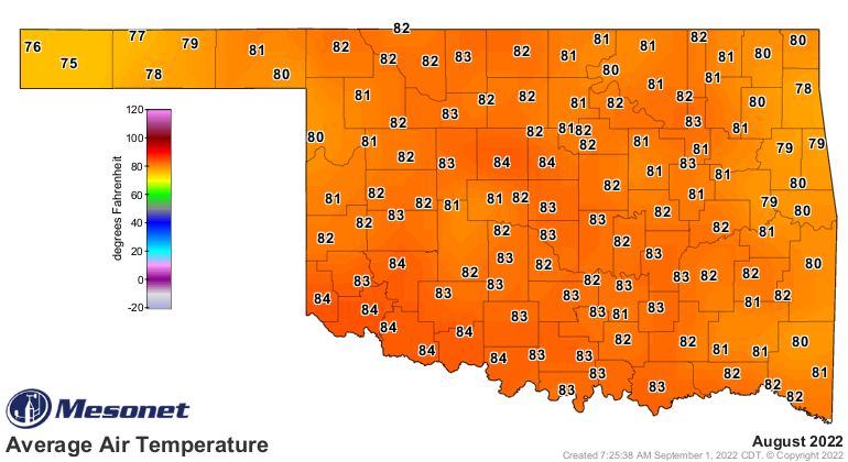
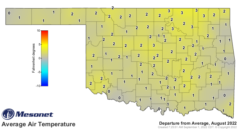
The statewide average temperature finished at 81.9 degrees, 1.1 degrees above
normal and ranked as the 46th warmest August on record dating back to 1895.
Temperatures peaked early in the month with Hollis hitting the month’s high
mark at 110 degrees on Aug. 4. Triple-digit temperatures occurred on 18 of
August’s 31 days, and were recorded 826 times at Mesonet sites during the month.
The month’s lowest temperature of 51 degrees was recorded at Eva on the 25th.
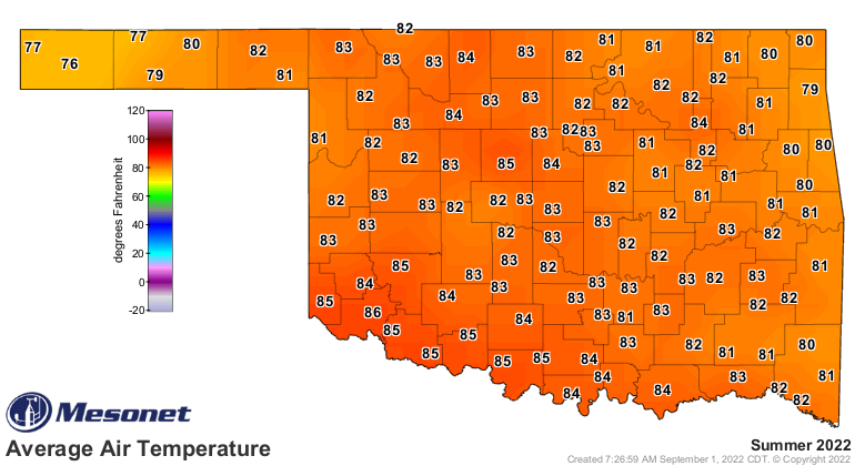
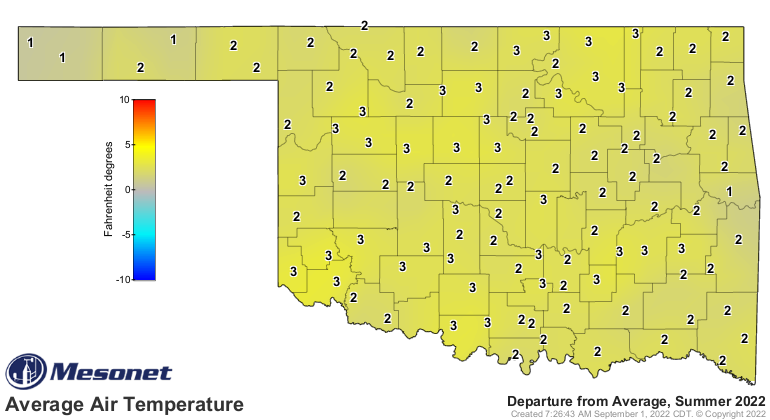
August’s heat topped off an uncommonly hot summer, which ended with a statewide
average of 82.7 degrees, 2.6 degrees above normal and ranked as the 11th warmest
June-August on record. That also marks the summer as the warmest in Oklahoma
since 2011’s 86.8 degrees, which tied with Texas that year for the hottest
summer in any state and any year since records began in 1895. This summer’s
temperatures topped out on July 19 at Mangum at 115 degrees, tying the Mesonet’s
all-time highest reading with six other sites dating back to 1997. Oklahoma had
not seen a temperature that high since Kingfisher hit 115 back on Aug. 1, 2012.
The heat continued to mount for 2022 with the first eight months of the year
finishing at 63.5 degrees, 0.8 degrees above normal and ranking as the 23rd
warmest January-August on record.
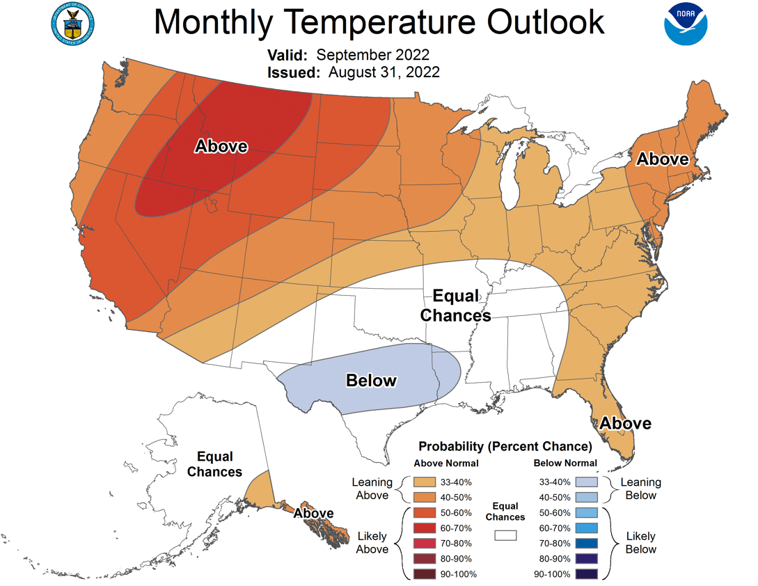
The September temperature and precipitation outlooks from the Climate Prediction
Center aren’t full of doom and gloom at least, but they aren’t exactly rosy,
either. The outlooks show equal odds of above-, below-, and near-normal
temperatures and precipitation over the bulk of the state. There are increased
odds of above normal temperatures in the western Panhandle and above normal
rainfall in far southeastern Oklahoma. CPC’s September drought outlook calls for
some improvement in the drought across roughly the southeastern one-third of the
state, but persistence across the remainder of Oklahoma.


###
Gary McManus
State Climatologist
Oklahoma Mesonet
Oklahoma Climatological Survey
gmcmanus@mesonet.org
September 1 in Mesonet History
| Record | Value | Station | Year |
|---|---|---|---|
| Maximum Temperature | 110°F | WAUR | 2000 |
| Minimum Temperature | 49°F | GOOD | 2024 |
| Maximum Rainfall | 7.50 inches | BYAR | 2020 |
Mesonet records begin in 1994.
Search by Date
If you're a bit off, don't worry, because just like horseshoes, “almost” counts on the Ticker website!