Ticker for August 31, 2022
MESONET TICKER ... MESONET TICKER ... MESONET TICKER ... MESONET TICKER ...
August 31, 2022 August 31, 2022 August 31, 2022 August 31, 2022
It ain't ever good enough!
Welcome to the award winning (our Mom said so) Ticker, the most popular weather
blog ever produced by this office, and coincidentally the ONLY weather blog
produced by this office. Still, it was a close vote (thanks Mom).
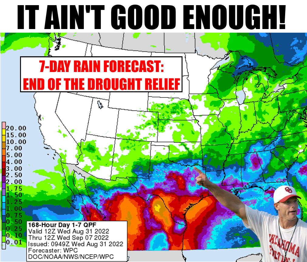
And welcome Coach Venables to the weather meme hot seat. Now tens and tens of
our fans will see you proclaim that our drought relief is over...surely the most
criticism you're gonna receive over the next few months, no?
Speaking of criticism, Mother Nature gets a full dose thanks to her Rain-cne
(rain that looks like acne...remember?) display over the previous seven days.
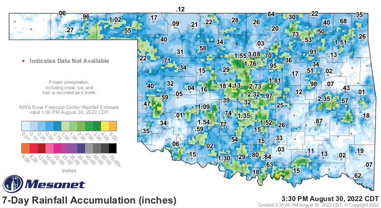
So a few came out winners, but even more came out, uhhhhh, not winners. And on top
of that, summer is back in full force. Our lame attempts to wish it out of
existence fell flat, although it's not where it was for most of June, July, and the
first half of August for sure! But, our foray into early fall lasted for only
a scant few days before roaring back into above normal heat territory.
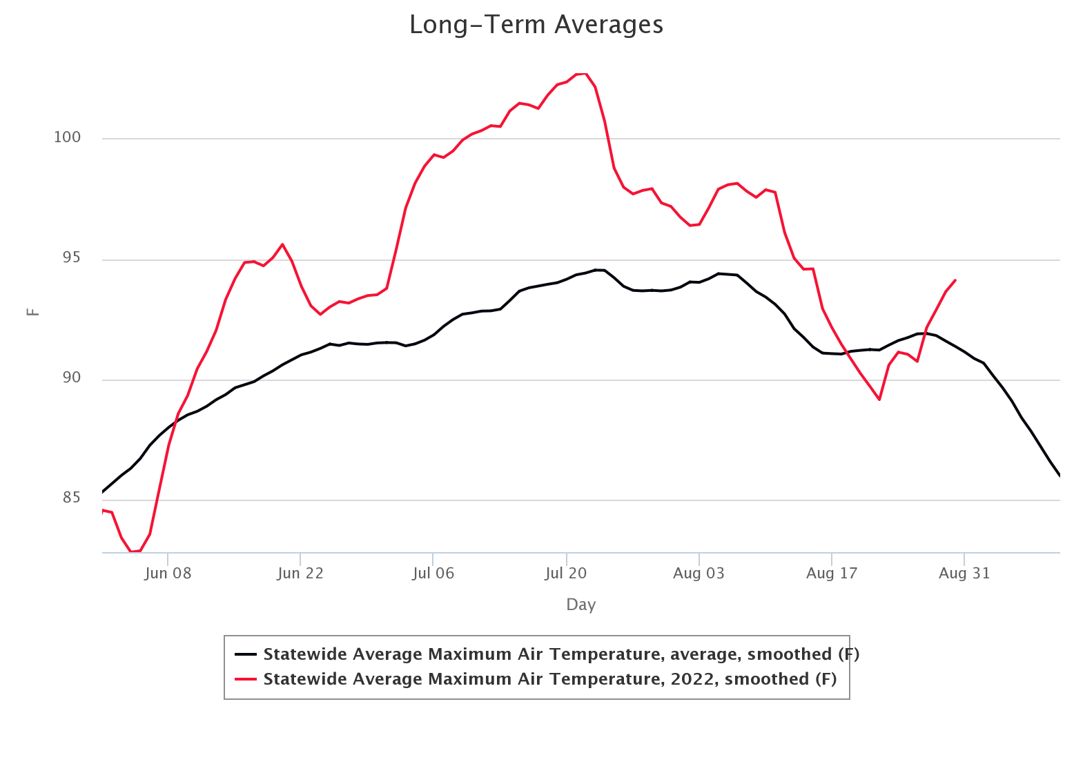
But again, the "normal" is sinking slowly as our days grow shorter, the sun
sinks farther to the south, and our peak heat of the day comes earlier and
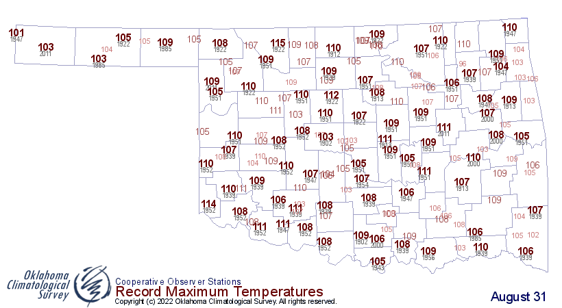
earlier. Even our record highs for this time of the year are mostly below the
110 degrees category.
So even if you WANT the heat of summer to stick around (pssst, I have a secret...
so do I), you can't fight what's coming. Orbital mechanics says so. But, we can
still get nice and toasty, and that's what we're gonna see more often than not
over the next week or so. And when it's not toasty, it will be somewhat
oppressive thanks to abundant moisture in the area. Heat index values will be
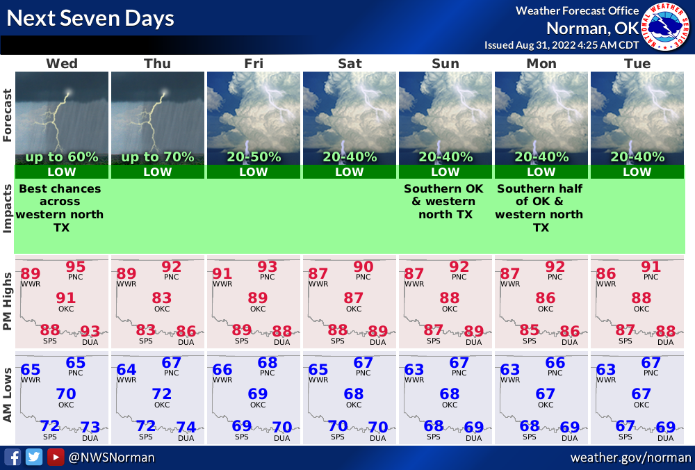
elevated to some degree. Watch for highs in the upper 80s and lower 90s through
the period with the heat index values a few degree higher at times. Rain chances
are mostly across southern Oklahoma through the weekend, and if storms do go
up they could have some pretty hefty rains in them with high winds and a bit of
hail.
Oh yeah, today marks the end of both August (unless there's an Aug. 32nd, and it
is 2022 so it's possible!) AND climatological summer. We're compiling our stats
for the press release tomorrow so here's a little preview:
August, a bit warmer than normal, and pretty dry.
Yeah, I know...DUH!
Summer, pretty darned hot, and pretty dry.
Right, second "DUH!" implied.
At any rate, we'll have the stats tomorrow. Stay tuned...
Gary McManus
State Climatologist
Oklahoma Mesonet
Oklahoma Climatological Survey
gmcmanus@mesonet.org
August 31 in Mesonet History
| Record | Value | Station | Year |
|---|---|---|---|
| Maximum Temperature | 111°F | FREE | 2011 |
| Minimum Temperature | 45°F | NOWA | 2009 |
| Maximum Rainfall | 5.29 inches | YUKO | 2020 |
Mesonet records begin in 1994.
Search by Date
If you're a bit off, don't worry, because just like horseshoes, “almost” counts on the Ticker website!