Ticker for August 8, 2022
MESONET TICKER ... MESONET TICKER ... MESONET TICKER ... MESONET TICKER ...
August 8, 2022 August 8, 2022 August 8, 2022 August 8, 2022
A little bit
So this "cold front" doesn't appear to be as strong as the one we had at the end
of July, but there's still plenty to celebrate, right? I would say it's like
kissing your sister, but this ain't (insert name of state you want to insult...and
Texas is lazy on your part). I KID...I KIDDDDDDDD! We can be happy that:
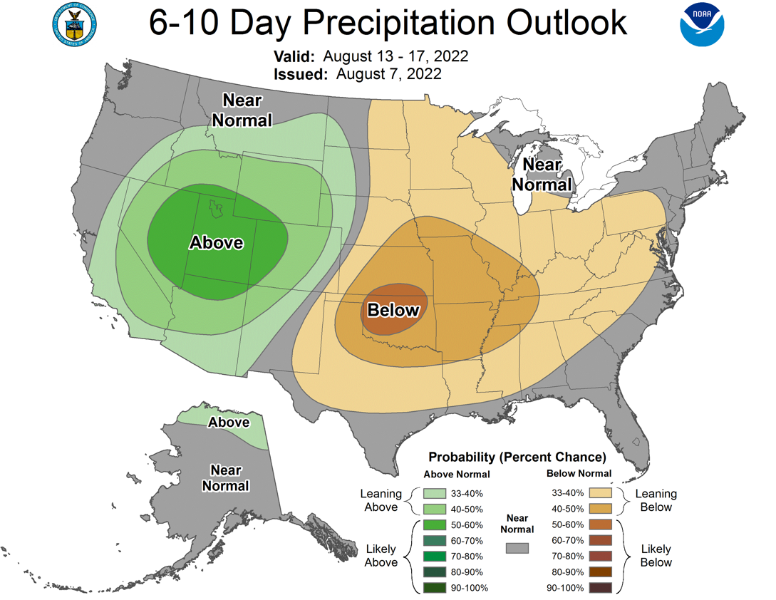
1) We're gonna see an increased chance of rain for the next few days. And while
once again it won't be as robust as what we saw at the end of July, it might be a
bit more widespread. And as we know from summertime type storms, these will be
slow-movers (if at all) and they will dump tremendous amounts of rain in localized
areas. So while we see a quarter-inch to an inch on the 7-day rain forecast map,
some folks will get a whole lot more...and maybe others not much at all.
This will lead to what I call "raincne." Remember back to when you were a teenager
(I have to count the days on my abacus to even start to comprehend those days)
and the lovely red spots that would magically form on your face on school picture
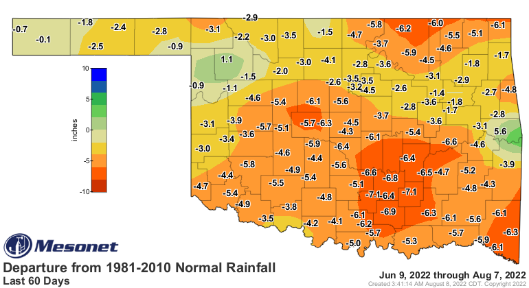
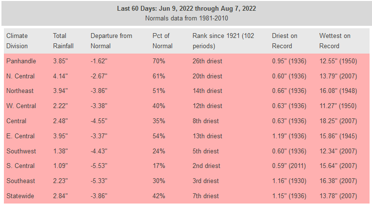
day. That's what our rainfall maps will look like, I'm betting. And we hope to
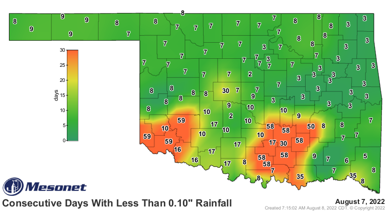
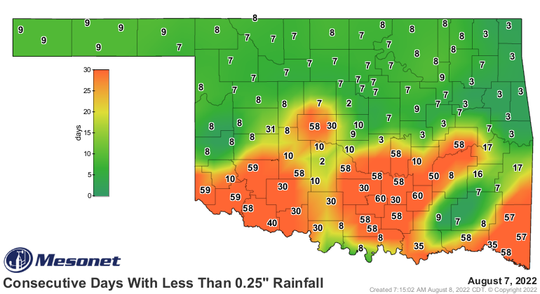
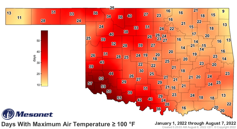
interrupt the current iteration of our flash drought, already starting to
get boosted by the current dry spell and heat after our fortunes, mostly
across northern Oklahoma, from late July. For those across southern OK, it's
been full steam ahead all along.


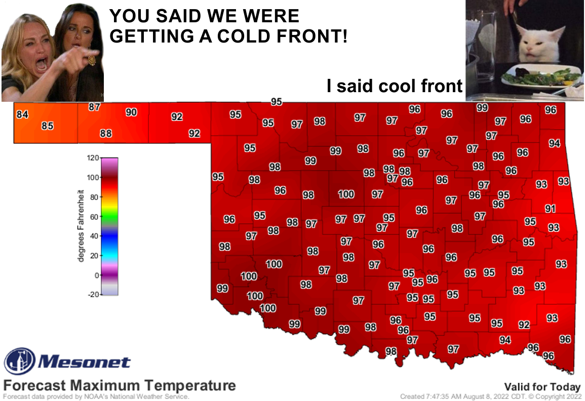
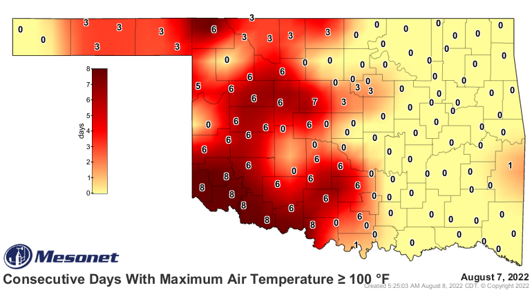
2) We WILL see some cooler weather, if not at least more of a dry heat than
the sauna we've been seeing. So our maps like this from yesterday
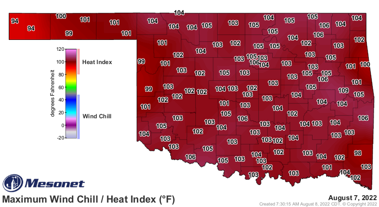
will look a little more restrained this week.
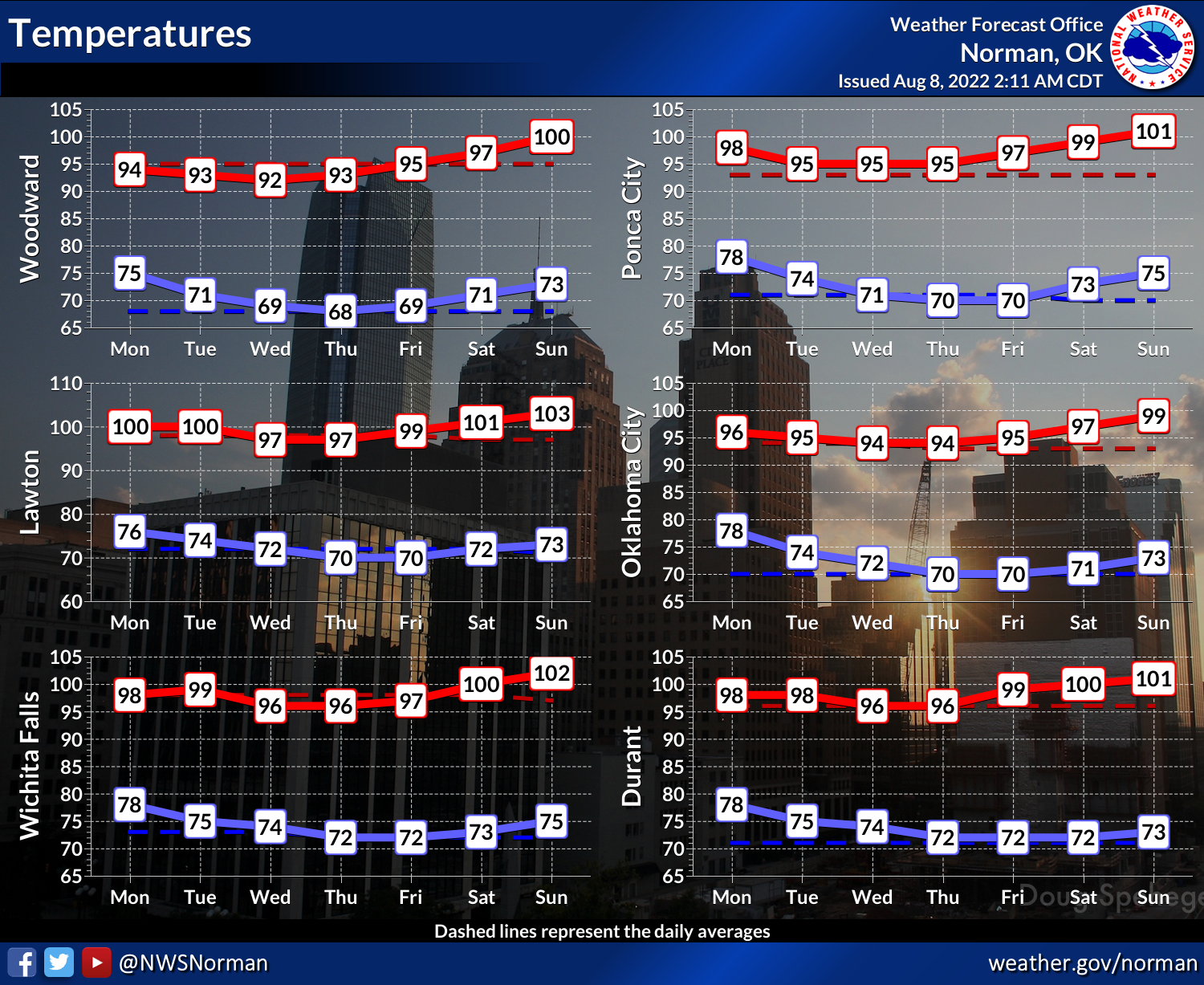
The clouds and moisture will still make it a bit uncomfortable for a few days,
but hopefully the weather will cool down enough to take the heat index values
just a bit closer to triple-digits and not well up above that mark. Then when
the ridge builds back in for the weekend, we will have more "dry heat" than the
previously mentioned sauna. Our current stanza of the heat wave is just about
8 or 9 days strong, so we were due a break.
There are hopes that the ridge will stick a bit farther west, allowing us
some upper-level flow from the NW, but that's a bit dicey at this point. As it
is, we look towards mid-August with some trepidation (English to Okie
translation: "fear") for our underarms as the heat looks to ramp back up.
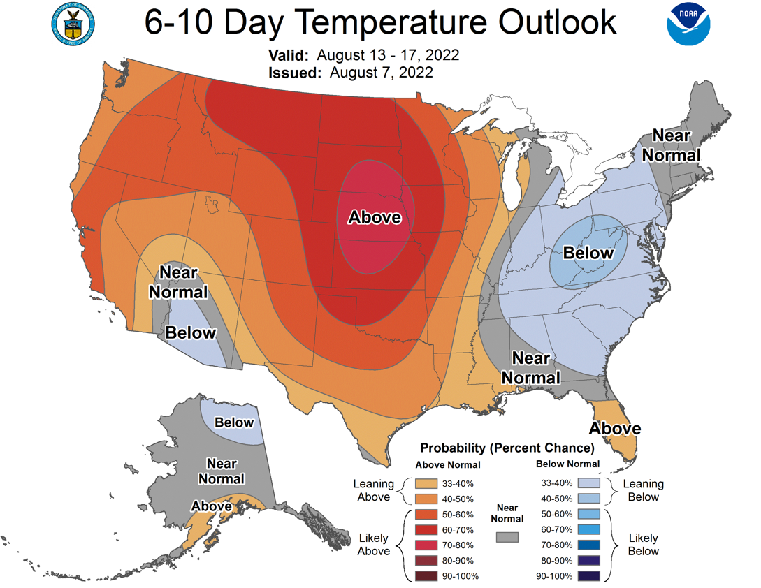
That would also hopefully ramp down the dry slant to the weather that is
expected to build back in again.
Now we're getting into fantasy-cast territory, so take with a grain of salt. I
prefer a grain of paprika, or at least cumin. Wait, are those things actually
granular?
In that case, just go with yellow mustard.
Gary McManus
State Climatologist
Oklahoma Mesonet
Oklahoma Climatological Survey
gmcmanus@mesonet.org
August 8 in Mesonet History
| Record | Value | Station | Year |
|---|---|---|---|
| Maximum Temperature | 111°F | KIN2 | 2011 |
| Minimum Temperature | 53°F | EVAX | 2017 |
| Maximum Rainfall | 4.48 inches | WIST | 2023 |
Mesonet records begin in 1994.
Search by Date
If you're a bit off, don't worry, because just like horseshoes, “almost” counts on the Ticker website!